Glasgow Moss

Wood, Forest in Fife

Scotland

Glasgow Moss

Rough field near the border Long unkempt grassland near the old railway line on the Clackmannan/Fife border.
Rough field near the border Credit: Scott Cormie

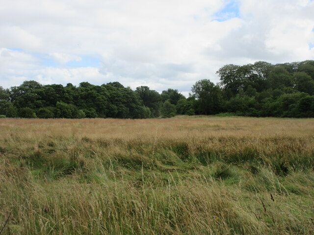
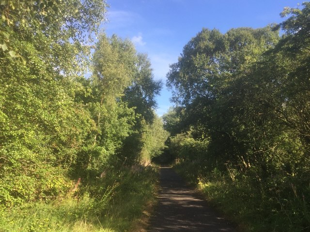
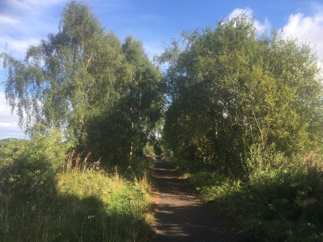
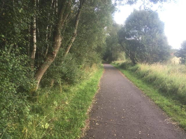
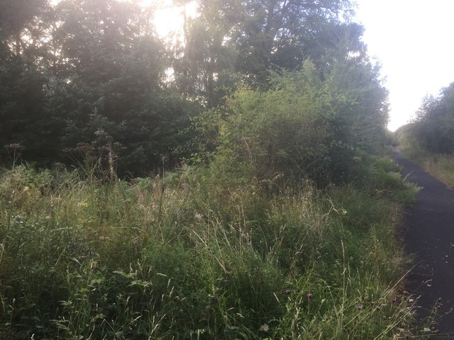
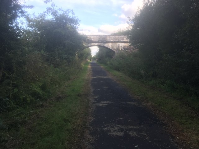
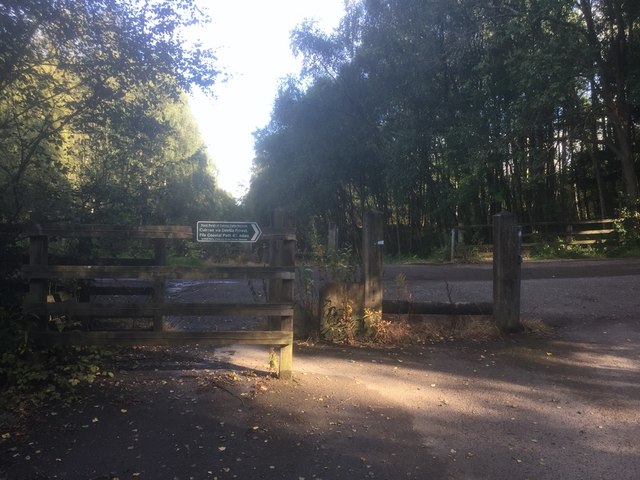
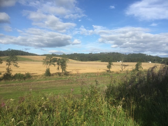
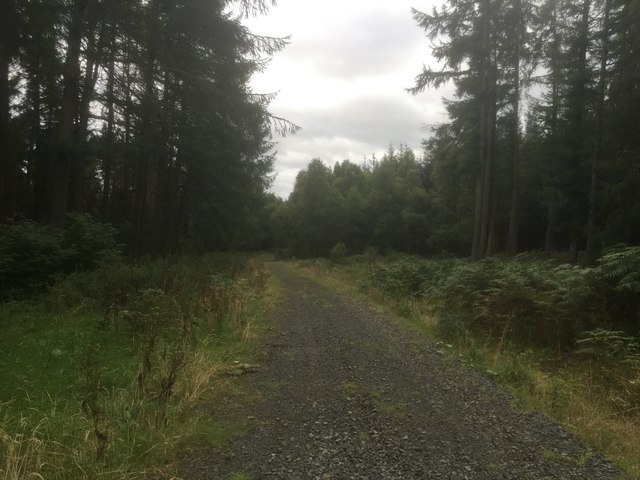
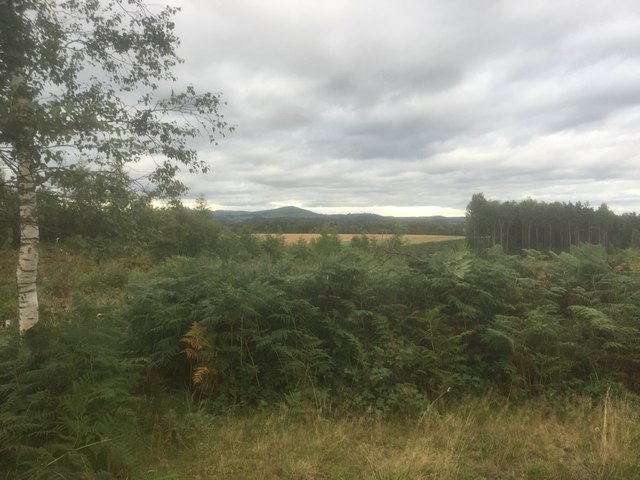
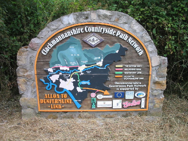
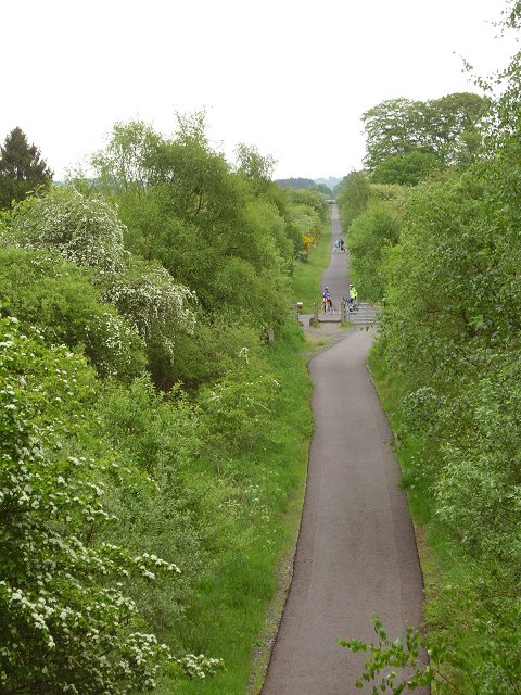
Glasgow Moss, located in Fife, Scotland, is a picturesque woodland area renowned for its lush greenery and natural beauty. Spanning over a vast expanse, the moss is a haven for nature enthusiasts and a popular destination for walkers, hikers, and birdwatchers alike.

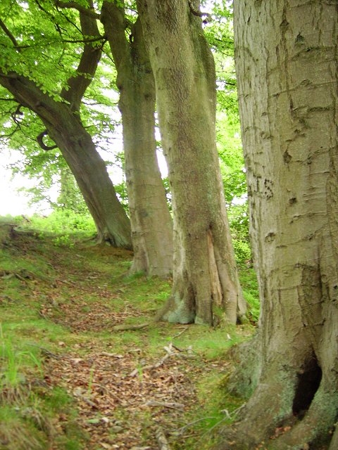
The moss is characterized by its diverse flora and fauna, with a wide variety of plant species thriving in its fertile soil. Towering trees, including oak, beech, and birch, dominate the landscape and provide a shaded canopy for the moss floor below. Delicate wildflowers, such as bluebells and primroses, add a vibrant splash of color to the woodland, particularly during the spring and summer months.

The moss is also home to an array of wildlife, making it a haven for animal lovers. Roe deer, foxes, and badgers are often spotted roaming the woodland, while squirrels playfully leap from tree to tree. The moss is particularly renowned for its bird population, with species such as blue tits, robins, and woodpeckers frequently spotted among the branches.

In addition to its natural beauty, Glasgow Moss holds historical significance. The moss has been utilized by local communities for centuries, serving as a source of timber and fuel. Today, it remains an important area for conservation and is protected to ensure the preservation of its unique ecosystem.

Overall, Glasgow Moss is a captivating woodland area in Fife, offering visitors a chance to immerse themselves in nature, explore its diverse habitats, and appreciate the tranquility of this enchanting forest.

If you have any feedback on the listing, please let us know in the comments section below.

Glasgow Moss Images

Images are sourced within 2km of 56.088257/-3.6703569 or Grid Reference NS9689. Thanks to Geograph Open Source API. All images are credited.

Rough field near the border Long unkempt grassland near the old railway line on the Clackmannan/Fife border.
Rough field near the border
Long unkempt grassland near the old railway line on the Clackmannan/Fife border.
A907 heading for Clackmannan The A907 westbound in Fife not far from the Clackmannanshire border.
A907 heading for Clackmannan
The A907 westbound in Fife not far from the Clackmannanshire border.
West Fife Cycleway, Bogside
West Fife Cycleway
West Fife Cycleway
West Fife Cycleway
West Fife Cycleway
Accommodation bridge, Whitehall Farm
Road into Devilla Forest, Bogside
View from the trackbed, Bogside
A through route to Maggie Duncan's Hill, Devilla Forest
View from Peat Hill, Devilla
West Fife Cycleway, Devilla turn off. The cycleway is very popular and forms part of an extensive network around Fife.
West Fife Cycleway, Devilla turn off.
The cycleway is very popular and forms part of an extensive network around Fife.
Disused signal box at the site of Bogside Station An interesting surviving relic from the railway along the West Fife Cycleway.
Disused signal box at the site of Bogside Station
An interesting surviving relic from the railway along the West Fife Cycleway.
Clackmannanshire Countryside Path Network Sign The sign is on the Fife and Clackmannanshire boundary where it is crossed by the Dunfermline to Alloa cycleway.
Clackmannanshire Countryside Path Network Sign
The sign is on the Fife and Clackmannanshire boundary where it is crossed by the Dunfermline to Alloa cycleway.
Craigmantoy The grasslands on Maggie Duncan's Hill give way to woodland. The land to the east of here is largely forest.
Craigmantoy
The grasslands on Maggie Duncan's Hill give way to woodland. The land to the east of here is largely forest.
Clashies Beech trees grown from a hedge alongside a minor road in a forest.
Clashies
Beech trees grown from a hedge alongside a minor road in a forest.
Disused railway, Brucefield Between Alloa and Dunfirmline, the railway is now a newly surfaced cyclepath.
Disused railway, Brucefield
Between Alloa and Dunfirmline, the railway is now a newly surfaced cyclepath.
Farm Bogside Farm with sand quarry structure on the horizon.
Farm
Bogside Farm with sand quarry structure on the horizon.
Show me another place!

Glasgow Moss is located at Grid Ref: NS9689 (Lat: 56.088257, Lng: -3.6703569)

Unitary Authority: Fife

Police Authority: Fife

What 3 Words

///drilled.furnish.cackling. Near Kincardine, Fife

Nearby Locations

Glasgow Moss

Related Wikis

Bogside (Fife) railway station

Bogside (Fife) railway station served the hamlet of Bogside, Fife, Scotland from 1850 to 1958 on the Stirling and Dunfermline Railway. == History == The...

Brucefield House

Brucefield is an 18th-century country house in Clackmannanshire, Scotland. It is located 4 kilometres (2.5 mi) east of Clackmannan. The house was largely...

Balgownie Wood

Balgownie Wood is a woodland in West Fife, Scotland, south of the village of Blairhall and east of Balgownie Mains. The woods used to belong to nearby...

Tulliallan Castle

Tulliallan Castle is a large house in Kincardine, Fife, Scotland. It is the second structure to have the name, and is a mixture of Gothic and Italian style...

Kilbagie railway station

Kilbagie railway station served the town of Clackmannan, Clackmannanshire, Scotland from 1894 to 1930 on the Kincardine Line. == History == The station...

Forest Mill railway station

Forest Mill railway station served the hamlet of Forestmill, Clackmannanshire, Scotland from 1850 to 1930 on the Stirling and Dunfermline Railway. ��2...

Tulliallan

Tulliallan (Gaelic tulach-aluinn, 'Beautiful knoll') was an estate in Perthshire, Scotland, near to Kincardine, and a parish. The Blackadder lairds of...

Longannet coal mine

Longannet coal mine was a deep mine complex in Fife, Scotland. == History == Longannet was the remnant of three mines, established in the 1960s. Built...

Nearby Amenities

Located within 500m of 56.088257,-3.6703569
Power: pole
Lat/Long: 56.0907987/-3.6738647
Material: wood
Power: pole
Lat/Long: 56.087818/-3.6627271
Material: wood
Power: pole
Lat/Long: 56.0901608/-3.6686188
Power: pole
Lat/Long: 56.0910544/-3.6754231
Material: wood
Power: pole
Lat/Long: 56.0884475/-3.66392
Material: wood
Power: pole
Lat/Long: 56.0903343/-3.6703062
Material: wood
Power: pole
Lat/Long: 56.0890259/-3.6650006
Material: wood
Power: pole
Lat/Long: 56.0905091/-3.6718859
Material: wood
Power: pole
Lat/Long: 56.0895029/-3.6658894
Power: pole
Lat/Long: 56.0906887/-3.6731137
Material: wood
Power: pole
Lat/Long: 56.0899642/-3.6667333
Material: wood
Power: pole
Lat/Long: 56.0901061/-3.6768062
Material: wood
Power: pole
Lat/Long: 56.0900442/-3.6754277
Material: wood
Power: pole
Lat/Long: 56.0899847/-3.6740179
Material: wood
Power: pole
Lat/Long: 56.0899415/-3.6728758
Material: wood
Power: pole
Lat/Long: 56.0898867/-3.6716082
Material: wood
Power: pole
Lat/Long: 56.0898365/-3.6704159
Material: wood
Power: pole
Lat/Long: 56.0897782/-3.6692006
Material: wood
Power: pole
Lat/Long: 56.0897128/-3.6677824
Material: wood
Power: pole
Lat/Long: 56.0896626/-3.6663893
Material: wood
Power: pole
Lat/Long: 56.0896054/-3.664946
Material: wood
Power: pole
Lat/Long: 56.0895249/-3.6638332
Material: wood
Power: pole
Lat/Long: 56.0894491/-3.6626096
The data included in this document is from www.openstreetmap.org. The data is made available under ODbL.

Have you been to Glasgow Moss?

Leave your review of Glasgow Moss below (or comments, questions and feedback).