Alton Priors

Settlement in Wiltshire

England

Alton Priors

Kennet & Avon Canal Kennet & Avon Canal East of Stanton Bridge
Kennet & Avon Canal Credit: Michel Van den Berghe

Alton Priors is a picturesque village located in the county of Wiltshire, England. Situated near the Vale of Pewsey, it is nestled amidst rolling hills and tranquil countryside, making it a popular destination for nature lovers and those seeking a peaceful retreat.

The village is known for its rich history, dating back to the Saxon period. One of its most notable landmarks is the Church of St. Mary, an ancient building that dates back to the 12th century. This Norman church is renowned for its unique architecture, including a rare double nave and a stunning 13th-century wall painting of St. Christopher.

Alton Priors is also famed for its ancient and mysterious landmarks. The Alton Barnes White Horse, a chalk horse carving on a nearby hillside, is a prominent feature of the area and attracts visitors from far and wide. Additionally, the village is home to the Alton Priors Manor, a beautiful manor house that dates back to the 17th century.

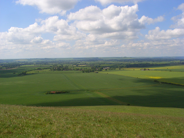
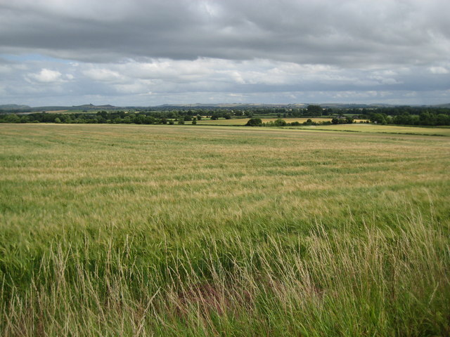
The surrounding countryside offers ample opportunities for outdoor activities such as walking, hiking, and birdwatching. The nearby Pewsey Downs National Nature Reserve is a haven for wildlife enthusiasts, boasting a diverse range of flora and fauna.

With its historic charm, stunning natural beauty, and close proximity to other attractions in Wiltshire, Alton Priors is a delightful destination for those seeking a tranquil escape in the heart of the English countryside.

If you have any feedback on the listing, please let us know in the comments section below.

Alton Priors Images

Images are sourced within 2km of 51.358978/-1.840261 or Grid Reference SU1162. Thanks to Geograph Open Source API. All images are credited.

Kennet & Avon Canal Kennet & Avon Canal East of Stanton Bridge
Kennet & Avon Canal
Kennet & Avon Canal East of Stanton Bridge
Stanton Bridge, Kennet and Avon Canal Stanton Bridge carries a minor metalled road, so why the 'tank trap' visible on the right is there is a mystery, as clearly it cannot obstruct the passage of the bridge.
Stanton Bridge, Kennet and Avon Canal
Stanton Bridge carries a minor metalled road, so why the 'tank trap' visible on the right is there is a mystery, as clearly it cannot obstruct the passage of the bridge.
Downland view, Stanton St Bernard A view across the Vale of Pewsey towards Salisbury Plain. The group of old farm buildings, left of centre, is beside the footpath between the village and Milk Hill.
Downland view, Stanton St Bernard
A view across the Vale of Pewsey towards Salisbury Plain. The group of old farm buildings, left of centre, is beside the footpath between the village and Milk Hill.
Main road, Stanton St Bernard The Pewsey to Devizes road which skirts to the north of the village.
Main road, Stanton St Bernard
The Pewsey to Devizes road which skirts to the north of the village.
Pillbox between Stanton St Bernard and Alton Barnes
2009 : Barley and barn, Stanton St. Bernard Looking west to the north of the minor road between Devizes and Pewsey.
Note the glowing colour of the wheat field beyond the barn, this is only seen for a few weeks each year as the wheat ripens.
2009 : Barley and barn, Stanton St. Bernard
Looking west to the north of the minor road between Devizes and Pewsey. Note the glowing colour of the wheat field beyond the barn, this is only seen for a few weeks each year as the wheat ripens.
2009 : Crop sprayer and crop, Stanton St. Bernard A field of barley to the north of the village.
Is the harvest about to start? No! It's a crop sprayer, as pointed out by two kind Geographers. The combine will not be there for another 6 weeks at least, had to make a smart move to let him enter the field.
2009 : Crop sprayer and crop, Stanton St. Bernard
A field of barley to the north of the village. Is the harvest about to start? No! It's a crop sprayer, as pointed out by two kind Geographers. The combine will not be there for another 6 weeks at least, had to make a smart move to let him enter the field.
2009 : Minor road near Stanton St. Bernard Looking toward Alton Priors and Pewsey.
Woodborough Hill <a href="https://www.geograph.org.uk/gridref/SU1161">SU1161</a> is on the skyline, it's clump of trees is a distinctive landmark.
2009 : Minor road near Stanton St. Bernard
Looking toward Alton Priors and Pewsey. Woodborough Hill SU1161 is on the skyline, it's clump of trees is a distinctive landmark.
2009 : Farmland north of Stanton St. Bernard The harvest has started, note the vehicles approaching the distant barn. I think it is barley they are bringing in, much too early for wheat.
Milk Hill <a href="https://www.geograph.org.uk/gridref/SU1064">SU1064</a> is behind the barn to the right and Tan Hill <a href="https://www.geograph.org.uk/gridref/SU0964">SU0964</a> to the left.
2009 : Farmland north of Stanton St. Bernard
The harvest has started, note the vehicles approaching the distant barn. I think it is barley they are bringing in, much too early for wheat. Milk Hill SU1064 is behind the barn to the right and Tan Hill SU0964 to the left.
2009 : View from the minor road north of Stanton St. Bernard Barley near ready for harvesting.
A somewhat grubby white horse (grey horse?) looks down from Milk Hill. When it is clean and gleaming boaters on the Kennet & Avon Canal coming from Devizes know they are not far from Honeystreet (one word) when they see it.
2009 : View from the minor road north of Stanton St. Bernard
Barley near ready for harvesting. A somewhat grubby white horse (grey horse?) looks down from Milk Hill. When it is clean and gleaming boaters on the Kennet & Avon Canal coming from Devizes know they are not far from Honeystreet (one word) when they see it.
2009 : View over a field of barley Of a distant barn.
The simplicity of this shot appealed to me.
Milk Hill is in the distance to the right.
Had to wait about half an hour for the clouds to be in the right position.
2009 : View over a field of barley
Of a distant barn. The simplicity of this shot appealed to me. Milk Hill is in the distance to the right. Had to wait about half an hour for the clouds to be in the right position.
Farmland north of Stanton St Bernard The farmland is arable. In a few weeks it might be possible to identify the crop that is starting to germinate. The white horse in the background is this one <a href="https://www.geograph.org.uk/photo/1744619">SU1063 : Alton Barnes White Horse</a>. This image has been got at by a blogger but that's OK <span class="nowrap"><a title="http://bakerblinker.files.wordpress.com/2010/03/blueskytest02c.jpg" rel="nofollow ugc noopener" href="http://bakerblinker.files.wordpress.com/2010/03/blueskytest02c.jpg">Link</a><img style="margin-left:2px;" alt="External link" title="External link - shift click to open in new window" src="https://s1.geograph.org.uk/img/external.png" width="10" height="10"/></span>
Farmland north of Stanton St Bernard
The farmland is arable. In a few weeks it might be possible to identify the crop that is starting to germinate. The white horse in the background is this one SU1063 : Alton Barnes White Horse. This image has been got at by a blogger but that's OK LinkExternal link
The road to Alton Barnes The road is seen here as it heads east for another kilometre before reaching Alton Barnes. There are a couple of WWII pillboxes visible in this image. The tree clump on the skyline marks the location of Woodborough Hill 2.6 kms away <a href="https://www.geograph.org.uk/photo/1744743">SU1161 : Woodborough Hill south-east of Alton Barnes</a>.
The road to Alton Barnes
The road is seen here as it heads east for another kilometre before reaching Alton Barnes. There are a couple of WWII pillboxes visible in this image. The tree clump on the skyline marks the location of Woodborough Hill 2.6 kms away SU1161 : Woodborough Hill south-east of Alton Barnes.
Footpath and farmland north of Stanton St Bernard The flat field in the foreground is in this square. The rest is in SU0963. The western shoulder of Milk Hill slopes down from the right. The footpath can be seen at the lower left leading towards the hill.
Footpath and farmland north of Stanton St Bernard
The flat field in the foreground is in this square. The rest is in SU0963. The western shoulder of Milk Hill slopes down from the right. The footpath can be seen at the lower left leading towards the hill.
Stanton St Bernard - The Sheds These buildings are being developed into some really interesting housing.
Stanton St Bernard - The Sheds
These buildings are being developed into some really interesting housing.
Stanton St Bernard - Byway Thisbyway leads through a field of rapeseed.
Stanton St Bernard - Byway
Thisbyway leads through a field of rapeseed.
Stanton St  Bernard - Rapeseed A field of rapeseed and in the distance is the Alton Barns White Horse.
Stanton St Bernard - Rapeseed
A field of rapeseed and in the distance is the Alton Barns White Horse.
Stanton St  Bernard - Road The road to alton Barnes.
Stanton St Bernard - Road
The road to alton Barnes.
Show me another place!

Alton Priors is located at Grid Ref: SU1162 (Lat: 51.358978, Lng: -1.840261)

Unitary Authority: Wiltshire

Police Authority: Wiltshire

What 3 Words

///cornering.violin.learning. Near Woodborough, Wiltshire

Nearby Locations

Alton Priors

Related Wikis

All Saints Church, Alton Priors

All Saints Church in Alton Priors, Wiltshire, England, dates from the 12th century. It is recorded in the National Heritage List for England as a Grade...

Alton, Wiltshire

Alton is a civil parish in Wiltshire, England. The parish includes the adjacent villages of Alton Barnes and Alton Priors, and the nearby hamlet of Honeystreet...

Battle of Woden's Burg (592)

The Anglo-Saxon Chronicle records a battle fought in the year 592 at Woden's Barrow (Old English "Wōdnesbeorġ"), the neolithic long barrow now known as...

Battle of Woden's Burg (715)

The Anglo-Saxon Chronicle records a battle fought in the year 715 at Woden's Burg, the neolithic long barrow now known as Adam's Grave, near Marlborough...

Vale of Pewsey

The Vale of Pewsey or Pewsey Vale is an area of Wiltshire, England to the east of Devizes and south of Marlborough, centred on the village of Pewsey....
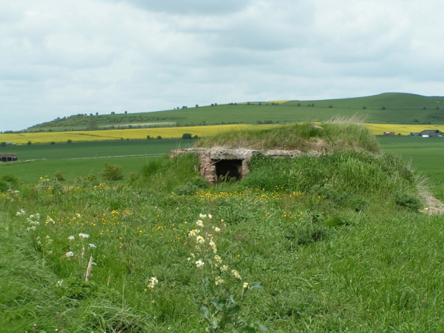
Adam's Grave

Adam's Grave was a Neolithic long barrow near Alton Barnes in Wiltshire, southwest England. Its remains have been scheduled as an ancient monument.The...

Pewsey Downs

Pewsey Downs (grid reference SU113636) is a 305.3 hectare biological Site of Special Scientific Interest on the southern edge of the Marlborough Downs...

Alton Barnes White Horse

Alton Barnes White Horse is a chalk hill figure of a white horse located on Milk Hill some 1,000 metres north of the village of Alton, Wiltshire, England...

Nearby Amenities

Located within 500m of 51.358978,-1.840261
Alton Priors
Place: village
Wikidata: Q2804492
Lat/Long: 51.3590847/-1.8424802
Post Box
Brand: Royal Mail
Brand Wikidata: Q638098
Collection Times: Mo-Fr 16:15; Sa 08:30
Drive Through: no
Operator: Royal Mail
Operator Wikidata: Q638098
Post Box Type: lamp
Ref: SN8 19
Royal Cypher: EIIR
Royal Cypher Wikidata: Q33102113
Lat/Long: 51.3599863/-1.8427071
Telephone
Booth: K6
Covered: booth
Listed Status: Grade II
Mapillary: 618220102747832
Operator: BT
Phone: +44 1672 851272
Survey Date: 2021-06-13
Lat/Long: 51.3600817/-1.842704
The data included in this document is from www.openstreetmap.org. The data is made available under ODbL.

Have you been to Alton Priors?

Leave your review of Alton Priors below (or comments, questions and feedback).