Bank Plantation

Wood, Forest in Lanarkshire

Scotland

Bank Plantation

Grassland and woodland near Bodsberry End An old field system off the B7076.
Grassland and woodland near Bodsberry End Credit: JThomas

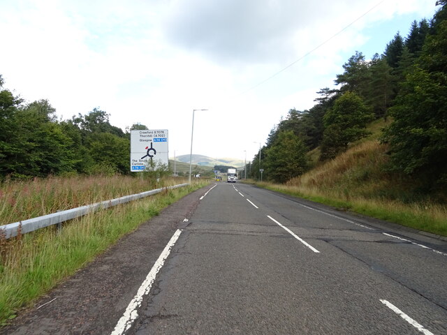
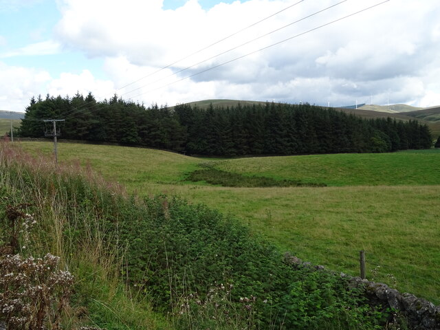
Bank Plantation is a scenic woodland located in the Lanarkshire region of Scotland. Situated in the heart of the countryside, this idyllic forest is a popular destination for nature enthusiasts and outdoor adventurers alike.

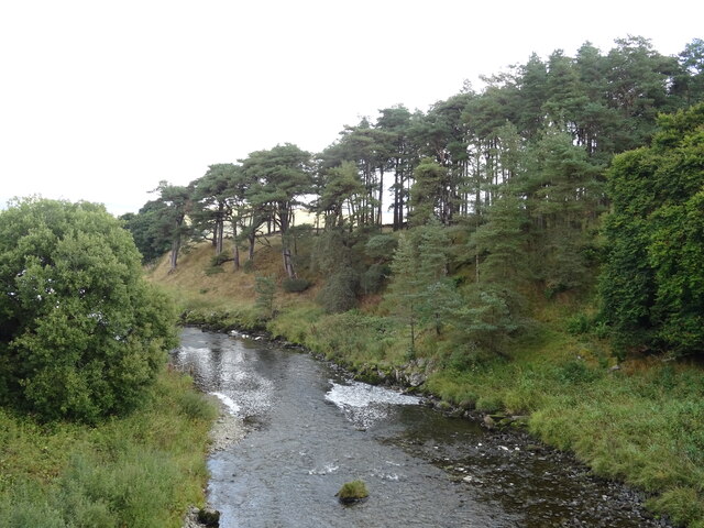
Covering an expansive area, Bank Plantation is primarily made up of a diverse range of trees, including oak, beech, and birch. The forest boasts a rich and vibrant ecosystem, with an abundance of wildlife such as deer, foxes, and various bird species. The dense foliage and tranquil atmosphere make it an ideal spot for birdwatching and wildlife photography.

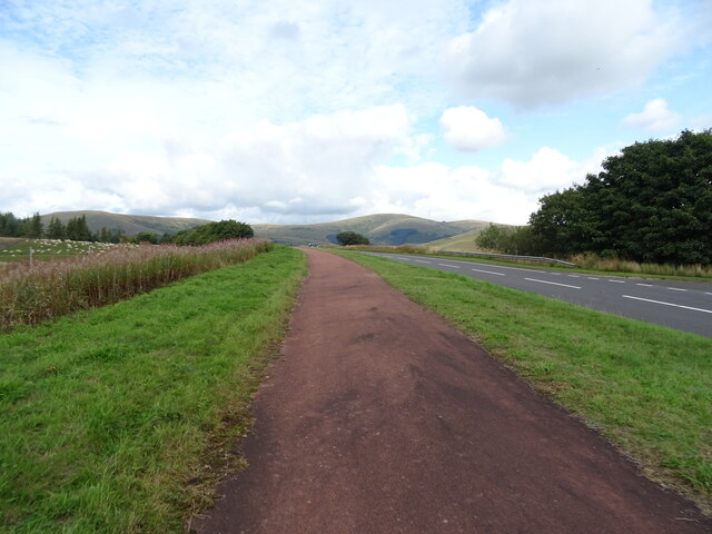
The woodland is crisscrossed by a network of well-maintained trails, allowing visitors to explore the area on foot or by bike. These paths wind through the forest, leading to picturesque viewpoints and hidden gems, such as a serene pond nestled amidst the trees. The well-marked trails also make Bank Plantation a popular destination for joggers and dog walkers.

Bank Plantation offers a range of recreational activities, making it a perfect getaway for families and individuals seeking outdoor adventures. Picnic areas are scattered throughout the forest, providing a peaceful setting for visitors to relax and enjoy a meal amidst nature. Additionally, the forest offers opportunities for camping, allowing visitors to immerse themselves in the beauty of the woodland overnight.

Overall, Bank Plantation in Lanarkshire is a stunning woodland that offers a tranquil retreat from the hustle and bustle of everyday life. With its diverse flora and fauna, scenic trails, and recreational facilities, it is a must-visit destination for nature lovers and outdoor enthusiasts.

If you have any feedback on the listing, please let us know in the comments section below.

Bank Plantation Images

Images are sourced within 2km of 55.442585/-3.6536232 or Grid Reference NS9517. Thanks to Geograph Open Source API. All images are credited.

Grassland and woodland near Bodsberry End An old field system off the B7076.
Grassland and woodland near Bodsberry End
An old field system off the B7076.
National Cycle Route 74 towards Crawford On the B7076.
National Cycle Route 74 towards Crawford
On the B7076.
Cleared woodland, Bodsberry Hill Above the B7076.
Cleared woodland, Bodsberry Hill
Above the B7076.
Woodland near the A74(M)
Rough grazing and woodland beside the B7076 Looking towards the A74(M).
Rough grazing and woodland beside the B7076
Looking towards the A74(M).
National Cycle Route 74 towards Crawford On the B7076.
National Cycle Route 74 towards Crawford
On the B7076.
B7076 approaching roundabout Heading north on National Cycle Route 74.
B7076 approaching roundabout
Heading north on National Cycle Route 74.
A74(M) bridge over the River Clyde From Elvanfoot Bridge on the B7076.
A74(M) bridge over the River Clyde
From Elvanfoot Bridge on the B7076.
B7076, Elvanfoot Bridge Heading north where it shortly becomes the A702.
B7076, Elvanfoot Bridge
Heading north where it shortly becomes the A702.
The River Clyde, Elvanfoot Bridge
Grazing towards the River Clyde Off the A702.
Grazing towards the River Clyde
Off the A702.
Stoneyburn Wood
Stoneyburn Wood
Grazing, Stoneyburn Towards the River Clyde.
Grazing, Stoneyburn
Towards the River Clyde.
A702, Stoneyburn Towards Crawford.
A702, Stoneyburn
Towards Crawford.
National Cycle Route 74, Stoneyburn Towards Crawford.
National Cycle Route 74, Stoneyburn
Towards Crawford.
A74(M) near Bodsberry End Towards Glasgow.
A74(M) near Bodsberry End
Towards Glasgow.
West Coast Main Line, Crawford Taken from a bridge on versions 1 and 2 of the A74 and looking to the A74(M) bridge. The old dual carriageway is now single with the northbound carriageway buried. Much of the redundant carriageway is wooded.  The trees on Wellshot Hill in the background were planted in the 1980s.
West Coast Main Line, Crawford
Taken from a bridge on versions 1 and 2 of the A74 and looking to the A74(M) bridge. The old dual carriageway is now single with the northbound carriageway buried. Much of the redundant carriageway is wooded. The trees on Wellshot Hill in the background were planted in the 1980s.
Ellershie Hill and underpass, A74(M)
Show me another place!

Bank Plantation is located at Grid Ref: NS9517 (Lat: 55.442585, Lng: -3.6536232)

Unitary Authority: South Lanarkshire

Police Authority: Lanarkshire

What 3 Words

///afraid.galaxies.pools. Near Douglas, South Lanarkshire

Nearby Locations

Bank Plantation Elvanfoot

Related Wikis

Elvanfoot railway station

Elvanfoot railway station was a station which served Elvanfoot, in the Scottish county of South Lanarkshire. It was served by local trains on what is now...

Elvanfoot

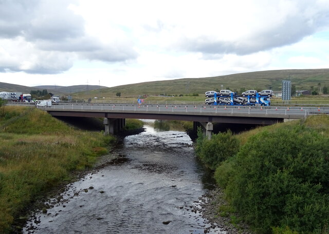
Elvanfoot is a small village in South Lanarkshire, Scotland. Elvanfoot is located at the confluence of the River Clyde and Elvan Water. The Clyde is crossed...

Crawford, South Lanarkshire

Crawford is a village and civil parish in South Lanarkshire, Scotland.Crawford is close to the source of the River Clyde and the M74 motorway, 50 miles...
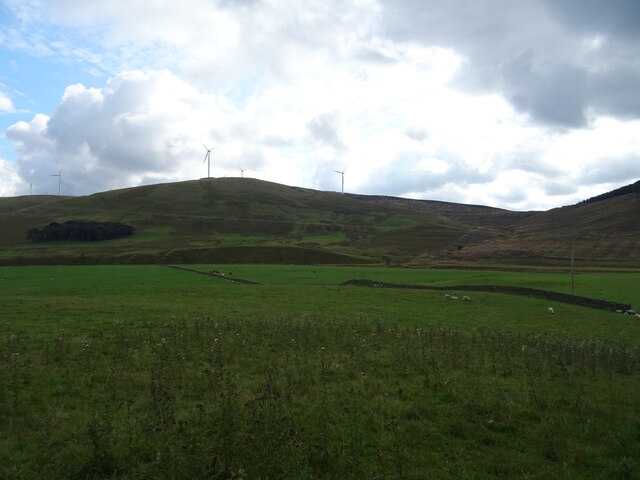
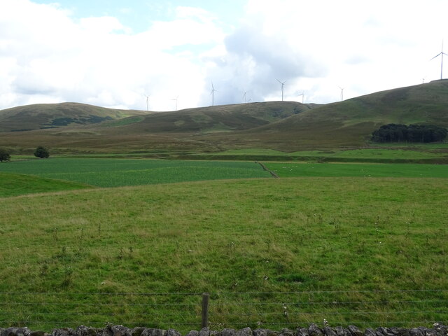
Clyde Wind Farm

The Clyde Wind Farm is a 522 megawatt (MW) wind farm near Abington in South Lanarkshire, Scotland. == Planning == The first stage of the project consists...

Crawford railway station (Scotland)

Crawford railway station was a station which served the village of Crawford, near Abington, in the Scottish county of South Lanarkshire. It was served...

Crawford Castle

Crawford Castle, substantially in ruins, is located on the north bank of the River Clyde, around 1⁄2 mile (800 metres) north of Crawford, South Lanarkshire...
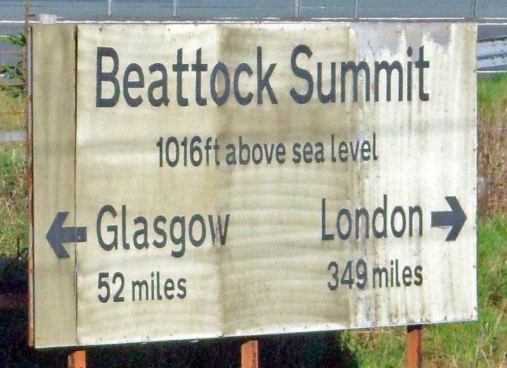
Beattock Summit

Beattock Summit is the highest point of the West Coast Main Line (WCML) railway and of the A74(M) motorway as they cross between Dumfries and Galloway...

Abington railway station

Abington railway station was a station which served Abington, in the Scottish county of South Lanarkshire. It was served by local trains on what is now...

Nearby Amenities

Located within 500m of 55.442585,-3.6536232
Created By: Merkaartor 0.13
Lat/Long: 55.4451269/-3.6504206
Created By: Merkaartor 0.13
Lat/Long: 55.4446633/-3.6506328
Created By: Merkaartor 0.13
Lat/Long: 55.4427901/-3.651833
Created By: Merkaartor 0.13
Lat/Long: 55.4434573/-3.6519333
Created By: Merkaartor 0.13
Lat/Long: 55.4440133/-3.6509486
Created By: Merkaartor 0.13
Lat/Long: 55.4430743/-3.6511435
Created By: Merkaartor 0.13
Lat/Long: 55.4437134/-3.6509969
Created By: Merkaartor 0.13
Lat/Long: 55.4445829/-3.6507622
Created By: Merkaartor 0.13
Lat/Long: 55.4445407/-3.6506794
Created By: Merkaartor 0.13
Lat/Long: 55.444128/-3.6508951
Created By: Merkaartor 0.13
Lat/Long: 55.4441221/-3.6509675
Created By: Merkaartor 0.13
Lat/Long: 55.4420575/-3.6515595
Parking
Source: Bing
Lat/Long: 55.4406517/-3.6593381
Material: wood
Power: pole
Lat/Long: 55.4417759/-3.650084
Power: pole
Lat/Long: 55.4443258/-3.6496978
Material: wood
Power: pole
Lat/Long: 55.4401616/-3.6482333
Place: farm
Lat/Long: 55.4437394/-3.6583755
Elvanfoot Junction
Historic Railway: junction
Railway: site
Lat/Long: 55.4384577/-3.6557952
Power: pole
Lat/Long: 55.443145/-3.6598841
Power: pole
Lat/Long: 55.4433286/-3.6594399
Power: pole
Lat/Long: 55.4435662/-3.6589111
Power: pole
Lat/Long: 55.4437185/-3.6585642
Power: pole
Lat/Long: 55.4403438/-3.6603516
Power: pole
Lat/Long: 55.441101/-3.6602247
Power: pole
Lat/Long: 55.4419739/-3.6599857
Power: pole
Lat/Long: 55.4425799/-3.6599645
Power: pole
Lat/Long: 55.443583/-3.6597805
Power: pole
Lat/Long: 55.4440029/-3.659918
Power: pole
Lat/Long: 55.4444744/-3.6600661
Power: pole
Lat/Long: 55.439835/-3.6598249
Power: pole
Lat/Long: 55.4403018/-3.6583992
Power: pole
Lat/Long: 55.4406006/-3.6575298
Power: pole
Lat/Long: 55.4407158/-3.6571702
Power: pole
Lat/Long: 55.4408358/-3.6565842
Power: pole
Lat/Long: 55.4408106/-3.6555541
Power: pole
Lat/Long: 55.4413602/-3.6548666
Power: pole
Lat/Long: 55.4414946/-3.6538142
Power: pole
Lat/Long: 55.4416002/-3.6529935
Power: pole
Lat/Long: 55.4416823/-3.6522954
Material: wood
Power: pole
Lat/Long: 55.4413134/-3.6527174
Power: pole
Lat/Long: 55.440942/-3.6531891
Power: pole
Lat/Long: 55.4407734/-3.6571596
Power: pole
Lat/Long: 55.4414922/-3.6573119
Power: pole
Lat/Long: 55.4422121/-3.6574515
Power: pole
Lat/Long: 55.4429452/-3.65757
Power: pole
Lat/Long: 55.4436639/-3.6577159
Power: pole
Lat/Long: 55.4443718/-3.6575467
Power: pole
Lat/Long: 55.4450329/-3.6573521
Power: pole
Lat/Long: 55.4457384/-3.6571448
The data included in this document is from www.openstreetmap.org. The data is made available under ODbL.

Have you been to Bank Plantation?

Leave your review of Bank Plantation below (or comments, questions and feedback).