Moss Wood
Wood, Forest in Kirkcudbrightshire
Scotland
Moss Wood

Moss Wood is a picturesque forest located in Kirkcudbrightshire, Scotland. Spanning over a vast area, it is known for its natural beauty and diverse flora and fauna. The wood is situated in a rural setting, surrounded by rolling hills and meandering streams, providing a tranquil escape for nature enthusiasts.
The forest is predominantly composed of dense deciduous trees, including oak, beech, and birch, which create a lush canopy overhead. These trees provide a habitat for various woodland creatures such as squirrels, deer, and a multitude of bird species. Moss Wood is particularly renowned for its vibrant birdlife, attracting birdwatchers from far and wide.
Visitors to Moss Wood can enjoy a variety of activities, including walking trails that wind through the forest, allowing for exploration of its different sections and hidden corners. The trails are well-maintained and provide opportunities to observe the woodland’s rich biodiversity up close. Along the paths, there are occasional benches where visitors can pause and take in the peaceful surroundings.
For those seeking a more immersive experience, camping is available in designated areas within the wood. This allows visitors to fully immerse themselves in the beauty of the forest and enjoy a night under the stars.
Overall, Moss Wood in Kirkcudbrightshire offers a captivating natural environment, perfect for nature lovers and outdoor enthusiasts. Its diverse range of flora and fauna, picturesque landscapes, and well-maintained trails make it a must-visit destination for anyone seeking a peaceful retreat in the heart of Scotland.
If you have any feedback on the listing, please let us know in the comments section below.
Moss Wood Images
Images are sourced within 2km of 55.042113/-3.6534189 or Grid Reference NX9473. Thanks to Geograph Open Source API. All images are credited.


Moss Wood is located at Grid Ref: NX9473 (Lat: 55.042113, Lng: -3.6534189)
Unitary Authority: Dumfries and Galloway
Police Authority: Dumfries and Galloway
What 3 Words
///rewrites.things.pockets. Near Dumfries, Dumfries & Galloway
Nearby Locations
Related Wikis

Pict's Knowe
Pict's Knowe (grid reference NX 9538 7213) is a henge monument in the parish of Troqueer, Dumfries and Galloway. It is one of a small group of henge monuments...
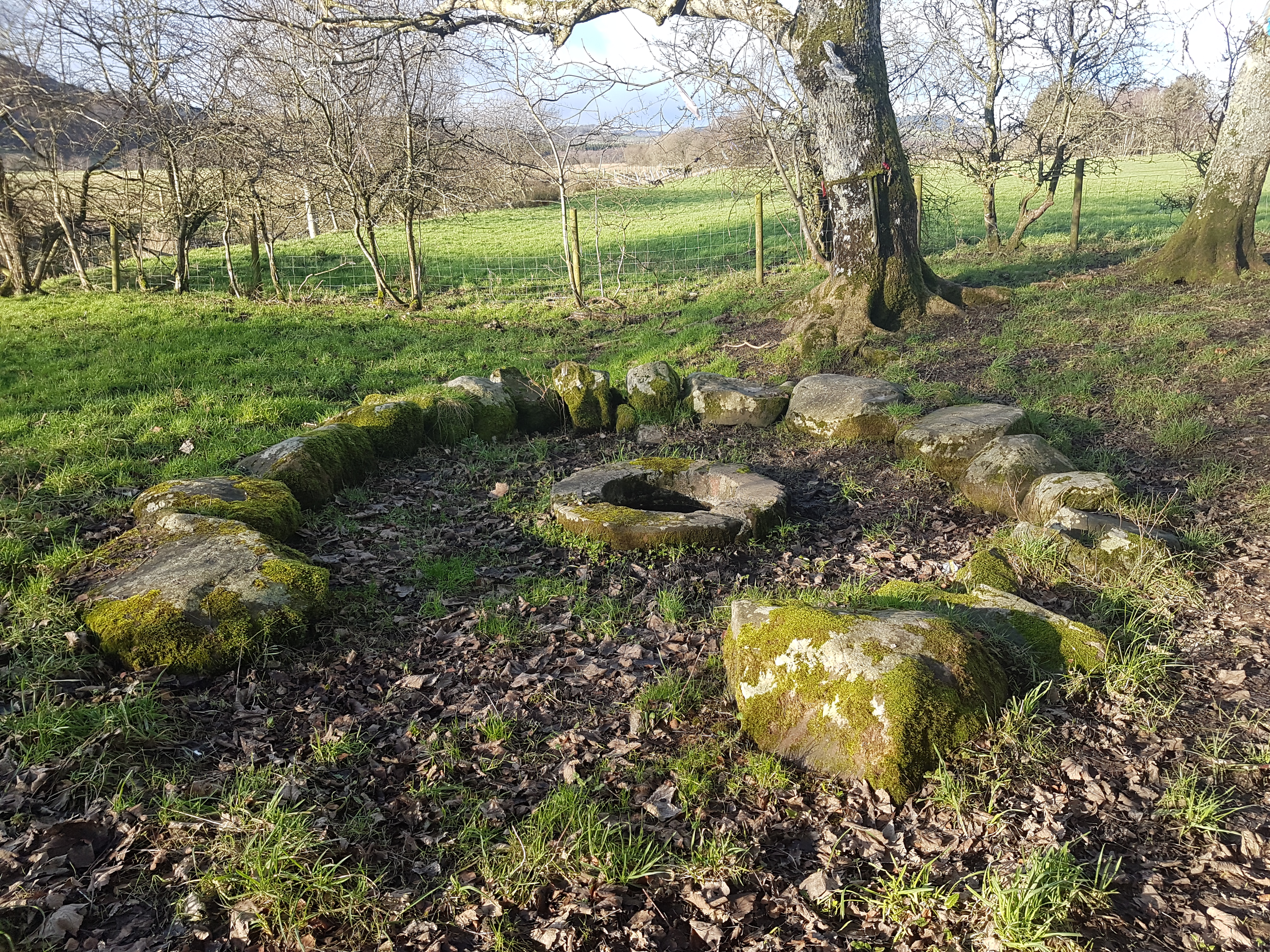
St Queran's Well
St Queran's Well is a holy well in Dumfries and Galloway, located in the parish of Troqueer in the historic county of Kirkcudbrightshire. A spring feeds...
Cargenbridge
Cargenbridge is a village located in Dumfries and Galloway, United Kingdom southwest of Dumfries. It is in Troqueer parish, in the historic county of Kirkcudbrightshire...

Dumfries and Galloway Royal Infirmary
Dumfries and Galloway Royal Infirmary is the main hospital in Dumfries and Galloway, Scotland. The hospital is managed by NHS Dumfries and Galloway....
Mabie, Dumfries and Galloway
Mabie is a collection of mountain biking routes located in Dumfries and Galloway, southwest Scotland. The mountain bike routes are part of the 7Stanes...
Curriestanes cursus
Curriestanes cursus (grid reference NX 95990 75170) is a large neolithic ditched enclosure on the outskirts of Dumfries, in the parish of Troqueer, Dumfries...

Easthill stone circle
Easthill stone circle (grid reference NX91937388), also known as the Seven Grey Stanes, is a small oval stone circle 3¾ miles south-west of Dumfries. Eight...
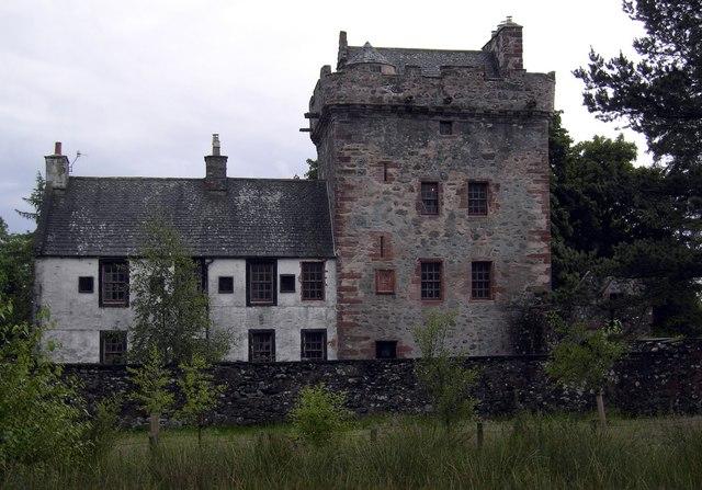
Hills Tower
Hills Tower is a sixteenth-century square tower house, with an adjoining eighteenth-century wing, near Dumfries in Scotland. Originally built around 1527...
Nearby Amenities
Located within 500m of 55.042113,-3.6534189Have you been to Moss Wood?
Leave your review of Moss Wood below (or comments, questions and feedback).