Broad Wood

Wood, Forest in Perthshire

Scotland

Broad Wood

Loanhead of Duchally Cattle on the side of the Ochil Hills.
Loanhead of Duchally Credit: Richard Webb

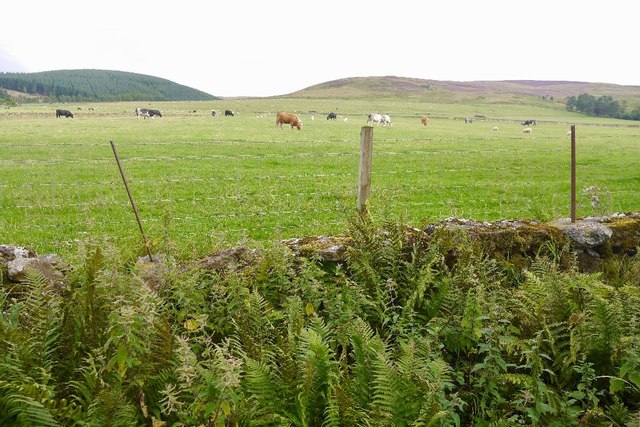
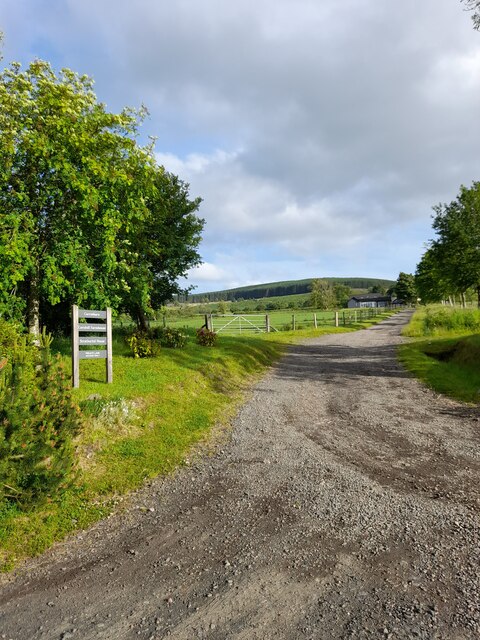
Broad Wood is a picturesque forest located in Perthshire, Scotland. Covering an area of approximately 500 acres, it is known for its stunning natural beauty and diverse wildlife. The wood is situated on the outskirts of the village of Ballinluig, offering easy access to visitors from both urban and rural areas.

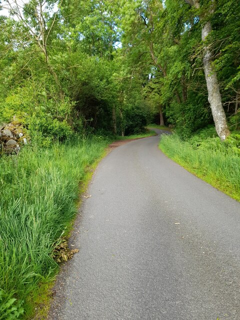
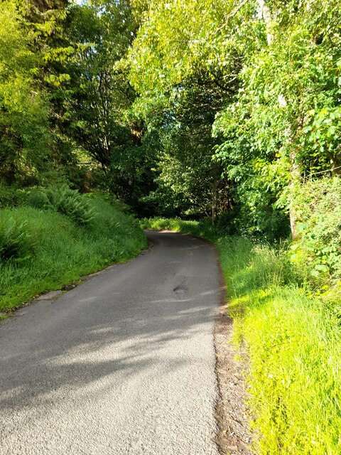
The forest is predominantly composed of native Scottish trees, including oak, birch, and pine. These towering trees provide a lush canopy, creating a peaceful and tranquil atmosphere. Walking trails wind their way through the wood, allowing visitors to explore its enchanting surroundings.

Broad Wood is home to a wide variety of wildlife, making it a popular destination for nature enthusiasts and birdwatchers. The forest provides habitat for numerous bird species, including woodpeckers, owls, and buzzards. Red squirrels can also be spotted darting through the trees, while deer occasionally emerge from the shadows.

In addition to its natural attractions, Broad Wood offers recreational activities for all ages. There are designated picnic areas where visitors can enjoy a leisurely lunch amidst the serenity of the forest. The wood is also a favored spot for outdoor activities such as cycling, horse riding, and wildlife photography.

Overall, Broad Wood is a cherished natural gem in Perthshire, offering a haven of tranquility and a chance to immerse oneself in the wonders of Scotland's native woodlands. Whether it's a peaceful walk, a family picnic, or an opportunity to connect with nature, this forest provides an idyllic escape from the bustle of everyday life.

If you have any feedback on the listing, please let us know in the comments section below.

Broad Wood Images

Images are sourced within 2km of 56.286821/-3.7069903 or Grid Reference NN9411. Thanks to Geograph Open Source API. All images are credited.

Loanhead of Duchally Cattle on the side of the Ochil Hills.
Loanhead of Duchally
Cattle on the side of the Ochil Hills.
A9, northbound The A9 is a strategic link between the Highlands of Scotland and the Central Belt. It runs 279 miles from junction 5 of the M9 at Polmont to Scrabster. Originally it ran from Edinburgh.
<span class="nowrap"><a title="https://www.sabre-roads.org.uk/wiki/index.php?title=A9" rel="nofollow ugc noopener" href="https://www.sabre-roads.org.uk/wiki/index.php?title=A9">Link</a><img style="margin-left:2px;" alt="External link" title="External link - shift click to open in new window" src="https://s1.geograph.org.uk/img/external.png" width="10" height="10"/></span>
A9, northbound
The A9 is a strategic link between the Highlands of Scotland and the Central Belt. It runs 279 miles from junction 5 of the M9 at Polmont to Scrabster. Originally it ran from Edinburgh. LinkExternal link
Speed cameras, A9 The A9 is a strategic link between the Highlands of Scotland and the Central Belt. It runs 279 miles from junction 5 of the M9 at Polmont to Scrabster. Originally it ran from Edinburgh.
<span class="nowrap"><a title="https://www.sabre-roads.org.uk/wiki/index.php?title=A9" rel="nofollow ugc noopener" href="https://www.sabre-roads.org.uk/wiki/index.php?title=A9">Link</a><img style="margin-left:2px;" alt="External link" title="External link - shift click to open in new window" src="https://s1.geograph.org.uk/img/external.png" width="10" height="10"/></span>
Speed cameras, A9
The A9 is a strategic link between the Highlands of Scotland and the Central Belt. It runs 279 miles from junction 5 of the M9 at Polmont to Scrabster. Originally it ran from Edinburgh. LinkExternal link
Abbey Road Bridge, A9 The A9 is a strategic link between the Highlands of Scotland and the Central Belt. It runs 279 miles from junction 5 of the M9 at Polmont to Scrabster. Originally it ran from Edinburgh.
<span class="nowrap"><a title="https://www.sabre-roads.org.uk/wiki/index.php?title=A9" rel="nofollow ugc noopener" href="https://www.sabre-roads.org.uk/wiki/index.php?title=A9">Link</a><img style="margin-left:2px;" alt="External link" title="External link - shift click to open in new window" src="https://s1.geograph.org.uk/img/external.png" width="10" height="10"/></span>
Abbey Road Bridge, A9
The A9 is a strategic link between the Highlands of Scotland and the Central Belt. It runs 279 miles from junction 5 of the M9 at Polmont to Scrabster. Originally it ran from Edinburgh. LinkExternal link
Layby - A9 northbound
Abbey Road bridge - A9 northbound
Auto & Plant, Auchterarder Closed and fenced off along with an office of Stuart Milne on the site.  More houses coming?
Auto & Plant, Auchterarder
Closed and fenced off along with an office of Stuart Milne on the site. More houses coming?
Stuart Milne, former office in Auchterarder
High Street, Auchterarder
Shop, Auchterarder High Street A health food shop.
Shop, Auchterarder High Street
A health food shop.
High Street, Auchterarder
A9 passing Auchterarder
Auchterarder seen from Black Maller
Feus, Auchterarder Eastern end of Auchterarder's long street (former A9).
Feus, Auchterarder
Eastern end of Auchterarder's long street (former A9).
Double bend
Double bend
Private road
Private road
Double bend
Double bend
Show me another place!

Broad Wood is located at Grid Ref: NN9411 (Lat: 56.286821, Lng: -3.7069903)

Unitary Authority: Perth and Kinross

Police Authority: Tayside

What 3 Words

///imprints.curry.situates. Near Auchterarder, Perth & Kinross

Nearby Locations

Broad Wood

Related Wikis

Kincardine Castle, Auchterarder

Kincardine Castle is a 19th-century manor house near Auchterarder in Perth and Kinross, Scotland. The building lies 1.5 kilometres (0.93 mi) south-west...

Auchterarder

Auchterarder ( ; Scottish Gaelic: Uachdar Àrdair, meaning Upper Highland) is a town north of the Ochil Hills in Perth and Kinross, Scotland, and home to...

Old Kincardine Castle, Auchterarder

Old Kincardine Castle was a 13th-century castle near Auchterarder in Perth and Kinross, Scotland. The castle was located on a promontory overlooking the...

St Margaret's Hospital, Auchterarder

St Margaret's Hospital is a health facility in Western Road, Auchterarder, Scotland. It is managed by NHS Tayside. It is a Category B listed building....

Nearby Amenities

Located within 500m of 56.286821,-3.7069903
Power: pole
Lat/Long: 56.2909305/-3.7078947
Power: pole
Lat/Long: 56.2905601/-3.7091588
Power: pole
Lat/Long: 56.2904528/-3.7094915
Power: pole
Lat/Long: 56.2904251/-3.7078282
Power: pole
Lat/Long: 56.2898833/-3.7115612
Power: pole
Lat/Long: 56.2894748/-3.7127234
Power: pole
Lat/Long: 56.2891391/-3.7136071
Parking
Lat/Long: 56.2898637/-3.7088038
The data included in this document is from www.openstreetmap.org. The data is made available under ODbL.

Have you been to Broad Wood?

Leave your review of Broad Wood below (or comments, questions and feedback).