Bareness Holm Wood

Wood, Forest in Kirkcudbrightshire

Scotland

Bareness Holm Wood

Southwick Water at Caulkerbush
Southwick Water at Caulkerbush Credit: Eirian Evans

Bareness Holm Wood is a tranquil forest located in Kirkcudbrightshire, Scotland. Covering an area of approximately 100 hectares, it is renowned for its natural beauty and diverse flora and fauna. The wood is situated near the village of Bareness, providing a peaceful retreat for locals and visitors alike.

The forest is characterized by its mix of broadleaf and coniferous trees, creating a rich and varied landscape. Towering oak, beech, and birch trees dominate the canopy, providing shade and shelter for a wide range of wildlife. The forest floor is adorned with a carpet of ferns, mosses, and wildflowers, adding to the wood's enchanting atmosphere.

Bareness Holm Wood is home to a diverse array of animal species. Visitors may catch glimpses of red squirrels darting among the branches or hear the melodic songs of various bird species, including woodpeckers and thrushes. The wood also supports a population of roe deer, which can occasionally be spotted grazing in clearings.

For nature enthusiasts, the wood offers a network of well-maintained footpaths, allowing visitors to explore its beauty at their own pace. The paths wind through ancient woodland, past picturesque streams, and lead to panoramic views across the surrounding countryside.

Bareness Holm Wood is an important natural habitat that is protected and managed by local conservation organizations. Their efforts ensure the preservation of this haven for wildlife and the enjoyment of those seeking solace in the tranquility of nature.

If you have any feedback on the listing, please let us know in the comments section below.

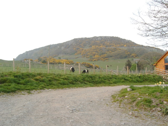
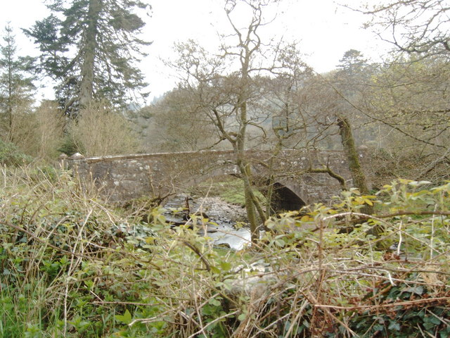
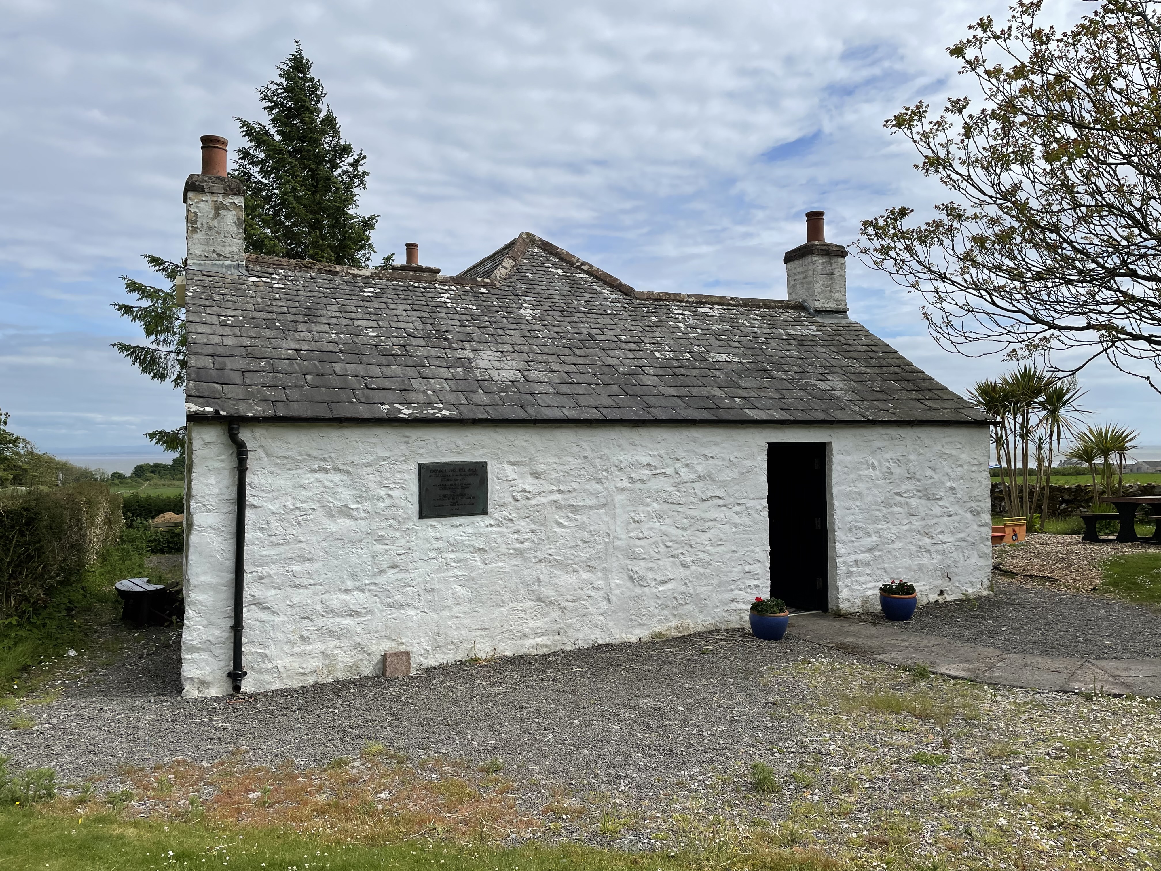
Bareness Holm Wood Images

Images are sourced within 2km of 54.899917/-3.6735056 or Grid Reference NX9257. Thanks to Geograph Open Source API. All images are credited.

Southwick Water at Caulkerbush
Grazing land and forest west of Mainsriddle
Visitors Centre Mersehead RSPB reserve. The sculpture is a collection box for parking fees.
Visitors Centre Mersehead
RSPB reserve. The sculpture is a collection box for parking fees.
Mersehead RSPB Reserve View from the car park.
Mersehead RSPB Reserve
View from the car park.
Cottage in the Hills Nestling between two hills, overlooking the nature reserve, this seems an ideal place to live.
Cottage in the Hills
Nestling between two hills, overlooking the nature reserve, this seems an ideal place to live.
Bird's Eye View Overlooking Mersehead Nature Reserve.
Bird's Eye View
Overlooking Mersehead Nature Reserve.
Water Ditch Flowing through the middle of Mersehead nature reserve creating wetland areas for many species of bird
Water Ditch
Flowing through the middle of Mersehead nature reserve creating wetland areas for many species of bird
Woodland at Mersehead Nature Reserve A small woodland area home of Grasshopper and Garden warblers
Woodland at Mersehead Nature Reserve
A small woodland area home of Grasshopper and Garden warblers
View from Bird Hide A great view from the bird hide across small ponds and wetland, the home of birds as varied as Grey Heron and Little Grebe
View from Bird Hide
A great view from the bird hide across small ponds and wetland, the home of birds as varied as Grey Heron and Little Grebe
Caulkerbush War Memorial
Castle Farm Viewed from the B793.
Castle Farm
Viewed from the B793.
Old RAC Road Sign This relic still survives opposite Southwick Parish Church.
Old RAC Road Sign
This relic still survives opposite Southwick Parish Church.
Clifton Craig Info from a climbing website:  Clifton is one of Southern Scotland's best kept secrets. South facing, quick drying, close to the road and in a beautiful location: its only weak point is the diminutive stature of the climbs. However, these pack such a punch into their short length that they are guaranteed to leave you just as drained as a 50m pitch would on most other crags.  Please keep dogs on a lead when in the fields. In spring, peregrines often nest near The Main Area or Red Slab and these buttresses should be avoided at this time.
Clifton Craig
Info from a climbing website: Clifton is one of Southern Scotland's best kept secrets. South facing, quick drying, close to the road and in a beautiful location: its only weak point is the diminutive stature of the climbs. However, these pack such a punch into their short length that they are guaranteed to leave you just as drained as a 50m pitch would on most other crags. Please keep dogs on a lead when in the fields. In spring, peregrines often nest near The Main Area or Red Slab and these buttresses should be avoided at this time.
Clifton Craig From a climbing website: "Clifton is one of Southern Scotland's best kept secrets. South facing, quick drying, close to the road and in a beautiful location: its only weak point is the diminutive stature of the climbs. However, these pack such a punch into their short length that they are guaranteed to leave you just as drained as a 50m pitch would on most other crags.  Please keep dogs on a lead when in the fields. In spring, peregrines often nest near The Main Area or Red Slab and these buttresses should be avoided at this time."
Clifton Craig
From a climbing website: "Clifton is one of Southern Scotland's best kept secrets. South facing, quick drying, close to the road and in a beautiful location: its only weak point is the diminutive stature of the climbs. However, these pack such a punch into their short length that they are guaranteed to leave you just as drained as a 50m pitch would on most other crags. Please keep dogs on a lead when in the fields. In spring, peregrines often nest near The Main Area or Red Slab and these buttresses should be avoided at this time."
Woodside Bridge over Southwick Water
Woodside Bridge
over Southwick Water
Southwick Water from the Woodside Bridge
Woodside Bridge seen from the north
Woodside Bridge
seen from the north
Southwick Parish Church at Caulkerbush From the internet: 

Church of Scotland.  Standing by woodland just outside the policies of Southwick House, a stone church of local grey granite with dressings of red sandstone. By Peddie & Kinnear 1891, a mixture of Early Christian and Norman. Its crossing tower was derived from the 14th-century tower of St Monans Parish Church. A wagon roof over the nave, the chancel arch enriched with chevron decoration. On either side of the chancel arch, a neo-Norman font by Cox & Buckley 1898 and a neo-Jacobean pulpit. Wrought iron Arts & Crafts light fittings, once for oil lamps. Late 19th-century stained glass. Organ replaced in May 1999 with Ahlborn SL100. A710 from Dumfries, turn right immediately over Southwick Bridge onto B793 Dalbeattie. Linked with Colvend and Kirkbean.
Southwick Parish Church at Caulkerbush
From the internet: Church of Scotland. Standing by woodland just outside the policies of Southwick House, a stone church of local grey granite with dressings of red sandstone. By Peddie & Kinnear 1891, a mixture of Early Christian and Norman. Its crossing tower was derived from the 14th-century tower of St Monans Parish Church. A wagon roof over the nave, the chancel arch enriched with chevron decoration. On either side of the chancel arch, a neo-Norman font by Cox & Buckley 1898 and a neo-Jacobean pulpit. Wrought iron Arts & Crafts light fittings, once for oil lamps. Late 19th-century stained glass. Organ replaced in May 1999 with Ahlborn SL100. A710 from Dumfries, turn right immediately over Southwick Bridge onto B793 Dalbeattie. Linked with Colvend and Kirkbean.
Show me another place!

Bareness Holm Wood is located at Grid Ref: NX9257 (Lat: 54.899917, Lng: -3.6735056)

Unitary Authority: Dumfries and Galloway

Police Authority: Dumfries and Galloway

What 3 Words

///hampers.congratulations.dislikes. Near Dalbeattie, Dumfries & Galloway

Related Wikis

Nearby Amenities

Located within 500m of 54.899917,-3.6735056
Caulkerbush
Is In: Dumfries & Galloway, Scotland, UK
Name Sco: Caukerbush
Place: hamlet
Lat/Long: 54.8978619/-3.6738287
Bus Stop
Southwick
Naptan AtcoCode: 680000030333
Naptan Bearing: W
Naptan BusStopType: CUS
Naptan CommonName: Southwick
Naptan Indicator: opp Road End
Naptan Landmark: B793
Naptan NaptanCode: 34238463
Naptan Notes: none
Naptan Street: A710
Naptan Verified: no
Source: naptan_import
Lat/Long: 54.8976519/-3.6731535
Bus Stop
Southwick
Naptan AtcoCode: 680000030444
Naptan Bearing: E
Naptan CommonName: Southwick
Naptan Indicator: Road End
Naptan Landmark: B793
Naptan NaptanCode: 34238464
Naptan Notes: none
Naptan Street: A710
Naptan Verified: no
Source: naptan_import
Lat/Long: 54.8978842/-3.6731722
Bus Stop
Southwick
Naptan AtcoCode: 680000786333
Naptan Bearing: SW
Naptan BusStopType: CUS
Naptan CommonName: Southwick
Naptan Indicator: opp PO
Naptan Landmark: Post Office
Naptan NaptanCode: 34238465
Naptan Notes: none
Naptan Street: A710
Naptan Verified: no
Source: naptan_import
Lat/Long: 54.8966769/-3.6766465
Bus Stop
Southwick
Naptan AtcoCode: 680000786444
Naptan Bearing: NE
Naptan BusStopType: CUS
Naptan CommonName: Southwick
Naptan Indicator: Post Office
Naptan Landmark: Post Office
Naptan NaptanCode: 34238467
Naptan Notes: none
Naptan Street: A710
Naptan Verified: no
Source: naptan_import
Lat/Long: 54.8967015/-3.6768191
Post Box
Ref: DG2 122
Lat/Long: 54.896723/-3.6761695
Place Of Worship
Seamark Landmark Function: church
Seamark Type: landmark
Lat/Long: 54.8995486/-3.6741739
Power: pole
Lat/Long: 54.8956354/-3.6711776
Power: pole
Lat/Long: 54.895783/-3.6727283
Power: pole
Lat/Long: 54.8959221/-3.6741964
Power: pole
Lat/Long: 54.8960672/-3.675639
Power: pole
Lat/Long: 54.8961526/-3.6769224
Power: pole
Lat/Long: 54.8963234/-3.6779513
Power: pole
Lat/Long: 54.8962161/-3.6694974
Power: pole
Lat/Long: 54.8972603/-3.6693001
Power: pole
Lat/Long: 54.8983766/-3.6690604
Power: pole
Lat/Long: 54.8992317/-3.6688843
Power: pole
Lat/Long: 54.8979496/-3.6702505
Power: pole
Lat/Long: 54.8969432/-3.6766064
Power: pole
Lat/Long: 54.8968565/-3.6773022
Power: pole
Lat/Long: 54.8967333/-3.6783035
Power: pole
Lat/Long: 54.8969432/-3.6789993
Power: pole
Lat/Long: 54.8971396/-3.6795891
Power: pole
Lat/Long: 54.9034321/-3.675971
Power: pole
Lat/Long: 54.9026209/-3.6755191
Power: pole
Lat/Long: 54.9017732/-3.6750757
Power: pole
Lat/Long: 54.9010255/-3.6746769
Power: pole
Lat/Long: 54.9005083/-3.674399
Power: pole
Lat/Long: 54.9001374/-3.6744287
Power: pole
Lat/Long: 54.8996458/-3.6747214
Power: pole
Lat/Long: 54.8988358/-3.6750927
Power: pole
Lat/Long: 54.8982503/-3.6762701
The data included in this document is from www.openstreetmap.org. The data is made available under ODbL.

Have you been to Bareness Holm Wood?

Leave your review of Bareness Holm Wood below (or comments, questions and feedback).