Cartbridge

Settlement in Surrey Woking

England

Cartbridge

Sutton Green Road at the junction of New Lane
Sutton Green Road at the junction of New Lane Credit: David Howard

Cartbridge is a small village located in the county of Surrey, England. Situated in the South East of the country, it is part of the borough of Waverley. The village is surrounded by a picturesque countryside landscape, characterized by rolling hills, woodlands, and open fields.

Cartbridge is known for its tranquil and idyllic atmosphere, making it a popular destination for those seeking a peaceful retreat away from the hustle and bustle of city life. The village is dotted with charming cottages and historic buildings, giving it a quintessential English village feel.

Despite its small size, Cartbridge has a strong sense of community. The village is home to a close-knit population who take pride in their surroundings. The locals actively participate in community events and initiatives, fostering a welcoming and inclusive atmosphere.

One of the notable features of Cartbridge is its proximity to the beautiful Surrey Hills Area of Outstanding Natural Beauty. This designation ensures the preservation and protection of the area's unique natural and cultural heritage. As a result, residents and visitors alike can enjoy a range of outdoor activities such as hiking, cycling, and horse riding.

In terms of amenities, Cartbridge has a few local shops and services to cater to the basic needs of its residents. However, for a wider range of amenities, the nearby town of Godalming is easily accessible.

Overall, Cartbridge offers a charming and rural lifestyle within a stunning natural setting, making it an ideal place for those seeking a peaceful and close-knit community in the heart of Surrey.

If you have any feedback on the listing, please let us know in the comments section below.
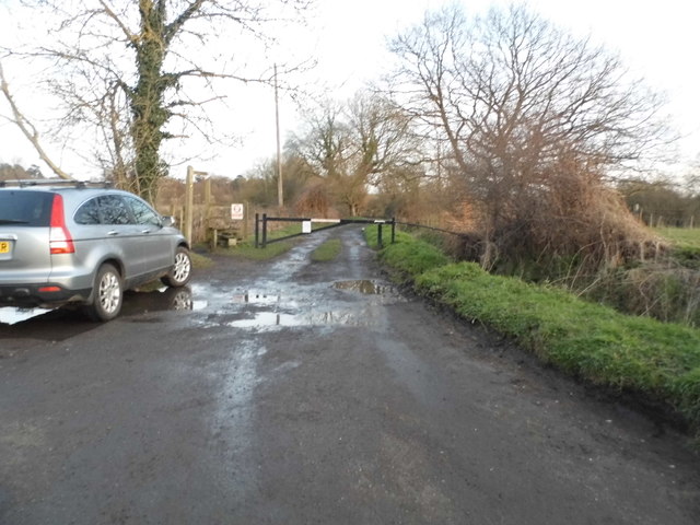
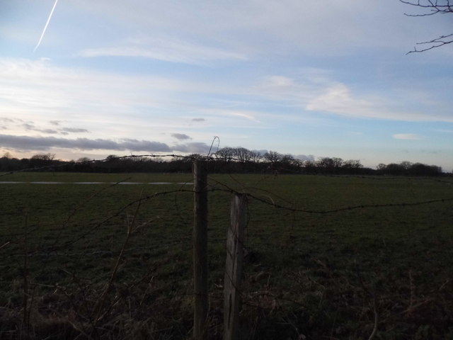
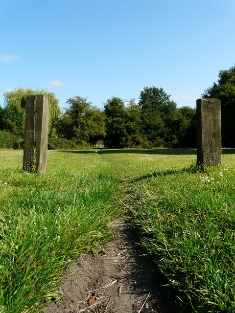
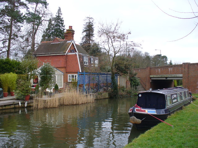
Cartbridge Images

Images are sourced within 2km of 51.294756/-0.54179696 or Grid Reference TQ0156. Thanks to Geograph Open Source API. All images are credited.

Sutton Green Road at the junction of New Lane
Private track at the end of Runtley Wood Lane
The entrance to Runtleywood Farm
Field by Runtleywood Farm
Runtley Wood Lane, Sutton Green
Sunset over Runtley Wood Lane, Sutton Green
Field by Runtleywood Farm
Sundridge Road, Woking
Lower Westfield Farm, Sutton Green
Trees by Robin Hood Lane, Sutton Green
Robin Hood Lane, Sutton Green
Field by Robin Hood Lane, Sutton Green
Robin Hood Lane, Sutton Green
New building by Lower Westfield Farm This is the approximate location (looking west towards the sunset), as it's not yet up on Google but I wasn't anywhere else at that moment.
New building by Lower Westfield Farm
This is the approximate location (looking west towards the sunset), as it's not yet up on Google but I wasn't anywhere else at that moment.
Elmbridge Lane, Woking
Show me another place!

Cartbridge is located at Grid Ref: TQ0156 (Lat: 51.294756, Lng: -0.54179696)

Administrative County: Surrey

District: Woking

Police Authority: Surrey

What 3 Words

///asset.month.ports. Near Send, Surrey

Related Wikis

St Peter's Church, Old Woking

St Peter's Church is situated in Old Woking, Surrey, England. It is recorded in the Domesday Book. It also has the third oldest surviving door in the...

Old Woking

Old Woking is a ward and the original settlement of the town and borough of Woking, Surrey, about 1.3 miles (2.1 km) southeast of the modern town centre...

Westfield Common

Westfield Common is an area of land in Westfield, Woking that is registered common land. == Attributes == Westfield Common has boundaries that have been...

Send, Surrey

Send is a village and civil parish in the Guildford borough of the English county of Surrey. The name is thought to mean "sandy place" and sand was extracted...

Woking College

Woking College is a sixth form college in Woking, Surrey, with over 1,500 16-19-year-olds studying A Levels and advanced vocational courses. It was the...

Westfield, Woking, Surrey

Westfield is an area in Woking borough, Surrey. Westfield marks the southern boundary of Woking altering from English archetypal suburban homes in the...

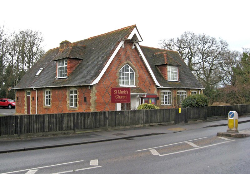
St Mark's Church, Woking

St Mark's Church is located in Westfield, Woking, England. The church is in the Parish of the South Woking Team Ministry and the Diocese of Guildford....

Hoe Bridge School

Hoe Bridge School is an independent co-educational, pre-prep and prep school in Woking, England. At its last full inspection in 2023 it was rated excellent...

Nearby Amenities

Located within 500m of 51.294756,-0.54179696
Worsfold Gates
Seamark Type: gate
Waterway: lock_gate
Lat/Long: 51.2912296/-0.5443604
Worsfold Gates
Seamark Type: gate
Waterway: lock_gate
Lat/Long: 51.2914142/-0.544204
Pub
The New Inn
Addr City: Send
Addr Country: GB
Addr Housename: The New Inn
Addr Postcode: GU23 7EN
Addr Street: Send Road
Brewery: yes
Fhrs Authority: Guildford
Fhrs Id: 1012689
Fhrs Local Authority Id: 10432
Internet Access: wlan
Note: This pub has a small book library.
Outdoor Seating: yes
Smoking: outside
Website: https://www.thenewinnsend.com/
Lat/Long: 51.29448/-0.5417217
Power: tower
Lat/Long: 51.2961212/-0.5373076
Power: tower
Lat/Long: 51.2966847/-0.5400456
Power: tower
Lat/Long: 51.2972053/-0.5428265
Power: tower
Lat/Long: 51.297055/-0.5450667
Power: tower
Lat/Long: 51.2969316/-0.5472811
Source: OS_OpenData_VectorMapDI
Lat/Long: 51.2974811/-0.5424285
Source: OS_OpenData_VectorMapDI
Lat/Long: 51.2972667/-0.5425759
Barrier: stile
Lat/Long: 51.2934469/-0.5469782
Church Rooms
Building: yes
Lat/Long: 51.2924233/-0.5358106
Parking
Access: private
Lat/Long: 51.2923443/-0.5358399
Post Box
Brand: Royal Mail
Brand Wikidata: Q638098
Collection Plate: CP7D
Collection Times: Mo-Fr 09:00; Sa 07:00
Operator: Royal Mail
Operator Wikidata: Q638098
Post Box Mounting: wooden_post
Post Box Type: lamp
Ref: GU23 99D
Royal Cypher: EIIR
Royal Cypher Wikidata: Q33102113
Lat/Long: 51.2928367/-0.5414827
Bus Stop
Broadmeads
Bus: yes
Naptan AtcoCode: 40004407225A
Naptan Bearing: SW
Naptan CommonName: Broadmeads
Naptan Indicator: Just after
Naptan Landmark: Broadmeads
Naptan NaptanCode: surapmaj
Naptan PlusbusZoneRef: WOKING
Naptan Street: Broadmead Road
Naptan Verified: no
Public Transport: platform
Source: naptan_import
Lat/Long: 51.2960862/-0.5414109
Bus Stop
Broadmeads
Bus: yes
Naptan AtcoCode: 40004407225B
Naptan Bearing: N
Naptan CommonName: Broadmeads
Naptan Indicator: Opp
Naptan Landmark: Broadmeads
Naptan NaptanCode: surapmam
Naptan PlusbusZoneRef: WOKING
Naptan Street: Broadmead Road
Naptan Verified: no
Public Transport: platform
Source: naptan_import
Lat/Long: 51.2962316/-0.5414932
Bus Stop
New Inn
Naptan AtcoCode: 40004407226A
Naptan Bearing: SE
Naptan CommonName: New Inn
Naptan Indicator: Opp
Naptan Landmark: New Inn
Naptan NaptanCode: surapmap
Naptan PlusbusZoneRef: WOKING
Naptan Street: Send Road
Naptan Verified: no
Public Transport: platform
Source: naptan_import
Lat/Long: 51.2944683/-0.5412024
Bus Stop
New Inn
Naptan AtcoCode: 40004407226B
Naptan Bearing: NW
Naptan CommonName: New Inn
Naptan Indicator: adj
Naptan Landmark: New Inn
Naptan NaptanCode: surapmat
Naptan PlusbusZoneRef: WOKING
Naptan Street: Send Road
Naptan Verified: no
Public Transport: platform
Source: naptan_import
Lat/Long: 51.2946584/-0.5417576
Bus Stop
Lancaster Hall
Naptan AtcoCode: 40004407227A
Naptan Bearing: SE
Naptan CommonName: Lancaster Hall
Naptan Indicator: O/s
Naptan Landmark: Lancaster Hall
Naptan NaptanCode: surapmaw
Naptan PlusbusZoneRef: WOKING
Naptan Street: Send Road
Naptan Verified: no
Public Transport: platform
Source: naptan_import
Lat/Long: 51.2929399/-0.5368988
Bus Stop
Lancaster Hall
Naptan AtcoCode: 40004407227B
Naptan Bearing: NW
Naptan CommonName: Lancaster Hall
Naptan Indicator: Just after
Naptan Landmark: Lancaster Hall
Naptan NaptanCode: surapmda
Naptan PlusbusZoneRef: WOKING
Naptan Street: Send Road
Naptan Verified: no
Public Transport: platform
Source: naptan_import
Lat/Long: 51.2929717/-0.5374464
Source: OS_OpenData_VectorMapDI
Lat/Long: 51.2934543/-0.5438212
Source: OS_OpenData_VectorMapDI
Lat/Long: 51.2934544/-0.5437609
Source: OS_OpenData_VectorMapDI
Lat/Long: 51.2935419/-0.5437094
Source: OS_OpenData_VectorMapDI
Lat/Long: 51.2935753/-0.5437184
Source: OS_OpenData_VectorMapDI
Lat/Long: 51.2936437/-0.5435814
Source: OS_OpenData_VectorMapDI
Lat/Long: 51.2936772/-0.543599
Source: OS_OpenData_VectorMapDI
Lat/Long: 51.2937358/-0.5435131
Source: OS_OpenData_VectorMapDI
Lat/Long: 51.2937551/-0.5435455
Source: OS_OpenData_VectorMapDI
Lat/Long: 51.2937689/-0.5435006
Source: OS_OpenData_VectorMapDI
Lat/Long: 51.2937902/-0.5435515
Source: OS_OpenData_VectorMapDI
Lat/Long: 51.2938094/-0.5435065
Source: OS_OpenData_VectorMapDI
Lat/Long: 51.2938329/-0.543586
Source: OS_OpenData_VectorMapDI
Lat/Long: 51.2938458/-0.5435354
Source: OS_OpenData_VectorMapDI
Lat/Long: 51.2938881/-0.5435902
Source: OS_OpenData_VectorMapDI
Lat/Long: 51.2939563/-0.5437499
Source: OS_OpenData_VectorMapDI
Lat/Long: 51.293963/-0.5437038
Source: OS_OpenData_VectorMapDI
Lat/Long: 51.2939838/-0.5437189
Source: OS_OpenData_VectorMapDI
Lat/Long: 51.2939943/-0.5437659
Source: OS_OpenData_VectorMapDI
Lat/Long: 51.2940446/-0.5437629
Source: OS_OpenData_VectorMapDI
Lat/Long: 51.2940487/-0.5437284
Source: OS_OpenData_VectorMapDI
Lat/Long: 51.2940697/-0.5437506
Source: OS_OpenData_VectorMapDI
Lat/Long: 51.2941022/-0.5437977
Source: OS_OpenData_VectorMapDI
Lat/Long: 51.2941157/-0.5437635
Source: OS_OpenData_VectorMapDI
Lat/Long: 51.2942173/-0.5438026
Source: OS_OpenData_VectorMapDI
Lat/Long: 51.2942222/-0.5437573
Source: OS_OpenData_VectorMapDI
Lat/Long: 51.294441/-0.5437497
Source: OS_OpenData_VectorMapDI
Lat/Long: 51.2944575/-0.5437011
Source: OS_OpenData_VectorMapDI
Lat/Long: 51.2946201/-0.5437956
Source: OS_OpenData_VectorMapDI
Lat/Long: 51.2946785/-0.5437565
Source: OS_OpenData_VectorMapDI
Lat/Long: 51.2947326/-0.543805
Source: OS_OpenData_VectorMapDI
Lat/Long: 51.2947522/-0.5437549
Source: OS_OpenData_VectorMapDI
Lat/Long: 51.2948105/-0.5437774
Source: OS_OpenData_VectorMapDI
Lat/Long: 51.2948497/-0.5437095
Source: OS_OpenData_VectorMapDI
Lat/Long: 51.2948569/-0.5437487
Source: OS_OpenData_VectorMapDI
Lat/Long: 51.2951167/-0.5435225
Source: OS_OpenData_VectorMapDI
Lat/Long: 51.2951223/-0.5434649
Source: OS_OpenData_VectorMapDI
Lat/Long: 51.2952394/-0.5434081
Source: OS_OpenData_VectorMapDI
Lat/Long: 51.2952511/-0.5434515
Source: OS_OpenData_VectorMapDI
Lat/Long: 51.295379/-0.5433585
Source: OS_OpenData_VectorMapDI
Lat/Long: 51.295382/-0.5433047
Source: OS_OpenData_VectorMapDI
Lat/Long: 51.2954501/-0.5433247
Source: OS_OpenData_VectorMapDI
Lat/Long: 51.2956054/-0.5432352
Source: OS_OpenData_VectorMapDI
Lat/Long: 51.2956136/-0.5432787
Source: OS_OpenData_VectorMapDI
Lat/Long: 51.2957272/-0.543265
Source: OS_OpenData_VectorMapDI
Lat/Long: 51.2957473/-0.5432199
Source: bing
Waterway: weir
Lat/Long: 51.2957516/-0.5449338
Source: OS_OpenData_VectorMapDI
Lat/Long: 51.2958411/-0.5432787
Source: OS_OpenData_VectorMapDI
Lat/Long: 51.2958609/-0.5432436
Source: OS_OpenData_VectorMapDI
Lat/Long: 51.295882/-0.5445783
Source: OS_OpenData_VectorMapDI
Lat/Long: 51.2958986/-0.5433077
Source: OS_OpenData_VectorMapDI
Lat/Long: 51.2959176/-0.5432798
Source: OS_OpenData_VectorMapDI
Lat/Long: 51.2959857/-0.5434039
Source: OS_OpenData_VectorMapDI
Lat/Long: 51.2959882/-0.5433543
Source: OS_OpenData_VectorMapDI
Lat/Long: 51.2960537/-0.5433802
Source: OS_OpenData_VectorMapDI
Lat/Long: 51.2960918/-0.5433718
Source: OS_OpenData_VectorMapDI
Lat/Long: 51.2961166/-0.5434471
Source: OS_OpenData_VectorMapDI
Lat/Long: 51.2961528/-0.5434258
Source: OS_OpenData_VectorMapDI
Lat/Long: 51.2961647/-0.5432993
Source: OS_OpenData_VectorMapDI
Lat/Long: 51.296165/-0.5433982
Source: OS_OpenData_VectorMapDI
Lat/Long: 51.2961747/-0.5433427
Source: OS_OpenData_VectorMapDI
Lat/Long: 51.2961897/-0.5432877
Source: OS_OpenData_VectorMapDI
Lat/Long: 51.2961915/-0.5433235
Source: OS_OpenData_VectorMapDI
Lat/Long: 51.296362/-0.543369
Source: OS_OpenData_VectorMapDI
Lat/Long: 51.2963711/-0.5443147
Source: OS_OpenData_VectorMapDI
Lat/Long: 51.2963781/-0.5443015
Source: OS_OpenData_VectorMapDI
Lat/Long: 51.2963803/-0.5433175
Source: OS_OpenData_VectorMapDI
Lat/Long: 51.2964664/-0.5432997
Source: OS_OpenData_VectorMapDI
Lat/Long: 51.2964737/-0.5433433
Source: OS_OpenData_VectorMapDI
Lat/Long: 51.2964939/-0.5425494
Source: OS_OpenData_VectorMapDI
Lat/Long: 51.2964948/-0.5425114
Source: OS_OpenData_VectorMapDI
Lat/Long: 51.296484/-0.5424534
Source: OS_OpenData_VectorMapDI
Lat/Long: 51.296511/-0.5424743
Source: OS_OpenData_VectorMapDI
Lat/Long: 51.2965374/-0.5432609
Source: OS_OpenData_VectorMapDI
Lat/Long: 51.2965394/-0.5427029
Source: OS_OpenData_VectorMapDI
Lat/Long: 51.2965474/-0.5424057
Source: OS_OpenData_VectorMapDI
Lat/Long: 51.2965832/-0.5432179
Source: OS_OpenData_VectorMapDI
Lat/Long: 51.2965947/-0.5429177
Source: OS_OpenData_VectorMapDI
Lat/Long: 51.2965986/-0.5431916
Source: OS_OpenData_VectorMapDI
Lat/Long: 51.2966032/-0.5432409
Source: OS_OpenData_VectorMapDI
Lat/Long: 51.296607/-0.5424311
Source: OS_OpenData_VectorMapDI
Lat/Long: 51.2966071/-0.5431511
Source: OS_OpenData_VectorMapDI
Lat/Long: 51.2966172/-0.5428826
Source: OS_OpenData_VectorMapDI
Lat/Long: 51.2966229/-0.5423661
Source: OS_OpenData_VectorMapDI
Lat/Long: 51.2966296/-0.5429783
Source: OS_OpenData_VectorMapDI
Lat/Long: 51.29663/-0.5431848
Source: OS_OpenData_VectorMapDI
Lat/Long: 51.2966361/-0.5431366
Source: OS_OpenData_VectorMapDI
Lat/Long: 51.296705/-0.5423513
Source: OS_OpenData_VectorMapDI
Lat/Long: 51.2967126/-0.5424206
Source: OS_OpenData_VectorMapDI
Lat/Long: 51.296772/-0.5423857
Source: OS_OpenData_VectorMapDI
Lat/Long: 51.2967943/-0.5424417
Source: OS_OpenData_VectorMapDI
Lat/Long: 51.2968102/-0.5423888
Source: OS_OpenData_VectorMapDI
Lat/Long: 51.2968366/-0.5424792
Source: OS_OpenData_VectorMapDI
Lat/Long: 51.2968413/-0.5424301
Source: OS_OpenData_VectorMapDI
Lat/Long: 51.297029/-0.5425153
Source: OS_OpenData_VectorMapDI
Lat/Long: 51.2971132/-0.5425972
Source: OS_OpenData_VectorMapDI
Lat/Long: 51.2971396/-0.5425555
Source: OS_OpenData_VectorMapDI
Lat/Long: 51.2971888/-0.5426077
Source: OS_OpenData_VectorMapDI
Lat/Long: 51.2971963/-0.5425537
Source: OS_OpenData_VectorMapDI
Lat/Long: 51.2972648/-0.5424985
Source: OS_OpenData_VectorMapDI
Lat/Long: 51.2975334/-0.5421515
Source: OS_OpenData_VectorMapDI
Lat/Long: 51.2975796/-0.5424677
Place Of Worship
Send Evangelical Church
Denomination: evangelical
Religion: christian
Website: https://www.sendec.org/
Lat/Long: 51.2956648/-0.5415347
Water Point
Waterway: yes
Lat/Long: 51.2957724/-0.5408691
Surrey Bouncy Castles
Addr City: Woking
Addr Housenumber: 4
Addr Postcode: GU23 7AE
Addr Street: Potters Lane
Operator: Surrey Bouncy Castles
Shop: rental
Website: https://www.surreybouncycastles.co.uk
Lat/Long: 51.2921399/-0.5411622
Defibrillator
Defibrillator Location: On the outside of The New Inn pub on the southern wall, by the entrance.
Emergency: defibrillator
Indoor: no
Source: visit to pub
Lat/Long: 51.2944284/-0.5417884
Waste Basket
Colour: black
Covered: yes
Source: survey
Lat/Long: 51.2944054/-0.5414615
Parking
Access: customers
Parking: surface
Lat/Long: 51.2955676/-0.5414544
Source: OS_OpenData_VectorMapDI
Lat/Long: 51.2965819/-0.5428636
Source: OS_OpenData_VectorMapDI
Lat/Long: 51.2965819/-0.5428636
Source: OS_OpenData_VectorMapDI
Lat/Long: 51.2965151/-0.5427309
Source: OS_OpenData_VectorMapDI
Lat/Long: 51.2964797/-0.5426265
Source: OS_OpenData_VectorMapDI
Lat/Long: 51.2964696/-0.5425861
Source: OS_OpenData_VectorMapDI
Lat/Long: 51.2964718/-0.5425085
The data included in this document is from www.openstreetmap.org. The data is made available under ODbL.

Have you been to Cartbridge?

Leave your review of Cartbridge below (or comments, questions and feedback).