Mill Moor

Downs, Moorland in Surrey Woking

England

Mill Moor

Apartments in Mount Hermon Road
Apartments in Mount Hermon Road Credit: Basher Eyre

Mill Moor is a picturesque area located in Surrey, England. Situated within the larger region of the Surrey Downs, Mill Moor is characterized by its stunning moorland landscapes and vibrant biodiversity. This area spans approximately 20 square kilometers and is renowned for its natural beauty and tranquility.

The moorland in Mill Moor is dominated by a variety of grasses and heather, creating a patchwork of colors that change with the seasons. This unique ecosystem supports a diverse range of wildlife, including numerous bird species such as curlews, lapwings, and red grouse. Visitors to Mill Moor often enjoy birdwatching, as well as hiking and photography amidst the breathtaking scenery.

The area is also home to several historical landmarks, adding to its charm and cultural significance. One notable feature is an ancient mill, which dates back to the 18th century and played a vital role in the local community's economy. Today, the mill has been restored and serves as a popular tourist attraction, providing insight into the region's industrial heritage.

In addition to its natural and historical attractions, Mill Moor offers a range of recreational activities. The moorland provides an ideal setting for outdoor pursuits such as walking, cycling, and horse riding. There are also various picnic spots and designated nature reserves where visitors can relax and immerse themselves in the peaceful surroundings.

Overall, Mill Moor is a captivating destination that showcases the beauty of Surrey's downs and moorland. With its rich biodiversity, historical landmarks, and recreational opportunities, it offers something for everyone seeking a tranquil escape in a stunning natural setting.

If you have any feedback on the listing, please let us know in the comments section below.
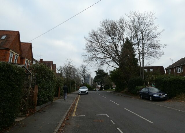
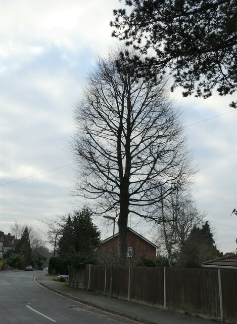
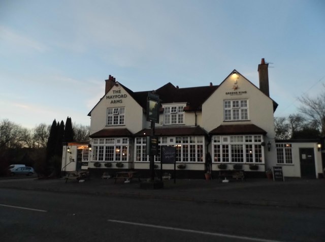
Mill Moor Images

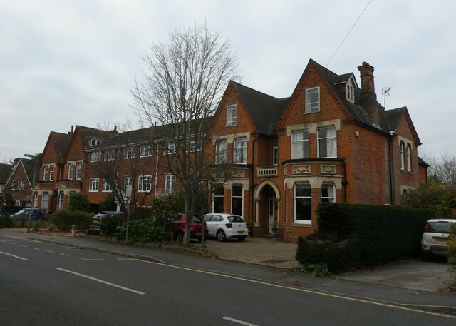
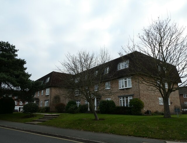
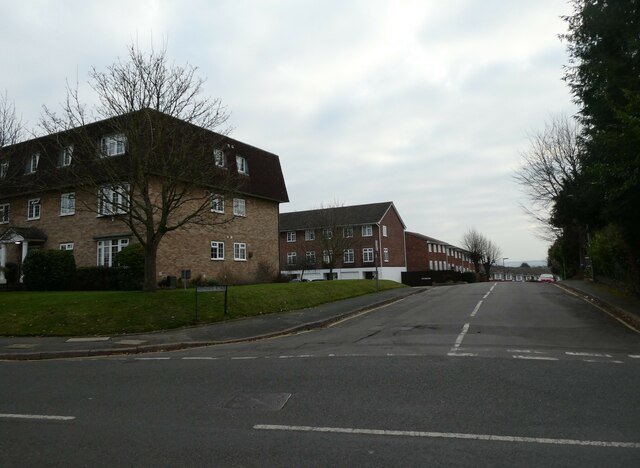
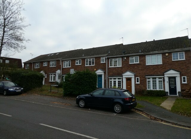
Images are sourced within 2km of 51.300571/-0.54593044 or Grid Reference TQ0156. Thanks to Geograph Open Source API. All images are credited.

Apartments in Mount Hermon Road
Winter trees in Mount Hermon Road
Looking from Mount Hermon Road into Midhope Road
Hanover Court, Mount Hermon Road
Mount Hermon Road: December 2021
St Mary of Bethany, Woking: December 2021
Looking south-southeast along Mount Hermon Road
Path from St Mary's Church to York Road
Post box outside St Mary's Church Post boxes come in many forms from free standing pillar boxes to those built into walls. The monarch's cypher is always present to give an indication of age.
In the British Isles the first red pillar post boxes were erected in Jersey in 1852. Roadside wall boxes first appeared in 1857 as a cheaper alternative to pillar boxes, especially in rural districts. In 1853 the first pillar box in the United Kingdom was installed at Botchergate, Carlisle. In 1856, Richard Redgrave of the Department of Science and Art designed an ornate pillar box for use in London and other large cities. In 1859 the design was improved, and this became the first National Standard pillar box. Green was adopted as the standard colour for the early Victorian post boxes. Between 1866 and 1879 the hexagonal Penfold post box became the standard design for pillar boxes and it was during this period that red was first adopted as the standard colour. The first boxes to be painted red were in London in July 1874, although it would be nearly 10 years before all the boxes had been repainted.(excerpt from Wikipedia)
Post box outside St Mary's Church
Post boxes come in many forms from free standing pillar boxes to those built into walls. The monarch's cypher is always present to give an indication of age. In the British Isles the first red pillar post boxes were erected in Jersey in 1852. Roadside wall boxes first appeared in 1857 as a cheaper alternative to pillar boxes, especially in rural districts. In 1853 the first pillar box in the United Kingdom was installed at Botchergate, Carlisle. In 1856, Richard Redgrave of the Department of Science and Art designed an ornate pillar box for use in London and other large cities. In 1859 the design was improved, and this became the first National Standard pillar box. Green was adopted as the standard colour for the early Victorian post boxes. Between 1866 and 1879 the hexagonal Penfold post box became the standard design for pillar boxes and it was during this period that red was first adopted as the standard colour. The first boxes to be painted red were in London in July 1874, although it would be nearly 10 years before all the boxes had been repainted.(excerpt from Wikipedia)
Winter tree in West Hill Road
Top end of West Hill Road
Looking along West Hill Road towards Mount Hermon Road
Looking north-northwest along West Hill Road
Lamppost in West Hill Road Road lighting predates the earliest cars by thousands of years. In the 5th century BC, people in Beijing used bamboo pipes to harness and lead natural gas from volcano leaks to their communities which they then used to ignite lamps that  lit up their thoroughfares at night. 1417 marked the first organized public street lighting system in London. Its mayor, Sir Henry Barton, ordered people to place oil lanterns outside their homes at night during the winter. In 1802, William Murdoch invented the first coal-ignited gas lighting system and in 1879 Paris produced the world’s first electric streetlight system. A year later, Thomas Edison introduced the first carbon-thread incandescent lamp. By 1965 most systems used  high-pressure sodium (HID) lamps.  Today, street lighting commonly uses high-intensity discharge lamps. Milan, Italy is the first major city to have entirely switched to LED lighting
Lamppost in West Hill Road
Road lighting predates the earliest cars by thousands of years. In the 5th century BC, people in Beijing used bamboo pipes to harness and lead natural gas from volcano leaks to their communities which they then used to ignite lamps that lit up their thoroughfares at night. 1417 marked the first organized public street lighting system in London. Its mayor, Sir Henry Barton, ordered people to place oil lanterns outside their homes at night during the winter. In 1802, William Murdoch invented the first coal-ignited gas lighting system and in 1879 Paris produced the world’s first electric streetlight system. A year later, Thomas Edison introduced the first carbon-thread incandescent lamp. By 1965 most systems used high-pressure sodium (HID) lamps. Today, street lighting commonly uses high-intensity discharge lamps. Milan, Italy is the first major city to have entirely switched to LED lighting
Houses in West Hill Road
Bus heading down West Hill Road
The Mayford Arms
The Mayford Arms
Mayford Motors on Egley Road I've been here before <a title="https://www.geograph.org.uk/photo/4438822" href="https://www.geograph.org.uk/photo/4438822">Link</a>
Mayford Motors on Egley Road
I've been here before Link
Show me another place!

Mill Moor is located at Grid Ref: TQ0156 (Lat: 51.300571, Lng: -0.54593044)

Administrative County: Surrey

District: Woking

Police Authority: Surrey

What 3 Words

///mess.hotel.part. Near Send, Surrey

Related Wikis

St Peter's Church, Old Woking

St Peter's Church is situated in Old Woking, Surrey, England. It is recorded in the Domesday Book. It also has the third oldest surviving door in the...

Old Woking

Old Woking is a ward and the original settlement of the town and borough of Woking, Surrey, about 1.3 miles (2.1 km) southeast of the modern town centre...

Woking College

Woking College is a sixth form college in Woking, Surrey, with over 1,500 16-19-year-olds studying A Levels and advanced vocational courses. It was the...

St John the Baptist School, Woking

St John the Baptist School is a coeducational Catholic secondary school and sixth form in Woking, Surrey, England. The school was one of the first 100...

White Rose Lane

White Rose Lane is a 3.4-hectare (8.4-acre) Local Nature Reserve in Woking in Surrey. It is owned and managed by Woking Borough Council.This site is damp...

Westfield, Woking, Surrey

Westfield is an area in Woking borough, Surrey. Westfield marks the southern boundary of Woking altering from English archetypal suburban homes in the...

Hoe Bridge School

Hoe Bridge School is an independent co-educational, pre-prep and prep school in Woking, England. At its last full inspection in 2023 it was rated excellent...

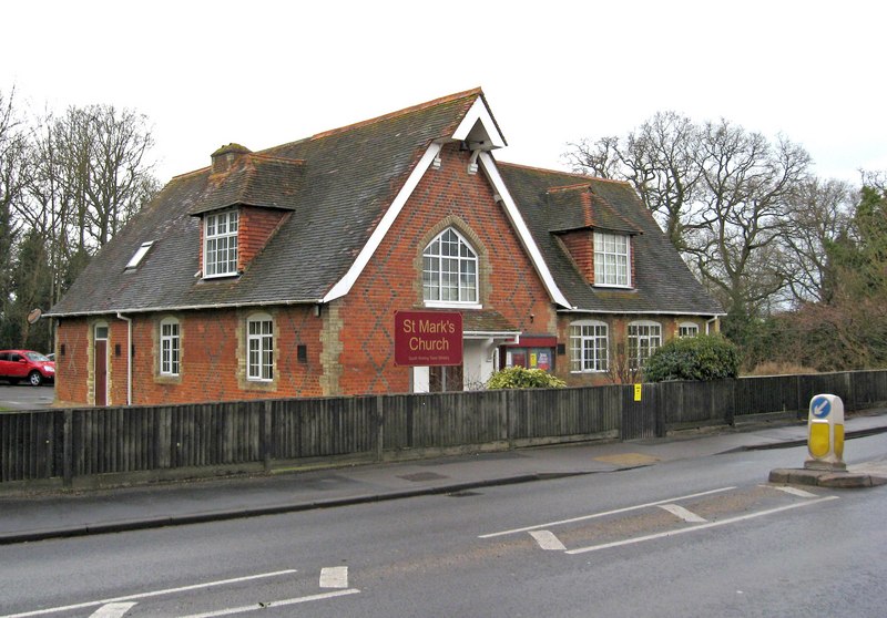
St Mark's Church, Woking

St Mark's Church is located in Westfield, Woking, England. The church is in the Parish of the South Woking Team Ministry and the Diocese of Guildford....

Nearby Amenities

Located within 500m of 51.300571,-0.54593044
Mini Roundabout
Direction: clockwise
Source: photo
Lat/Long: 51.303157/-0.5513909
Old Woking
Place: village
Wikidata: Q7085435
Lat/Long: 51.3046405/-0.544982
Power: tower
Lat/Long: 51.2972053/-0.5428265
Power: tower
Lat/Long: 51.297055/-0.5450667
Power: tower
Lat/Long: 51.2969316/-0.5472811
Power: tower
Lat/Long: 51.2989763/-0.5479506
Power: tower
Lat/Long: 51.3003662/-0.5474442
Power: tower
Lat/Long: 51.3020674/-0.5468091
Turning Circle
Lat/Long: 51.3034948/-0.5414275
Post Box
Collection Plate: CP8
Collection Times: Mo-Fr 16:00; Sa 12:15
Last Check: 2020-02-13
Operator: Royal Mail
Post Box Type: pillar
Postal Code: GU22
Ref: GU22 144
Royal Cypher: EIIR
Royal Cypher Wikidata: Q33102113
Lat/Long: 51.3029734/-0.5513398
Pub
Crown & Anchor
Accommodation: yes
Check Date: 2019-05-22
Food: yes
Internet Access: wlan
Internet Access Fee: no
Toilets: yes
Toilets Access: customers
Lat/Long: 51.3020936/-0.5449516
Source: OS_OpenData_VectorMapDI
Lat/Long: 51.2974811/-0.5424285
Source: OS_OpenData_VectorMapDI
Lat/Long: 51.2972667/-0.5425759
Telephone
Booth: KX100
Contact Phone: +44 1483 762214
Covered: booth
Operator: BT
Payment Coins: yes
Payment Credit Cards: no
Payment Debit Cards: no
Lat/Long: 51.3022962/-0.5395118
Barrier: stile
Lat/Long: 51.2991774/-0.5483177
Bus Stop
Manor Way
Naptan AtcoCode: 40004404057A
Naptan Bearing: E
Naptan CommonName: Manor Way
Naptan Indicator: Just after
Naptan Landmark: Manor Way
Naptan NaptanCode: surgdjmt
Naptan PlusbusZoneRef: WOKING
Naptan Street: High Street
Naptan Verified: no
Public Transport: platform
Source: naptan_import
Lat/Long: 51.3020893/-0.5413388
Bus Stop
Manor Way
Naptan AtcoCode: 40004404057B
Naptan Bearing: W
Naptan CommonName: Manor Way
Naptan Indicator: Opp
Naptan Landmark: Manor Way
Naptan NaptanCode: surgdjmw
Naptan PlusbusZoneRef: WOKING
Naptan Street: High Street
Naptan Verified: no
Public Transport: platform
Source: naptan_import
Lat/Long: 51.3020168/-0.5420361
Bus Stop
Crown And Anchor
Naptan AtcoCode: 40004404058A
Naptan Bearing: E
Naptan CommonName: Crown And Anchor
Naptan Indicator: Opp
Naptan Landmark: Crown And Anchor
Naptan NaptanCode: surgdjpa
Naptan PlusbusZoneRef: WOKING
Naptan Street: High Street
Naptan Verified: no
Public Transport: platform
Source: naptan_import
Lat/Long: 51.3022938/-0.5447396
Bus Stop
Crown And Anchor
Naptan AtcoCode: 40004404058B
Naptan Bearing: W
Naptan CommonName: Crown And Anchor
Naptan Indicator: O/s
Naptan Landmark: Crown And Anchor
Naptan NaptanCode: surgdjpd
Naptan PlusbusZoneRef: WOKING
Naptan Street: High Street
Naptan Verified: no
Public Transport: platform
Source: naptan_import
Lat/Long: 51.3021774/-0.5450876
Bus Stop
Shackleford Road
Naptan AtcoCode: 40004404059A
Naptan Bearing: E
Naptan CommonName: Shackleford Road
Naptan Indicator: Just Before
Naptan Landmark: Shackleford Road
Naptan NaptanCode: surgdjpg
Naptan PlusbusZoneRef: WOKING
Naptan Street: High Street
Naptan Verified: no
Public Transport: platform
Source: naptan_import
Lat/Long: 51.3030288/-0.5505864
Bus Stop
Shackleford Road
Naptan AtcoCode: 40004404059B
Naptan Bearing: W
Naptan CommonName: Shackleford Road
Naptan Indicator: Just after
Naptan Landmark: Shackleford Road
Naptan NaptanCode: surgdjpj
Naptan PlusbusZoneRef: WOKING
Naptan Street: High Street
Naptan Verified: no
Public Transport: platform
Source: naptan_import
Lat/Long: 51.3028622/-0.5500894
Source: OS_OpenData_VectorMapDI
Lat/Long: 51.2963711/-0.5443147
Source: OS_OpenData_VectorMapDI
Lat/Long: 51.2963781/-0.5443015
Source: OS_OpenData_VectorMapDI
Lat/Long: 51.2963803/-0.5433175
Source: OS_OpenData_VectorMapDI
Lat/Long: 51.2964664/-0.5432997
Source: OS_OpenData_VectorMapDI
Lat/Long: 51.2964737/-0.5433433
Source: OS_OpenData_VectorMapDI
Lat/Long: 51.2965374/-0.5432609
Source: OS_OpenData_VectorMapDI
Lat/Long: 51.2965832/-0.5432179
Source: OS_OpenData_VectorMapDI
Lat/Long: 51.2965947/-0.5429177
Source: OS_OpenData_VectorMapDI
Lat/Long: 51.2965986/-0.5431916
Source: OS_OpenData_VectorMapDI
Lat/Long: 51.2966032/-0.5432409
Source: OS_OpenData_VectorMapDI
Lat/Long: 51.2966071/-0.5431511
Source: OS_OpenData_VectorMapDI
Lat/Long: 51.2966172/-0.5428826
Source: OS_OpenData_VectorMapDI
Lat/Long: 51.2966296/-0.5429783
Source: OS_OpenData_VectorMapDI
Lat/Long: 51.29663/-0.5431848
Source: OS_OpenData_VectorMapDI
Lat/Long: 51.2966361/-0.5431366
Source: OS_OpenData_VectorMapDI
Lat/Long: 51.296705/-0.5423513
Source: OS_OpenData_VectorMapDI
Lat/Long: 51.2967126/-0.5424206
Source: OS_OpenData_VectorMapDI
Lat/Long: 51.296772/-0.5423857
Source: OS_OpenData_VectorMapDI
Lat/Long: 51.2967943/-0.5424417
Source: OS_OpenData_VectorMapDI
Lat/Long: 51.2968102/-0.5423888
Source: OS_OpenData_VectorMapDI
Lat/Long: 51.2968366/-0.5424792
Source: OS_OpenData_VectorMapDI
Lat/Long: 51.2968413/-0.5424301
Source: OS_OpenData_VectorMapDI
Lat/Long: 51.297029/-0.5425153
Source: OS_OpenData_VectorMapDI
Lat/Long: 51.2971132/-0.5425972
Source: OS_OpenData_VectorMapDI
Lat/Long: 51.2971396/-0.5425555
Source: OS_OpenData_VectorMapDI
Lat/Long: 51.2971888/-0.5426077
Source: OS_OpenData_VectorMapDI
Lat/Long: 51.2971963/-0.5425537
Source: OS_OpenData_VectorMapDI
Lat/Long: 51.2972648/-0.5424985
Source: OS_OpenData_VectorMapDI
Lat/Long: 51.2975334/-0.5421515
Source: OS_OpenData_VectorMapDI
Lat/Long: 51.2975796/-0.5424677
Mini Roundabout
Lat/Long: 51.3021421/-0.5398624
Fast Food
Happy Fish Bar
Addr City: Woking
Addr Housenumber: 4
Addr Postcode: GU22 9ES
Addr Street: High Street
Cuisine: fish_and_chips
Opening Hours: Mo-Sa 11:30-14:00,16:30-22:00; Su,PH off
Phone: +44 1483 826872
Website: https://www.bigreddirectory.com/happy-fish-bar-old-woking-woking
Lat/Long: 51.3030672/-0.5497918
Mulgas Ltd
Addr City: Woking
Addr Housenumber: 9D
Addr Postcode: GU22 9JX
Addr Street: Manor Way
Lat/Long: 51.3027214/-0.5418607
Cafe
Old Woking Cafe
Addr City: Woking
Addr Housenumber: 33
Addr Street: High Street
Contact Phone: +44 1483 808520
Internet Access: no
Outdoor Seating: yes
Payment Cash: only
Phone: +44 1483 808520
Smoking: outside
Lat/Long: 51.3029242/-0.5485114
Fuel
Shell
Addr City: Woking
Addr Housenumber: 65
Addr Postcode: GU22 9LN
Addr Street: High Street
Brand: Shell
Brand Wikidata: Q110716465
Note: I have added the "Shell Gas Station" tag.
Note 1: This petrol station stocks the "Jamie Oliver Deli By Shell" food range.
Note 2: This petrol station has the Uber Eats delivery.
Opening Hours: Mo-Su 06:00-23:00
Phone: +44 1483 728603
Ref Navads: NVDS353_12038558
Source: visit to petrol station
Website: https://find.shell.com/gb/fuel/12038558-shell-old-woking
Lat/Long: 51.302557/-0.546158
Waste Basket
Lat/Long: 51.3022751/-0.5394989
Post Box
Collection Plate: CP1D
Collection Times: Mo-Fr 09:00; Sa 07:00
Last Checked: 2020-02-13
Operator: Royal Mail
Post Box Type: pillar
Ref: GU22 118D
Royal Cypher: GVIR
Royal Cypher Wikidata: Q33102169
Source: survey
Lat/Long: 51.3019913/-0.5399302
Woking Hospice
Addr City: Woking
Addr Housename: 1 Ashcombe Parade
Addr Postcode: GU22 9EJ
Addr Street: Kingfield Road
Opening Hours: Mo-Sa 09:30-16:30. Closed Sundays and Bank Holidays.
Payment Credit Cards: minimum spend for contactless is £1;minimum spend for chip and pin is £5.
Phone: +44 1483 722110
Shop: charity
Source: survey and receipt from visit
Lat/Long: 51.303196/-0.551727
Coral
Addr City: Woking
Addr Street: High Street
Brand: Coral
Brand Wikidata: Q54621344
Brand Wikipedia: en:Coral (bookmaker)
Shop: bookmaker
Source: survey and visit
Lat/Long: 51.3029405/-0.54858
Addr Housenumber: 25
Addr Street: Farm Road
Lat/Long: 51.3038291/-0.5426271
Generator Method: photovoltaic
Generator Output Electricity: yes
Generator Source: solar
Generator Type: solar_photovoltaic_panel
Power: generator
Lat/Long: 51.3046211/-0.54313
Addr Housenumber: 30
Addr Street: Farm Road
Lat/Long: 51.304011/-0.5433981
Barrier: bollard
Lat/Long: 51.3036586/-0.5427936
S Murray & Co
Office: yes
Lat/Long: 51.3028974/-0.5425241
R&B Sims
Office: company
Lat/Long: 51.3033528/-0.5411935
Fast Food
The Burger Hut
Lat/Long: 51.3036232/-0.5415485
Arthurs Bridge Garage
Shop: car_repair
Lat/Long: 51.3037236/-0.5416083
Esteem
Office: company
Lat/Long: 51.303266/-0.5419742
Mulgas Ltd
Office: company
Lat/Long: 51.3034536/-0.5409468
Hire Services Southern
Shop: tool_hire
Lat/Long: 51.3038287/-0.5421012
Barrier: yes
Foot: permissive
Lat/Long: 51.3033814/-0.5403098
Pearton Tooling
Office: company
Lat/Long: 51.3033641/-0.5405627
Car Wash
F1 Woking Hand Wash
Opening Hours: 09:00-19:00
Lat/Long: 51.3030326/-0.5414253
Kace
Office: company
Lat/Long: 51.303707/-0.5410427
Generator Method: photovoltaic
Generator Output Electricity: yes
Generator Source: solar
Generator Type: solar_photovoltaic_panel
Location: roof
Power: generator
Lat/Long: 51.3039217/-0.5496463
Generator Method: photovoltaic
Generator Output Electricity: yes
Generator Source: solar
Generator Type: solar_photovoltaic_panel
Location: roof
Power: generator
Lat/Long: 51.3039451/-0.5496705
Generator Method: photovoltaic
Generator Output Electricity: yes
Generator Source: solar
Generator Type: solar_photovoltaic_panel
Location: roof
Power: generator
Lat/Long: 51.3039368/-0.5496007
Generator Method: photovoltaic
Generator Output Electricity: yes
Generator Source: solar
Generator Type: solar_photovoltaic_panel
Location: roof
Power: generator
Lat/Long: 51.3043023/-0.5478908
Generator Method: photovoltaic
Generator Output Electricity: yes
Generator Source: solar
Generator Type: solar_photovoltaic_panel
Location: roof
Power: generator
Lat/Long: 51.3045991/-0.5464076
Generator Method: photovoltaic
Generator Output Electricity: yes
Generator Source: solar
Generator Type: solar_photovoltaic_panel
Location: roof
Power: generator
Lat/Long: 51.3045748/-0.5461139
Generator Method: photovoltaic
Generator Output Electricity: yes
Generator Source: solar
Generator Type: solar_photovoltaic_panel
Location: roof
Power: generator
Lat/Long: 51.3049152/-0.5461407
Generator Method: photovoltaic
Generator Output Electricity: yes
Generator Source: solar
Generator Type: solar_photovoltaic_panel
Location: roof
Power: generator
Lat/Long: 51.304937/-0.5461004
Generator Method: photovoltaic
Generator Output Electricity: yes
Generator Source: solar
Generator Type: solar_photovoltaic_panel
Location: roof
Power: generator
Lat/Long: 51.3049462/-0.5461769
Generator Method: photovoltaic
Generator Output Electricity: yes
Generator Source: solar
Generator Type: solar_photovoltaic_panel
Location: roof
Power: generator
Lat/Long: 51.3042956/-0.5421978
Generator Method: photovoltaic
Generator Output Electricity: yes
Generator Source: solar
Generator Type: solar_photovoltaic_panel
Location: roof
Power: generator
Lat/Long: 51.3013643/-0.5403122
Man Made: village_sign
Lat/Long: 51.3020804/-0.5395643
Bench
Lat/Long: 51.3020854/-0.5395134
Bench
Lat/Long: 51.3020611/-0.5395294
Parcel Locker
Amazon Hub Locker
Brand: Amazon Hub
Brand Wikidata: Q16974764
Colour: blue
Indoor: no
Opening Hours: 24/7
Source: survey
Survey Date: 2022-11-17
Lat/Long: 51.3030001/-0.5464588
Atm
Fee: no
Indoor: no
Opening Hours: 24/7
Operator: Cash Zone
Source: survey
Survey Date: 2022-11-17
Lat/Long: 51.3029092/-0.5465228
Vending Machine
Costa Express
Brand: Costa Express
Brand Wikidata: Q113556385
Description: In the Shell petrol station shop
Source: visit to petrol station
Vending: coffee
Lat/Long: 51.3025868/-0.5462217
Source: OS_OpenData_VectorMapDI
Lat/Long: 51.2965819/-0.5428636
Source: OS_OpenData_VectorMapDI
Lat/Long: 51.2965819/-0.5428636
The data included in this document is from www.openstreetmap.org. The data is made available under ODbL.

Have you been to Mill Moor?

Leave your review of Mill Moor below (or comments, questions and feedback).