Dallick Plantation

Wood, Forest in Perthshire

Scotland

Dallick Plantation

A scene at the Sma' Glen The A822 (General Wade's military road) is overshadowed by the great bulk of Coire Mhurcha hill on the left.
A scene at the Sma' Glen Credit: James Denham

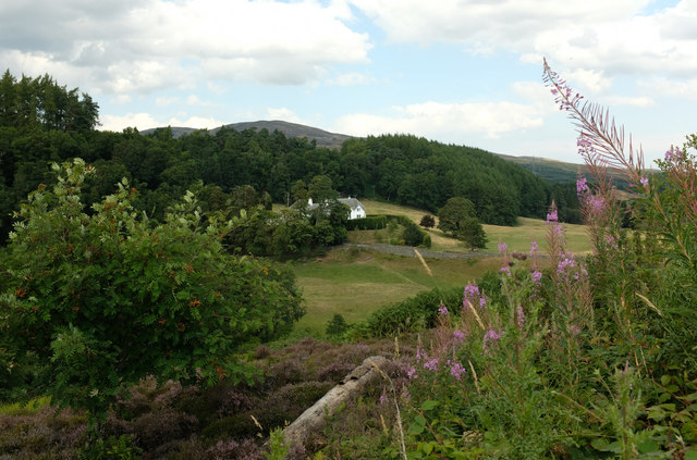
Dallick Plantation is a picturesque wooded area located in the heart of Perthshire, Scotland. Spanning over a vast expanse of land, the plantation is renowned for its lush greenery, towering trees, and serene atmosphere. It is a popular destination for nature enthusiasts, hikers, and those seeking a peaceful retreat from the bustling city life.

The woodland in Dallick Plantation is predominantly composed of native Scottish trees, including oak, birch, and pine. These trees create a dense canopy that provides shade and shelter for a wide variety of flora and fauna. The forest floor is carpeted with a rich layer of moss, creating a soft and cushiony ground cover.

Walking through the plantation, visitors are greeted by a symphony of sounds from chirping birds, rustling leaves, and the occasional scampering of woodland creatures. The air is crisp and fresh, carrying the scent of pine needles and damp earth.

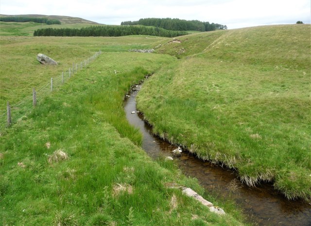
Numerous walking trails crisscross the plantation, offering visitors the opportunity to explore its beauty at their own pace. The paths wind through the dense forest, occasionally opening up to reveal breathtaking views of the surrounding hills and valleys.

Dallick Plantation is not only a haven for nature lovers but also a habitat for a diverse range of wildlife. Red squirrels, roe deer, and a variety of bird species can often be spotted among the trees and bushes.

Overall, Dallick Plantation is a haven of tranquility and natural beauty, offering visitors a chance to immerse themselves in the peaceful serenity of the Scottish woodlands.

If you have any feedback on the listing, please let us know in the comments section below.

Dallick Plantation Images

Images are sourced within 2km of 56.439782/-3.7674691 or Grid Reference NN9128. Thanks to Geograph Open Source API. All images are credited.

A scene at the Sma' Glen The A822 (General Wade's military road) is overshadowed by the great bulk of Coire Mhurcha hill on the left.
A scene at the Sma' Glen
The A822 (General Wade's military road) is overshadowed by the great bulk of Coire Mhurcha hill on the left.
Dun Mor in the Sma' Glen The majestic mountain overlooking the River Almond and the Sma' Glen.
Dun Mor in the Sma' Glen
The majestic mountain overlooking the River Almond and the Sma' Glen.
A scene in the Sma' Glen between Gilmerton and Aberfeldy The River Almond, identified by the dark strokes across the photograph, cuts through the glen here below below Meall nan Caorach.
A scene in the Sma' Glen between Gilmerton and Aberfeldy
The River Almond, identified by the dark strokes across the photograph, cuts through the glen here below below Meall nan Caorach.
Sma Glen View up the Almond where it escapes through the hills.
Sma Glen
View up the Almond where it escapes through the hills.
Military Road, Sma Glen Wade's road to Aberfeldy and Ruthven squeezes though the hills at a famed beauty spot.
Military Road, Sma Glen
Wade's road to Aberfeldy and Ruthven squeezes though the hills at a famed beauty spot.
Beautiful scene over the valley of the Fendoch Burn On the lands of Fendoch Farm, sadly spoiled by the great pylons.
Beautiful scene over the valley of the Fendoch Burn
On the lands of Fendoch Farm, sadly spoiled by the great pylons.
Dallick House near the Sma' Glen in Perthshire A telephoto view of the scene and the luxury self catering house near the entrance to the Sma' Glen.
Dallick House near the Sma' Glen in Perthshire
A telephoto view of the scene and the luxury self catering house near the entrance to the Sma' Glen.
Dallick House Seen from beside the A822.  In the foreground the River Almond passes hidden from view by the slopes of the hill and the vegetation which consists of a Rowan tree, Heather and Rosebay Willowherb.   On the horizon left of centre is Botich with Craig na Hash behind.
Dallick House
Seen from beside the A822. In the foreground the River Almond passes hidden from view by the slopes of the hill and the vegetation which consists of a Rowan tree, Heather and Rosebay Willowherb. On the horizon left of centre is Botich with Craig na Hash behind.
View Towards Stroness Looking over the valley of the River Almond in the left foreground.   Behind the bank of Heather in the centre a van can be seen on the B8063 heading towards Buchanty.   Behind the van in the middle distance sheep can be seen grazing on the site of a Roman fort below the slopes of Stroness.
View Towards Stroness
Looking over the valley of the River Almond in the left foreground. Behind the bank of Heather in the centre a van can be seen on the B8063 heading towards Buchanty. Behind the van in the middle distance sheep can be seen grazing on the site of a Roman fort below the slopes of Stroness.
Highway Maintenance Lorry A Tayside Contracts lorry makes its way along the A822 at the south end of Sma' Glen.   From the Tayside Contracts website 'Tayside Contracts is a commercially based local authority contracting organisation providing catering, cleaning, roads maintenance, vehicle maintenance and winter maintenance throughout the Tayside area of Scotland.'
Highway Maintenance Lorry
A Tayside Contracts lorry makes its way along the A822 at the south end of Sma' Glen. From the Tayside Contracts website 'Tayside Contracts is a commercially based local authority contracting organisation providing catering, cleaning, roads maintenance, vehicle maintenance and winter maintenance throughout the Tayside area of Scotland.'
Old Milestone by the A822, near Fendoch, Fowlis Wester Parish By the A822, in parish of Fowlis Wester (District), 1 mile South of B8063 near Fendoch, on verge, South side of road.

Inscription once read:- : Aberfeldy / 18 : : Crieff / 5 :  

Surveyed

Milestone Society National ID: PK_AFCF18.
Old Milestone by the A822, near Fendoch, Fowlis Wester Parish
By the A822, in parish of Fowlis Wester (District), 1 mile South of B8063 near Fendoch, on verge, South side of road. Inscription once read:- : Aberfeldy / 18 : : Crieff / 5 : Surveyed Milestone Society National ID: PK_AFCF18.
Old Milestone by the B8063, West Buchanty, Fowlis Wester By the B8063, in parish of Fowlis Wester (District), Glen Almond, nearly opposite farm, South side of road.

Inscription once read:-
: (Crieff / 7) : : (Perth / 13) :

Surveyed

Milestone Society National ID: PK_CFLN07
Old Milestone by the B8063, West Buchanty, Fowlis Wester
By the B8063, in parish of Fowlis Wester (District), Glen Almond, nearly opposite farm, South side of road. Inscription once read:- : (Crieff / 7) : : (Perth / 13) : Surveyed Milestone Society National ID: PK_CFLN07
Old Milestone by the B8063, Fort Cottage, Fowlis Wester parish Stone post by the B8063, in parish of Fowlis Wester (District), just East of the A822, by entrance to Fort Cottage.

Inscription once read:-
: Crief / 6 : : Perth / 14 :

Surveyed

Milestone Society National ID: PK_CFLN06
Old Milestone by the B8063, Fort Cottage, Fowlis Wester parish
Stone post by the B8063, in parish of Fowlis Wester (District), just East of the A822, by entrance to Fort Cottage. Inscription once read:- : Crief / 6 : : Perth / 14 : Surveyed Milestone Society National ID: PK_CFLN06
Old Milestone by the A822, Sma' Glen, Fowlis Wester parish Stone post by the A822, in parish of Fowlis Wester (District), Sma' Glen, just North of B8063 junction, on verge behind low 'chicken wire' fence, North side of road.

Surveyed

Milestone Society National ID: PK_AFCF17
Old Milestone by the A822, Sma' Glen, Fowlis Wester parish
Stone post by the A822, in parish of Fowlis Wester (District), Sma' Glen, just North of B8063 junction, on verge behind low 'chicken wire' fence, North side of road. Surveyed Milestone Society National ID: PK_AFCF17
Old Milestone by the A822, Sma' Glen, Fowlis Wester parish Milestone by the A822, in parish of Fowlis Wester (District), Sma' Glen, top of straight by the forest.

Inscription once read:-
: (Crieff / 7) : : (Aberfeldy / 16) :

Surveyed

Milestone Society National ID: PK_AFCF16
Old Milestone by the A822, Sma' Glen, Fowlis Wester parish
Milestone by the A822, in parish of Fowlis Wester (District), Sma' Glen, top of straight by the forest. Inscription once read:- : (Crieff / 7) : : (Aberfeldy / 16) : Surveyed Milestone Society National ID: PK_AFCF16
Fendoch Burn reaching the A822 The source of this burn is on Meall Tarsuinn a mile or so west of the Sma' Glen.
Fendoch Burn reaching the A822
The source of this burn is on Meall Tarsuinn a mile or so west of the Sma' Glen.
A plantation of pines at Fendoch The trees are no more than 50 years old.
A plantation of pines at Fendoch
The trees are no more than 50 years old.
Dallick House Tucked below its woodland shelter.
Dallick House
Tucked below its woodland shelter.
Show me another place!

Dallick Plantation is located at Grid Ref: NN9128 (Lat: 56.439782, Lng: -3.7674691)

Unitary Authority: Perth and Kinross

Police Authority: Tayside

What 3 Words

///voucher.trainers.cyber. Near Crieff, Perth & Kinross

Nearby Locations

Dallick Plantation

Related Wikis

Glenalmond

Glenalmond or Glen Almond (Scottish Gaelic: Gleann Amain) is a glen which stretches for several miles to the west of the city of Perth in Perth and Kinross...
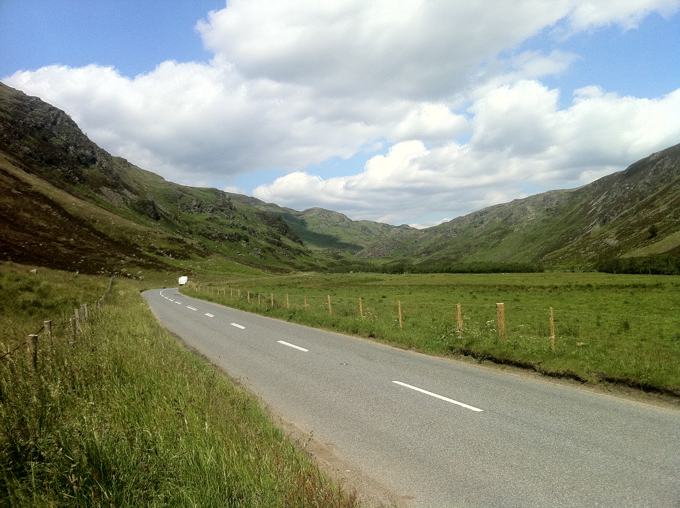
A822 road

The A822 is a road which runs through Perthshire in Scotland. It runs from the A9 road at Greenloaning, and rejoins the A9 at Dunkeld. It goes through...

Fowlis Wester

Fowlis Wester is a small village in Perth and Kinross, Scotland. It is around 6 kilometres (3.7 mi) east of Crieff and 19 kilometres (12 mi) west of Perth...

Monzie Castle

Monzie Castle is a castellated mansion, near Monzie in Perth and Kinross, Scotland that incorporates an L-plan, early 17th-century building that was enlarged...

Abercairny

Abercairny is an estate in the Scottish region of Perth and Kinross. It had the distinction of a short visit by Queen Victoria 12 September 1842, when...
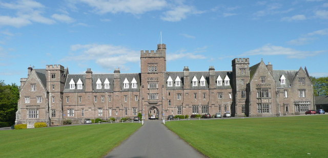
Glenalmond College

Glenalmond College is a co-educational independent boarding school in Perth and Kinross, Scotland, for children aged between 12 and 18 years. It is situated...

Harrietfield

Harrietfield is a village near Glenalmond in Perth and Kinross. It is about 9 miles (14 km) north-west of Perth. It has been suggested that the village...
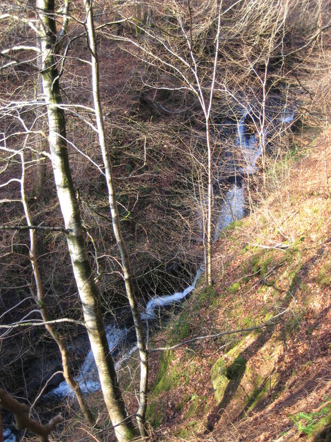
Falls of Barvick

Falls of Barvick is a waterfall in Scotland. It is 492 feet (150 m) at its highest point and has an average width of 20 feet (6.1 m). It is a cascades...

Nearby Amenities

Located within 500m of 56.439782,-3.7674691
Power: pole
Lat/Long: 56.4432746/-3.7708927
Power: pole
Lat/Long: 56.4427731/-3.770208
Power: pole
Lat/Long: 56.4422744/-3.7695549
Power: pole
Lat/Long: 56.4417769/-3.7688654
Power: pole
Lat/Long: 56.441238/-3.7681324
Power: pole
Lat/Long: 56.441008/-3.7672228
Power: pole
Lat/Long: 56.4407405/-3.7661512
Power: pole
Lat/Long: 56.4404583/-3.7650795
Power: pole
Lat/Long: 56.4401842/-3.7640393
Power: pole
Lat/Long: 56.4391986/-3.7652561
Power: pole
Lat/Long: 56.4392374/-3.7651642
Power: pole
Lat/Long: 56.4394326/-3.764765
Power: pole
Lat/Long: 56.4397054/-3.7642038
Power: pole
Lat/Long: 56.4406469/-3.7636474
Power: pole
Lat/Long: 56.4411511/-3.7631273
Power: pole
Lat/Long: 56.4416779/-3.7625805
Power: pole
Lat/Long: 56.4421339/-3.762087
Power: pole
Lat/Long: 56.4426301/-3.7614097
The data included in this document is from www.openstreetmap.org. The data is made available under ODbL.

Have you been to Dallick Plantation?

Leave your review of Dallick Plantation below (or comments, questions and feedback).