Broad Wood

Wood, Forest in Dumfriesshire

Scotland

Broad Wood

Dalquhairn and See Morris Dalquhairn Hill and See Morris Hill seen from Steilston Hill.
Dalquhairn and See Morris Credit: Richard Webb

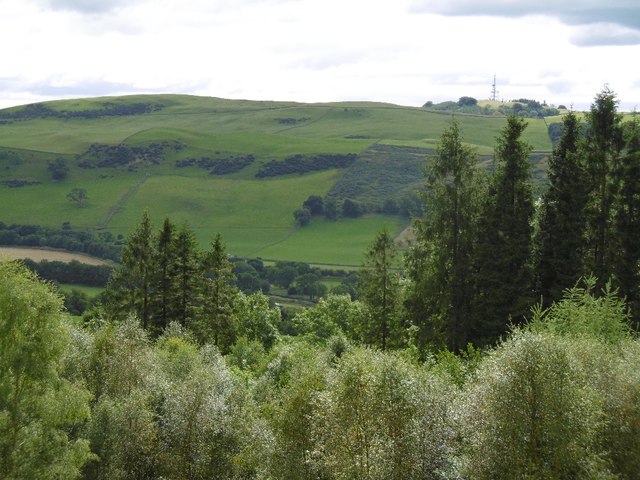
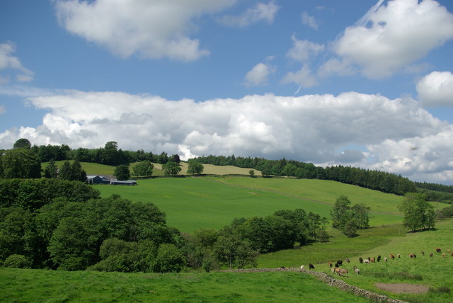
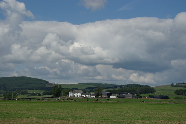
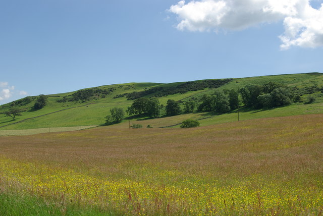
Broad Wood is a picturesque forest located in Dumfriesshire, Scotland. Spanning over a vast area of land, this woodland is a nature lover's paradise. With its diverse flora and fauna, it offers a myriad of opportunities for outdoor activities and exploration.

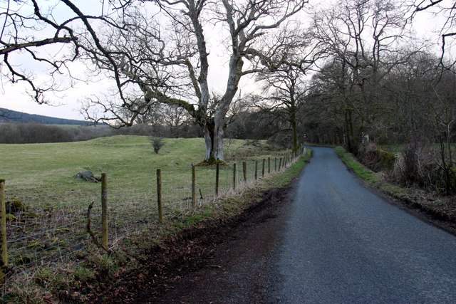
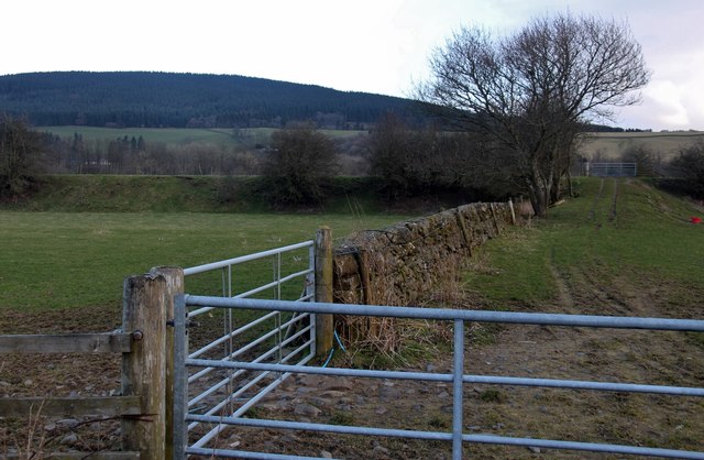
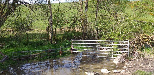
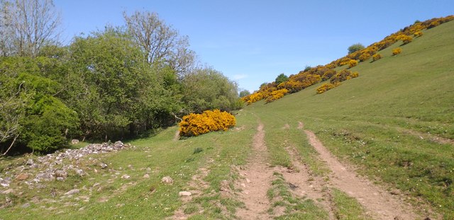
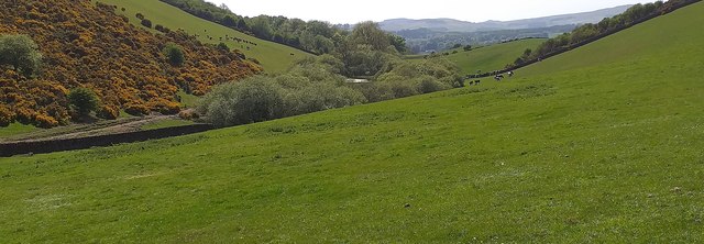
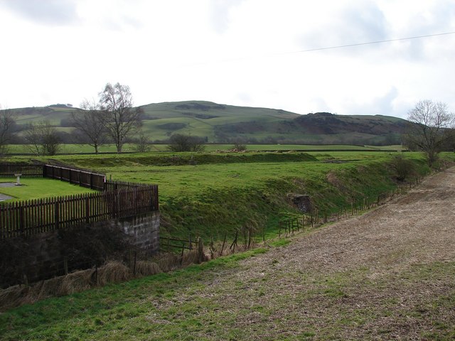
The forest is primarily composed of native broadleaved trees, such as oak, birch, and ash, which create a rich and vibrant canopy. This dense canopy allows only dappled sunlight to filter through, creating a peaceful and serene atmosphere within the woods. The forest floor is covered with a thick layer of moss and ferns, providing a lush carpet of greenery.

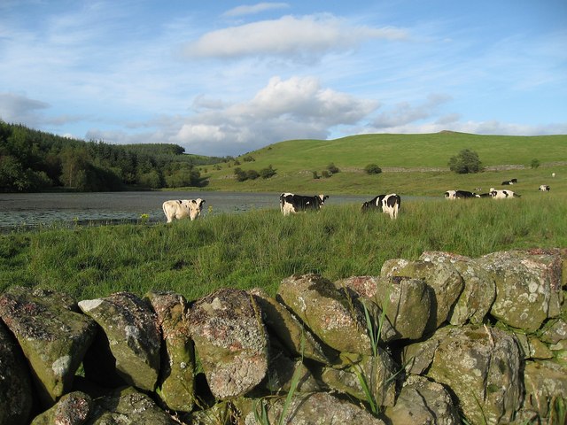
Broad Wood is home to a variety of wildlife. Many bird species, including woodpeckers and owls, can be spotted amongst the trees. Squirrels can be seen darting from branch to branch, while deer and rabbits roam freely throughout the forest. The tranquil setting of the wood makes it an ideal location for birdwatching and wildlife photography.

Visitors to Broad Wood can enjoy a range of activities. There are several walking trails that wind through the forest, allowing visitors to explore the area at their own pace. These trails offer stunning views of the surrounding countryside and are suitable for both beginners and experienced hikers. The forest also has designated picnic areas where visitors can relax and enjoy the peaceful surroundings.

Overall, Broad Wood in Dumfriesshire is a beautiful and enchanting forest that offers a tranquil escape from the hustle and bustle of everyday life. Whether it is for a leisurely stroll, birdwatching, or simply immersing oneself in nature, this woodland provides a perfect setting for all nature enthusiasts.

If you have any feedback on the listing, please let us know in the comments section below.
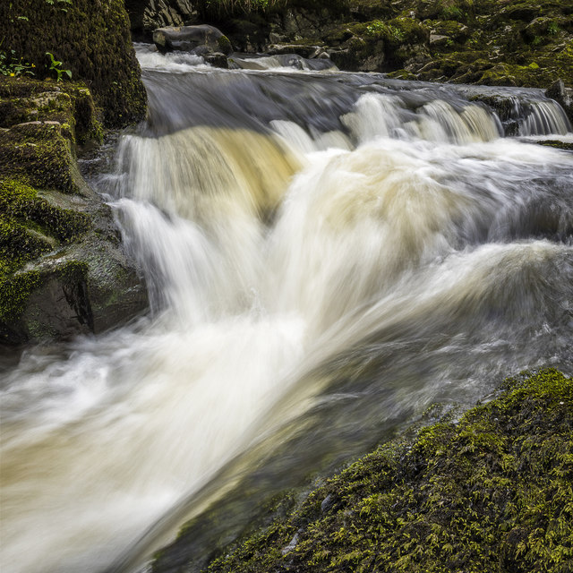
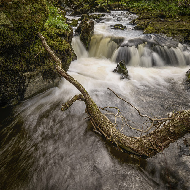
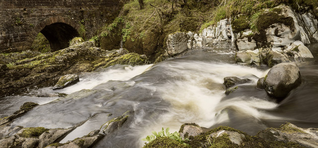
Broad Wood Images

Images are sourced within 2km of 55.109319/-3.7260829 or Grid Reference NX8980. Thanks to Geograph Open Source API. All images are credited.

Dalquhairn and See Morris Dalquhairn Hill and See Morris Hill seen from Steilston Hill.
Dalquhairn and See Morris
Dalquhairn Hill and See Morris Hill seen from Steilston Hill.
Torrent Check it out on my Flickr page.

<span class="nowrap"><a title="www.flickr.com/photos/jetjohn/32467318296/in/dateposted-public/" rel="nofollow ugc noopener" href="http://www.flickr.com/photos/jetjohn/32467318296/in/dateposted-public/">Link</a><img style="margin-left:2px;" alt="External link" title="External link - shift click to open in new window" src="https://s1.geograph.org.uk/img/external.png" width="10" height="10"/></span>

At the Routin' Bridge - Irongray.

The only river strictly belonging to the parish is the Auld, which has its source on the confines of Kirkpatrick-Durham, and, after flowing for some miles through this parish in an eastern course, curves towards the north, and falls into the Cairn, which, afterwards taking the name of the Cluden, forms a boundary of the parish. The Auld water, near its influx into the Cairn, makes a small but picturesque cascade of two falls, the highest of which is twenty feet; and near the lower fall is a romantic bridge of one arch, which, from the noise of the water, has obtained the appellation of the Routing Bridge.

The above description is taken from  "A Topographical Dictionary of Scotland" by Samuel Lewis, published in 1846.
Torrent
Check it out on my Flickr page. LinkExternal link At the Routin' Bridge - Irongray. The only river strictly belonging to the parish is the Auld, which has its source on the confines of Kirkpatrick-Durham, and, after flowing for some miles through this parish in an eastern course, curves towards the north, and falls into the Cairn, which, afterwards taking the name of the Cluden, forms a boundary of the parish. The Auld water, near its influx into the Cairn, makes a small but picturesque cascade of two falls, the highest of which is twenty feet; and near the lower fall is a romantic bridge of one arch, which, from the noise of the water, has obtained the appellation of the Routing Bridge. The above description is taken from "A Topographical Dictionary of Scotland" by Samuel Lewis, published in 1846.
Fallen Check it out on my Flickr page.

<span class="nowrap"><a title="www.flickr.com/photos/jetjohn/32819058425/in/dateposted-public/" rel="nofollow ugc noopener" href="http://www.flickr.com/photos/jetjohn/32819058425/in/dateposted-public/">Link</a><img style="margin-left:2px;" alt="External link" title="External link - shift click to open in new window" src="https://s1.geograph.org.uk/img/external.png" width="10" height="10"/></span>

At the Routin' Bridge - Irongray.
Fallen
Check it out on my Flickr page. LinkExternal link At the Routin' Bridge - Irongray.
At The Routin' Bridge At the Routin' Bridge - Irongray.

Check it out on my Flickr page.

<span class="nowrap"><a title="https://flic.kr/p/R1gN57" rel="nofollow ugc noopener" href="https://flic.kr/p/R1gN57">Link</a><img style="margin-left:2px;" alt="External link" title="External link - shift click to open in new window" src="https://s1.geograph.org.uk/img/external.png" width="10" height="10"/></span>
At The Routin' Bridge
At the Routin' Bridge - Irongray. Check it out on my Flickr page. LinkExternal link
Three rivers from the air Cairn Water and Old Water converge to form Cluden Water, immediately left of  the water treatment works which can be seen on the left.
Three rivers from the air
Cairn Water and Old Water converge to form Cluden Water, immediately left of the water treatment works which can be seen on the left.
Country road near Routin Bridge
Disused Railway Embankment
Horsebog Loch outflow The outflow from Horsebog Loch a very overgrown area.
Horsebog Loch outflow
The outflow from Horsebog Loch a very overgrown area.
Track at Horsebog Loch A rough track which runs beside Horsebog Loch.
Track at Horsebog Loch
A rough track which runs beside Horsebog Loch.
Horsebog Loch Surrounded by trees, Horsebog Loch.
Horsebog Loch
Surrounded by trees, Horsebog Loch.
B729 near Blackpark Farm
B729 near Newhouse Farm
Farmland below Greenhead View towards the farm of Townhead
Farmland below Greenhead
View towards the farm of Townhead
Blackpark
Blackpark
Burnside of Baltersan
Grassland & NW slopes of Hall Hill
Fourmerkland Tower Built in 1590, on older foundations, it is well hidden in the wood. Spring daffodils surround the tower on a beautiful spring day. The building seems in good condition, although unoccupied. See archaeological notes here: <span class="nowrap"><a title="http://canmore.rcahms.gov.uk/en/site/65914/details/fourmerkland+tower+and+barmkin/" rel="nofollow ugc noopener" href="http://canmore.rcahms.gov.uk/en/site/65914/details/fourmerkland+tower+and+barmkin/">Link</a><img style="margin-left:2px;" alt="External link" title="External link - shift click to open in new window" src="https://s1.geograph.org.uk/img/external.png" width="10" height="10"/></span>
Fourmerkland Tower
Built in 1590, on older foundations, it is well hidden in the wood. Spring daffodils surround the tower on a beautiful spring day. The building seems in good condition, although unoccupied. See archaeological notes here: LinkExternal link
Cattle by Loweberry Loch
Show me another place!

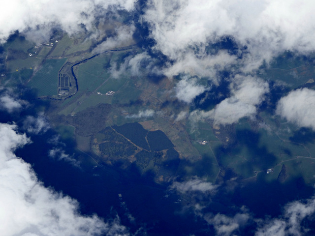
Broad Wood is located at Grid Ref: NX8980 (Lat: 55.109319, Lng: -3.7260829)

Unitary Authority: Dumfries and Galloway

Police Authority: Dumfries and Galloway

What 3 Words

///crew.earpiece.outlined. Near Dumfries, Dumfries & Galloway

Related Wikis

Hallhill Covenanter Martyrs Memorial

The Hallhill Covenanter Martyrs Memorial at Irongray (NX 910797) near Kirkpatrick Irongray Church in the old county of Kirkcudbrightshire, now Dumfries...

Irongray railway station

Irongray was one of the principal stations on the Cairn Valley Light Railway branch, from Dumfries. It served a rural area in Dumfries and Galloway The...

Newtonairds railway station

Newtonairds (NX877801) was one of the principal stations on the now closed Cairn Valley Light Railway branch from Dumfries. It served a very rural area...

Nithsdale

Nithsdale (Srath Nid in Scottish Gaelic), also known as Strathnith, Stranith or Stranit, is the strath or dale of the River Nith in southern Scotland....

Stepford railway station

Stepford (NX864815) was one of the minor request stop stations on the Cairn Valley Light Railway branch from Dumfries. It served a very rural area in...

Ellisland Farm

Ellisland Farm lies about 6.5 mi/10.4 km northwest of Dumfries near the village of Auldgirth, located in the Parish of Dunscore, Dumfries and Galloway...

Holywood, Dumfries and Galloway

Holywood is a village and civil parish in the historical county of Dumfriesshire in Dumfries and Galloway, Scotland. The village of Holywood was developed...

Carse Loch

Carse Loch is situated (NX 926 849) in a low-lying area, surrounded by woodland, close to the A76 at Friar's Carse, in Dumfries and Galloway, Parish of...

Nearby Amenities

Located within 500m of 55.109319,-3.7260829
Power: pole
Lat/Long: 55.1125244/-3.7278403
Power: pole
Lat/Long: 55.1121264/-3.7266226
Power: pole
Lat/Long: 55.1116762/-3.7254028
Power: pole
Lat/Long: 55.1126615/-3.7290241
Power: pole
Lat/Long: 55.1127355/-3.7297157
Power: pole
Lat/Long: 55.1122405/-3.7314468
Power: pole
Lat/Long: 55.1114578/-3.7316674
Power: pole
Lat/Long: 55.1106436/-3.7318711
Power: pole
Lat/Long: 55.1097905/-3.7320747
Power: pole
Lat/Long: 55.1089253/-3.7322805
Power: pole
Lat/Long: 55.1083149/-3.7324545
Power: pole
Lat/Long: 55.1075358/-3.7326517
Power: pole
Lat/Long: 55.1082348/-3.7335937
Power: pole
Lat/Long: 55.1124807/-3.7248066
Power: pole
Lat/Long: 55.1128581/-3.7215714
Power: pole
Lat/Long: 55.1125972/-3.7227701
Power: pole
Lat/Long: 55.1125414/-3.7237905
Power: pole
Lat/Long: 55.11238/-3.7265377
The data included in this document is from www.openstreetmap.org. The data is made available under ODbL.

Have you been to Broad Wood?

Leave your review of Broad Wood below (or comments, questions and feedback).