Canal Wood

Wood, Forest in Dumfriesshire

Scotland

Canal Wood

Dalquhairn and See Morris Dalquhairn Hill and See Morris Hill seen from Steilston Hill.
Dalquhairn and See Morris Credit: Richard Webb

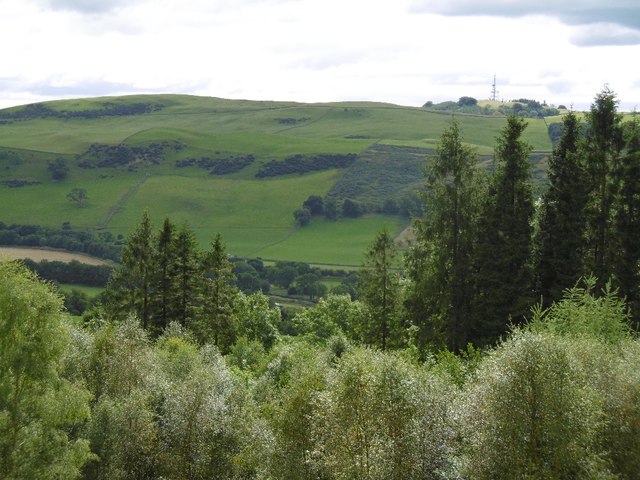
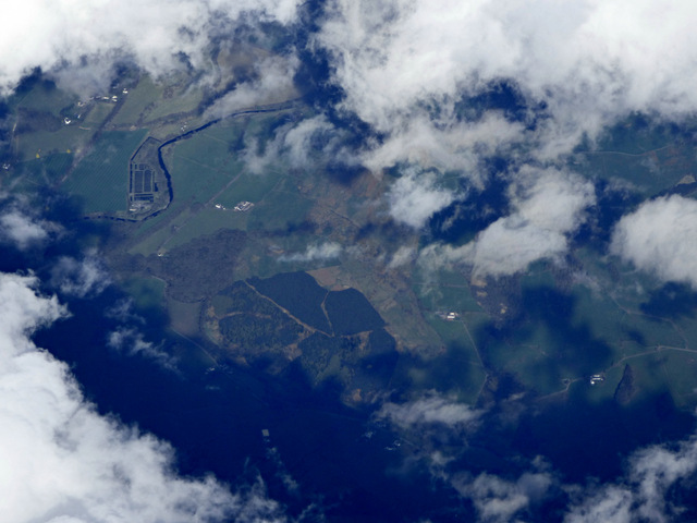
Canal Wood is a picturesque forest located in Dumfriesshire, Scotland. Spanning over a vast area, this woodland is a haven for nature lovers and offers a range of activities for visitors.

The forest is named after the nearby Caledonian Canal, a historic waterway that stretches from the east to the west coast of Scotland. Canal Wood is situated close to the canal, providing stunning views of the water and creating a tranquil atmosphere for visitors.

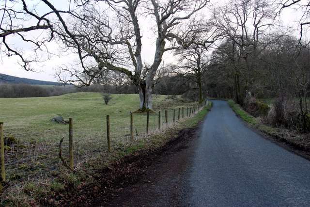
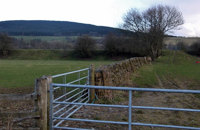
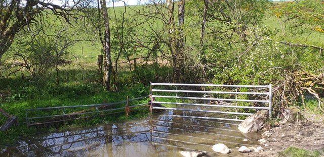
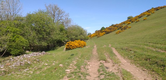
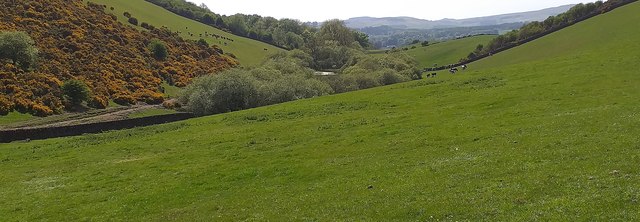
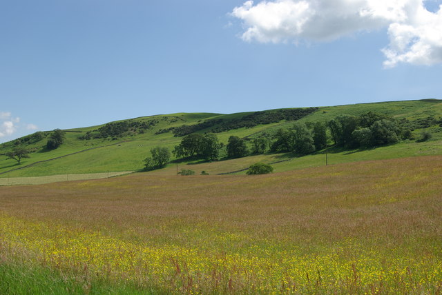
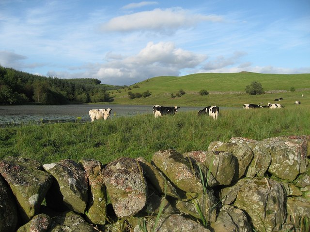
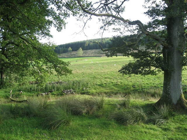
The woodland is rich in biodiversity, with a variety of tree species such as oak, beech, and Scots pine. Walking through the forest, visitors can enjoy the fresh scent of pine needles and the soothing sounds of birdsong. The forest floor is covered in a carpet of moss and ferns, adding to the enchanting ambiance.

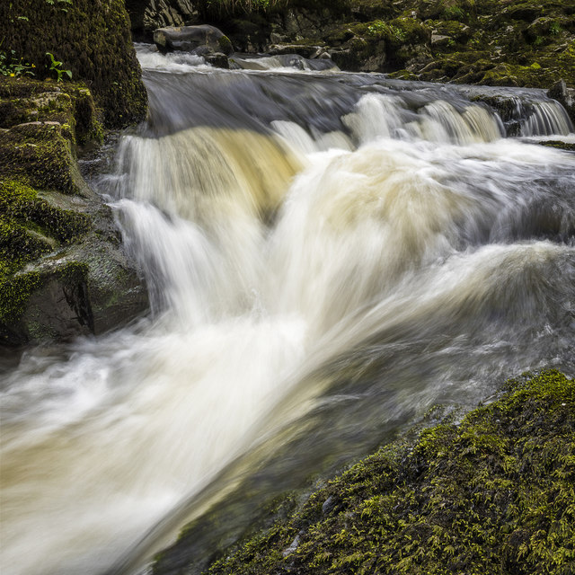
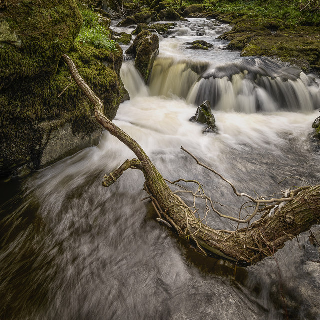
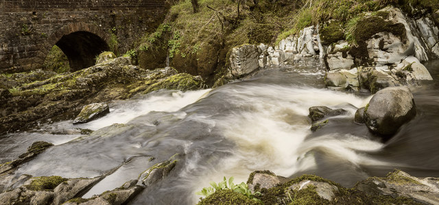
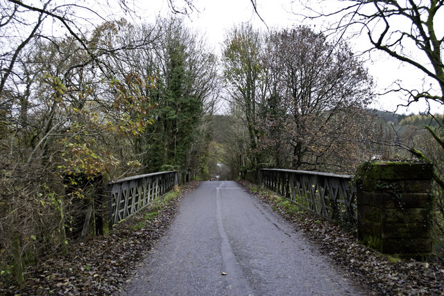
Canal Wood is a popular destination for outdoor enthusiasts, offering several well-maintained trails for walking, hiking, and cycling. These paths wind through the forest, leading visitors to hidden gems such as a serene loch and a charming waterfall. The forest also has designated picnic areas, providing the perfect spot to relax and enjoy a packed lunch amidst the natural beauty.

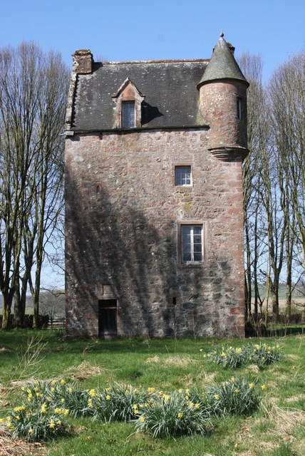
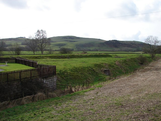
In addition to its natural attractions, Canal Wood has a rich history. The forest was once part of a larger estate belonging to a local noble family, and remnants of old stone walls and ruins can still be found within its boundaries. This historical significance adds an extra layer of intrigue for those exploring the woodland.

Overall, Canal Wood is a captivating destination that offers a blend of natural beauty, recreational activities, and historical charm. Whether it's a peaceful stroll, an adrenaline-filled bike ride, or a leisurely picnic, this Dumfriesshire forest has something for everyone to enjoy.

If you have any feedback on the listing, please let us know in the comments section below.

Canal Wood Images

Images are sourced within 2km of 55.10331/-3.7340532 or Grid Reference NX8980. Thanks to Geograph Open Source API. All images are credited.

Dalquhairn and See Morris Dalquhairn Hill and See Morris Hill seen from Steilston Hill.
Dalquhairn and See Morris
Dalquhairn Hill and See Morris Hill seen from Steilston Hill.
Torrent Check it out on my Flickr page.

<span class="nowrap"><a title="www.flickr.com/photos/jetjohn/32467318296/in/dateposted-public/" rel="nofollow ugc noopener" href="http://www.flickr.com/photos/jetjohn/32467318296/in/dateposted-public/">Link</a><img style="margin-left:2px;" alt="External link" title="External link - shift click to open in new window" src="https://s1.geograph.org.uk/img/external.png" width="10" height="10"/></span>

At the Routin' Bridge - Irongray.

The only river strictly belonging to the parish is the Auld, which has its source on the confines of Kirkpatrick-Durham, and, after flowing for some miles through this parish in an eastern course, curves towards the north, and falls into the Cairn, which, afterwards taking the name of the Cluden, forms a boundary of the parish. The Auld water, near its influx into the Cairn, makes a small but picturesque cascade of two falls, the highest of which is twenty feet; and near the lower fall is a romantic bridge of one arch, which, from the noise of the water, has obtained the appellation of the Routing Bridge.

The above description is taken from  "A Topographical Dictionary of Scotland" by Samuel Lewis, published in 1846.
Torrent
Check it out on my Flickr page. LinkExternal link At the Routin' Bridge - Irongray. The only river strictly belonging to the parish is the Auld, which has its source on the confines of Kirkpatrick-Durham, and, after flowing for some miles through this parish in an eastern course, curves towards the north, and falls into the Cairn, which, afterwards taking the name of the Cluden, forms a boundary of the parish. The Auld water, near its influx into the Cairn, makes a small but picturesque cascade of two falls, the highest of which is twenty feet; and near the lower fall is a romantic bridge of one arch, which, from the noise of the water, has obtained the appellation of the Routing Bridge. The above description is taken from "A Topographical Dictionary of Scotland" by Samuel Lewis, published in 1846.
Fallen Check it out on my Flickr page.

<span class="nowrap"><a title="www.flickr.com/photos/jetjohn/32819058425/in/dateposted-public/" rel="nofollow ugc noopener" href="http://www.flickr.com/photos/jetjohn/32819058425/in/dateposted-public/">Link</a><img style="margin-left:2px;" alt="External link" title="External link - shift click to open in new window" src="https://s1.geograph.org.uk/img/external.png" width="10" height="10"/></span>

At the Routin' Bridge - Irongray.
Fallen
Check it out on my Flickr page. LinkExternal link At the Routin' Bridge - Irongray.
At The Routin' Bridge At the Routin' Bridge - Irongray.

Check it out on my Flickr page.

<span class="nowrap"><a title="https://flic.kr/p/R1gN57" rel="nofollow ugc noopener" href="https://flic.kr/p/R1gN57">Link</a><img style="margin-left:2px;" alt="External link" title="External link - shift click to open in new window" src="https://s1.geograph.org.uk/img/external.png" width="10" height="10"/></span>
At The Routin' Bridge
At the Routin' Bridge - Irongray. Check it out on my Flickr page. LinkExternal link
Three rivers from the air Cairn Water and Old Water converge to form Cluden Water, immediately left of  the water treatment works which can be seen on the left.
Three rivers from the air
Cairn Water and Old Water converge to form Cluden Water, immediately left of the water treatment works which can be seen on the left.
Country road near Routin Bridge
Disused Railway Embankment
Horsebog Loch outflow The outflow from Horsebog Loch a very overgrown area.
Horsebog Loch outflow
The outflow from Horsebog Loch a very overgrown area.
Track at Horsebog Loch A rough track which runs beside Horsebog Loch.
Track at Horsebog Loch
A rough track which runs beside Horsebog Loch.
Horsebog Loch Surrounded by trees, Horsebog Loch.
Horsebog Loch
Surrounded by trees, Horsebog Loch.
Grassland & NW slopes of Hall Hill
Fourmerkland Tower Built in 1590, on older foundations, it is well hidden in the wood. Spring daffodils surround the tower on a beautiful spring day. The building seems in good condition, although unoccupied. See archaeological notes here: <span class="nowrap"><a title="http://canmore.rcahms.gov.uk/en/site/65914/details/fourmerkland+tower+and+barmkin/" rel="nofollow ugc noopener" href="http://canmore.rcahms.gov.uk/en/site/65914/details/fourmerkland+tower+and+barmkin/">Link</a><img style="margin-left:2px;" alt="External link" title="External link - shift click to open in new window" src="https://s1.geograph.org.uk/img/external.png" width="10" height="10"/></span>
Fourmerkland Tower
Built in 1590, on older foundations, it is well hidden in the wood. Spring daffodils surround the tower on a beautiful spring day. The building seems in good condition, although unoccupied. See archaeological notes here: LinkExternal link
Cattle by Loweberry Loch
Field near Berryland Sheep grazing in a field near Berryland.
Field near Berryland
Sheep grazing in a field near Berryland.
Drumpark bridge
Drumpark bridge
Dalquhairn
Dalquhairn
The road to Boreland
Beech Shadow
Beech Shadow
Show me another place!

Canal Wood is located at Grid Ref: NX8980 (Lat: 55.10331, Lng: -3.7340532)

Unitary Authority: Dumfries and Galloway

Police Authority: Dumfries and Galloway

What 3 Words

///mulled.ourselves.crabmeat. Near Dumfries, Dumfries & Galloway

Related Wikis

Hallhill Covenanter Martyrs Memorial

The Hallhill Covenanter Martyrs Memorial at Irongray (NX 910797) near Kirkpatrick Irongray Church in the old county of Kirkcudbrightshire, now Dumfries...

Newtonairds railway station

Newtonairds (NX877801) was one of the principal stations on the now closed Cairn Valley Light Railway branch from Dumfries. It served a very rural area...

Irongray railway station

Irongray was one of the principal stations on the Cairn Valley Light Railway branch, from Dumfries. It served a rural area in Dumfries and Galloway The...

Nithsdale

Nithsdale (Srath Nid in Scottish Gaelic), also known as Strathnith, Stranith or Stranit, is the strath or dale of the River Nith in southern Scotland....

Stepford railway station

Stepford (NX864815) was one of the minor request stop stations on the Cairn Valley Light Railway branch from Dumfries. It served a very rural area in...

Terregles House

Terregles House was a late 18th-century country house, located near Terregles, in the historical county of Kirkcudbrightshire around 2 miles west of Dumfries...

Terregles

Terregles () is a village and civil parish near Dumfries, in Dumfries and Galloway, Scotland. It lies in the former county of Kirkcudbrightshire. The name...

Holywood, Dumfries and Galloway

Holywood is a village and civil parish in the historical county of Dumfriesshire in Dumfries and Galloway, Scotland. The village of Holywood was developed...

Nearby Amenities

Located within 500m of 55.10331,-3.7340532
Power: pole
Lat/Long: 55.0989709/-3.7325733
Power: pole
Lat/Long: 55.0989867/-3.7340073
Power: pole
Lat/Long: 55.0990025/-3.7354308
Power: pole
Lat/Long: 55.1075358/-3.7326517
Power: pole
Lat/Long: 55.1070407/-3.7337613
Power: pole
Lat/Long: 55.1065795/-3.7348283
The data included in this document is from www.openstreetmap.org. The data is made available under ODbL.

Have you been to Canal Wood?

Leave your review of Canal Wood below (or comments, questions and feedback).