Stonehill Wood
Wood, Forest in Lanarkshire
Scotland
Stonehill Wood

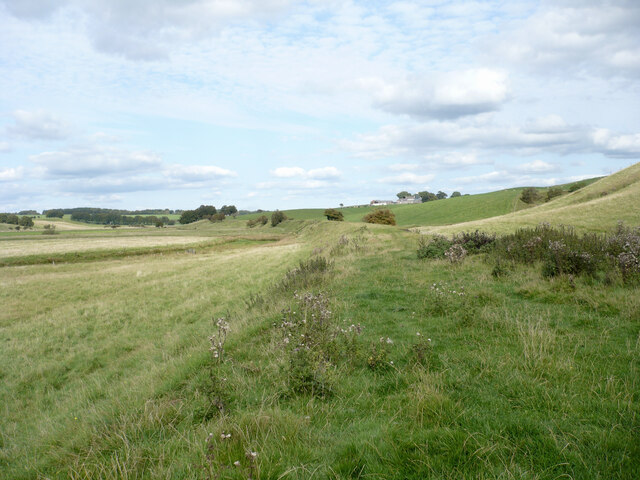
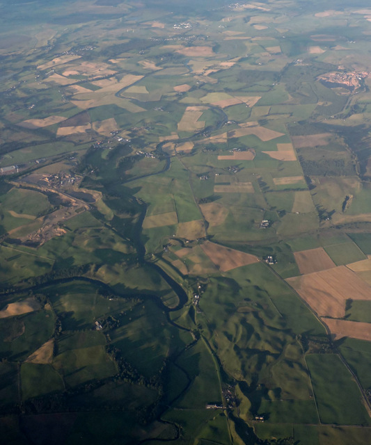
Stonehill Wood is a picturesque forest located in the Lanarkshire region of Scotland. Covering an area of approximately 200 acres, it is a popular destination for nature enthusiasts, hikers, and outdoor enthusiasts alike. The wood is situated in a rural area, offering a peaceful and tranquil atmosphere, perfect for those seeking a break from the hustle and bustle of city life.
The wood is predominantly made up of native Scottish tree species, such as oak, birch, and rowan, which provide a diverse and vibrant ecosystem. The dense canopy of trees creates a shaded environment, offering respite from the sun during the summer months. Visitors can explore the forest through a network of well-maintained walking trails, which meander through the wood, offering stunning views of the surrounding countryside and wildlife.
Stonehill Wood is home to a variety of wildlife species, including deer, foxes, badgers, and a wide range of bird species. Birdwatchers will be delighted to spot birds such as woodpeckers, owls, and various songbirds. Additionally, the wood is also home to a variety of plant species, including wildflowers and ferns, which add to the natural beauty of the area.
The wood is equipped with basic amenities, including picnic areas and benches, allowing visitors to relax and enjoy the peaceful surroundings. It is advisable to bring appropriate footwear and clothing, as the trails can be muddy and uneven, particularly during wet weather.
Overall, Stonehill Wood offers a delightful retreat for nature lovers and provides an opportunity to immerse oneself in the beauty of the Scottish countryside.
If you have any feedback on the listing, please let us know in the comments section below.
Stonehill Wood Images
Images are sourced within 2km of 55.616025/-3.7528413 or Grid Reference NS8937. Thanks to Geograph Open Source API. All images are credited.


Stonehill Wood is located at Grid Ref: NS8937 (Lat: 55.616025, Lng: -3.7528413)
Unitary Authority: South Lanarkshire
Police Authority: Lanarkshire
What 3 Words
///stiffly.having.dove. Near Lanark, South Lanarkshire
Nearby Locations
Related Wikis

A70 road
The A70 road is a major road in Scotland, United Kingdom. It runs a total of 74.3 miles (119.6 km) from Edinburgh to Ayr. It begins as Dalry Road at the...

Sandilands railway station
Sandilands railway station co-served the town of Lanark, in the historical county of Lanarkshire, Scotland, from 1864 to 1964 on the Douglas Branch....
Owenstown
Owenstown is the name of a proposed new town of 3200 homes to be built on 400 acres of a 2000-acre site in South Lanarkshire, next to Tinto Hill and the...

Carmichael, South Lanarkshire
Carmichael is a small village and civil parish between Biggar and Lanark in South Lanarkshire, Scotland. It is home to the Discover Carmichael Centre,...
Ponfeigh railway station
Ponfeigh railway station served the hamlet of Douglas Water, in the historical county of Lanarkshire, Scotland, from 1864 to 1964 on the Douglas Branch...

Douglas Water (hamlet)
Douglas Water is a hamlet in Lanarkshire, Scotland. Named after the Douglas Water, the river which flows through the hamlet, local mining operations provided...

South Lanarkshire
South Lanarkshire (Scots: Sooth Lanrikshire; Scottish Gaelic: Siorrachd Lannraig a Deas) is one of 32 unitary authorities of Scotland. It borders the south...
Rigside
Rigside is a small village in South Lanarkshire, Scotland, about 5 miles (8 kilometres) from the town of Lanark, and less than 1 mi (1.6 km) from Douglas...
Nearby Amenities
Located within 500m of 55.616025,-3.7528413Have you been to Stonehill Wood?
Leave your review of Stonehill Wood below (or comments, questions and feedback).