Millbank Plantation

Wood, Forest in Dumfriesshire

Scotland

Millbank Plantation

Anglo-Celtic Cross at Nith Bridge Next to the A702 Thornhill-Penpont road.
Anglo-Celtic Cross at Nith Bridge Credit: Billy McCrorie

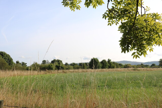
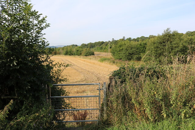
Millbank Plantation is an expansive woodland area located in Dumfriesshire, Scotland. Covering a vast area of approximately 500 acres, the plantation is known for its rich biodiversity and stunning natural beauty.

The woodland is predominantly made up of native tree species such as oak, birch, and beech, which form a dense and lush canopy overhead. The undergrowth is teeming with a variety of ferns, mosses, and wildflowers, creating a vibrant and enchanting atmosphere.

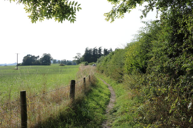
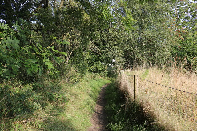
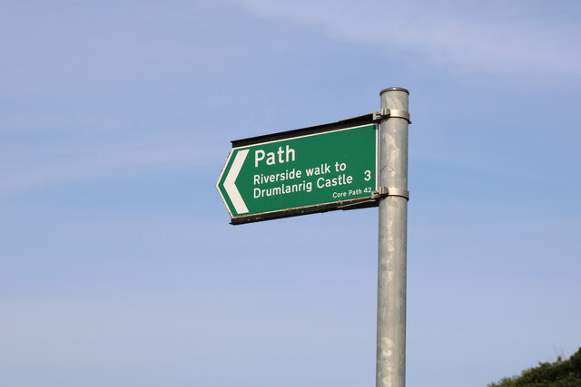
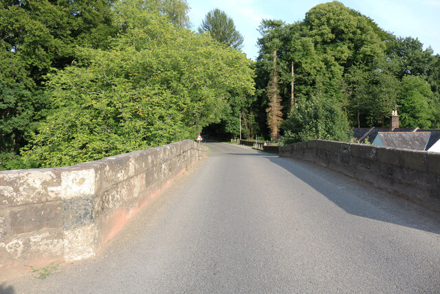
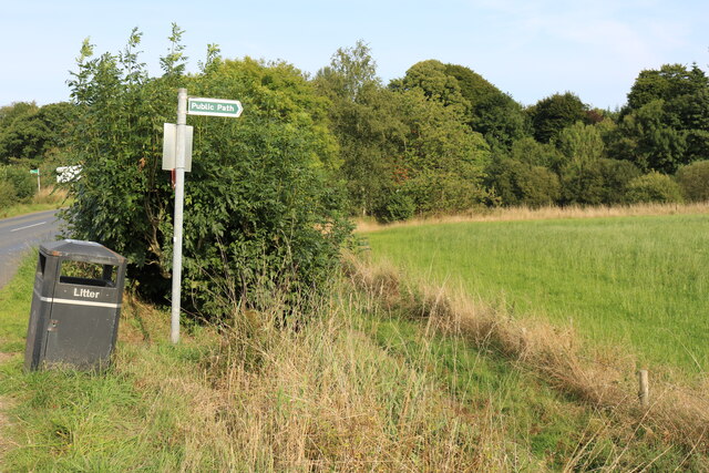
Millbank Plantation is crisscrossed with meandering paths, allowing visitors to explore the woodland at their own pace. These well-maintained trails offer an opportunity to immerse oneself in nature and enjoy a peaceful walk or a refreshing jog.

The plantation is home to a diverse range of wildlife, including several species of birds, small mammals, and insects. Birdwatchers can often spot woodpeckers, owls, and various songbirds among the trees, while squirrels and rabbits can be seen darting through the underbrush.

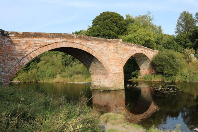
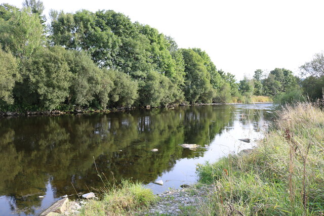
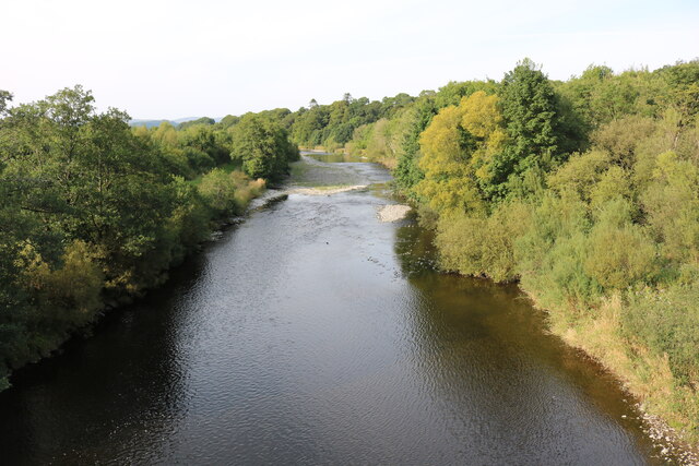
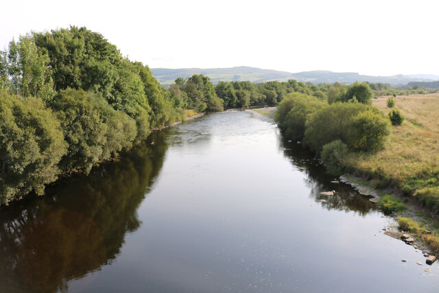
Nature enthusiasts will also appreciate the presence of a small stream that flows through the plantation, adding to the tranquility and charm of the area. The stream provides a habitat for aquatic life and creates a soothing soundtrack for visitors.

Millbank Plantation is a haven for those seeking a natural escape from the bustling city life. With its picturesque scenery, diverse flora and fauna, and peaceful ambiance, it is an ideal destination for outdoor enthusiasts, walkers, and nature lovers.

If you have any feedback on the listing, please let us know in the comments section below.

Millbank Plantation Images

Images are sourced within 2km of 55.257034/-3.7786662 or Grid Reference NX8797. Thanks to Geograph Open Source API. All images are credited.

Anglo-Celtic Cross at Nith Bridge Next to the A702 Thornhill-Penpont road.
Anglo-Celtic Cross at Nith Bridge
Next to the A702 Thornhill-Penpont road.
Anglo-Celtic Cross at Nith Bridge Next to the A702 Thornhill-Penpont Road.
Anglo-Celtic Cross at Nith Bridge
Next to the A702 Thornhill-Penpont Road.
The Nith Bridge Carrying the A702 near Thornhill.
The Nith Bridge
Carrying the A702 near Thornhill.
Gateway to the River Nith On a public footpath.
Gateway to the River Nith
On a public footpath.
The Nith Bridge Carrying the A702 near Thornhill.
The Nith Bridge
Carrying the A702 near Thornhill.
The River Nith From a public footpath.
The River Nith
From a public footpath.
Public Footpath at Nith Bridge Approaching the A702.
Public Footpath at Nith Bridge
Approaching the A702.
Public Footpath at Nith Bridge Approaching the River Nith.
Public Footpath at Nith Bridge
Approaching the River Nith.
Farmland at Nith Bridge From the public footpath.
Farmland at Nith Bridge
From the public footpath.
The A702 at Nith Bridge
Footpath Gate at Nith Bridge A 3 Mile walk to Drumlanrig Castle from the A702.
Footpath Gate at Nith Bridge
A 3 Mile walk to Drumlanrig Castle from the A702.
Footpath Sign at Nith Bridge On the A702.
Footpath Sign at Nith Bridge
On the A702.
The Nith Bridge The A702 heading for Thornhill.
The Nith Bridge
The A702 heading for Thornhill.
The River Nith Viewed from the Nith Bridge on the A702.
The River Nith
Viewed from the Nith Bridge on the A702.
The River Nith River on its way to Dumfries, viewed from the Nith Bridge on the A702.
The River Nith
River on its way to Dumfries, viewed from the Nith Bridge on the A702.
Public Footpath Sign at the Nith Bridge On the far mid left is the footpath sign for Drumlanrig Castle.
Public Footpath Sign at the Nith Bridge
On the far mid left is the footpath sign for Drumlanrig Castle.
Hillend or Upper Hillend Ruins at Hillend.
Photo taken on the 27th March 2022.
Hillend or Upper Hillend
Ruins at Hillend. Photo taken on the 27th March 2022.
Old Rifle-Range Somewhere in that new-ish plantation, about the middle of the photo, there was once a target butt for a rifle-range.   A quick search for any remains of the target butt was cut short, because the new trees are planted very close to each other and I was getting jagged everywhere with the needles.  Another search might happen, at another date when I have more time to spare.
This photo was taken on the 27th March 2022.
Old Rifle-Range
Somewhere in that new-ish plantation, about the middle of the photo, there was once a target butt for a rifle-range. A quick search for any remains of the target butt was cut short, because the new trees are planted very close to each other and I was getting jagged everywhere with the needles. Another search might happen, at another date when I have more time to spare. This photo was taken on the 27th March 2022.
Show me another place!

Millbank Plantation is located at Grid Ref: NX8797 (Lat: 55.257034, Lng: -3.7786662)

Unitary Authority: Dumfries and Galloway

Police Authority: Dumfries and Galloway

What 3 Words

///narrate.conquest.webcams. Near Thornhill, Dumfries & Galloway

Related Wikis

Carron Water, Dumfriesshire

The Carron Water (Scottish Gaelic: Carrann) is a tributary of the River Nith in southwest Scotland. It rises in the Dalveen Pass in the Lowther Hills as...
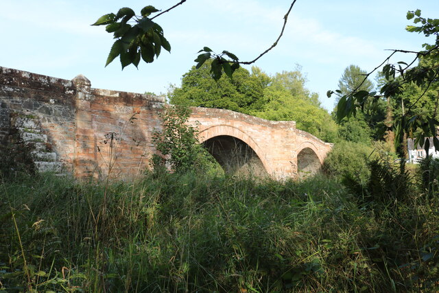
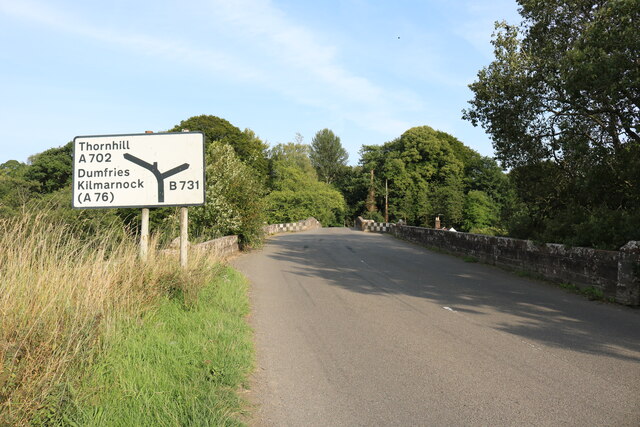
Carronbridge

Carronbridge is a village in the parish of Morton in Dumfries and Galloway, Scotland. The village is at the junction of the A76 and A702 roads approximately...

Tibbers Castle

Tibbers Castle is a motte-and-bailey castle overlooking a ford across the River Nith in Dumfries and Galloway, Scotland. To the east is the village of...
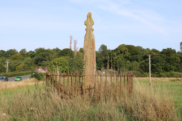
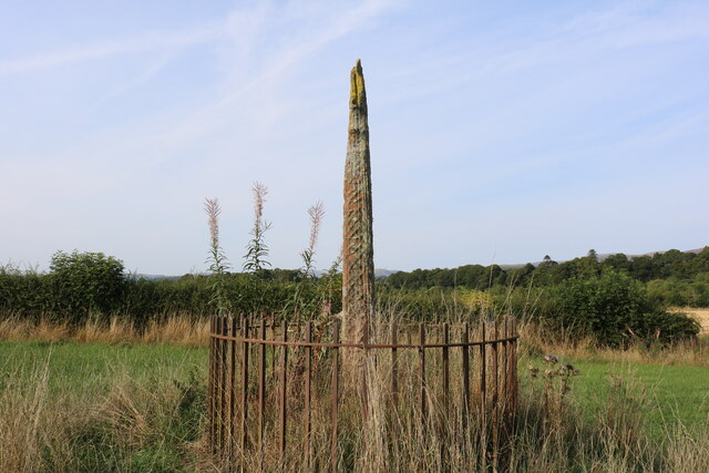
Nith Bridge cross

The Nith Bridge cross (also known as the Boatford cross) is a sculptured Anglo-Saxon cross, near the village of Thornhill, Dumfries and Galloway. It is...

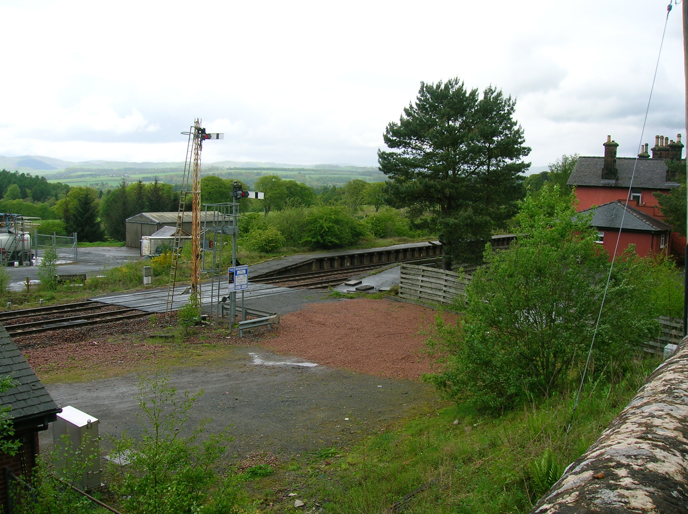
Thornhill (Dumfries) railway station

Thornhill is a closed station. It served the country town of Thornhill in Dumfries and Galloway. The station site is a mile or so from the town. Four...

Thornhill, Dumfries and Galloway

Thornhill (Scottish Gaelic: Bàrr na Driseig) is a village in the Mid Nithsdale area of Dumfries and Galloway, Scotland, south of Sanquhar and north of...

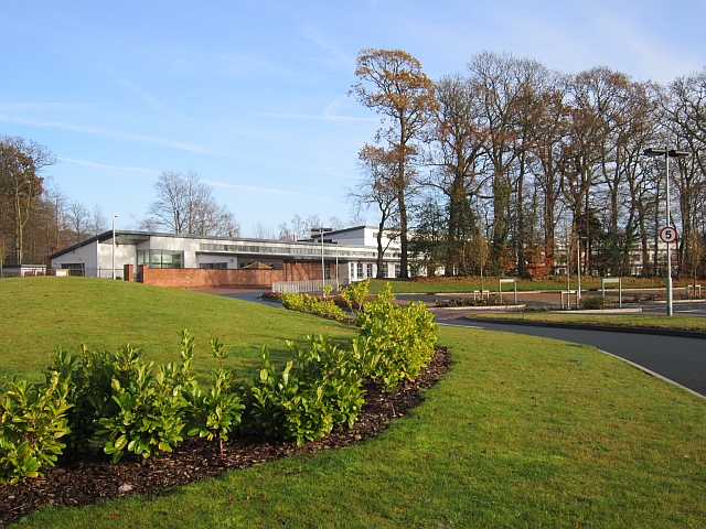
Wallace Hall (Thornhill)

Wallace Hall is a 2-18, state-operated comprehensive school in Thornhill, Dumfries and Galloway, south-west Scotland. The school serves all school-aged...

Thornhill Hospital

Thornhill Hospital is a health facility in Townhead Street, Thornhill, Dumfries and Galloway, Scotland. It is managed by NHS Dumfries and Galloway. �...

Nearby Amenities

Located within 500m of 55.257034,-3.7786662
Power: pole
Lat/Long: 55.2610305/-3.778493
Power: pole
Lat/Long: 55.2609531/-3.7805996
Power: pole
Lat/Long: 55.2609398/-3.7823689
Power: pole
Lat/Long: 55.2601879/-3.7796916
Power: pole
Lat/Long: 55.259477/-3.7788642
Power: pole
Lat/Long: 55.2587625/-3.7780072
Power: pole
Lat/Long: 55.2578026/-3.7776614
Power: pole
Lat/Long: 55.257076/-3.7774026
Power: pole
Lat/Long: 55.2563434/-3.7771162
Power: pole
Lat/Long: 55.2557449/-3.7769019
Power: pole
Lat/Long: 55.2551331/-3.7766664
Power: pole
Lat/Long: 55.25456/-3.7764416
Power: pole
Lat/Long: 55.2536338/-3.7761212
Power: pole
Lat/Long: 55.2564788/-3.7767513
Power: pole
Lat/Long: 55.2566758/-3.7762039
Power: pole
Lat/Long: 55.2569986/-3.7753957
Power: pole
Lat/Long: 55.2553096/-3.7790849
Power: pole
Lat/Long: 55.2552129/-3.7778269
Power: pole
Lat/Long: 55.2546712/-3.7750859
Power: pole
Lat/Long: 55.2543315/-3.7738152
Power: pole
Lat/Long: 55.2610776/-3.7754042
Power: pole
Lat/Long: 55.2604091/-3.7744644
Power: pole
Lat/Long: 55.2599739/-3.7738704
Power: pole
Lat/Long: 55.2595133/-3.7735882
Power: pole
Lat/Long: 55.25902/-3.7733018
The data included in this document is from www.openstreetmap.org. The data is made available under ODbL.

Have you been to Millbank Plantation?

Leave your review of Millbank Plantation below (or comments, questions and feedback).