Drumfern Moss

Wood, Forest in Kirkcudbrightshire

Scotland

Drumfern Moss

B793 near Dalbeattie
B793 near Dalbeattie Credit: Steven Brown

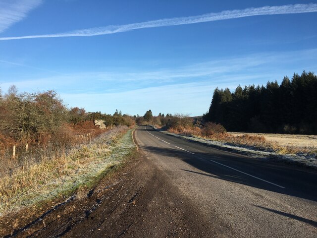
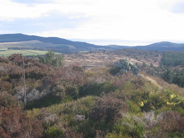
Drumfern Moss is a picturesque wood located in the region of Kirkcudbrightshire, Scotland. Spread across a vast area, the moss is known for its enchanting forest and natural beauty. The wood is situated near the small village of Drumfern, offering visitors a tranquil escape from the hustle and bustle of everyday life.

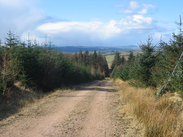
The moss is characterized by its dense woodland, consisting mainly of native tree species such as oak, birch, and pine. These towering trees create a dense canopy that filters sunlight, creating a cool and peaceful atmosphere for visitors to enjoy. The forest floor is adorned with a lush carpet of mosses, ferns, and wildflowers, adding to the overall charm of the wood.

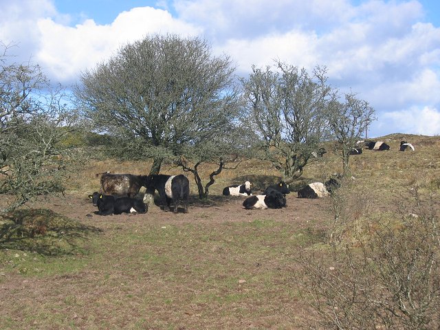
Drumfern Moss is home to a diverse range of wildlife, making it a popular spot for nature enthusiasts and wildlife photographers. Birdwatchers can often spot species such as woodpeckers, owls, and various songbirds, while mammals like red squirrels and deer can also be spotted in the undergrowth. Additionally, the moss is inhabited by a variety of insects, including butterflies and dragonflies, adding to the ecosystem's richness.

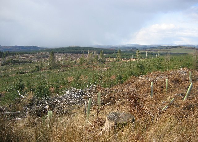
Visitors to Drumfern Moss can explore the wood through a network of well-maintained footpaths and trails. These paths allow visitors to immerse themselves in the natural surroundings, offering panoramic views of the forest and its inhabitants. The wood is also a haven for hikers and nature lovers, with opportunities for picnicking, photography, and simply enjoying the tranquility of the area.

Overall, Drumfern Moss in Kirkcudbrightshire is a captivating destination for those seeking a peaceful retreat in the heart of nature. The wood's diverse flora and fauna, combined with its well-kept trails, make it an ideal location for people of all ages to connect with the natural world.

If you have any feedback on the listing, please let us know in the comments section below.

Drumfern Moss Images

Images are sourced within 2km of 54.940642/-3.7789987 or Grid Reference NX8662. Thanks to Geograph Open Source API. All images are credited.

B793 near Dalbeattie
Landfill, Aucheninnes Moss. Landfill reception in the granite badlands east of Dalbeattie.
Landfill, Aucheninnes Moss.
Landfill reception in the granite badlands east of Dalbeattie.
Aucheninnes Moss. Another corner of the moss used as a landfill. View SE from the square's corner.
Aucheninnes Moss.
Another corner of the moss used as a landfill. View SE from the square's corner.
Kenmuir Knowe Knoll in the middle of Aucheninnes Moss. Landfill sites out of shot both left and right. View south.
Kenmuir Knowe
Knoll in the middle of Aucheninnes Moss. Landfill sites out of shot both left and right. View south.
Sawmill, Barclosh. Big sawmill, ideally placed to deal with big forests.
Sawmill, Barclosh.
Big sawmill, ideally placed to deal with big forests.
Sawmill, Barclosh. Big sawmill, as you might expect to find with all the commercial forestry in Galloway.
Sawmill, Barclosh.
Big sawmill, as you might expect to find with all the commercial forestry in Galloway.
Nether Hill Granite revealed by felling a Forestry Commission plantation.
Nether Hill
Granite revealed by felling a Forestry Commission plantation.
Belties Local breed on Barclosh Hill.
Belties
Local breed on Barclosh Hill.
Barclosh Hill Some of this rough hill has avoided the munching belties and is covered in hazel wood.
Barclosh Hill
Some of this rough hill has avoided the munching belties and is covered in hazel wood.
Loch Fern View east over a small reservoir towards Long Fern, one of the incredibly rough Solway granite hills.
Loch Fern
View east over a small reservoir towards Long Fern, one of the incredibly rough Solway granite hills.
Isles Farmland near Isles  with Clawbelly Hill in the distance.
Isles
Farmland near Isles with Clawbelly Hill in the distance.
Falgunzeon. Farm amongst the sour soils of the Solway granite. NE view.
Falgunzeon.
Farm amongst the sour soils of the Solway granite. NE view.
Woodland, Clawbelly Hill. A pocket of deciduous woodland in the pine forest on Clawbelly. Sadly it's another noxious introduced weed, sycamore.
Woodland, Clawbelly Hill.
A pocket of deciduous woodland in the pine forest on Clawbelly. Sadly it's another noxious introduced weed, sycamore.
Forest road on Clawbelly Hill. Second generation plantings. View northwest to snowshowers crossing the Galloway Hills.
Forest road on Clawbelly Hill.
Second generation plantings. View northwest to snowshowers crossing the Galloway Hills.
Clawbelly Hill. View west from the summit over a felled and replanted area of forest.
Clawbelly Hill.
View west from the summit over a felled and replanted area of forest.
Clawbelly Hill summit. The heathery summit with a view south to St Bee's Head.
Clawbelly Hill summit.
The heathery summit with a view south to St Bee's Head.
Forest, Clawbelly Hill Just on the corner of the square looking south east into it. Nearly all woodland.
Forest, Clawbelly Hill
Just on the corner of the square looking south east into it. Nearly all woodland.
Forest edge, Isles. Taken from just inside the eastern line, the granite dyke marks the edge of the forest. View west,
Forest edge, Isles.
Taken from just inside the eastern line, the granite dyke marks the edge of the forest. View west,
Show me another place!

Drumfern Moss is located at Grid Ref: NX8662 (Lat: 54.940642, Lng: -3.7789987)

Unitary Authority: Dumfries and Galloway

Police Authority: Dumfries and Galloway

What 3 Words

///keyboard.roadblock.jigsaw. Near Dalbeattie, Dumfries & Galloway

Related Wikis

Southwick railway station (Scotland)

Southwick (Dumfries & Galloway) railway station served the civil parish of Colvend and Southwick, Dumfries and Galloway, Scotland from 1859 to 1965 on...

Dalbeattie Star F.C.

Dalbeattie Star Football Club is a Scottish association football club based in Dalbeattie, Dumfries and Galloway. It currently competes in the South of...

Dalbeattie Town Hall

Dalbeattie Town Hall is a municipal building in the High Street in Dalbeattie, Dumfries and Galloway, Scotland. The structure, which is used as community...

Dalbeattie

Dalbeattie (, Scots: Dawbeattie, Scottish Gaelic: Dail Bheithe meaning 'haugh of the birch' or Dail bhàite 'drowned (i.e. liable to flood) haugh') is a...

Dalbeattie railway station

Dalbeattie railway station served the town of Dalbeattie, Dumfries and Galloway, Scotland from 1859 to 1965 on the Castle Douglas and Dumfries Railway...

Dalbeattie High School

Dalbeattie High School is a small rural secondary school on the edge of Dalbeattie in the historical county of Kirkcudbrightshire in the local council...

Buittle Bridge

Buittle Bridge, also known as Craignair Bridge is a bridge over the Urr Water just outside Dalbeattie in Dumfries and Galloway, Scotland. Completed in...

Buittle Castle

Buittle Castle, also known historically as Botle or Botel Castle, is a Motte and Bailey site in Galloway, south-west Scotland with significant early and...

Nearby Amenities

Located within 500m of 54.940642,-3.7789987
Power: pole
Lat/Long: 54.9423522/-3.7786786
Power: pole
Lat/Long: 54.9426105/-3.7799706
Power: pole
Lat/Long: 54.9428627/-3.7811946
Power: pole
Lat/Long: 54.9430906/-3.7823296
Power: pole
Lat/Long: 54.9432539/-3.7831612
Power: pole
Lat/Long: 54.9434793/-3.7843111
Power: pole
Lat/Long: 54.9421048/-3.7773909
Power: pole
Lat/Long: 54.9432649/-3.7783837
Power: pole
Lat/Long: 54.9438632/-3.7782204
Power: pole
Lat/Long: 54.9443445/-3.7779234
Power: pole
Lat/Long: 54.9447648/-3.7776497
Power: pole
Lat/Long: 54.9418392/-3.776135
Power: pole
Lat/Long: 54.9421499/-3.7747518
Power: pole
Lat/Long: 54.9424143/-3.7735638
Power: pole
Lat/Long: 54.9426836/-3.7723758
The data included in this document is from www.openstreetmap.org. The data is made available under ODbL.

Have you been to Drumfern Moss?

Leave your review of Drumfern Moss below (or comments, questions and feedback).