Whinnie Muir

Wood, Forest in Stirlingshire

Scotland

Whinnie Muir

Entrance to Torwood
Entrance to Torwood Credit: Alex McGregor

Whinnie Muir is a small village located in Stirlingshire, Scotland. Known for its beautiful woodlands and forests, it is a haven for nature lovers and outdoor enthusiasts. The village is situated amidst picturesque rolling hills and offers stunning panoramic views of the surrounding countryside.

The woodlands in Whinnie Muir are rich in biodiversity and are home to a wide variety of plant and animal species. Visitors can enjoy leisurely walks and hikes along the well-maintained trails that wind through the forests. The peaceful and serene atmosphere provides the perfect escape from the hustle and bustle of city life.

In addition to its natural beauty, Whinnie Muir also offers a range of recreational activities for visitors to enjoy. The village has a local community center where residents and visitors can participate in various events and workshops. The center also hosts regular art exhibitions and cultural events, showcasing the talent and creativity of the local community.

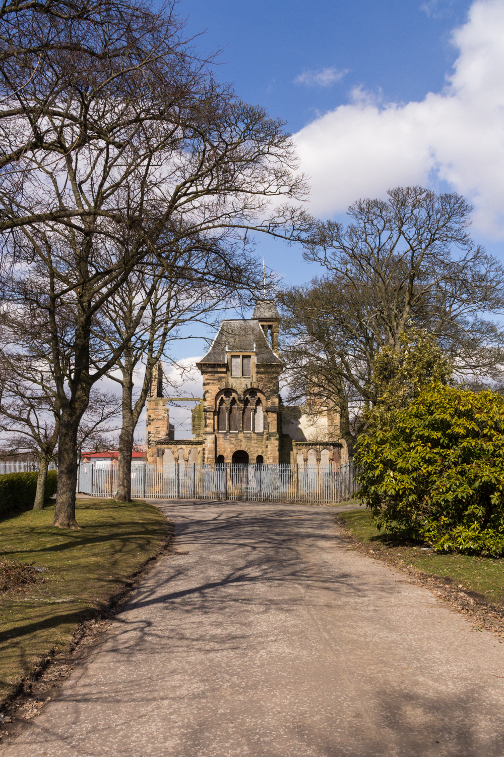
For those interested in history and heritage, Whinnie Muir has a few notable landmarks worth visiting. The village is home to a charming old church, which dates back several centuries and showcases beautiful architectural features. Additionally, the nearby Stirling Castle, a historic fortress, is a popular tourist attraction located just a short drive away.

Overall, Whinnie Muir in Stirlingshire is a quaint and picturesque village that offers a perfect blend of natural beauty, recreational activities, and historical charm. It is an ideal destination for those seeking a peaceful retreat in the heart of Scotland's stunning landscapes.

If you have any feedback on the listing, please let us know in the comments section below.

Whinnie Muir Images

Images are sourced within 2km of 56.041272/-3.8651246 or Grid Reference NS8384. Thanks to Geograph Open Source API. All images are credited.

Entrance to Torwood
Entrance to Torwood
The M876 at North Broomage
Path, Tor Wood A path up to the broch.
Path, Tor Wood
A path up to the broch.
Path, Tor Wood A rocky path up to the broch.
Path, Tor Wood
A rocky path up to the broch.
Tor Wood
Tor Wood
Tappoch Broch Surviving masonry at the summit of Tor Wood.
Tappoch Broch
Surviving masonry at the summit of Tor Wood.
Tappoch Broch This structure is also sometimes referred to as Torwood Broch. See <span class="nowrap"><a title="https://canmore.org.uk/site/47004/torwood-tappoch-broch" rel="nofollow ugc noopener" href="https://canmore.org.uk/site/47004/torwood-tappoch-broch">Link</a><img style="margin-left:2px;" alt="External link" title="External link - shift click to open in new window" src="https://s1.geograph.org.uk/img/external.png" width="10" height="10"/></span> (at Canmore) for details. Brochs are Iron Age round towers of dry-stone construction, typically consisting of two concentric walls. There would have been several timber floors and a roof in the circular interior space; stairs in the gap between the inner and outer walls would have allowed access to the upper floors. Tappoch Broch was first excavated in 1864, and again several times in the twentieth century. The main entrance can still be seen on the eastern side, and remains of a stairway on the southern side.

The broch is located within Tor Wood. On page 348 of his book "The Celtic Place-names of Scotland" (1926), W J Watson cites this name as an example of a part-translation: in a charter of 1150, the place is referred to as "nemus de Keltor". In the modern form of the name, the earlier "Kel" (from the Gael. "coille") has been replaced by its translation, "Wood", and the two elements of the name switched around: "Keltor" becomes "Torwood".
Tappoch Broch
This structure is also sometimes referred to as Torwood Broch. See LinkExternal link (at Canmore) for details. Brochs are Iron Age round towers of dry-stone construction, typically consisting of two concentric walls. There would have been several timber floors and a roof in the circular interior space; stairs in the gap between the inner and outer walls would have allowed access to the upper floors. Tappoch Broch was first excavated in 1864, and again several times in the twentieth century. The main entrance can still be seen on the eastern side, and remains of a stairway on the southern side. The broch is located within Tor Wood. On page 348 of his book "The Celtic Place-names of Scotland" (1926), W J Watson cites this name as an example of a part-translation: in a charter of 1150, the place is referred to as "nemus de Keltor". In the modern form of the name, the earlier "Kel" (from the Gael. "coille") has been replaced by its translation, "Wood", and the two elements of the name switched around: "Keltor" becomes "Torwood".
Tor Wood There is a path along a vague ridge line heading south from the broch.
Tor Wood
There is a path along a vague ridge line heading south from the broch.
View out of Tor Wood The turbines are now a landmark on M9 journeys.
View out of Tor Wood
The turbines are now a landmark on M9 journeys.
Torwood Castle A 16th century tower house.
Torwood Castle
A 16th century tower house.
Road from Torwood Castle
Bridge, near Torwood The bridge traverses the Tor Burn at this point.  The Tor Burn itself forms the county boundary between Falkirk and Stirling councils.
Bridge, near Torwood
The bridge traverses the Tor Burn at this point. The Tor Burn itself forms the county boundary between Falkirk and Stirling councils.
Torwood Castle A three to four storey L-plan tower house that appears to date from 1566.
Torwood Castle
A three to four storey L-plan tower house that appears to date from 1566.
Torwood Castle An inscribed stone indicates that Torwood Castle dates from 1566, and was the home of the Forresters of Garden family, who took their name form their role as royal foresters.
Torwood Castle
An inscribed stone indicates that Torwood Castle dates from 1566, and was the home of the Forresters of Garden family, who took their name form their role as royal foresters.
Path, Tor Wood
Path, Tor Wood
Powerlines near Denny From the direction of the former power stations at Kincardine and Longannet, heading for the huge substation  near Denny.
Powerlines near Denny
From the direction of the former power stations at Kincardine and Longannet, heading for the huge substation near Denny.
Farmland at Bogend
Farmland at Bogend
Fields North of Denny
Show me another place!

Whinnie Muir is located at Grid Ref: NS8384 (Lat: 56.041272, Lng: -3.8651246)

Unitary Authority: Falkirk

Police Authority: Forth Valley

What 3 Words

///clearly.asking.growth. Near Plean, Stirling

Related Wikis

Torwood

Torwood (Scottish Gaelic: Coille Tor) is a small village located 2 miles (3.2 km) north-northwest of Larbert, 4 miles (6.4 km) north-west of Falkirk and...
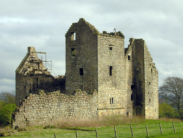
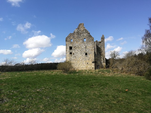
Torwood Castle

Torwood Castle is a ruined 16th-century L-plan castle near the village of Torwood, in the Falkirk Council area of central Scotland. It was designated as...

Tappoch Broch

Tappoch Broch, better known as Torwood Broch, is an iron-age broch located in a remote spot in dense woodland near Falkirk, Scotland. == History == Tappoch...

Alloa Junction railway station

Alloa Junction railway station was located near Plean, Stirling, Scotland, from 1850 to 1865. == History == The station was opened on 2 September 1850...

Royal Scottish National Hospital

The Royal Scottish National Hospital was a psychiatric institution situated in Larbert, Falkirk, Scotland. It was first founded as the Scottish National...

William Simpson's Home

The William Simpson's Home is a care home in Plean, Scotland. It provides care for members of the armed services who have developed mental health or alcohol...

Forth Valley Royal Hospital

Forth Valley Royal Hospital is a hospital located in Larbert, Scotland. With 860 inpatient beds, 25 wards, and 16 operating theatres, it was Scotland's...

Plean

Plean is a village, in the Stirling council area of central Scotland, located on the main A9 road from Falkirk. At the 2001 census, Plean had a population...

Nearby Amenities

Located within 500m of 56.041272,-3.8651246
Torwood
Name Gd: Coille Tor
Place: village
Population: 245
Source: npe
Wikidata: Q7827470
Wikipedia: en:Torwood
Lat/Long: 56.042029/-3.8611476
Power: tower
Lat/Long: 56.0417345/-3.860266
Power: tower
Lat/Long: 56.0387879/-3.8597042
Barrier: chain
Lat/Long: 56.0387349/-3.8697015
Glenbervie Trout Fishery
Leisure: fishing
Lat/Long: 56.0376572/-3.8622745
Post Box
Collection Times: Mo-Fr 16:00; Sa 11:30
Operator: Royal Mail
Post Box Type: lamp
Ref: FK5 75
Royal Cypher: scottish_crown
Source: survey
Lat/Long: 56.044047/-3.8603596
Turning Circle
Lat/Long: 56.0438307/-3.8615871
Bus Stop
Bench: no
Naptan AtcoCode: 66903690005
Naptan NaptanCode: 32523797
Shelter: no
Lat/Long: 56.0414613/-3.8604244
Power: pole
Lat/Long: 56.0455133/-3.8631427
Power: pole
Lat/Long: 56.0446869/-3.8617257
The data included in this document is from www.openstreetmap.org. The data is made available under ODbL.

Have you been to Whinnie Muir?

Leave your review of Whinnie Muir below (or comments, questions and feedback).