Differick Wood

Wood, Forest in Lanarkshire

Scotland

Differick Wood

Tree-lined road, Boreland The setting sun slants through the trees, giving a glow to the wintry scene.
Tree-lined road, Boreland Credit: Alan O'Dowd

Differick Wood is a picturesque forest located in Lanarkshire, Scotland. Spread over an area of approximately 100 acres, it is a popular destination for nature lovers and outdoor enthusiasts. The wood is situated near the village of Differick and is easily accessible by car or on foot.

The woodland boasts an impressive variety of tree species, including oak, birch, and pine, creating a diverse and vibrant ecosystem. The dense vegetation provides a habitat for various wildlife, such as deer, foxes, and numerous bird species, making it an ideal location for birdwatching and wildlife spotting.

Visitors to Differick Wood can explore the forest through a network of well-maintained walking trails. These trails offer different difficulty levels, catering to both casual strollers and experienced hikers. Along the way, visitors can enjoy the serene ambiance of the woods, with the soothing sound of birdsong and the rustling of leaves.

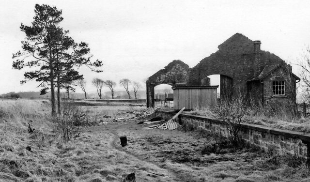
In addition to its natural beauty, Differick Wood also holds historical significance. The forest was once part of the hunting grounds of the nearby Differick Castle, which dates back to the 15th century. The castle is now in ruins, but remnants can still be seen in the surrounding area.

Overall, Differick Wood is a hidden gem in Lanarkshire, offering visitors a chance to immerse themselves in the tranquility of nature, observe diverse wildlife, and explore the rich history of the region.

If you have any feedback on the listing, please let us know in the comments section below.

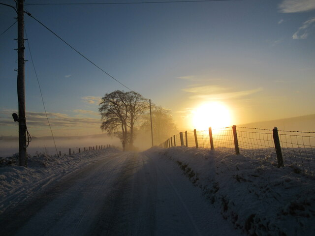
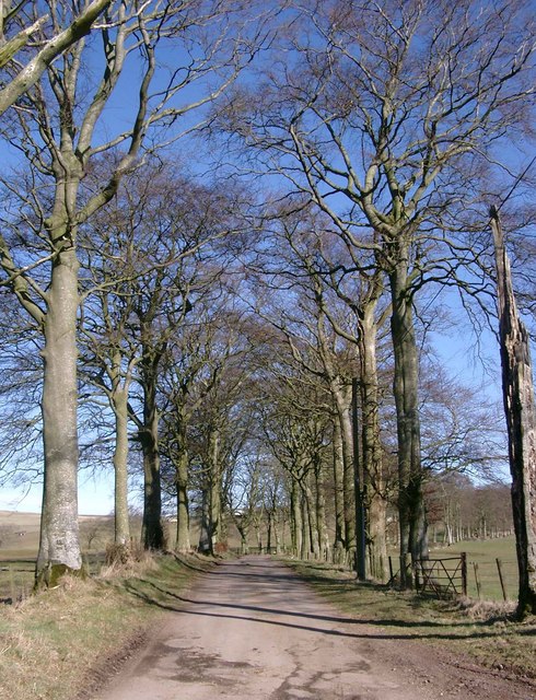
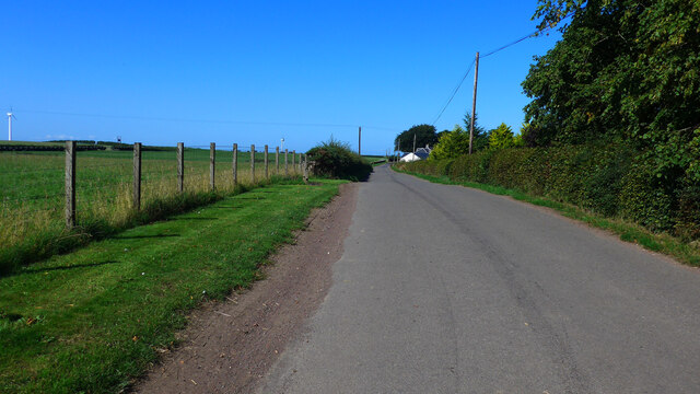
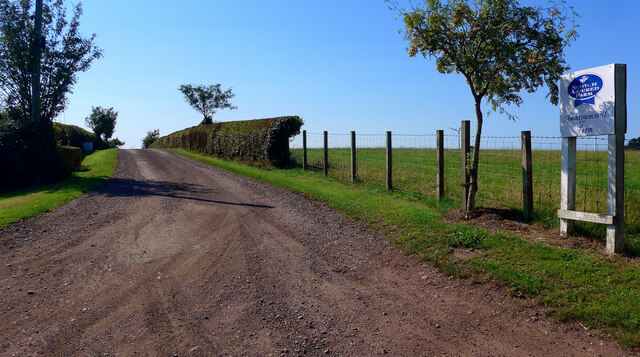
Differick Wood Images

Images are sourced within 2km of 55.651037/-3.8501951 or Grid Reference NS8341. Thanks to Geograph Open Source API. All images are credited.

Tree-lined road, Boreland The setting sun slants through the trees, giving a glow to the wintry scene.
Tree-lined road, Boreland
The setting sun slants through the trees, giving a glow to the wintry scene.
Snow and mist near Boreland An atmospheric scene with livestock feeding as the low December sun begins to set on a very cold afternoon.
Snow and mist near Boreland
An atmospheric scene with livestock feeding as the low December sun begins to set on a very cold afternoon.
Mist, snow and the setting sun, near Devonburn Taken during a very cold spell of weather with temperatures remaining below freezing all day.
Mist, snow and the setting sun, near Devonburn
Taken during a very cold spell of weather with temperatures remaining below freezing all day.
Access road to Moat and Moat Mains The sloping field on the left is full of plastic-wrapped bales.
Access road to Moat and Moat Mains
The sloping field on the left is full of plastic-wrapped bales.
Derelict building at Blackhall
There's nowhere else to be on a day like today! Warm sun, but air temperature -2 degrees C.  Winter trees on the road to Boreland
There's nowhere else to be on a day like today!
Warm sun, but air temperature -2 degrees C. Winter trees on the road to Boreland
Antenna array
Antenna array
Towards Boghill
Towards Boghill
Track and outbuildings at Auchmeddan
Farmland, Near Boreland Boreland Wood on the left of hill in the distance.
Farmland, Near Boreland
Boreland Wood on the left of hill in the distance.
The B7018 leaving Brocketsbrae
Entrance to the "Allotment gardens" at Brocketsbrae The parentheses because that is what the OS tells us, although I could not see the allotments.
Entrance to the "Allotment gardens" at Brocketsbrae
The parentheses because that is what the OS tells us, although I could not see the allotments.
The road to Dillarburn at Hoodshill
Hoodshill, near Dillarburn
Approaching Muirhouse
Auchtygemmell Farm roadend
Minor road south of Black Hill heading towards Linnville
Scottish Water reservoir south of Black Hill
Show me another place!

Differick Wood is located at Grid Ref: NS8341 (Lat: 55.651037, Lng: -3.8501951)

Unitary Authority: South Lanarkshire

Police Authority: Lanarkshire

What 3 Words

///division.crop.tickling. Near Lesmahagow, South Lanarkshire

Related Wikis

Brocketsbrae railway station

Brocketsbrae railway station served the hamlet of Brocketsbrae, South Lanarkshire, Scotland, from 1866 to 1951 on the Lesmahagow Junction to Bankend Colliery...

Black Hill (South Lanarkshire)

The Black Hill in South Lanarkshire is owned by the National Trust for Scotland. It overlooks the Clyde Valley, and is the location of a burial cairn from...

Lesmahagow F.C.

Lesmahagow Junior Football Club is a Scottish football club based in the town of Lesmahagow, South Lanarkshire, located just off the M74 motorway approximately...

Lesmahagow Railway

The Lesmahagow Railway, south of Glasgow in Scotland, was developed by a company known as The Lesmahagow Branches (later known as The Lesmahagow Guarantee...

Nearby Amenities

Located within 500m of 55.651037,-3.8501951
Dillar Hill
Natural: peak
Lat/Long: 55.6527464/-3.8561992
Power: pole
Lat/Long: 55.6494457/-3.8541069
Power: pole
Lat/Long: 55.6502623/-3.8485729
Power: pole
Lat/Long: 55.6506163/-3.8429952
Power: pole
Lat/Long: 55.6497777/-3.8515543
Power: pole
Lat/Long: 55.650468/-3.8459617
Power: pole
Lat/Long: 55.6503499/-3.8473833
Power: pole
Lat/Long: 55.6502558/-3.8474898
Power: pole
Lat/Long: 55.649179/-3.8571187
Power: pole
Lat/Long: 55.6492926/-3.8552847
Power: pole
Lat/Long: 55.6496834/-3.8530095
Power: pole
Lat/Long: 55.6495953/-3.8529566
Power: pole
Lat/Long: 55.6493393/-3.8557915
Power: pole
Lat/Long: 55.6505981/-3.8445724
Power: pole
Lat/Long: 55.6500594/-3.8501192
Power: pole
Lat/Long: 55.6498882/-3.8515321
Power: pole
Lat/Long: 55.6499498/-3.8502307
Power: pole
Lat/Long: 55.6491123/-3.8566709
Power: pole
Lat/Long: 55.6503499/-3.8463165
Power: pole
Lat/Long: 55.6508009/-3.8422817
Power: pole
Lat/Long: 55.6505242/-3.8441436
Power: pole
Lat/Long: 55.6506678/-3.8436819
Power: pole
Lat/Long: 55.6504495/-3.845075
Power: pole
Lat/Long: 55.649507/-3.8544358
Power: pole
Lat/Long: 55.6501744/-3.8485045
Generator Method: wind_turbine
Generator Source: wind
Generator Type: horizontal_axis
Power: generator
Lat/Long: 55.6488765/-3.8467634
Generator Method: wind_turbine
Generator Source: wind
Generator Type: horizontal_axis
Power: generator
Lat/Long: 55.6487827/-3.8458703
Generator Method: wind_turbine
Generator Source: wind
Generator Type: horizontal_axis
Power: generator
Lat/Long: 55.6484584/-3.8453359
The data included in this document is from www.openstreetmap.org. The data is made available under ODbL.

Have you been to Differick Wood?

Leave your review of Differick Wood below (or comments, questions and feedback).