Black Plantation

Wood, Forest in Kirkcudbrightshire

Scotland

Black Plantation

Inn on the Loch The Inn on the Loch is a hotel and restaurant, situated on the banks of Auchenreoch Loch, adjacent to the A75.
Inn on the Loch Credit: David Dixon

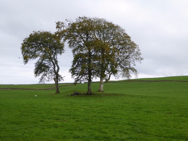
Black Plantation is a dense wooded area located in Kirkcudbrightshire, Scotland. This forested area covers approximately 200 acres and is known for its dark and mysterious atmosphere due to the thick canopy of trees that block out much of the sunlight. The plantation is primarily made up of native species such as oak, beech, and birch, providing a rich habitat for a variety of wildlife including deer, birds, and small mammals.

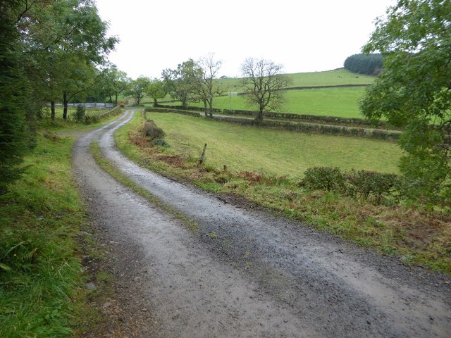
The forest floor is covered in a thick layer of leaf litter and moss, creating a damp and quiet environment that is perfect for exploring and immersing oneself in nature. There are several walking trails that wind through the plantation, allowing visitors to enjoy the peaceful surroundings and spot some of the local wildlife.

Black Plantation is a popular destination for nature lovers, hikers, and birdwatchers looking to escape the hustle and bustle of everyday life. The tranquil beauty of this forested area makes it a perfect place to relax, unwind, and connect with the natural world.

If you have any feedback on the listing, please let us know in the comments section below.

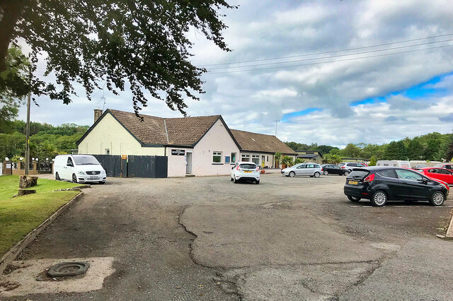
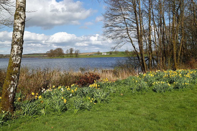
Black Plantation Images

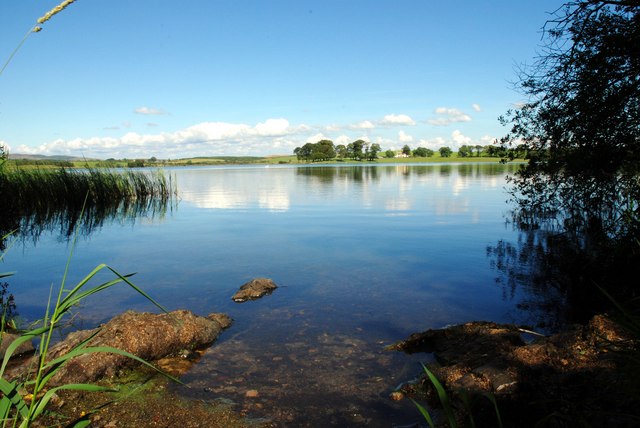
Images are sourced within 2km of 55.008738/-3.8313202 or Grid Reference NX8269. Thanks to Geograph Open Source API. All images are credited.

Inn on the Loch The Inn on the Loch is a hotel and restaurant, situated on the banks of Auchenreoch Loch, adjacent to the A75.
Inn on the Loch
The Inn on the Loch is a hotel and restaurant, situated on the banks of Auchenreoch Loch, adjacent to the A75.
Old milestone A view to the west to show the setting of the 10 miles from Dumfries milestone on the Old Military Road at Stonehouse.
Old milestone
A view to the west to show the setting of the 10 miles from Dumfries milestone on the Old Military Road at Stonehouse.
Farm Still a few bales left at Stonehouse Farm after the winter feed and bedding.    This is on the opposite side of the Old Military Road to the milestone 10 miles from Dumfries.
Farm
Still a few bales left at Stonehouse Farm after the winter feed and bedding. This is on the opposite side of the Old Military Road to the milestone 10 miles from Dumfries.
Trees in a field Trees in a field opposite Auchenreoch Loch.  The same trees were photographed in snow back in December 2010 <a href="https://www.geograph.org.uk/photo/2204362">NX8271 : Copse close to Auchenreoch Loch</a>.
Trees in a field
Trees in a field opposite Auchenreoch Loch. The same trees were photographed in snow back in December 2010 NX8271 : Copse close to Auchenreoch Loch.
Track by a quarry on Fell Hill
Milton Loch The loch was viewed from the roadside opposite Beech Cottage.
Milton Loch
The loch was viewed from the roadside opposite Beech Cottage.
Lay-by on the A75 near Springholm The entrance to the lay-by east of Springholm.
Lay-by on the A75 near Springholm
The entrance to the lay-by east of Springholm.
Auchenreoch Loch
Auchenreoch Loch
Auchenreoch Loch
Auchenreoch Loch
The Inn on the Loch
The Inn on the Loch
Inn on the Loch
Inn on the Loch
Lay-by at Auchenreoch Loch
Burnbrae Amongst the drumlins, Newton.
Burnbrae
Amongst the drumlins, Newton.
Military Road near Milton
Milton Loch Looking out over Milton Loch near Crocketford.
Milton Loch
Looking out over Milton Loch near Crocketford.
Old quarry access road at Fell Hill
Road junction at Auchengibbert
Upper Auchenreoach Long track to this farm of the A75 with Fiddle Wood left of picture on the horizon.
Upper Auchenreoach
Long track to this farm of the A75 with Fiddle Wood left of picture on the horizon.
Show me another place!

Black Plantation is located at Grid Ref: NX8269 (Lat: 55.008738, Lng: -3.8313202)

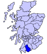
Unitary Authority: Dumfries and Galloway

Police Authority: Dumfries and Galloway

What 3 Words

///symphony.rekindle.cool. Near Dalbeattie, Dumfries & Galloway

Nearby Locations

Black Plantation

Related Wikis

Milton Loch

Milton Loch is an alkaline freshwater loch located in Dumfries and Galloway, Scotland. In the loch and nearby are archaeological sites including three...

Springholm

Springholm is a village in the historical county of Kirkcudbrightshire in Dumfries and Galloway, Scotland. It is located 14 miles (23 km) west of Dumfries...

Crocketford

Crocketford (/ˈkrɒkɪtfɔːd/, also frequently /ˈkrɒkɪtfəd/) also known as Ninemile Bar (Scottish Gaelic: Ath Crogaid), as it is approximately equidistant...

Stewartry

The Stewartry was a local government district from 1975 until 1996 within the Dumfries and Galloway region in south-west Scotland. Under the name The Stewartry...

Nearby Amenities

Located within 500m of 55.008738,-3.8313202
Power: pole
Lat/Long: 55.0093615/-3.8389552
The data included in this document is from www.openstreetmap.org. The data is made available under ODbL.

Have you been to Black Plantation?

Leave your review of Black Plantation below (or comments, questions and feedback).