Barscone Wood

Wood, Forest in Kirkcudbrightshire

Scotland

Barscone Wood

Farmland north of Dalbeattie
Farmland north of Dalbeattie Credit: John Whelan

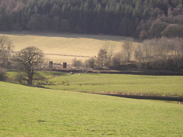
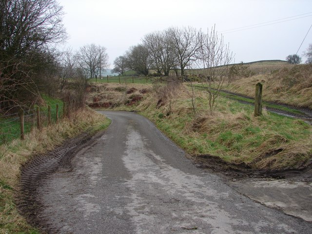
Barscone Wood is a picturesque forest located in Kirkcudbrightshire, Scotland. Spanning over a vast area, it is known for its stunning natural beauty and rich biodiversity. The wood is situated near the village of Balmaclellan, offering visitors a peaceful and serene environment to explore.

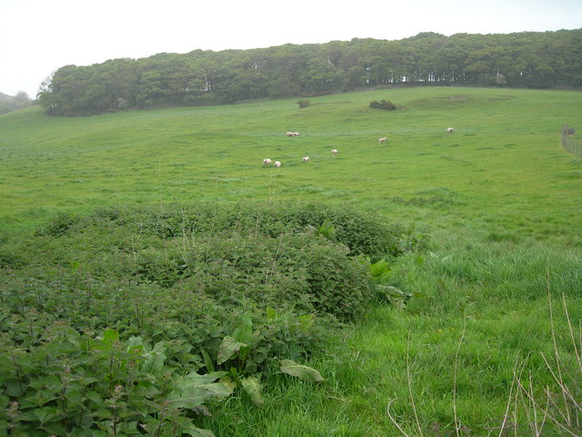
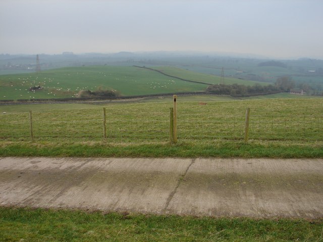
The wood is predominantly composed of broadleaf trees, including oak, birch, and beech. These towering trees create a dense canopy that provides shade and shelter to a variety of wildlife species. The forest floor is adorned with a carpet of wildflowers during the spring and summer months, adding to the wood's vibrant charm.

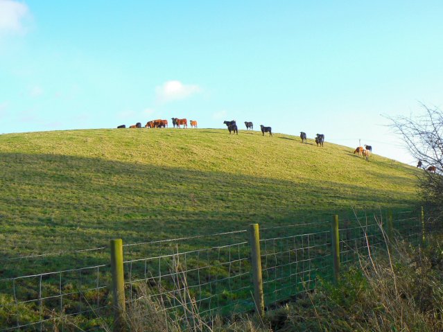
Barscone Wood is home to a diverse range of wildlife, making it a haven for nature enthusiasts and birdwatchers. Common sightings include red squirrels, roe deer, and various species of birds such as woodpeckers, jays, and buzzards. The tranquil atmosphere and abundance of wildlife make it an ideal destination for those seeking a peaceful retreat in nature.

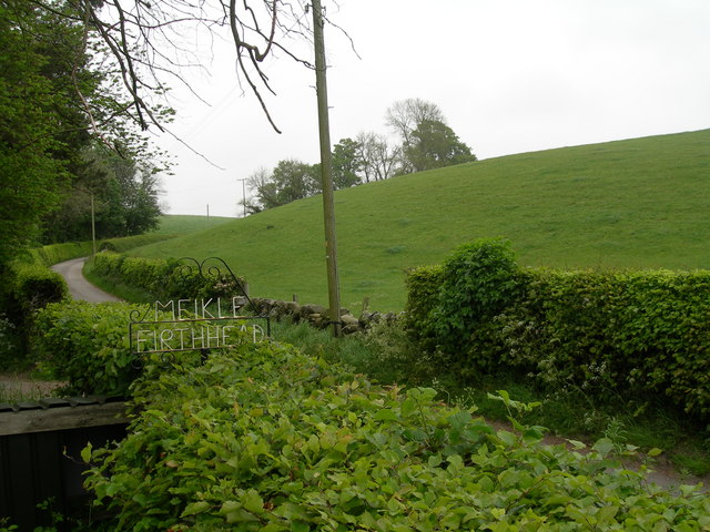
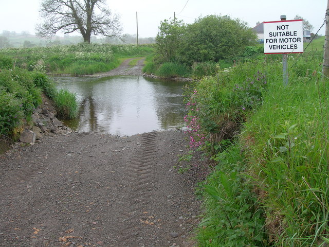
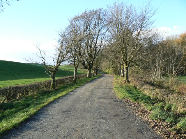
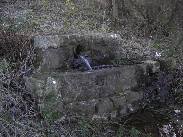
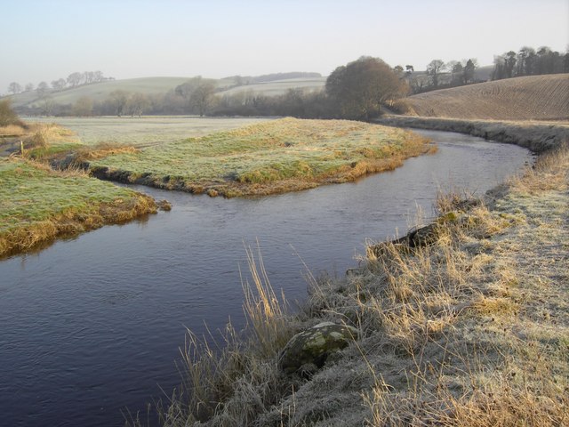
The wood offers a network of walking trails, allowing visitors to explore its hidden gems. The paths meander through the trees, revealing scenic viewpoints and charming spots for picnics. The wood is also intersected by a small river, adding to its enchanting ambiance.

Overall, Barscone Wood is a natural oasis in Kirkcudbrightshire, where visitors can immerse themselves in the beauty of nature. Whether it's a leisurely stroll, birdwatching, or simply enjoying the tranquility, this wood offers a wonderful escape from the hustle and bustle of everyday life.

If you have any feedback on the listing, please let us know in the comments section below.

Barscone Wood Images

Images are sourced within 2km of 54.953745/-3.8501037 or Grid Reference NX8163. Thanks to Geograph Open Source API. All images are credited.

Farmland north of Dalbeattie
Roadway to Meikle Firthhead & edge of Dalmoney Hill
Ford over Urr Water, south west of Netheryett
Railway bridge (remaining buttresses)  across the Urr This is part of the old Dalbeattie - Castle Douglas line opened in 1859 and closed under Beeching in the 1960s
Railway bridge (remaining buttresses) across the Urr
This is part of the old Dalbeattie - Castle Douglas line opened in 1859 and closed under Beeching in the 1960s
Hill of cows Small hill north of Edingham Loch.
Hill of cows
Small hill north of Edingham Loch.
Heading for Torkatrine A dead-end road leading to a farm and standing stone.
Heading for Torkatrine
A dead-end road leading to a farm and standing stone.
Buittle Bridge The Meikle Knox-Netheryett lane very briefly enters this grid square at Buittle Bridge cottage. Above the garden is the embankment of the former Dumfries-Stranraer railway (1859-1965), known as the 'Port Line'; beyond that is Barn Hill. The site of the bridge and short lived station is just ENE (right) in <a href="https://www.geograph.org.uk/gridref/NX8164">NX8164</a>.
Buittle Bridge
The Meikle Knox-Netheryett lane very briefly enters this grid square at Buittle Bridge cottage. Above the garden is the embankment of the former Dumfries-Stranraer railway (1859-1965), known as the 'Port Line'; beyond that is Barn Hill. The site of the bridge and short lived station is just ENE (right) in NX8164.
Buittle Station The Meikle Knox-Netheryett lane bears left though an embankment, once an overbridge on the former Dumfries-Stranraer railway (1859-1965). The track on the right leads up to the site of Buittle Station, closed 1894 due to doubling of the line. All that is left is the rubble of the railway cottages - demolished 1960's.
Buittle Station
The Meikle Knox-Netheryett lane bears left though an embankment, once an overbridge on the former Dumfries-Stranraer railway (1859-1965). The track on the right leads up to the site of Buittle Station, closed 1894 due to doubling of the line. All that is left is the rubble of the railway cottages - demolished 1960's.
Halketleaths Bridge Bridge over the Birkland Burn at the junction of the Meikle Knox, Blackerne and Netheryett lanes.
Halketleaths Bridge
Bridge over the Birkland Burn at the junction of the Meikle Knox, Blackerne and Netheryett lanes.
West Logan Farm on the Meikle Knox - Netheryett lane.
West Logan
Farm on the Meikle Knox - Netheryett lane.
East Logan Track to East Logan farm, situated on the slopes of Fellside. Beyond lies the Urr Valley towards Dalbeattie.
East Logan
Track to East Logan farm, situated on the slopes of Fellside. Beyond lies the Urr Valley towards Dalbeattie.
Guffogland Winter view NW from Guffogland farm road toward Meikle Knox and Halket Leathes.
Guffogland
Winter view NW from Guffogland farm road toward Meikle Knox and Halket Leathes.
Barrsyard Barrsyard Farm stands on the western slopes of the Urr Valley at the end of the track from Buittle Place near Dalbeattie. In the distance (N) can be seen the housing of Haugh of Urr and Hardgate.
Barrsyard
Barrsyard Farm stands on the western slopes of the Urr Valley at the end of the track from Buittle Place near Dalbeattie. In the distance (N) can be seen the housing of Haugh of Urr and Hardgate.
The Well An old well on the Dalbeattie to Haugh of Urr road.
The Well
An old well on the Dalbeattie to Haugh of Urr road.
The Bridge A bridge over the Urr Water leading to East Logan Farm.
The Bridge
A bridge over the Urr Water leading to East Logan Farm.
The Urr Water The Urr Water near Dalbeattie.
The Urr Water
The Urr Water near Dalbeattie.
Sign of the Times Behind the ivy, signs and nesting box, lurks a tree.
Sign of the Times
Behind the ivy, signs and nesting box, lurks a tree.
Murray Hill, Meikle Firthhead View NNW across Murray Hill fields from Meikle Firthhead dairy farm.
Murray Hill, Meikle Firthhead
View NNW across Murray Hill fields from Meikle Firthhead dairy farm.
Show me another place!

Barscone Wood is located at Grid Ref: NX8163 (Lat: 54.953745, Lng: -3.8501037)

Unitary Authority: Dumfries and Galloway

Police Authority: Dumfries and Galloway

What 3 Words

///journals.manifests.unfilled. Near Dalbeattie, Dumfries & Galloway

Nearby Locations

Barscone Wood

Related Wikis

Buittle railway station

Buittle railway station, also known as Buittle Halt, Buittle Mill and Buittle Mill Halt, served the civil parish of Buittle, Dumfries and Galloway, Scotland...
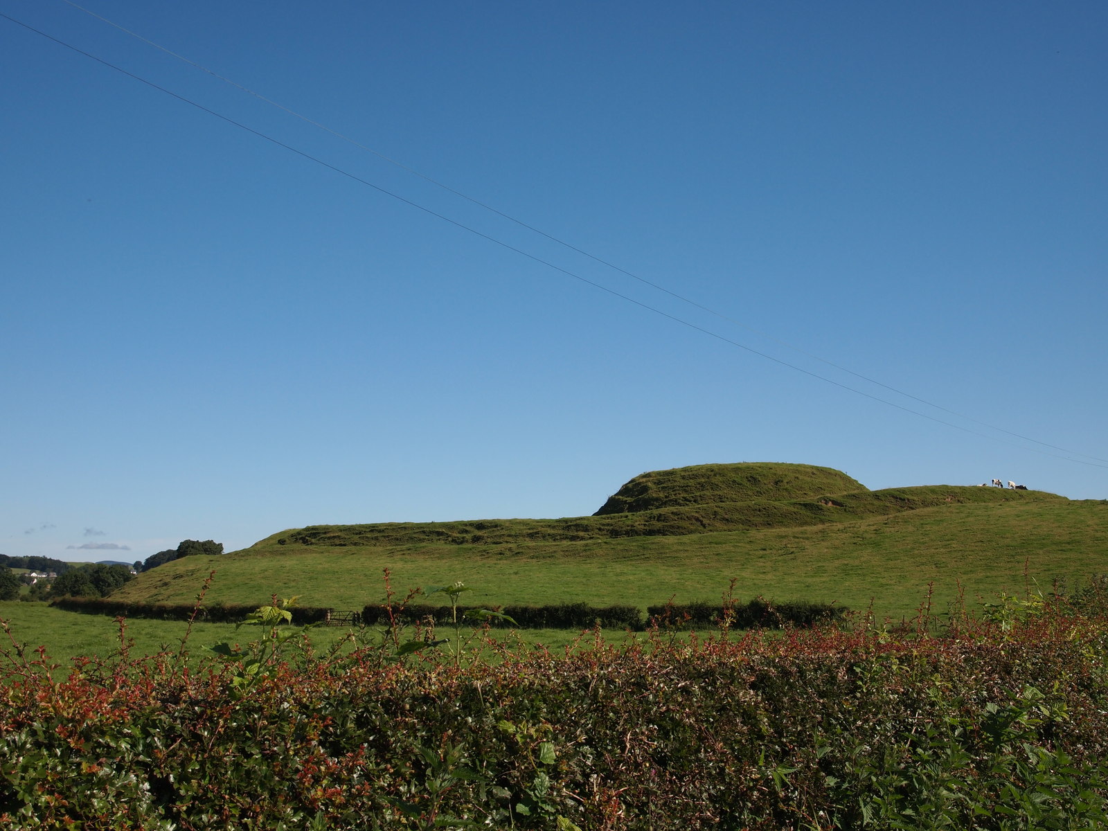
Motte of Urr

The Motte of Urr is the remains of a 12th-century motte-and-bailey castle located near the Haugh of Urr in Dumfries and Galloway, Scotland. == History... ==

Buittle

Buittle is an ecclesiastical and civil parish in Dumfries and Galloway, southwest Scotland, in the traditional county of Kirkcudbrightshire. It lies to...

Buittle Castle

Buittle Castle, also known historically as Botle or Botel Castle, is a Motte and Bailey site in Galloway, south-west Scotland with significant early and...

Dalbeattie railway station

Dalbeattie railway station served the town of Dalbeattie, Dumfries and Galloway, Scotland from 1859 to 1965 on the Castle Douglas and Dumfries Railway...

Dalbeattie High School

Dalbeattie High School is a small rural secondary school on the edge of Dalbeattie in the historical county of Kirkcudbrightshire in the local council...

Dalbeattie Town Hall

Dalbeattie Town Hall is a municipal building in the High Street in Dalbeattie, Dumfries and Galloway, Scotland. The structure, which is used as community...

Haugh of Urr

Haugh of Urr (), is a village in the historical county of Kirkcudbrightshire in Dumfries and Galloway, Scotland. It is approximately 4 miles (6 kilometres...

Nearby Amenities

Located within 500m of 54.953745,-3.8501037
Power: tower
Lat/Long: 54.9553862/-3.8528217
Power: tower
Lat/Long: 54.9526586/-3.8573865
Power: tower
Lat/Long: 54.9544183/-3.8544416
Power: pole
Lat/Long: 54.9500116/-3.8475988
Power: pole
Lat/Long: 54.9504151/-3.8485027
Power: pole
Lat/Long: 54.9508203/-3.8494227
Power: pole
Lat/Long: 54.951022/-3.8504795
Power: pole
Lat/Long: 54.95123/-3.8514692
Power: pole
Lat/Long: 54.951441/-3.8524911
Power: pole
Lat/Long: 54.951384/-3.8538456
Power: pole
Lat/Long: 54.9513385/-3.8550741
Power: pole
Lat/Long: 54.9513047/-3.8560504
Power: tower
Lat/Long: 54.9564491/-3.8510627
Barscone
Natural: peak
Lat/Long: 54.9525423/-3.8511077
Power: pole
Lat/Long: 54.9503329/-3.8544245
Power: pole
Lat/Long: 54.9507135/-3.8526251
Power: pole
Lat/Long: 54.9510002/-3.8512633
Power: pole
Lat/Long: 54.9511466/-3.8503328
Power: pole
Lat/Long: 54.9513064/-3.8494787
Power: pole
Lat/Long: 54.9515065/-3.8484505
Power: pole
Lat/Long: 54.951648/-3.8474223
The data included in this document is from www.openstreetmap.org. The data is made available under ODbL.

Have you been to Barscone Wood?

Leave your review of Barscone Wood below (or comments, questions and feedback).