The Belt

Wood, Forest in Dumfriesshire

Scotland

The Belt

Crawfordton Farmland in Glencairn, east of Moniaive.
Crawfordton Credit: Richard Webb

The Belt, located in Dumfriesshire, Scotland, is a renowned woodland area nestled within a vast forest. Covering an expansive area, it is a place of natural beauty and enchantment. The Belt is home to a diverse range of trees, including oak, birch, and pine, creating a captivating tapestry of colors throughout the seasons.

This woodland is renowned for its serene atmosphere, offering visitors a chance to escape the hustle and bustle of everyday life. The tranquility found within The Belt is enhanced by the absence of modern amenities, making it an ideal destination for those seeking a true retreat into nature.

Numerous walking trails wind their way through the forest, providing an opportunity for exploration and discovery. The paths are well-maintained, ensuring ease of access for visitors of all ages and abilities. As visitors stroll through The Belt, they may encounter various wildlife species, from elusive deer to vibrant birdsong.

The Belt also boasts a rich history, with evidence of human habitation dating back centuries. Ruins of old buildings and remnants of ancient settlements can be found, allowing visitors to glimpse into the past and imagine the lives of those who once called this area home.

Overall, The Belt in Dumfriesshire offers a serene and captivating experience for nature lovers and history enthusiasts alike. With its stunning woodland, diverse wildlife, and echoes of the past, it is a destination that offers a true escape from the modern world.

If you have any feedback on the listing, please let us know in the comments section below.

The Belt Images

Images are sourced within 2km of 55.180923/-3.880863 or Grid Reference NX8089. Thanks to Geograph Open Source API. All images are credited.

Crawfordton Farmland in Glencairn, east of Moniaive.
Crawfordton
Farmland in Glencairn, east of Moniaive.
Woodland, Crawfordton
Crawfordton and Kirkland from the air Crawfordton is on the left, Kirkland is further along Cairn Water. The course of the long closed Glasgow & South Western railway line from Dumfries to Moniaive (Cairn Valley) can be discerned, if you know where to look (this side of the river and loosely following its course).
Crawfordton and Kirkland from the air
Crawfordton is on the left, Kirkland is further along Cairn Water. The course of the long closed Glasgow & South Western railway line from Dumfries to Moniaive (Cairn Valley) can be discerned, if you know where to look (this side of the river and loosely following its course).
Ingleston Sheep grazing on the south side of Glencairn.
Ingleston
Sheep grazing on the south side of Glencairn.
Upper Ingleston View upstream towards Moniaive.
Upper Ingleston
View upstream towards Moniaive.
Road, Upper Ingleston A very quiet road opposite Moniaive.
Road, Upper Ingleston
A very quiet road opposite Moniaive.
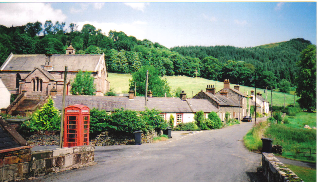
Kirkland Church
Kirkland Church
Fields at Kirkland Bridge With Gravelpit Cottage and the B729 across the near grass field.
Fields at Kirkland Bridge
With Gravelpit Cottage and the B729 across the near grass field.
Trees at Gravelpit Cottage Beyond a grass field and, in the distance, Castlehill Wood.
Trees at Gravelpit Cottage
Beyond a grass field and, in the distance, Castlehill Wood.
Lower Ingleston Farm
Entrance to a field Next to Upper Ingleston Farm.
Entrance to a field
Next to Upper Ingleston Farm.
Trig Pillar S7737, Green Craig The flush bracket faces 4°, north. The pillar completed on 18th February 1954 costing £17.16s.9d. In 1954 this marker was computed for triangulation as tertiary station NT99/T15 in the Dumfries secondary block. The flush bracket was levelled for height also in 1954. This trig point was last maintained by the OS in May 1978. Panoramic views to surrounding hills.
Trig Pillar S7737, Green Craig
The flush bracket faces 4°, north. The pillar completed on 18th February 1954 costing £17.16s.9d. In 1954 this marker was computed for triangulation as tertiary station NT99/T15 in the Dumfries secondary block. The flush bracket was levelled for height also in 1954. This trig point was last maintained by the OS in May 1978. Panoramic views to surrounding hills.
Dalmacallan Forest A cleared area at the north side of the plantation viewed from a forestry road.
Dalmacallan Forest
A cleared area at the north side of the plantation viewed from a forestry road.
Dalmacallan Forest A view over a forestry road to the next generation of Sitka trees.
Dalmacallan Forest
A view over a forestry road to the next generation of Sitka trees.
Dalmacallan Forest Young larch trees in a clear fell area with an old stump, viewed from a forestry road in mid February.
Dalmacallan Forest
Young larch trees in a clear fell area with an old stump, viewed from a forestry road in mid February.
Forest road in Jarbruck Wood The small Jarbruck Wood is the property of The Woodland Trust. There's no barrier or gate at the start of the forest road to the wood and to the much larger Dalmacallan Forest beyond; no signs to deter access either but a short way into the wood there's the space here where cars can be parked and a sign there tells that that's the limit for private motoring.
Forest road in Jarbruck Wood
The small Jarbruck Wood is the property of The Woodland Trust. There's no barrier or gate at the start of the forest road to the wood and to the much larger Dalmacallan Forest beyond; no signs to deter access either but a short way into the wood there's the space here where cars can be parked and a sign there tells that that's the limit for private motoring.
Trig point on Poundland Hill Poundland Hill lies to the north of Dalmacallan Forest; it's trig point has the flush bracket number S7737. Wauk Hill is the highest part of the undulating distant ridge.
Trig point on Poundland Hill
Poundland Hill lies to the north of Dalmacallan Forest; it's trig point has the flush bracket number S7737. Wauk Hill is the highest part of the undulating distant ridge.
Maxwelton House A largely 17th century house,it was B listed in 1971.
Maxwelton House
A largely 17th century house,it was B listed in 1971.
Show me another place!

The Belt is located at Grid Ref: NX8089 (Lat: 55.180923, Lng: -3.880863)

Unitary Authority: Dumfries and Galloway

Police Authority: Dumfries and Galloway

What 3 Words

///decoded.frowns.launched. Near Thornhill, Dumfries & Galloway

Related Wikis

Kirkland railway station

Kirkland railway station (NX810897) was one of the minor stations on the Cairn Valley Light Railway branch, from Dumfries. It served the rural area around...

Glencairn, Dumfries and Galloway

Glencairn is an ecclesiastical and civil parish in Dumfries and Galloway, Scotland. == Location == According to John Bartholomew's 1887 Gazetteer of the...

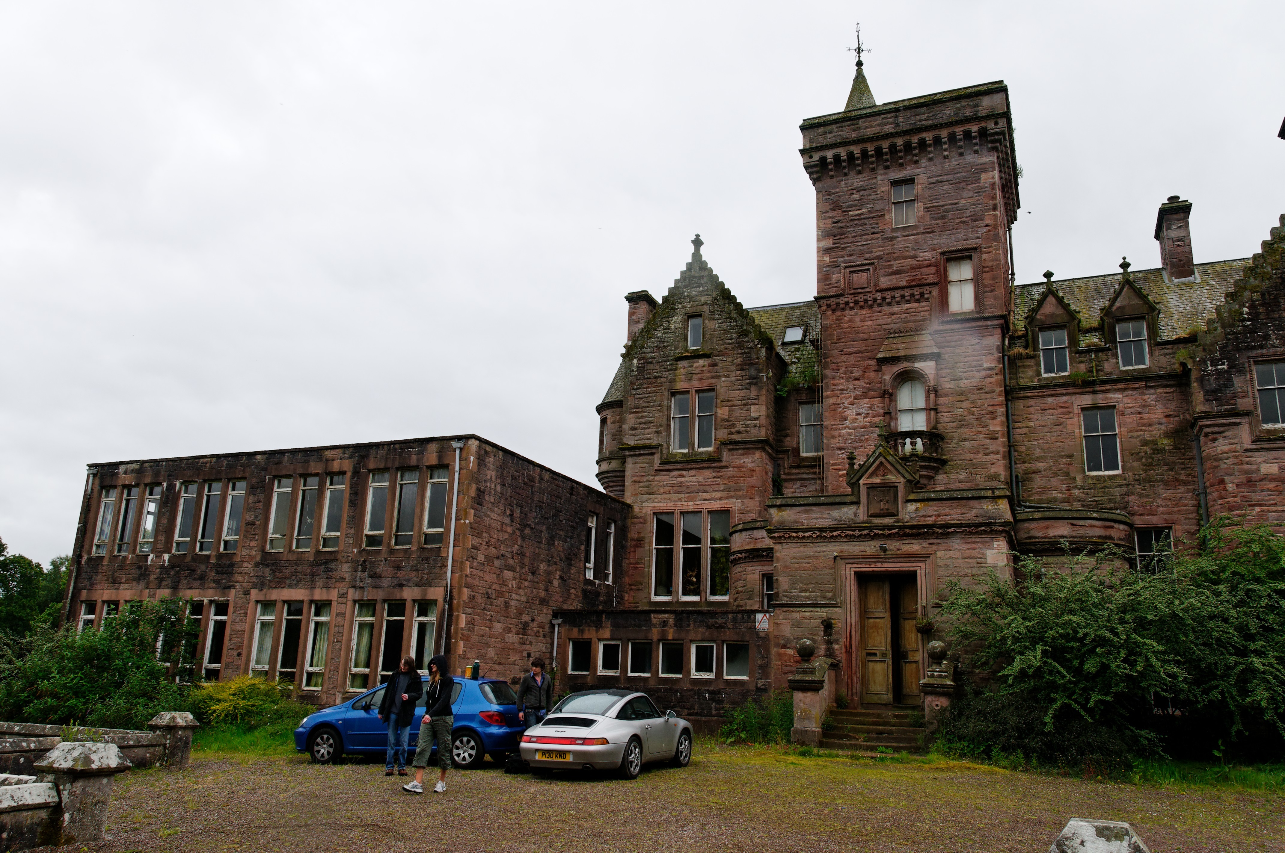
Crawfordton House

Crawfordton House is a category B listed 19th-century country house, situated close to Moniaive in Dumfriesshire, Scotland. It was operated as Crawfordton...

Cademuir International School

Cademuir International School was a specialist school at Moniaive in Dumfries and Galloway, Scotland. The school, founded by Robert Mulvey in 1990, was...

Moniaive railway station

Moniaive railway station is the closed station terminus of the Cairn Valley Light Railway (CVR) branch, from Dumfries. It served the rural area of Moniaive...

Crossford railway station

Crossford is a closed station of the Cairn Valley Light Railway branch, from Dumfries. It served the rural area of Crossford in Dumfries and Galloway...

Moniaive

Moniaive ( 'monny-IVE'; Scottish Gaelic: Am Moine Naomh, "The Holy Moor") is a village in the Parish of Glencairn, in Dumfries and Galloway, southwest...

Tynron

Tynron is a village and civil parish in Dumfries and Galloway, south-west Scotland, lying in a hollow of the Shinnel Water, 2 miles (3.2 km) from Moniaive...

Nearby Amenities

Located within 500m of 55.180923,-3.880863
Power: pole
Lat/Long: 55.1825317/-3.8879946
Power: pole
Lat/Long: 55.1821162/-3.8874175
Power: pole
Lat/Long: 55.1816281/-3.8867662
Power: pole
Lat/Long: 55.1811666/-3.8861383
Power: pole
Lat/Long: 55.1806881/-3.8854722
Power: pole
Lat/Long: 55.1799383/-3.8853406
Power: pole
Lat/Long: 55.179226/-3.88519
Power: pole
Lat/Long: 55.1784871/-3.8850203
Power: pole
Lat/Long: 55.1777772/-3.8848824
The data included in this document is from www.openstreetmap.org. The data is made available under ODbL.

Have you been to The Belt?

Leave your review of The Belt below (or comments, questions and feedback).