Kenningknowes Community Woodland

Wood, Forest in Stirlingshire

Scotland

Kenningknowes Community Woodland

Premier Inn, Stirling City Centre On Forthside Way.
Premier Inn, Stirling City Centre Credit: Richard Sutcliffe

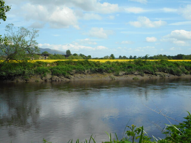
Kenningknowes Community Woodland is a beautiful forest located in Stirlingshire, Scotland. It spans over a vast area and is known for its diverse range of woodlands and natural habitats. The woodland is owned and managed by the local community, making it a valuable asset for both residents and visitors.

The woodland is home to a variety of tree species, including oak, birch, and Scots pine. This mix of trees creates a stunning landscape, especially during the autumn months when the leaves change color. The forest also boasts a rich undergrowth, with an array of wildflowers, ferns, and mosses adding to its natural beauty.

The woodland is a haven for wildlife, providing a safe habitat for many species. It is a popular spot for birdwatching enthusiasts, with a wide range of bird species, including woodpeckers, owls, and various songbirds. The forest is also home to mammals such as red squirrels, badgers, and deer, making it an ideal destination for nature lovers.

Kenningknowes Community Woodland offers various recreational activities for visitors. There are well-maintained walking trails that allow people to explore the forest at their own pace. The woodland also has picnic areas and benches, providing a tranquil space for relaxation and enjoying the peaceful surroundings.

Overall, Kenningknowes Community Woodland is a treasured natural gem in Stirlingshire. Its diverse woodlands, wildlife, and recreational facilities make it a popular destination for nature enthusiasts, families, and individuals looking for a peaceful retreat in the heart of Scotland's beautiful countryside.

If you have any feedback on the listing, please let us know in the comments section below.

Kenningknowes Community Woodland Images

Images are sourced within 2km of 56.109709/-3.9547809 or Grid Reference NS7892. Thanks to Geograph Open Source API. All images are credited.

Premier Inn, Stirling City Centre On Forthside Way.
Premier Inn, Stirling City Centre
On Forthside Way.
River Forth A crop of oilseed rape is in flower in the loop of the river.
River Forth
A crop of oilseed rape is in flower in the loop of the river.
Vue Cinema At Forthside, by the old army barracks.
Vue Cinema
At Forthside, by the old army barracks.
Forthside Way Looking east from outside the Vue cinema.
Forthside Way
Looking east from outside the Vue cinema.
Premier Inn and Beefeater restaurant At Forthside Way, opposite the Vue cinema.
Premier Inn and Beefeater restaurant
At Forthside Way, opposite the Vue cinema.
Old army barracks At Forthside, known locally as the French Barracks. See Canmore <span class="nowrap"><a title="https://canmore.org.uk/site/317321/stirling-the-barracks" rel="nofollow ugc noopener" href="https://canmore.org.uk/site/317321/stirling-the-barracks">Link</a><img style="margin-left:2px;" alt="External link" title="External link - shift click to open in new window" src="https://s1.geograph.org.uk/img/external.png" width="10" height="10"/></span> for more information.
Old army barracks
At Forthside, known locally as the French Barracks. See Canmore LinkExternal link for more information.
Small Shopping Area beside the A905, Stirling South-east of Stirling city centre.
Small Shopping Area beside the A905, Stirling
South-east of Stirling city centre.
Path junction, Broomridge Once a sandy, broom covered ridge above Broomridge  Farm, it was not built upon and remains a broomy rig to this day.

As a visitor, can I say the cleanliness of the area is a credit to those who live there.
Path junction, Broomridge
Once a sandy, broom covered ridge above Broomridge Farm, it was not built upon and remains a broomy rig to this day. As a visitor, can I say the cleanliness of the area is a credit to those who live there.
Factory Open land, probably under threat of development at the south side of Stirling's industrial estate.
Factory
Open land, probably under threat of development at the south side of Stirling's industrial estate.
Forth Valley College, Stirling
The North Church North Parish Church, Stirling.
The North Church
North Parish Church, Stirling.
River Forth at Stirling Wharfs used to line the nearer bank of the river in connection with an adjacent Army depot but the closure of the swing bridge at Kincardine ten miles downstream to shipping traffic and the building of the fixed span Clackmannanshire Bridge just above it have ensured that sea-going ships will never again be seen at Stirling.  In connection with the redevelopment of the waterside a new footpath is being constructed alongside the river.  Note that riverside flood banks not only keep the river out of the fields but can also prevent water draining down the fields finding its way out into the river!
River Forth at Stirling
Wharfs used to line the nearer bank of the river in connection with an adjacent Army depot but the closure of the swing bridge at Kincardine ten miles downstream to shipping traffic and the building of the fixed span Clackmannanshire Bridge just above it have ensured that sea-going ships will never again be seen at Stirling. In connection with the redevelopment of the waterside a new footpath is being constructed alongside the river. Note that riverside flood banks not only keep the river out of the fields but can also prevent water draining down the fields finding its way out into the river!
Linden Avenue Going towards the Linden Inn
Linden Avenue
Going towards the Linden Inn
Show me another place!

Kenningknowes Community Woodland is located at Grid Ref: NS7892 (Lat: 56.109709, Lng: -3.9547809)

Unitary Authority: Stirling

Police Authority: Forth Valley

What 3 Words

///frost.impact.expect. Near Stirling

Related Wikis

Torbrex Village

Torbrex is a small village in Scotland. Geographically Torbrex is enclosed within Stirling by Cambusbarron to the west, St. Ninians to the south, Livlilands...

Birkhill House, Stirling

Birkhill House is a historic house situated between the city of Stirling and the village of Cambusbarron in central Scotland. == History == There is evidence...

Stirling High School

Stirling High School is a state high school for 11- to 18-year-olds run by Stirling Council in Stirling, Scotland. It is one of seven high schools in...

Cambusbarron

Cambusbarron is a village in Stirling, Scotland. In the 2001 census, it had a population of 3,224. There is evidence of settlement at the site since the...

Nearby Amenities

Located within 500m of 56.109709,-3.9547809
Mini Roundabout
Direction: clockwise
Lat/Long: 56.1054476/-3.9553862
Mini Roundabout
Direction: clockwise
Lat/Long: 56.1090298/-3.9519389
Power: substation
Lat/Long: 56.1087106/-3.9484652
Bus Stop
Bus: yes
Public Transport: platform
Lat/Long: 56.1085044/-3.9498277
Post Box
Collection Times: Mo-Fr 09:00; Sa 07:00
Operator: Royal Mail
Post Box Manufacturer: Carron Company, Stirlingshire
Post Box Type: pillar
Ref: FK8 202D
Royal Cypher: scottish_crown
Lat/Long: 56.1084341/-3.9496769
Torbrex
Is In: Stirling
Place: suburb
Wikidata: Q48741957
Wikipedia: en:Torbrex Village
Lat/Long: 56.1063685/-3.9498118
Barrier: bollard
Lat/Long: 56.1113542/-3.9488144
Turning Circle
Lat/Long: 56.1111127/-3.9555205
Post Box
Postal Code: FK7
Ref: FK7 12
Lat/Long: 56.1124738/-3.9560723
Barrier: bollard
Lat/Long: 56.111711/-3.9491258
Barrier: kissing_gate
Bicycle: yes
Lat/Long: 56.1119545/-3.9488036
Golf: pin
Lat/Long: 56.1121537/-3.9502336
Golf: pin
Lat/Long: 56.1138192/-3.9549708
Building: residential
Lat/Long: 56.1112631/-3.9568968
Bus Stop
Bus: yes
Public Transport: platform
Lat/Long: 56.1108951/-3.9611876
Bus Stop
Bus: yes
Public Transport: platform
Lat/Long: 56.1058866/-3.9520012
Generator Method: photovoltaic
Generator Output Electricity: yes
Generator Source: solar
Generator Type: solar_photovoltaic_panel
Power: generator
Lat/Long: 56.1131777/-3.9596758
Generator Method: photovoltaic
Generator Output Electricity: yes
Generator Source: solar
Generator Type: solar_photovoltaic_panel
Power: generator
Lat/Long: 56.1078309/-3.9484328
Generator Method: photovoltaic
Generator Output Electricity: yes
Generator Source: solar
Generator Type: solar_photovoltaic_panel
Power: generator
Lat/Long: 56.1076864/-3.9484699
Generator Method: photovoltaic
Generator Output Electricity: yes
Generator Source: solar
Generator Type: solar_photovoltaic_panel
Power: generator
Lat/Long: 56.108274/-3.9475002
The data included in this document is from www.openstreetmap.org. The data is made available under ODbL.

Have you been to Kenningknowes Community Woodland?

Leave your review of Kenningknowes Community Woodland below (or comments, questions and feedback).