Haggs Wood

Wood, Forest in Stirlingshire

Scotland

Haggs Wood

M80 merges with M9 (end of M80) The M80 joins Glasgow to Stirling. It runs 25 miles from Glasgow to Bannockburn.
<span class="nowrap"><a title="https://www.sabre-roads.org.uk/wiki/index.php?title=M80" rel="nofollow ugc noopener" href="https://www.sabre-roads.org.uk/wiki/index.php?title=M80">Link</a><img style="margin-left:2px;" alt="External link" title="External link - shift click to open in new window" src="https://s1.geograph.org.uk/img/external.png" width="10" height="10"/></span>
M80 merges with M9 (end of M80) Credit: N Chadwick

Haggs Wood, located in Stirlingshire, Scotland, is a picturesque and diverse woodland that is spread over an area of approximately 100 acres. It is part of the larger Haggs Castle Estate and is a popular destination for nature lovers and outdoor enthusiasts.

The wood is predominantly made up of broadleaf trees, including oak, birch, and beech, which provide a rich and vibrant canopy during the summer months. It is also home to a variety of flora and fauna, with bluebells and wild garlic carpeting the forest floor in springtime, and a wide range of bird species, such as woodpeckers and owls, calling the wood their home.

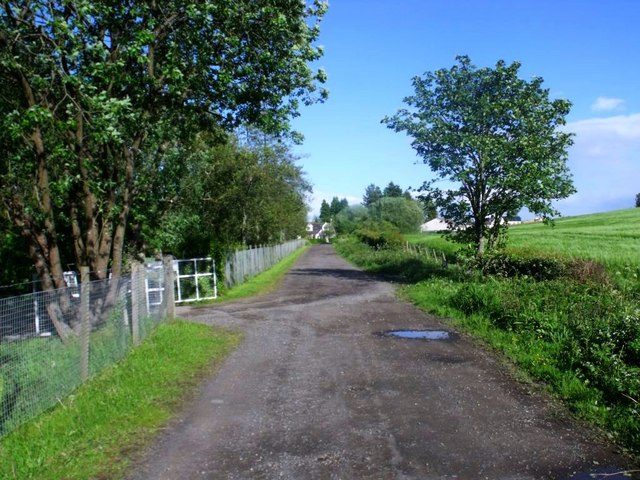
Visitors can explore Haggs Wood through a network of well-maintained trails that wind through the trees, offering stunning views and the opportunity to spot wildlife. Along the trails, there are informative signposts that provide details about the different tree species and the history of the wood.

In addition to its natural beauty, Haggs Wood also has a rich cultural heritage. The wood has been part of the local landscape for centuries and has witnessed various historical events. It is believed that the wood played a role in the Jacobite Rebellion of 1745, with some remnants of the rebellion still visible today.

Haggs Wood offers a tranquil and peaceful environment for visitors to escape the hustle and bustle of everyday life and immerse themselves in the beauty of nature. Whether it's a leisurely stroll, birdwatching, or simply enjoying a picnic surrounded by the sights and sounds of the woodland, Haggs Wood is a must-visit destination for nature enthusiasts in Stirlingshire.

If you have any feedback on the listing, please let us know in the comments section below.

Haggs Wood Images

Images are sourced within 2km of 56.099294/-3.9570344 or Grid Reference NS7891. Thanks to Geograph Open Source API. All images are credited.

M80 merges with M9 (end of M80) The M80 joins Glasgow to Stirling. It runs 25 miles from Glasgow to Bannockburn.
<span class="nowrap"><a title="https://www.sabre-roads.org.uk/wiki/index.php?title=M80" rel="nofollow ugc noopener" href="https://www.sabre-roads.org.uk/wiki/index.php?title=M80">Link</a><img style="margin-left:2px;" alt="External link" title="External link - shift click to open in new window" src="https://s1.geograph.org.uk/img/external.png" width="10" height="10"/></span>
M80 merges with M9 (end of M80)
The M80 joins Glasgow to Stirling. It runs 25 miles from Glasgow to Bannockburn. LinkExternal link
Track giving access to Howlands and Swanswater Fisheries Looking south-westward.
Track giving access to Howlands and Swanswater Fisheries
Looking south-westward.
M80 and M9 (at M9 Junction 9)
Stubble, Chartershall The new bridge over the M9 is in the background.
Stubble, Chartershall
The new bridge over the M9 is in the background.
The famous Bannock Burn From New Line Road.  The burn wriggles eastwards across the built up landscape for two miles before reaching the site of the battle in 1314.
The famous Bannock Burn
From New Line Road. The burn wriggles eastwards across the built up landscape for two miles before reaching the site of the battle in 1314.
Burn, Cultenhove A tributary of the Bannock Burn, downstream of the Swanswater Fishery. The fields are being grazed by cows with young calves.
Burn, Cultenhove
A tributary of the Bannock Burn, downstream of the Swanswater Fishery. The fields are being grazed by cows with young calves.
Old dyke, Middlethird Wood Mature conifer plantation which I doubt will be around much longer. The dyke is a remnant from farming days.
Old dyke, Middlethird Wood
Mature conifer plantation which I doubt will be around much longer. The dyke is a remnant from farming days.
Road to Middlethird The road serves the woodlands and here it runs between a mature plantation and a field.
Road to Middlethird
The road serves the woodlands and here it runs between a mature plantation and a field.
Inside Middlethird Wood Mature conifer wood, probably due to be felled soon. The clearing is shown on the current orienteering map and is a bit easier to spot than most mapped clearings.
Inside Middlethird Wood
Mature conifer wood, probably due to be felled soon. The clearing is shown on the current orienteering map and is a bit easier to spot than most mapped clearings.
Bluebell wood, Middlethird Genuine wild hyacinths rather than the garden escapes and their hybrids which dominate the Stirling area.
Bluebell wood, Middlethird
Genuine wild hyacinths rather than the garden escapes and their hybrids which dominate the Stirling area.
Road, Sauchieburn Road serving Old Sauchie and Sauchieburn.
Road, Sauchieburn
Road serving Old Sauchie and Sauchieburn.
Gateside Formerly a farm.
Gateside
Formerly a farm.
Chartershall, grazing The south western outskirts of Stirling on the horizon.
Chartershall, grazing
The south western outskirts of Stirling on the horizon.
Road at Cultenhove The dwellings on the right are called Elmbank.
Road at Cultenhove
The dwellings on the right are called Elmbank.
Growing barley at Cultenhove A fine looking growth.
Growing barley at Cultenhove
A fine looking growth.
Cultenhove, Swanswater Fishery The Mill pond.
Cultenhove, Swanswater Fishery
The Mill pond.
Cultenhove, Swanswater Fishery A view of the access road and sluice that feeds the eastern pond. The mill lade continues through a culvert to the site of the flour mill - of which photos can be seen <span class="nowrap"><a title="http://canmore.rcahms.gov.uk/en/site/146339/details/cultenhove+mill+and+the+old+mill/" rel="nofollow ugc noopener" href="http://canmore.rcahms.gov.uk/en/site/146339/details/cultenhove+mill+and+the+old+mill/">Link</a><img style="margin-left:2px;" alt="External link" title="External link - shift click to open in new window" src="https://s1.geograph.org.uk/img/external.png" width="10" height="10"/></span>
Cultenhove, Swanswater Fishery
A view of the access road and sluice that feeds the eastern pond. The mill lade continues through a culvert to the site of the flour mill - of which photos can be seen LinkExternal link
Cultenhove The road leading to Stirling.
Cultenhove
The road leading to Stirling.
Show me another place!

Haggs Wood is located at Grid Ref: NS7891 (Lat: 56.099294, Lng: -3.9570344)

Unitary Authority: Stirling

Police Authority: Forth Valley

What 3 Words

///rock.pinch.chef. Near Stirling

Related Wikis

Torbrex Village

Torbrex is a small village in Scotland. Geographically Torbrex is enclosed within Stirling by Cambusbarron to the west, St. Ninians to the south, Livlilands...

Stirling High School

Stirling High School is a state high school for 11- to 18-year-olds run by Stirling Council in Stirling, Scotland. It is one of seven high schools in...

Gillies Hill

Gillies Hill is located west of Stirling and the M9, south of Cambusbarron, and north of the Bannock Burn in Central Scotland. Gillies Hill covers a 140...

St. Ninians

St. Ninians is a long-standing settlement which is now a district of the city of Stirling in central Scotland. It is located approximately one mile south...

Nearby Amenities

Located within 500m of 56.099294,-3.9570344
Barrier: bollard
Bicycle: yes
Foot: yes
Horse: yes
Source: survey
Lat/Long: 56.09581/-3.9569643
Man Made: tower
Tower Type: communication
Lat/Long: 56.0955863/-3.9581466
Power: pole
Lat/Long: 56.096858/-3.9521089
Power: pole
Lat/Long: 56.0965483/-3.9532408
Power: pole
Lat/Long: 56.0959753/-3.9554617
Power: pole
Lat/Long: 56.096279/-3.9543593
Power: pole
Lat/Long: 56.0957448/-3.9567438
Power: pole
Lat/Long: 56.0955399/-3.9574143
Power: pole
Lat/Long: 56.0951284/-3.9589459
Generator Method: photovoltaic
Generator Output Electricity: yes
Generator Source: solar
Generator Type: solar_photovoltaic_panel
Location: roof
Power: generator
Lat/Long: 56.1025547/-3.9520472
Generator Method: photovoltaic
Generator Output Electricity: yes
Generator Source: solar
Generator Type: solar_photovoltaic_panel
Location: roof
Power: generator
Lat/Long: 56.1019833/-3.9519185
Generator Method: photovoltaic
Generator Output Electricity: yes
Generator Source: solar
Generator Type: solar_photovoltaic_panel
Location: roof
Power: generator
Lat/Long: 56.1010364/-3.9511943
Generator Method: photovoltaic
Generator Output Electricity: yes
Generator Source: solar
Generator Type: solar_photovoltaic_panel
Location: roof
Power: generator
Lat/Long: 56.100634/-3.9499229
Generator Method: photovoltaic
Generator Output Electricity: yes
Generator Source: solar
Generator Type: solar_photovoltaic_panel
Location: roof
Power: generator
Lat/Long: 56.1007028/-3.9504352
Generator Method: photovoltaic
Generator Output Electricity: yes
Generator Source: solar
Generator Type: solar_photovoltaic_panel
Location: roof
Power: generator
Lat/Long: 56.1006818/-3.9505506
Generator Method: photovoltaic
Generator Output Electricity: yes
Generator Source: solar
Generator Type: solar_photovoltaic_panel
Location: roof
Power: generator
Lat/Long: 56.0994491/-3.9494026
Generator Method: photovoltaic
Generator Output Electricity: yes
Generator Source: solar
Generator Type: solar_photovoltaic_panel
Location: roof
Power: generator
Lat/Long: 56.0992816/-3.9490539
Generator Method: photovoltaic
Generator Output Electricity: yes
Generator Source: solar
Generator Type: solar_photovoltaic_panel
Location: roof
Power: generator
Lat/Long: 56.0993399/-3.9509958
Generator Method: photovoltaic
Generator Output Electricity: yes
Generator Source: solar
Generator Type: solar_photovoltaic_panel
Location: roof
Power: generator
Lat/Long: 56.0991679/-3.9508992
Generator Method: photovoltaic
Generator Output Electricity: yes
Generator Source: solar
Generator Type: solar_photovoltaic_panel
Location: roof
Power: generator
Lat/Long: 56.0990288/-3.9506632
Generator Method: photovoltaic
Generator Output Electricity: yes
Generator Source: solar
Generator Type: solar_photovoltaic_panel
Location: roof
Power: generator
Lat/Long: 56.0981162/-3.9503682
Bench
Backrest: yes
Lat/Long: 56.1016751/-3.963258
Bench
Backrest: yes
Lat/Long: 56.1013916/-3.963596
Power: pole
Lat/Long: 56.0951363/-3.9589219
Power: pole
Lat/Long: 56.1027003/-3.9544168
Power: pole
Lat/Long: 56.1030381/-3.9554058
Power: pole
Lat/Long: 56.1033244/-3.9562691
Power: pole
Lat/Long: 56.1035464/-3.9569166
Bench
Lat/Long: 56.0970517/-3.9625376
Bench
Lat/Long: 56.0970632/-3.9625276
The data included in this document is from www.openstreetmap.org. The data is made available under ODbL.

Have you been to Haggs Wood?

Leave your review of Haggs Wood below (or comments, questions and feedback).