Coxet Hill

Settlement in Stirlingshire

Scotland

Coxet Hill

M80 merges with M9 (end of M80) The M80 joins Glasgow to Stirling. It runs 25 miles from Glasgow to Bannockburn.
<span class="nowrap"><a title="https://www.sabre-roads.org.uk/wiki/index.php?title=M80" rel="nofollow ugc noopener" href="https://www.sabre-roads.org.uk/wiki/index.php?title=M80">Link</a><img style="margin-left:2px;" alt="External link" title="External link - shift click to open in new window" src="https://s1.geograph.org.uk/img/external.png" width="10" height="10"/></span>
M80 merges with M9 (end of M80) Credit: N Chadwick

Coxet Hill is a prominent geographical feature located in Stirlingshire, Scotland. It is situated approximately 4 miles east of the town of Falkirk and stands at an elevation of 275 meters (902 feet) above sea level. The hill is part of the larger Bathgate Hills, which form the southern boundary of the Scottish Lowlands.

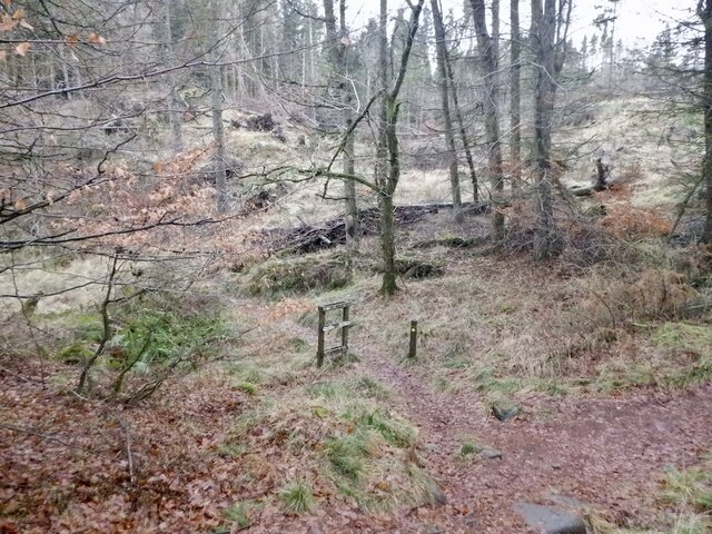
Coxet Hill is characterized by its distinctive conical shape and is covered by a mix of grassland and woodland. The hill offers stunning panoramic views of the surrounding landscape, including the Forth Valley, the Ochil Hills, and the distant peaks of the Trossachs. Its strategic location makes it a popular spot for outdoor activities such as hiking, walking, and nature observation.

Historically, Coxet Hill played a significant role in the area. It was once the site of an Iron Age hillfort, evidencing human settlement as far back as 2,500 years ago. The remains of the fort, including earthworks and ditches, can still be observed today. Additionally, during the Roman period, Coxet Hill formed part of the Antonine Wall, a defensive structure built by the Romans in the 2nd century AD.

Today, Coxet Hill retains its cultural and historical significance while also serving as a recreational destination for locals and visitors alike. Its accessible location and stunning vistas make it a favorite spot for outdoor enthusiasts and nature lovers seeking to explore the beauty of Stirlingshire.

If you have any feedback on the listing, please let us know in the comments section below.

Coxet Hill Images

Images are sourced within 2km of 56.096158/-3.9626791 or Grid Reference NS7891. Thanks to Geograph Open Source API. All images are credited.

M80 merges with M9 (end of M80) The M80 joins Glasgow to Stirling. It runs 25 miles from Glasgow to Bannockburn.
<span class="nowrap"><a title="https://www.sabre-roads.org.uk/wiki/index.php?title=M80" rel="nofollow ugc noopener" href="https://www.sabre-roads.org.uk/wiki/index.php?title=M80">Link</a><img style="margin-left:2px;" alt="External link" title="External link - shift click to open in new window" src="https://s1.geograph.org.uk/img/external.png" width="10" height="10"/></span>
M80 merges with M9 (end of M80)
The M80 joins Glasgow to Stirling. It runs 25 miles from Glasgow to Bannockburn. LinkExternal link
Track giving access to Howlands and Swanswater Fisheries Looking south-westward.
Track giving access to Howlands and Swanswater Fisheries
Looking south-westward.
Path junction, Middlethird Wood
M80 and M9 (at M9 Junction 9)
Stubble, Chartershall The new bridge over the M9 is in the background.
Stubble, Chartershall
The new bridge over the M9 is in the background.
The famous Bannock Burn From New Line Road.  The burn wriggles eastwards across the built up landscape for two miles before reaching the site of the battle in 1314.
The famous Bannock Burn
From New Line Road. The burn wriggles eastwards across the built up landscape for two miles before reaching the site of the battle in 1314.
Burn, Cultenhove A tributary of the Bannock Burn, downstream of the Swanswater Fishery. The fields are being grazed by cows with young calves.
Burn, Cultenhove
A tributary of the Bannock Burn, downstream of the Swanswater Fishery. The fields are being grazed by cows with young calves.
Old dyke, Middlethird Wood Mature conifer plantation which I doubt will be around much longer. The dyke is a remnant from farming days.
Old dyke, Middlethird Wood
Mature conifer plantation which I doubt will be around much longer. The dyke is a remnant from farming days.
Road to Middlethird The road serves the woodlands and here it runs between a mature plantation and a field.
Road to Middlethird
The road serves the woodlands and here it runs between a mature plantation and a field.
Inside Middlethird Wood Mature conifer wood, probably due to be felled soon. The clearing is shown on the current orienteering map and is a bit easier to spot than most mapped clearings.
Inside Middlethird Wood
Mature conifer wood, probably due to be felled soon. The clearing is shown on the current orienteering map and is a bit easier to spot than most mapped clearings.
Bluebell wood, Middlethird Genuine wild hyacinths rather than the garden escapes and their hybrids which dominate the Stirling area.
Bluebell wood, Middlethird
Genuine wild hyacinths rather than the garden escapes and their hybrids which dominate the Stirling area.
Windy Yet Glen Azalias outwith the web of wire which surrounds Sauchieburn. The path leads to the craggy escarpment above North Third Reservoir and on to the reservoir itself.
Windy Yet Glen
Azalias outwith the web of wire which surrounds Sauchieburn. The path leads to the craggy escarpment above North Third Reservoir and on to the reservoir itself.
Road, Sauchieburn Road serving Old Sauchie and Sauchieburn.
Road, Sauchieburn
Road serving Old Sauchie and Sauchieburn.
Gateside Formerly a farm.
Gateside
Formerly a farm.
Chartershall, grazing The south western outskirts of Stirling on the horizon.
Chartershall, grazing
The south western outskirts of Stirling on the horizon.
Road at Cultenhove The dwellings on the right are called Elmbank.
Road at Cultenhove
The dwellings on the right are called Elmbank.
Growing barley at Cultenhove A fine looking growth.
Growing barley at Cultenhove
A fine looking growth.
Cultenhove, Swanswater Fishery The Mill pond.
Cultenhove, Swanswater Fishery
The Mill pond.
Show me another place!

Coxet Hill is located at Grid Ref: NS7891 (Lat: 56.096158, Lng: -3.9626791)

Unitary Authority: Stirling

Police Authority: Forth Valley

What 3 Words

///idea.lowest.scared. Near Stirling

Related Wikis

Gillies Hill

Gillies Hill is located west of Stirling and the M9, south of Cambusbarron, and north of the Bannock Burn in Central Scotland. Gillies Hill covers a 140...

Torbrex Village

Torbrex is a small village in Scotland. Geographically Torbrex is enclosed within Stirling by Cambusbarron to the west, St. Ninians to the south, Livlilands...

Stirling High School

Stirling High School is a state high school for 11- to 18-year-olds run by Stirling Council in Stirling, Scotland. It is one of seven high schools in...

Cambusbarron

Cambusbarron is a village in Stirling, Scotland. In the 2001 census, it had a population of 3,224. There is evidence of settlement at the site since the...

Nearby Amenities

Located within 500m of 56.096158,-3.9626791
Barrier: bollard
Bicycle: yes
Foot: yes
Horse: yes
Source: survey
Lat/Long: 56.09581/-3.9569643
Man Made: tower
Tower Type: communication
Lat/Long: 56.0955863/-3.9581466
Power: pole
Lat/Long: 56.0959753/-3.9554617
Power: pole
Lat/Long: 56.0957448/-3.9567438
Power: pole
Lat/Long: 56.0955399/-3.9574143
Power: pole
Lat/Long: 56.0951284/-3.9589459
Power: pole
Lat/Long: 56.094717/-3.960413
Power: pole
Lat/Long: 56.094494/-3.9611748
Power: pole
Lat/Long: 56.0942876/-3.961966
Power: pole
Lat/Long: 56.0938731/-3.9633957
Power: pole
Lat/Long: 56.0937459/-3.9647985
Power: pole
Lat/Long: 56.0940571/-3.967368
Power: pole
Lat/Long: 56.0934377/-3.9681646
Power: pole
Lat/Long: 56.0935957/-3.9665324
Power: pole
Lat/Long: 56.0951363/-3.9589219
Bench
Lat/Long: 56.0970517/-3.9625376
Bench
Lat/Long: 56.0970632/-3.9625276
The data included in this document is from www.openstreetmap.org. The data is made available under ODbL.

Have you been to Coxet Hill?

Leave your review of Coxet Hill below (or comments, questions and feedback).