Carn Brea Village

Settlement in Cornwall

England

Carn Brea Village

Weighing Machine Redruth Station A redundant weighing machine at Redruth Station sits as it always has set into the platform.
Weighing Machine Redruth Station Credit: Tom Jolliffe

Carn Brea Village is a charming settlement located in the county of Cornwall, England. Situated on the outskirts of Redruth, this historic village offers a captivating blend of natural beauty and cultural heritage. Nestled atop the rugged Carn Brea hill, the village enjoys panoramic views of the surrounding countryside and coastline.

The centerpiece of Carn Brea Village is undoubtedly Carn Brea Castle, a 14th-century fortress steeped in history. Originally built as a hunting lodge, the castle now serves as a restaurant and wedding venue, attracting visitors from far and wide. Its elevated position provides a stunning vantage point to admire the picturesque landscape.

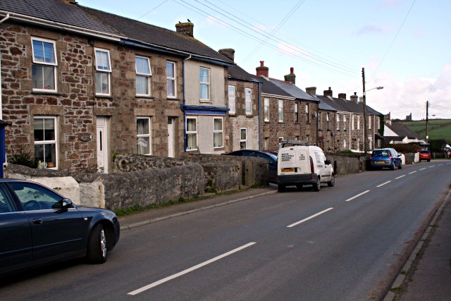
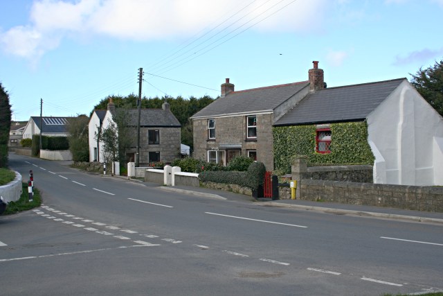
Aside from the castle, the village boasts a selection of traditional stone cottages, giving it a quaint and idyllic character. Walking through the narrow streets, visitors can explore local shops and cafes, offering a taste of Cornish hospitality. The area is also home to a vibrant arts and crafts community, with several galleries and studios showcasing the talents of local artisans.

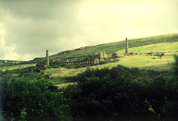
For outdoor enthusiasts, Carn Brea Village offers numerous opportunities for exploration. The hill itself is riddled with walking trails, allowing visitors to discover ancient monuments, such as the Neolithic burial chamber known as "Carn Brea Cairn." Additionally, the village is located near Tehidy Country Park, a sprawling woodland with picnic areas, lakes, and an abundance of wildlife.

In summary, Carn Brea Village is a captivating destination that seamlessly blends history, natural beauty, and artistic culture. Whether it's exploring the castle, strolling through the charming streets, or immersing oneself in the surrounding countryside, this Cornish gem has something to offer every visitor.

If you have any feedback on the listing, please let us know in the comments section below.

Carn Brea Village Images

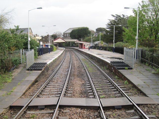
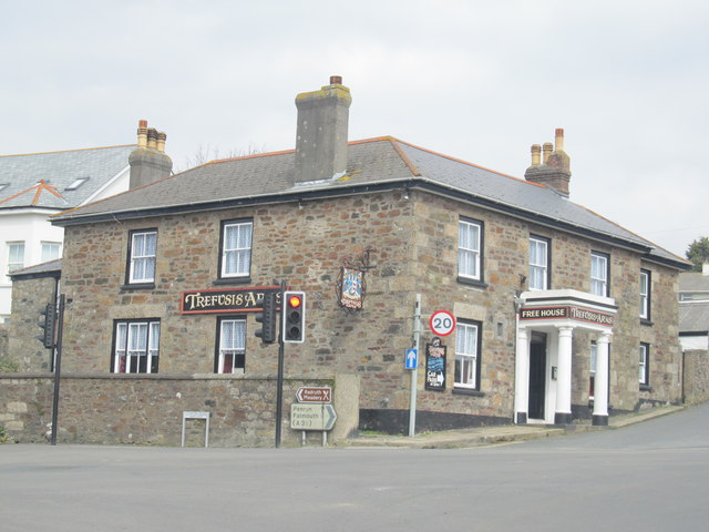
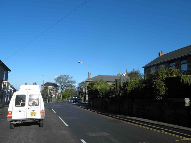
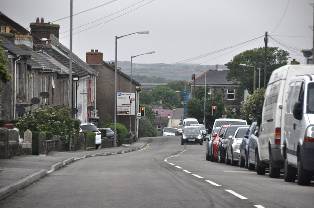
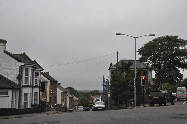
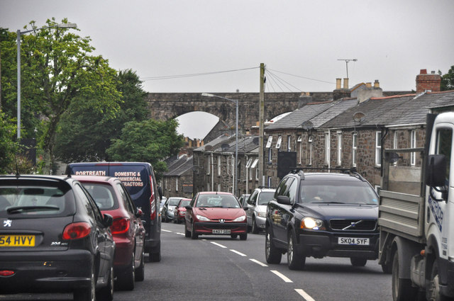
Images are sourced within 2km of 50.227062/-5.241897 or Grid Reference SW6841. Thanks to Geograph Open Source API. All images are credited.

Weighing Machine Redruth Station A redundant weighing machine at Redruth Station sits as it always has set into the platform.
Weighing Machine Redruth Station
A redundant weighing machine at Redruth Station sits as it always has set into the platform.
Redruth Station and Footbridge
Redruth Railway Station Footbridge The footbridge at Redruth Station was significantly renovated two years ago. The work is holding up well and shows how such investment improves the environment.
Redruth Railway Station Footbridge
The footbridge at Redruth Station was significantly renovated two years ago. The work is holding up well and shows how such investment improves the environment.
Redruth Railway Station Footbridge The renovation of the footbridge two years ago greatly enhanced the appearance of the station. Were these the original colours of the Great Western Railway? Between the house in the background and the end of the canopy on the platform the Pednandrea Stack can be seen marking the industrial history of Redruth. Also see <a href="https://www.geograph.org.uk/photo/1904221">SW7041 : Basset Street and Pednandrea Stack, Redruth</a>
Redruth Railway Station Footbridge
The renovation of the footbridge two years ago greatly enhanced the appearance of the station. Were these the original colours of the Great Western Railway? Between the house in the background and the end of the canopy on the platform the Pednandrea Stack can be seen marking the industrial history of Redruth. Also see SW7041 : Basset Street and Pednandrea Stack, Redruth
Footbridge Redruth Railway Station The colours of the footbridge look a little too bright and cheerful to be true to the original railway company. The Great Western locomotives were painted green and the coaches were brown and cream. Wagons were painted red at one time. Pednandrea Stack can be seen in the background.
Footbridge Redruth Railway Station
The colours of the footbridge look a little too bright and cheerful to be true to the original railway company. The Great Western locomotives were painted green and the coaches were brown and cream. Wagons were painted red at one time. Pednandrea Stack can be seen in the background.
Redruth railway station, Cornwall Opened in 1852 by the West Cornwall Railway on its line from Truro to Penzance. View north east towards Truro from the rear of a departing train.
Redruth railway station, Cornwall
Opened in 1852 by the West Cornwall Railway on its line from Truro to Penzance. View north east towards Truro from the rear of a departing train.
The Trefusis Arms, Redruth
Traffic lights on Southgate Street Redruth
Redruth : Southgate Street B3300 A road heading through the town of Redruth.
Redruth : Southgate Street B3300
A road heading through the town of Redruth.
Redruth : Falmouth Road B3300 Looking along a road at the junction where Clinton Road heads to the right.
Redruth : Falmouth Road B3300
Looking along a road at the junction where Clinton Road heads to the right.
Redruth : Falmouth Road B3300 A road heading through Redruth.
Redruth : Falmouth Road B3300
A road heading through Redruth.
Wheal Basset This is the area of the Great Flat Lode, one of the richest sources of copper and tin in Cornwall and where the Basset family made their fortune. The countryside is littered with the remains of mining activity.
Wheal Basset
This is the area of the Great Flat Lode, one of the richest sources of copper and tin in Cornwall and where the Basset family made their fortune. The countryside is littered with the remains of mining activity.
Carnkie Methodist Church In the village of Carnkie just south of Carn Brea hill.
Carnkie Methodist Church
In the village of Carnkie just south of Carn Brea hill.
Horses, Farm Buildings and a Telecommunications Mast.
Terraced Housing, Carnkie
Carnkie Carnkie is a small village with a varied history, starting out as a small group of houses inhabited by workers at local quarries.  The village grew rapidly in the 19th century as it found itself at the centre of intense mining activity.  In the late 20th century some older houses have been renovated and others replaced by  modern bungalows.
Carnkie
Carnkie is a small village with a varied history, starting out as a small group of houses inhabited by workers at local quarries. The village grew rapidly in the 19th century as it found itself at the centre of intense mining activity. In the late 20th century some older houses have been renovated and others replaced by modern bungalows.
Carnkie Community Institute The panels on the front of this building detail the history of the village and the surrounding mines.  There is a lot of reading here!  Below the panels are name plaques very much in the style of 19th century Methodist churches.
Carnkie Community Institute
The panels on the front of this building detail the history of the village and the surrounding mines. There is a lot of reading here! Below the panels are name plaques very much in the style of 19th century Methodist churches.
Bridleway near Carnkie This bridleway is part of the Great Flat Lode Trail and is also used extensively for horse riding by nearby stables.
Bridleway near Carnkie
This bridleway is part of the Great Flat Lode Trail and is also used extensively for horse riding by nearby stables.
Show me another place!

Carn Brea Village is located at Grid Ref: SW6841 (Lat: 50.227062, Lng: -5.241897)

Unitary Authority: Cornwall

Police Authority: Devon and Cornwall

What 3 Words

///critic.sheds.creeps. Near Redruth, Cornwall

Related Wikis

Carn Brea Village

Carn Brea Village is a village in the civil parish of Carn Brea (where the 2011 census population is included), Cornwall, England. It is south of the railway...

Camborne Redruth Community Hospital

The Camborne Redruth Community Hospital is a National Health Service hospital in Cornwall, England. It is managed by Cornwall Partnership NHS Foundation...

Church Town, Cornwall

Church Town is a hamlet in the parish of Redruth, Cornwall, England. == References ==

Redruth Grammar School

Redruth Grammar School in Redruth, Cornwall, was a boys school between 1907 and 1976. == History == The school was opened on 5 October 1907 by General...

Nearby Amenities

Located within 500m of 50.227062,-5.241897
Direction: both
Traffic Calming: table
Lat/Long: 50.2270276/-5.2392798
Direction: both
Traffic Calming: cushion
Lat/Long: 50.2274122/-5.2374932
Noexit: yes
Lat/Long: 50.226291/-5.2430643
Post Box
Collection Times: Mo-Fr 09:00; Sa 07:00; Su off
Operator: Royal Mail
Operator Wikidata: Q638098
Post Box Design: 2010_pattern
Post Box Mounting: pier
Post Box Type: lamp
Ref: TR15 6D
Royal Cypher: EIIR
Royal Cypher Wikidata: Q33102113
Source: survey;aerial imagery
Lat/Long: 50.2270724/-5.2391494
Mini Roundabout
Direction: clockwise
Lat/Long: 50.2290123/-5.246805
Give Way
Direction: backward
Lat/Long: 50.2289524/-5.2465994
Parking
Lat/Long: 50.2283074/-5.2451384
Traffic Signals
Traffic Signals Direction: forward
Lat/Long: 50.2302599/-5.2466351
Bus Stop
South Park
Bench: yes
Bus: yes
Naptan AtcoCode: 0800COC30458
Naptan Bearing: W
Naptan CommonName: South Park
Naptan Crossing: South Park
Naptan NaptanCode: coramjgp
Naptan PlusbusZoneRef: CBORNE
Naptan Street: Blowinghouse Hill
Naptan Verified: no
Public Transport: platform
Shelter: yes
Source: naptan_import
Lat/Long: 50.2308119/-5.2412134
Bus Stop
South Park
Bench: no
Bin: no
Bus: yes
Naptan AtcoCode: 0800COC30459
Naptan Bearing: E
Naptan CommonName: South Park
Naptan Crossing: West Park
Naptan Indicator: Opp
Naptan NaptanCode: coramjgt
Naptan PlusbusZoneRef: CBORNE
Naptan Street: Blowinghouse Hill
Naptan Verified: no
Public Transport: platform
Shelter: no
Source: naptan_import
Lat/Long: 50.2309226/-5.2409251
Bus Stop
Euny Close
Bus: yes
Naptan AtcoCode: 0800COD41088
Naptan Bearing: W
Naptan CommonName: Euny Close
Naptan Crossing: West Trevingey
Naptan NaptanCode: coramjpj
Naptan PlusbusZoneRef: CBORNE
Naptan Street: Euny Close
Naptan Verified: no
Public Transport: platform
Source: naptan_import
Lat/Long: 50.2286144/-5.2383538
Bus Stop
Barncoose Hospital
Bus: yes
Naptan AtcoCode: 0800COD41089
Naptan Bearing: N
Naptan CommonName: Barncoose Hospital
Naptan NaptanCode: coramjdj
Naptan PlusbusZoneRef: CBORNE
Naptan Street: Car Park
Naptan Verified: no
Public Transport: platform
Source: naptan_import
Lat/Long: 50.2284748/-5.2449637
Bus Stop
Carn Brea Village
Bus: yes
Naptan AtcoCode: 0800FWX38505
Naptan Bearing: W
Naptan CommonName: Carn Brea Village
Naptan NaptanCode: coramjgd
Naptan PlusbusZoneRef: CBORNE
Naptan Street: St Uny Crescent
Naptan Verified: no
Public Transport: platform
Source: naptan_import
Lat/Long: 50.2269699/-5.2418324
Bus Stop
Railway View
Bus: yes
Naptan AtcoCode: 0800FWX38811
Naptan Bearing: S
Naptan CommonName: Railway View
Naptan NaptanCode: coramjga
Naptan PlusbusZoneRef: CBORNE
Naptan Street: Unclassified
Naptan Verified: no
Public Transport: platform
Source: naptan_import
Lat/Long: 50.2290529/-5.2448852
Bus Stop
Carn Brea Village
Bus: yes
Naptan AtcoCode: 0800FWZ38539
Naptan Bearing: E
Naptan CommonName: Carn Brea Village
Naptan NaptanCode: coramjgw
Naptan PlusbusZoneRef: CBORNE
Naptan Street: Unclassified
Naptan Verified: no
Public Transport: platform
Source: naptan_import
Lat/Long: 50.2266003/-5.2408958
Give Way
Direction: backward
Lat/Long: 50.2291546/-5.246844
Mini Roundabout
Direction: clockwise
Lat/Long: 50.2299102/-5.2458356
Traffic Signals
Crossing: traffic_signals
Lat/Long: 50.2312546/-5.2421698
Crossing Light: yes
Railway: crossing
Lat/Long: 50.2294028/-5.2388495
Camborne Signal R10
Railway: signal
Ref STANOX: 85624
Ref Tiploc: CBORR10
Lat/Long: 50.2288109/-5.2410095
Crossing Light: yes
Railway: crossing
Lat/Long: 50.2293807/-5.2388511
Give Way
Direction: backward
Lat/Long: 50.2305751/-5.2444134
Traffic Signals
Crossing: traffic_signals
Lat/Long: 50.2307444/-5.2429658
Give Way
Lat/Long: 50.2308504/-5.2422535
Traffic Signals
Lat/Long: 50.230884/-5.242869
Traffic Signals
Lat/Long: 50.2312423/-5.2423621
Crossing
Crossing: traffic_signals
Lat/Long: 50.231348/-5.2422534
Barrier: bollard
Bicycle: yes
Bollard: fixed
Foot: yes
Horse: yes
Material: metal
Motor Vehicle: no
Wheelchair: yes
Lat/Long: 50.2275539/-5.2365488
Bluefruit Software
Addr City: Redruth
Addr Housename: Gateway Business Centre, Barncoose Gateway Park
Addr Postcode: TR15 3RQ
Lat/Long: 50.2282107/-5.2475943
Give Way
Direction: backward
Lat/Long: 50.2288687/-5.2467869
Bench
Lat/Long: 50.2270641/-5.2391079
Barrier: stile
Stile: squeezer
Lat/Long: 50.2245377/-5.2386078
Information: guidepost
Tourism: information
Lat/Long: 50.2245922/-5.2386425
Barrier: cycle_barrier
Lat/Long: 50.2251793/-5.2399434
Barrier: bollard
Lat/Long: 50.2241056/-5.2374008
Information: guidepost
Tourism: information
Lat/Long: 50.224388/-5.2375147
Information: board
Tourism: information
Lat/Long: 50.224424/-5.2375469
Information: guidepost
Tourism: information
Lat/Long: 50.2246772/-5.2377038
Power: pole
Lat/Long: 50.2247595/-5.2358946
Power: pole
Lat/Long: 50.2250976/-5.2356157
Barrier: bollard
Lat/Long: 50.230546/-5.2388041
Barrier: bollard
Lat/Long: 50.2304795/-5.2387887
Barrier: bollard
Lat/Long: 50.2304752/-5.238839
Barrier: bollard
Lat/Long: 50.2305404/-5.2388518
Information: guidepost
Tourism: information
Lat/Long: 50.2295032/-5.2388169
Information: guidepost
Tourism: information
Lat/Long: 50.2292973/-5.2388524
Information: guidepost
Tourism: information
Lat/Long: 50.22868/-5.2385151
Generator Method: photovoltaic
Generator Output Electricity: yes
Generator Source: solar
Generator Type: solar_photovoltaic_panel
Location: roof
Power: generator
Lat/Long: 50.2286811/-5.2400453
Generator Method: photovoltaic
Generator Output Electricity: yes
Generator Source: solar
Generator Type: solar_photovoltaic_panel
Location: roof
Power: generator
Lat/Long: 50.22975/-5.2397449
Generator Method: photovoltaic
Generator Output Electricity: yes
Generator Source: solar
Generator Type: solar_photovoltaic_panel
Location: roof
Power: generator
Lat/Long: 50.2297689/-5.2395759
Generator Method: photovoltaic
Generator Output Electricity: yes
Generator Source: solar
Generator Type: solar_photovoltaic_panel
Location: roof
Power: generator
Lat/Long: 50.2301327/-5.2418423
Generator Method: photovoltaic
Generator Output Electricity: yes
Generator Source: solar
Generator Type: solar_photovoltaic_panel
Location: roof
Power: generator
Lat/Long: 50.2301498/-5.2418101
Generator Method: photovoltaic
Generator Output Electricity: yes
Generator Source: solar
Generator Type: solar_photovoltaic_panel
Location: roof
Power: generator
Lat/Long: 50.2302648/-5.242478
Generator Method: photovoltaic
Generator Output Electricity: yes
Generator Source: solar
Generator Type: solar_photovoltaic_panel
Location: roof
Power: generator
Lat/Long: 50.2302854/-5.2424136
Generator Method: photovoltaic
Generator Output Electricity: yes
Generator Source: solar
Generator Type: solar_photovoltaic_panel
Location: roof
Power: generator
Lat/Long: 50.2304121/-5.2375816
Generator Method: photovoltaic
Generator Output Electricity: yes
Generator Source: solar
Generator Type: solar_photovoltaic_panel
Location: roof
Power: generator
Lat/Long: 50.2306682/-5.2390075
Generator Method: photovoltaic
Generator Output Electricity: yes
Generator Source: solar
Generator Type: solar_photovoltaic_panel
Location: roof
Power: generator
Lat/Long: 50.2306682/-5.2389619
Generator Method: photovoltaic
Generator Output Electricity: small_installation
Generator Source: solar
Generator Type: solar_photovoltaic_panel
Location: roof
Power: generator
Source: bing
Lat/Long: 50.2270109/-5.235558
Generator Method: photovoltaic
Generator Output Electricity: small_installation
Generator Source: solar
Generator Type: solar_photovoltaic_panel
Location: roof
Power: generator
Source: bing
Lat/Long: 50.2315124/-5.2426303
Direction: W
Generator Method: photovoltaic
Generator Output Electricity: small_installation
Generator Source: solar
Generator Type: solar_photovoltaic_panel
Location: roof
Power: generator
Source: bing;survey
Survey Date: 2020-07-25
Lat/Long: 50.2291463/-5.2376904
Direction: E
Generator Method: photovoltaic
Generator Output Electricity: small_installation
Generator Source: solar
Generator Type: solar_photovoltaic_panel
Location: roof
Power: generator
Source: bing;survey
Survey Date: 2020-07-25
Lat/Long: 50.2291605/-5.2376401
Crossing
Crossing: uncontrolled
Crossing Island: no
Tactile Paving: yes
Lat/Long: 50.2296399/-5.2473022
Barrier: cycle_barrier
Lat/Long: 50.2295942/-5.2471639
Give Way
Direction: forward
Lat/Long: 50.228967/-5.2478801
Give Way
Direction: forward
Lat/Long: 50.228892/-5.2476065
Give Way
Direction: forward
Lat/Long: 50.2292364/-5.2474637
Give Way
Direction: forward
Lat/Long: 50.2290232/-5.246999
Give Way
Direction: forward
Lat/Long: 50.229219/-5.2478164
Give Way
Direction: forward
Lat/Long: 50.2290146/-5.247345
Crossing
Crossing: uncontrolled
Crossing Island: yes
Tactile Paving: yes
Lat/Long: 50.2304783/-5.2461312
Crossing
Crossing: uncontrolled
Crossing Island: no
Tactile Paving: yes
Lat/Long: 50.2303504/-5.2460976
Crossing
Crossing: uncontrolled
Crossing Island: yes
Tactile Paving: yes
Lat/Long: 50.2303384/-5.2466366
Crossing
Crossing: uncontrolled
Crossing Island: yes
Tactile Paving: yes
Lat/Long: 50.2303391/-5.2465232
Give Way
Direction: forward
Lat/Long: 50.2301608/-5.2465611
Traffic Signals
Traffic Signals Direction: backward
Lat/Long: 50.2304761/-5.2461614
Crossing
Crossing: marked
Crossing Island: yes
Crossing Markings: yes
Crossing Signals: no
Tactile Paving: yes
Lat/Long: 50.2308301/-5.2421575
Crossing
Crossing: marked
Crossing Island: yes
Crossing Markings: yes
Crossing Signals: no
Tactile Paving: yes
Lat/Long: 50.2309049/-5.2420834
Traffic Signals
Crossing: traffic_signals
Lat/Long: 50.2308857/-5.2430206
Public Bookcase
Booth: K6
Colour: red
Disused Amenity: telephone
Man Made: telephone_box
Public Bookcase Type: phone_box
Lat/Long: 50.2266969/-5.2405755
Redruth Junction
Railway: junction
Lat/Long: 50.229958/-5.2365576
Power: pole
Source: bing;wpd_open_data
Lat/Long: 50.2238309/-5.2374063
Power: pole
Source: bing;wpd_open_data
Lat/Long: 50.2245936/-5.2460401
Location Transition: yes
Power: pole
Source: bing;wpd_open_data
Lat/Long: 50.227979/-5.2456939
Power: pole
Source: bing;wpd_open_data
Lat/Long: 50.2277917/-5.2456924
Power: pole
Source: bing;wpd_open_data
Lat/Long: 50.2273828/-5.2456824
Power: pole
Source: bing;wpd_open_data
Lat/Long: 50.2263781/-5.2456542
Power: pole
Source: bing;wpd_open_data
Lat/Long: 50.2262553/-5.2457268
Power: pole
Source: bing;wpd_open_data
Lat/Long: 50.226021/-5.2468278
Power: pole
Source: bing;wpd_open_data
Lat/Long: 50.2257699/-5.2479381
Power: pole
Source: bing;wpd_open_data
Lat/Long: 50.2248419/-5.2443715
Power: pole
Source: bing;wpd_open_data
Lat/Long: 50.2243964/-5.242935
Power: pole
Source: bing;wpd_open_data
Lat/Long: 50.2236087/-5.2404389
Power: pole
Source: bing;wpd_open_data
Lat/Long: 50.2232533/-5.2392874
Power: pole
Source: bing;wpd_open_data
Lat/Long: 50.2256955/-5.2399131
Location Transition: yes
Power: pole
Source: bing;wpd_open_data
Lat/Long: 50.2281461/-5.2399194
Power: pole
Source: bing;wpd_open_data
Lat/Long: 50.227413/-5.2398607
Power: pole
Source: bing;wpd_open_data
Lat/Long: 50.2269499/-5.2400342
Power: pole
Source: bing;wpd_open_data
Lat/Long: 50.2265784/-5.2401873
Power: pole
Source: bing;wpd_open_data
Lat/Long: 50.2248054/-5.2396368
Power: pole
Source: bing;wpd_open_data
Lat/Long: 50.2243001/-5.2394348
Power: pole
Source: bing;wpd_open_data
Lat/Long: 50.2238009/-5.2393241
Power: pole
Source: bing;wpd_open_data
Lat/Long: 50.2233853/-5.2392092
Direction: 260
Man Made: surveillance
Surveillance: public
Surveillance Type: ALPR
Surveillance Zone: traffic
Lat/Long: 50.2305552/-5.2455454
Traffic Sign: yes
Traffic Sign Backward: GB:675
Traffic Sign Forward: GB:670V20
Lat/Long: 50.2305417/-5.2442792
Traffic Sign: yes
Traffic Sign Backward: GB:602
Traffic Sign Forward: GB:670V20
Lat/Long: 50.2304941/-5.2443315
Street Lamp
Lamp Mount: pole
Lamp Type: electric
Support: pole
Lat/Long: 50.2304847/-5.244302
Street Lamp
Lamp Mount: pole
Lamp Type: electric
Support: pole
Lat/Long: 50.2300274/-5.2434316
Street Lamp
Lamp Mount: pole
Lamp Type: electric
Support: pole
Lat/Long: 50.2296765/-5.2433297
Street Lamp
Lamp Mount: pole
Lamp Type: electric
Support: pole
Lat/Long: 50.229287/-5.2432264
Street Lamp
Lamp Mount: pole
Lamp Type: electric
Support: pole
Lat/Long: 50.2288744/-5.2431238
Street Lamp
Lamp Mount: bent_mast
Lamp Type: electric
Support: ground
Lat/Long: 50.2284282/-5.2430501
Street Lamp
Direction: both
Lamp Mount: bent_mast
Lamp Type: electric
Maxspeed: 20 mph
Support: ground
Traffic Sign: maxspeed
Lat/Long: 50.2282043/-5.2429287
Street Lamp
Lamp Mount: bent_mast
Lamp Type: electric
Support: ground
Lat/Long: 50.2279461/-5.2426122
Street Lamp
Direction: both
Lamp Mount: bent_mast
Lamp Type: electric
Maxspeed: 20 mph
Support: ground
Traffic Sign: maxspeed
Lat/Long: 50.2276381/-5.2422877
Street Lamp
Direction: both
Lamp Mount: bent_mast
Lamp Type: electric
Maxspeed: 20 mph
Support: ground
Traffic Sign: maxspeed
Lat/Long: 50.226829/-5.2413771
Maxspeed: 20 mph
Traffic Sign: maxspeed
Lat/Long: 50.2265489/-5.2412158
Distance: 260 yds
Maxheight: 2.7m 9'0"
Traffic Sign: GB:530
Lat/Long: 50.2265463/-5.2412228
Street Lamp
Lamp Mount: pole
Lamp Type: electric
Support: pole
Lat/Long: 50.2265553/-5.2410813
Traffic Sign: GB:816
Lat/Long: 50.2264824/-5.2412778
Traffic Sign: GB:816
Lat/Long: 50.2265098/-5.2412952
Street Lamp
Lamp Mount: straight_mast
Lamp Type: electric
Support: ground
Lat/Long: 50.2264657/-5.241129
Street Lamp
Lamp Mount: pole
Lamp Type: electric
Support: pole
Lat/Long: 50.226708/-5.2405208
Street Lamp
Lamp Mount: bent_mast
Lamp Type: electric
Support: ground
Lat/Long: 50.2271001/-5.2393325
Street Lamp
Lamp Mount: bent_mast
Lamp Type: electric
Support: ground
Lat/Long: 50.2270568/-5.2390113
Street Lamp
Lamp Mount: pole
Lamp Type: electric
Support: pole
Lat/Long: 50.2269032/-5.2382
Street Lamp
Lamp Mount: pole
Lamp Type: electric
Support: pole
Lat/Long: 50.2271885/-5.2380303
Street Lamp
Lamp Mount: pole
Lamp Type: electric
Support: pole
Lat/Long: 50.2273618/-5.2377581
Street Lamp
Lamp Mount: bent_mast
Lamp Type: electric
Support: ground
Lat/Long: 50.2274944/-5.2372532
Street Lamp
Lamp Mount: pole
Lamp Type: electric
Support: pole
Lat/Long: 50.2277384/-5.2361984
Street Lamp
Lamp Mount: pole
Lamp Type: electric
Support: pole
Lat/Long: 50.2278993/-5.2357377
Street Lamp
Lamp Mount: pole
Lamp Type: electric
Support: pole
Lat/Long: 50.2280422/-5.2353159
Street Lamp
Direction: both
Lamp Mount: straight_mast
Lamp Type: electric
Maxspeed: 20 mph
Support: ground
Traffic Sign: maxspeed
Lat/Long: 50.2269079/-5.2401
Direction: both
Traffic Calming: cushion
Lat/Long: 50.2277547/-5.2362916
Street Lamp
Lamp Mount: pole
Lamp Type: electric
Support: pole
Lat/Long: 50.2275837/-5.2366304
Street Lamp
Lamp Mount: pole
Lamp Type: electric
Support: pole
Lat/Long: 50.2272937/-5.242086
Street Lamp
Lamp Mount: pole
Lamp Type: electric
Support: pole
Lat/Long: 50.2302262/-5.2438509
Street Lamp
Lamp Mount: bent_mast
Lamp Type: electric
Support: ground
Lat/Long: 50.2311636/-5.2392185
Man Made: utility_pole
Material: wood
Utility: telecom
Lat/Long: 50.2311612/-5.2392397
Man Made: utility_pole
Material: wood
Utility: telecom
Lat/Long: 50.2310972/-5.2392744
Street Lamp
Lamp Mount: bent_mast
Lamp Type: electric
Support: ground
Lat/Long: 50.2310908/-5.2397743
Street Lamp
Lamp Mount: bent_mast
Lamp Type: electric
Support: ground
Lat/Long: 50.2310024/-5.2403749
Man Made: utility_pole
Material: wood
Utility: telecom
Lat/Long: 50.2308956/-5.2404553
Street Lamp
Lamp Mount: bent_mast
Lamp Type: electric
Support: ground
Lat/Long: 50.2309379/-5.2408532
Street Lamp
Lamp Mount: bent_mast
Lamp Type: electric
Support: ground
Lat/Long: 50.2308723/-5.2413515
Man Made: utility_pole
Material: wood
Utility: telecom
Lat/Long: 50.2307865/-5.2415159
Street Lamp
Lamp Mount: bent_mast
Lamp Type: electric
Support: ground
Lat/Long: 50.2307555/-5.2418001
Street Lamp
Lamp Mount: straight_mast
Lamp Type: electric
Support: ground
Lat/Long: 50.2309365/-5.2420234
Street Lamp
Lamp Mount: straight_mast
Lamp Type: electric
Support: ground
Lat/Long: 50.230745/-5.2422198
Direction: forward
Traffic Sign: GB956
Lat/Long: 50.2307511/-5.242063
Direction: forward
Traffic Sign: GB956
Lat/Long: 50.2308758/-5.2418476
The data included in this document is from www.openstreetmap.org. The data is made available under ODbL.

Have you been to Carn Brea Village?

Leave your review of Carn Brea Village below (or comments, questions and feedback).