Altens

Settlement in Kincardineshire

Scotland

Altens

Depot of oil drilling pipes
Depot of oil drilling pipes Credit: Alex McGregor

Altens is a small village located in the county of Kincardineshire, Scotland. Situated about 5 miles south of Aberdeen, it lies on the southern bank of the River Dee. With a population of around 2,000 residents, Altens is primarily a residential area with a mix of housing types, including detached houses, semi-detached houses, and apartments.

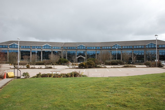
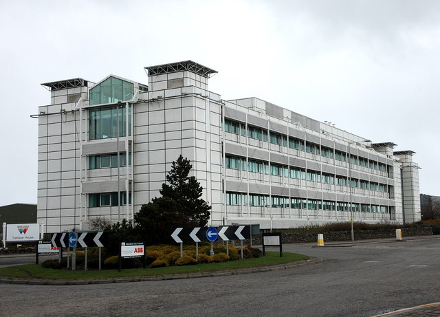
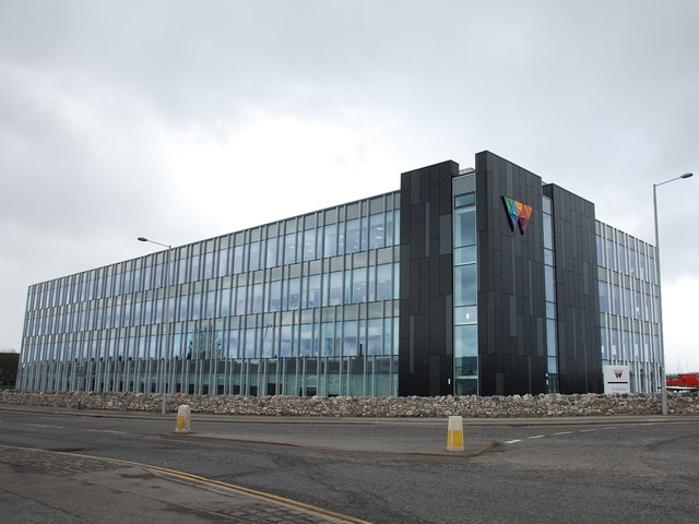
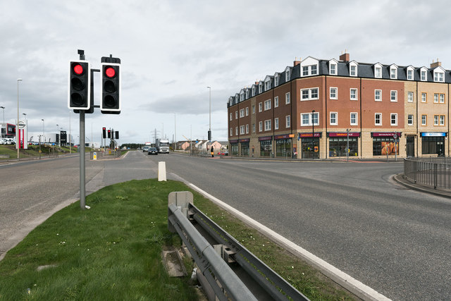
The village is well-connected to the nearby city of Aberdeen, with regular bus services and easy access to major road networks. Altens is also home to a number of industrial and commercial developments, including the Altens Industrial Estate, which houses various businesses and offers employment opportunities for local residents.

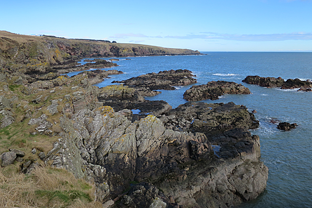
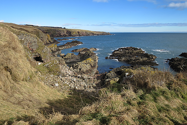
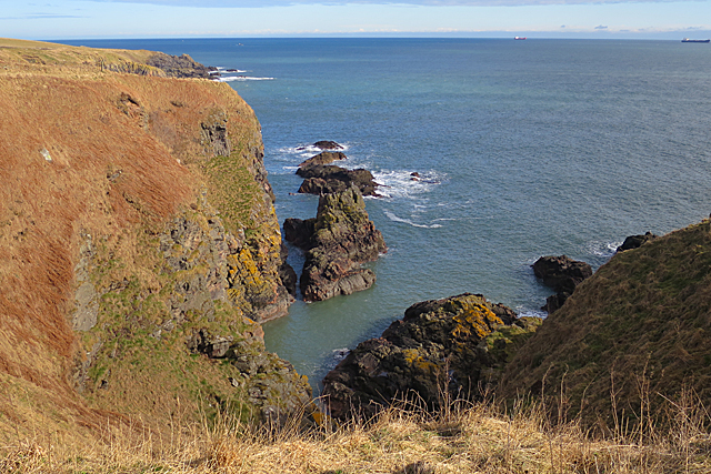
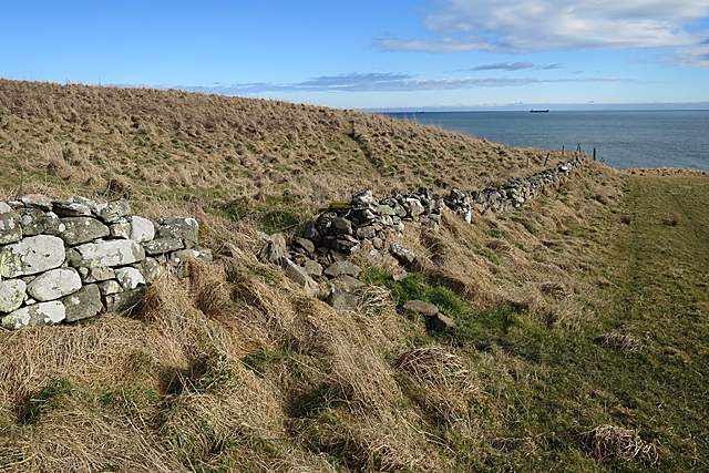
Altens benefits from its proximity to the River Dee, with scenic walks and outdoor recreational activities available for residents and visitors alike. The village is also close to the coast, offering stunning views of the North Sea and opportunities for water sports and beach activities.

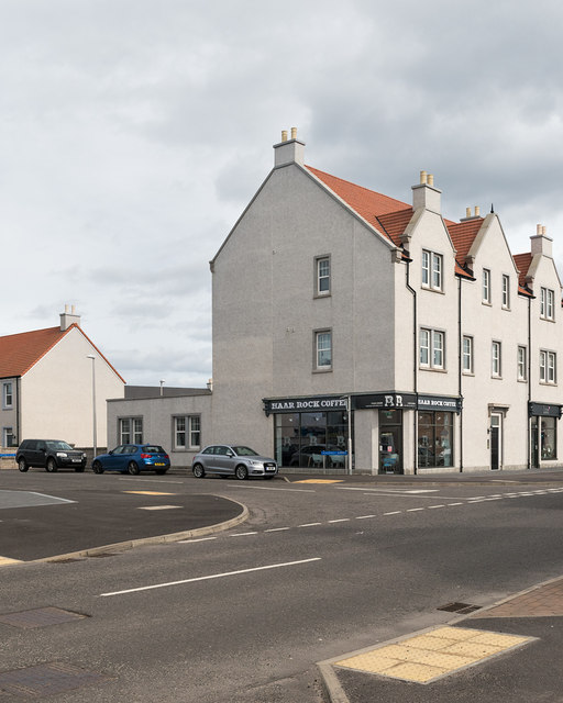
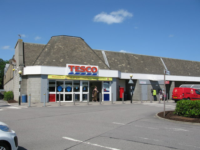
In terms of amenities, Altens has a primary school, a community center, and several shops, including convenience stores and small businesses. The village is also within close proximity to larger retail centers and supermarkets in Aberdeen.

Overall, Altens is a tranquil village with a strong sense of community, offering a peaceful residential environment while still providing access to urban amenities and employment opportunities. Its scenic location and convenient transport links make it an attractive place to live for those seeking a balance between rural and urban living.

If you have any feedback on the listing, please let us know in the comments section below.
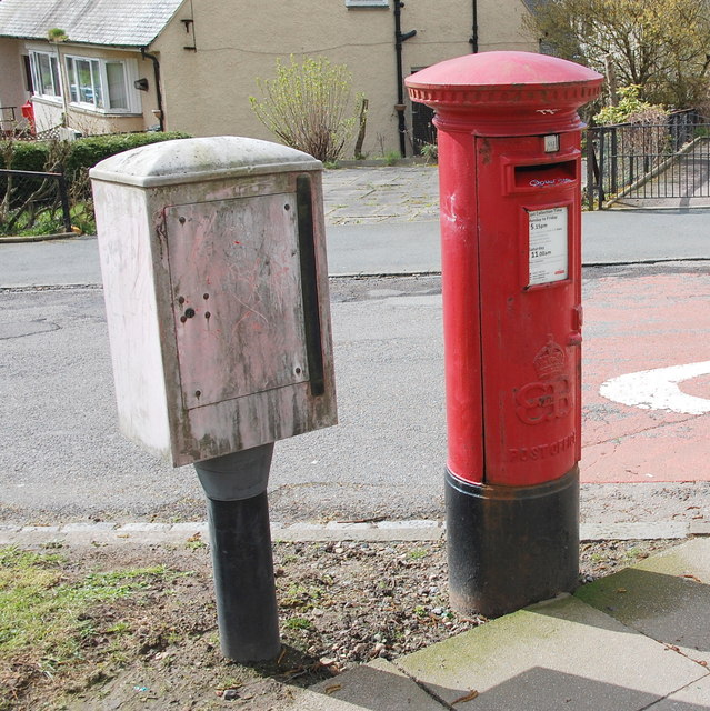
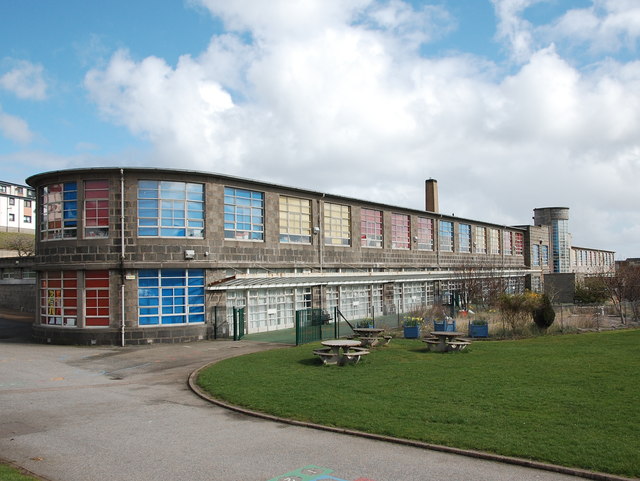
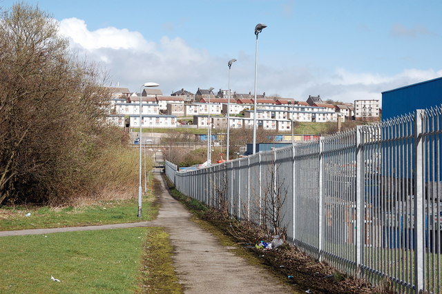
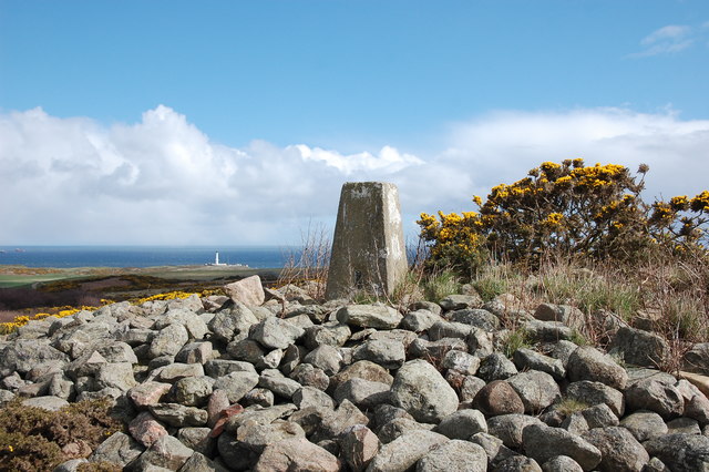
Altens Images

Images are sourced within 2km of 57.1156/-2.0781846 or Grid Reference NJ9502. Thanks to Geograph Open Source API. All images are credited.

Depot of oil drilling pipes
Edward VIII pillar box... ...at the junction of Gregness Gardens and Girdleness Road.  One of only two to be found in Aberdeen and 136 nationwide.
Edward VIII pillar box...
...at the junction of Gregness Gardens and Girdleness Road. One of only two to be found in Aberdeen and 136 nationwide.
Tullos Primary School The classroom blinds add a nice bit of colour to this iconic 1930s art deco building, but the rusting metal and crumbling mortar are concerning...   B-listed: <span class="nowrap"><a title="http://www.britishlistedbuildings.co.uk/sc-49995-tullos-primary-school-girdleness-road-#.VxNisaT2amQ" rel="nofollow ugc noopener" href="http://www.britishlistedbuildings.co.uk/sc-49995-tullos-primary-school-girdleness-road-#.VxNisaT2amQ">Link</a><img style="margin-left:2px;" alt="External link" title="External link - shift click to open in new window" src="https://s1.geograph.org.uk/img/external.png" width="10" height="10"/></span> .
Tullos Primary School
The classroom blinds add a nice bit of colour to this iconic 1930s art deco building, but the rusting metal and crumbling mortar are concerning... B-listed: LinkExternal link .
Path... ...through Greenbank industrial estate.  The fly tipping and rotting rubbish absolutely everywhere make it look like a third-world slum.  In the background rather 'boxy' 1960s houses on the steep hillside of Balnagask and behind them, Victorian villas in Torry.
Path...
...through Greenbank industrial estate. The fly tipping and rotting rubbish absolutely everywhere make it look like a third-world slum. In the background rather 'boxy' 1960s houses on the steep hillside of Balnagask and behind them, Victorian villas in Torry.
Beech grove... ...on the hillside above Greenbank industrial estate.
Beech grove...
...on the hillside above Greenbank industrial estate.
Baron's Cairn... ...at the top of Tullos Hill: <span class="nowrap"><a title="https://canmore.org.uk/site/20242/barons-cairn-tullos-hill" rel="nofollow ugc noopener" href="https://canmore.org.uk/site/20242/barons-cairn-tullos-hill">Link</a><img style="margin-left:2px;" alt="External link" title="External link - shift click to open in new window" src="https://s1.geograph.org.uk/img/external.png" width="10" height="10"/></span> .  Girdleness Lighthouse is just visible in the distance.
Baron's Cairn...
...at the top of Tullos Hill: LinkExternal link . Girdleness Lighthouse is just visible in the distance.
Nigg Kirk Nigg Kirk was built in 1829 to the design of John Smith to replace the (now ruined) St Fittick's Kirk in Torry.  Compare St Clement's Church: <a title="https://www.geograph.org.uk/photo/3378773" href="https://www.geograph.org.uk/photo/3378773">Link</a> .  As already pointed out by Peter Robinson (<a title="https://www.geograph.org.uk/photo/3065186" href="https://www.geograph.org.uk/photo/3065186">Link</a> ), the windows are fakes, presumably on top of the boarded-up originals.
Nigg Kirk
Nigg Kirk was built in 1829 to the design of John Smith to replace the (now ruined) St Fittick's Kirk in Torry. Compare St Clement's Church: Link . As already pointed out by Peter Robinson (Link ), the windows are fakes, presumably on top of the boarded-up originals.
Amec Foster Wheeler office block An energy consultancy: <span class="nowrap"><a title="http://www.amecfw.com/aboutus/at-a-glance" rel="nofollow ugc noopener" href="http://www.amecfw.com/aboutus/at-a-glance">Link</a><img style="margin-left:2px;" alt="External link" title="External link - shift click to open in new window" src="https://s1.geograph.org.uk/img/external.png" width="10" height="10"/></span> .
Amec Foster Wheeler office block
An energy consultancy: LinkExternal link .
Oil company office, Altens industrial estate
Wood Group offices, Altens industrial estate
Mixed residential and business development A recent mixed residential and business development at the junction of Wellington Road and Charleston Road North.  Sainsbury's occupies the ground floor on the corner.
Mixed residential and business development
A recent mixed residential and business development at the junction of Wellington Road and Charleston Road North. Sainsbury's occupies the ground floor on the corner.
Haar Rock Coffee A local coffee shop in a new development.
Haar Rock Coffee
A local coffee shop in a new development.
Road Bridge at Rare Breeds Farm The bridge carries a minor road across the railway between Aberdeen and Stonehaven railway stations. Someone seems to believe this is a peace bridge!
Road Bridge at Rare Breeds Farm
The bridge carries a minor road across the railway between Aberdeen and Stonehaven railway stations. Someone seems to believe this is a peace bridge!
Tesco, Aberdeen South On Wellington Road, A956.
Tesco, Aberdeen South
On Wellington Road, A956.
Crawpeel Shore Looking northwards from just above the harbour at Cove. See also <a href="https://www.geograph.org.uk/photo/5702201">NJ9500 : Crawpeel Shore</a>
Crawpeel Shore
Looking northwards from just above the harbour at Cove. See also NJ9500 : Crawpeel Shore
Crawpeel Shore I suspect that this view, rather than <a href="https://www.geograph.org.uk/photo/5702199">NJ9500 : Crawpeel Shore</a>, is actually of Crawpeel Shore, because it is possible to get down to shore level here. The rocky ridges to the left are named on the maps as The Graves.
Crawpeel Shore
I suspect that this view, rather than NJ9500 : Crawpeel Shore, is actually of Crawpeel Shore, because it is possible to get down to shore level here. The rocky ridges to the left are named on the maps as The Graves.
The Poor Man I think the Poor Man is the long offshore rock beyond the sea stack.
The Poor Man
I think the Poor Man is the long offshore rock beyond the sea stack.
Drystane Dyke Looking a bit the worse for wear, and clearly no longer performing any useful function.
Drystane Dyke
Looking a bit the worse for wear, and clearly no longer performing any useful function.
Show me another place!

Altens is located at Grid Ref: NJ9502 (Lat: 57.1156, Lng: -2.0781846)

Unitary Authority: City of Aberdeen

Police Authority: North East

What 3 Words

///judge.ending.dull. Near Cove, Aberdeen

Nearby Locations

Altens

Related Wikis

Altens

Altens is a district in Aberdeen, on the north-east coast of Scotland.Altens is home to a large industrial estate, alongside a similar estate in neighbouring...
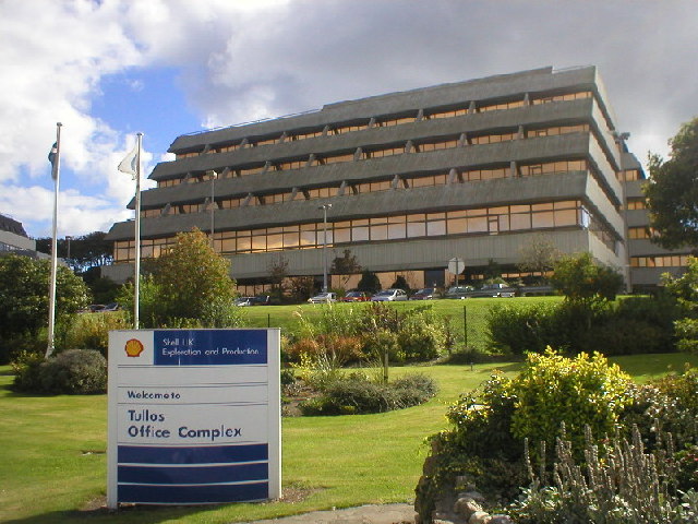
Tullos

Tullos is an area of Aberdeen, Scotland. The area takes its name from the Vale of Tullos, which lies between Tullos Hill and Torry Hill. Tullos derived...

NESS Energy Project

The NESS Energy Project is an incinerator currently under construction in Aberdeen, UK. It is situated in East Tullos Industrial Estate on a site formerly...

Nigg, Aberdeen

Nigg is an area of Aberdeen, Scotland, south of the River Dee. It has a population of 16,400 (2019 estimate). The area has a bay known as the Bay of Nigg...

Cove Bay

Cove Bay, known locally as Cove, is a suburb on the south-east edge of Aberdeen, Scotland. Today Cove is home to around 8,000 people. It is a popular residential...

Doonies Farm

Doonies Rare Breeds Farm was a farm in Aberdeen, Scotland. Doonies Farm had one of Scotland's largest collections of rare and endangered farm animal breeds...
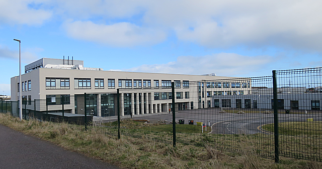
Lochside Academy

Lochside Academy is a co-educational secondary school in Altens, Aberdeen, run by Aberdeen City Council. Its feeder primary schools are Abbotswell School...

Original 106 (radio station)

Original 106 is an Independent Local Radio station owned by DC Thomson and broadcasting to Aberdeenshire and the cities of Aberdeen, Dundee and Perth in...

Nearby Amenities

Located within 500m of 57.1156,-2.0781846
Crossing
Crossing: uncontrolled
Crossing Island: no
Crossing Markings: zebra
Crossing Ref: zebra
Flashing Lights: yes
Kerb: flush
Tactile Paving: yes
Lat/Long: 57.114601/-2.0844833
Post Box
Collection Times: Mo-Fr 18:15; Sa 10:30
Operator: Royal Mail
Operator Wikidata: Q638098
Post Box Type: lamp
Ref: AB12 586
Lat/Long: 57.1158539/-2.0801067
Post Box
Collection Times: Mo-Fr 18:15; Sa 10:30
Operator: Royal Mail
Operator Wikidata: Q638098
Post Box Type: meter
Ref: AB12 902P
Lat/Long: 57.1158514/-2.0800851
Altens
Name En: Altens
Name Fa: آلتنز
Place: suburb
Source: OS_OpenData_StreetView
Wikidata: Q4736252
Wikipedia: en:Altens
Lat/Long: 57.1148769/-2.0734882
Mini Roundabout
Direction: clockwise
Lat/Long: 57.1170119/-2.0830858
Bus Stop
Minto Road
Bus: yes
Naptan AtcoCode: 639009072
Naptan CommonName: Minto Road
Naptan Indicator: S-bound
Naptan NaptanCode: 23237394
Naptan Verified: no
Public Transport: platform
Lat/Long: 57.1159282/-2.0729508
Bus Stop
Minto Road
Bus: yes
Naptan AtcoCode: 639009071
Naptan CommonName: Minto Road
Naptan Indicator: N-bound
Naptan NaptanCode: 23237393
Naptan Verified: no
Public Transport: platform
Lat/Long: 57.1160269/-2.0731162
Bus Stop
Peterseat Drive
Bus: yes
Naptan AtcoCode: 639009051
Naptan CommonName: Peterseat Drive
Naptan Indicator: adj
Naptan NaptanCode: 23237386
Naptan Verified: no
Public Transport: platform
Lat/Long: 57.1192512/-2.0740803
Bus Stop
Minto Avenue
Bus: yes
Naptan AtcoCode: 639009042
Naptan CommonName: Minto Avenue
Naptan Indicator: adj
Naptan NaptanCode: 23237385
Naptan Verified: no
Public Transport: platform
Lat/Long: 57.1171034/-2.0756117
Bus Stop
Hareness Road
Bus: yes
Naptan AtcoCode: 639009041
Naptan CommonName: Hareness Road
Naptan Indicator: N-bound
Naptan NaptanCode: 23237384
Naptan Verified: no
Public Transport: platform
Lat/Long: 57.1163923/-2.077823
Bus Stop
Altens Farm Road
Bus: yes
Naptan AtcoCode: 639002951
Naptan CommonName: Altens Farm Road
Naptan Indicator: SE-bound
Naptan NaptanCode: 23232537
Naptan Verified: no
Public Transport: platform
Lat/Long: 57.1170049/-2.0860187
Bus Stop
Minto Road
Bus: yes
Naptan AtcoCode: 639002981
Naptan CommonName: Minto Road
Naptan Indicator: adj
Naptan NaptanCode: 23232526
Naptan Verified: no
Public Transport: platform
Lat/Long: 57.1150021/-2.074336
Bus Stop
Minto Avenue
Bus: yes
Naptan AtcoCode: 639002972
Naptan CommonName: Minto Avenue
Naptan Indicator: opp
Naptan NaptanCode: 23232529
Naptan Verified: no
Public Transport: platform
Lat/Long: 57.1157356/-2.0793077
Bus Stop
Minto Avenue
Bus: yes
Naptan AtcoCode: 639002971
Naptan CommonName: Minto Avenue
Naptan Indicator: at
Naptan NaptanCode: 23232527
Naptan Verified: no
Public Transport: platform
Lat/Long: 57.1157002/-2.0784985
Bus Stop
Hareness Circle
Bus: yes
Naptan AtcoCode: 639002962
Naptan CommonName: Hareness Circle
Naptan Indicator: opp
Naptan NaptanCode: 23232534
Naptan Verified: no
Public Transport: platform
Lat/Long: 57.1162372/-2.081637
Bus Stop
Hareness Circle
Bus: yes
Naptan AtcoCode: 639002961
Naptan CommonName: Hareness Circle
Naptan Indicator: adj
Naptan NaptanCode: 23232494
Naptan Verified: no
Public Transport: platform
Lat/Long: 57.1162115/-2.0821386
Bus Stop
Blackness Avenue
Bench: no
Bus: yes
Naptan AtcoCode: 639002992
Naptan CommonName: Blackness Avenue
Naptan Indicator: NE-bound
Naptan NaptanCode: 23237325
Naptan Verified: no
Public Transport: platform
Shelter: no
Tactile Paving: no
Lat/Long: 57.1121598/-2.0753238
Bus Stop
Blackness Avenue
Bench: no
Bus: yes
Naptan AtcoCode: 639002991
Naptan CommonName: Blackness Avenue
Naptan Indicator: SW-bound
Naptan NaptanCode: 23232476
Naptan Verified: no
Public Transport: platform
Shelter: no
Tactile Paving: no
Lat/Long: 57.1118798/-2.0752743
Bus Stop
Minto Road
Bus: yes
Naptan AtcoCode: 639002982
Naptan CommonName: Minto Road
Naptan Indicator: opp
Naptan NaptanCode: 23232497
Naptan Verified: no
Public Transport: platform
Lat/Long: 57.1148944/-2.0745607
Turning Loop
Lat/Long: 57.1159222/-2.0811695
Barrier: lift_gate
Lat/Long: 57.1153043/-2.0747801
Cat's Cairn
Man Made: cairn
Lat/Long: 57.1194528/-2.0811431
Natural: shrub
Lat/Long: 57.1133287/-2.0767167
Natural: shrub
Lat/Long: 57.1132887/-2.0767343
Crossing
Crossing: unmarked
Crossing Island: yes
Crossing Markings: no
Tactile Paving: yes
Lat/Long: 57.1168153/-2.0831726
Generator Method: wind_turbine
Generator Output Electricity: yes
Generator Source: wind
Generator Type: vertical_axis
Power: generator
Lat/Long: 57.1164176/-2.0753847
Crossing
Crossing: unmarked
Crossing Island: no
Tactile Paving: yes
Lat/Long: 57.117026/-2.0752612
Crossing
Crossing: unmarked
Crossing Island: no
Tactile Paving: yes
Lat/Long: 57.1164713/-2.0720252
Parking
Access: private
Capacity: 9
Capacity Disabled: 1
Parking: surface
Surface: asphalt
Lat/Long: 57.1154375/-2.0761558
Parking
Access: private
Capacity: 4
Capacity Disabled: 4
Parking: surface
Surface: asphalt
Lat/Long: 57.115648/-2.0764147
Parking
Access: private
Capacity: 8
Parking: surface
Surface: asphalt
Lat/Long: 57.1167708/-2.075256
Parking
Access: private
Capacity: 6
Parking: surface
Surface: asphalt
Lat/Long: 57.1165232/-2.0754169
Bicycle Parking
Access: private
Bicycle Parking: stands
Capacity: 30
Covered: yes
Surveillance: yes
Lat/Long: 57.116781/-2.0765555
Direction: both
Traffic Calming: bump
Lat/Long: 57.1157048/-2.0763102
Direction: both
Traffic Calming: bump
Lat/Long: 57.1167073/-2.0754473
Direction: both
Traffic Calming: bump
Lat/Long: 57.1169229/-2.0753214
Give Way
Direction: backward
Lat/Long: 57.1156244/-2.0781415
Elevator
Indoor: yes
Wheelchair: yes
Lat/Long: 57.1170187/-2.0764569
Entrance: yes
Lat/Long: 57.1158465/-2.0771687
Entrance: main
Lat/Long: 57.1160779/-2.0772123
Bicycle Parking
Access: private
Bicycle Parking: stands
Capacity: 10
Covered: yes
Surveillance: yes
Lat/Long: 57.1166441/-2.0766306
Entrance: yes
Lat/Long: 57.1168938/-2.0764422
Crossing
Crossing: uncontrolled
Crossing Island: no
Crossing Markings: zebra
Kerb: no
Tactile Paving: no
Lat/Long: 57.11657/-2.0769305
Entrance: main
Lat/Long: 57.1168746/-2.0766391
Crossing
Crossing: uncontrolled
Crossing Island: no
Crossing Markings: zebra
Kerb: no
Tactile Paving: no
Lat/Long: 57.1157285/-2.0762965
Direction: both
Traffic Calming: bump
Lat/Long: 57.1159935/-2.0760444
Give Way
Direction: backward
Lat/Long: 57.1191819/-2.0768283
Give Way
Direction: backward
Lat/Long: 57.1194838/-2.076228
Give Way
Direction: forward
Lat/Long: 57.1165948/-2.072669
Give Way
Direction: forward
Lat/Long: 57.1141056/-2.0818772
Give Way
Lat/Long: 57.1170788/-2.0834152
Give Way
Direction: forward
Lat/Long: 57.1168707/-2.085865
The data included in this document is from www.openstreetmap.org. The data is made available under ODbL.

Have you been to Altens?

Leave your review of Altens below (or comments, questions and feedback).