Shinwalie Wood
Wood, Forest in Dumfriesshire
Scotland
Shinwalie Wood

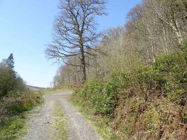
Shinwalie Wood, located in Dumfriesshire, Scotland, is a picturesque forest renowned for its natural beauty and diverse wildlife. Spanning an area of approximately 200 acres, the wood is situated in the heart of the Scottish countryside, offering visitors an idyllic escape from city life.
The wood is predominantly made up of native broadleaf trees, including oak, beech, and birch, which create a rich tapestry of colors throughout the year. In spring, the forest floor is carpeted with bluebells and wildflowers, creating a stunning display of vibrant hues. During autumn, the leaves turn shades of gold, orange, and red, providing a breathtaking spectacle.
Shinwalie Wood is a haven for wildlife enthusiasts, with an abundance of fauna inhabiting the area. Red squirrels can be spotted darting between the trees, while roe deer can often be seen grazing in the open glades. The woodland is also home to a variety of bird species, including woodpeckers, owls, and buzzards, providing a symphony of bird songs throughout the day.
The wood offers an extensive network of well-maintained trails, making it an ideal location for walkers, hikers, and nature lovers. These paths wind through the forest, leading visitors to tranquil ponds, hidden waterfalls, and breathtaking viewpoints. Additionally, there are picnic areas and benches scattered throughout the wood, allowing visitors to pause and soak in the serenity of their surroundings.
Shinwalie Wood is a true gem in Dumfriesshire, offering visitors a chance to connect with nature and experience the beauty of Scotland's woodlands.
If you have any feedback on the listing, please let us know in the comments section below.
Shinwalie Wood Images
Images are sourced within 2km of 55.19816/-3.9663835 or Grid Reference NX7491. Thanks to Geograph Open Source API. All images are credited.


Shinwalie Wood is located at Grid Ref: NX7491 (Lat: 55.19816, Lng: -3.9663835)
Unitary Authority: Dumfries and Galloway
Police Authority: Dumfries and Galloway
What 3 Words
///diverged.fight.mimes. Near Thornhill, Dumfries & Galloway
Nearby Locations
Related Wikis

Craigdarroch
"Craigdarroch, An Accessory to Murder" is an expansion set for the board game Kill Doctor Lucky Craigdarroch is a house near Moniaive, Dumfries and Galloway...

Moniaive
Moniaive ( 'monny-IVE'; Scottish Gaelic: Am Moine Naomh, "The Holy Moor") is a village in the Parish of Glencairn, in Dumfries and Galloway, southwest...

Moniaive railway station
Moniaive railway station is the closed station terminus of the Cairn Valley Light Railway (CVR) branch, from Dumfries. It served the rural area of Moniaive...

Carsphairn and Scaur Hills
The Carsphairn and Scaur Hills are the western and eastern hills respectively of a hill range in the Southern Uplands of Scotland. Ordnance Survey maps...

Crawfordton House
Crawfordton House is a category B listed 19th-century country house, situated close to Moniaive in Dumfriesshire, Scotland. It was operated as Crawfordton...

Cademuir International School
Cademuir International School was a specialist school at Moniaive in Dumfries and Galloway, Scotland. The school, founded by Robert Mulvey in 1990, was...

Tynron
Tynron is a village and civil parish in Dumfries and Galloway, south-west Scotland, lying in a hollow of the Shinnel Water, 2 miles (3.2 km) from Moniaive...

Glencairn, Dumfries and Galloway
Glencairn is an ecclesiastical and civil parish in Dumfries and Galloway, Scotland. == Location == According to John Bartholomew's 1887 Gazetteer of the...
Nearby Amenities
Located within 500m of 55.19816,-3.9663835Have you been to Shinwalie Wood?
Leave your review of Shinwalie Wood below (or comments, questions and feedback).