Carlton-le-Moorland

Settlement in Lincolnshire North Kesteven

England

Carlton-le-Moorland

Direction Sign – Signpost on Newark Road in Bassingham Located on the west side of the T junction of High Street, Newark Road and Lincoln Road in Bassingham parish. 3 arms and annulus finial.

Milestone Society National ID: LI_SK9059
Direction Sign – Signpost on Newark Road in Bassingham Credit: D Phillips

Carlton-le-Moorland is a small village located in the South Kesteven district of Lincolnshire, England. Situated approximately 10 miles south of the city of Lincoln, this rural community is nestled amidst picturesque countryside, offering a tranquil and idyllic setting.

The village has a rich history that dates back to the Domesday Book of 1086. Over the centuries, it has grown into a close-knit community that maintains its traditional charm. Carlton-le-Moorland is characterized by a mix of architectural styles, with a range of period cottages, farmhouses, and more modern housing.

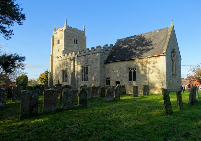
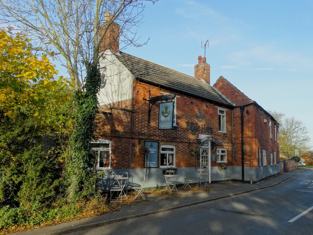
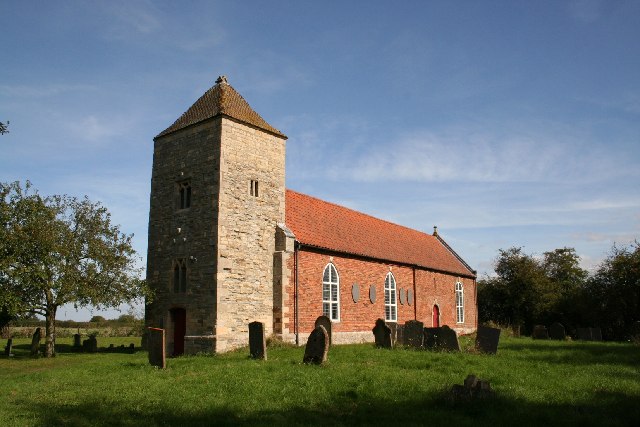
Despite its small size, the village boasts several amenities to cater to the needs of its residents. These include a village hall, a primary school, and a parish church, which serves as a focal point for community gatherings and events. Additionally, there is a pub, providing a social hub for locals and visitors alike.

The surrounding countryside offers ample opportunities for outdoor activities, such as hiking, cycling, and horse riding. Carlton-le-Moorland is also conveniently located near the Lincolnshire Showground, which hosts various events throughout the year, including agricultural shows, concerts, and exhibitions.

For those seeking a quieter pace of life, Carlton-le-Moorland provides a peaceful retreat away from the hustle and bustle of the city. With its charming architecture, strong sense of community, and proximity to natural beauty, this village offers a delightful place to reside or visit in Lincolnshire.

If you have any feedback on the listing, please let us know in the comments section below.

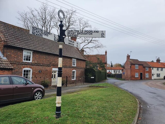
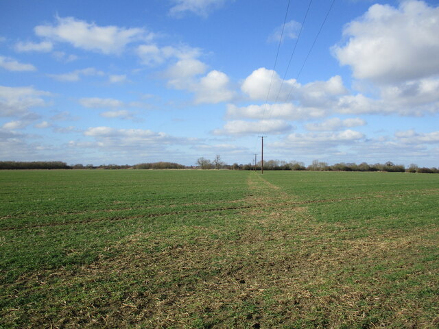
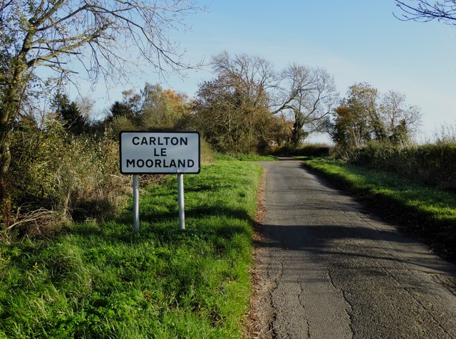
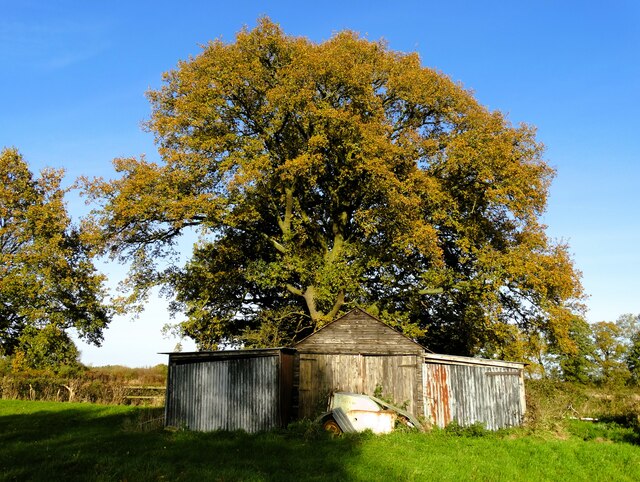
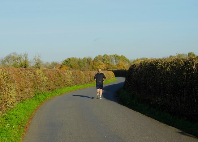
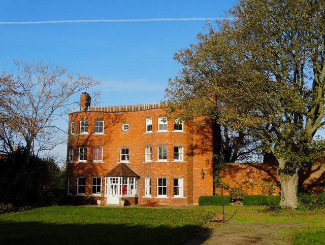
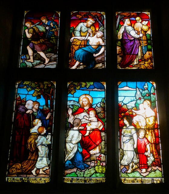
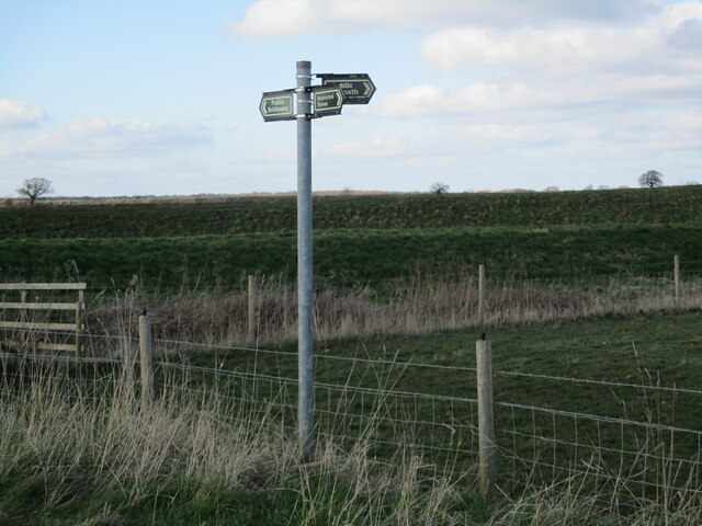
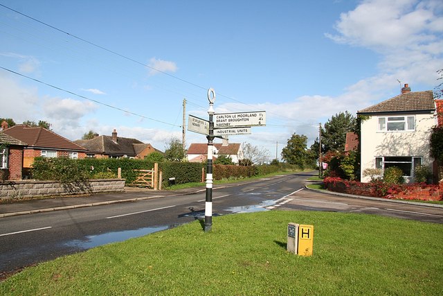
Carlton-le-Moorland Images

Images are sourced within 2km of 53.111749/-0.646895 or Grid Reference SK9058. Thanks to Geograph Open Source API. All images are credited.

Direction Sign – Signpost on Newark Road in Bassingham Located on the west side of the T junction of High Street, Newark Road and Lincoln Road in Bassingham parish. 3 arms and annulus finial.

Milestone Society National ID: LI_SK9059
Direction Sign – Signpost on Newark Road in Bassingham
Located on the west side of the T junction of High Street, Newark Road and Lincoln Road in Bassingham parish. 3 arms and annulus finial. Milestone Society National ID: LI_SK9059
Is this the footpath? I think not. There is no obvious line for the footpath across this field. What appears to be a footpath is in fact where machines have gone in the consrtruction of this new power line.
Is this the footpath?
I think not. There is no obvious line for the footpath across this field. What appears to be a footpath is in fact where machines have gone in the consrtruction of this new power line.
Spitfire Flypast by BBMF Supermarine Spitfire mark Vb AB910 for the Bassingham Open Gardens event
Spitfire
Flypast by BBMF Supermarine Spitfire mark Vb AB910 for the Bassingham Open Gardens event
Spitfire Flypast by BBMF Supermarine Spitfire mark Vb AB910 for the Bassingham Open Gardens event
Spitfire
Flypast by BBMF Supermarine Spitfire mark Vb AB910 for the Bassingham Open Gardens event
Entering Carlton-le-Moorland from the west On Clay Lane
Entering Carlton-le-Moorland from the west
On Clay Lane
Parish church Carlton-le-Moorland Dating back to the eleventh century and dedicated to St Mary.
Parish church Carlton-le-Moorland
Dating back to the eleventh century and dedicated to St Mary.
Memorial lych gate in Carlton-le-Moorland Dedicated to the men of the parish who lost their lives in World War One.
Memorial lych gate in Carlton-le-Moorland
Dedicated to the men of the parish who lost their lives in World War One.
Old farm shed beneath an oak in autumn North of Carlton-le-Moorland
Old farm shed beneath an oak in autumn
North of Carlton-le-Moorland
Jogger on Rinks Lane South of Bassingham
Jogger on Rinks Lane
South of Bassingham
Corner house on Whites Lane, Bassingham
"The Bugle Horn", Bassingham
St Michael's Church, Bassingham
Memorial stained glass window (1901) In St  Mary's Church, Carlton-le-Moorland. The window is dedicated to one Mary Jalland.
Memorial stained glass window (1901)
In St Mary's Church, Carlton-le-Moorland. The window is dedicated to one Mary Jalland.
Track to reservoirs near Carlton Trig Point
Carlton Trig Point Flush Bracket S4678
The complete set A footpath meets a bridleway and a restricted byway.
The complete set
A footpath meets a bridleway and a restricted byway.
Restricted byway near Stapleford
Minor drain near Stapleford
Show me another place!

Carlton-le-Moorland is located at Grid Ref: SK9058 (Lat: 53.111749, Lng: -0.646895)

Division: Parts of Kesteven

Administrative County: Lincolnshire

District: North Kesteven

Police Authority: Lincolnshire

What 3 Words

///fearfully.twins.colonies. Near Bassingham, Lincolnshire

Nearby Locations

Carlton-le-Moorland

Related Wikis

Carlton-le-Moorland

Carlton-le-Moorland, is a village and civil parish in the North Kesteven district of Lincolnshire, England, between Newark-on-Trent and Lincoln. The parish...

Bassingham

Bassingham is a village and civil parish in the North Kesteven district of Lincolnshire, England. The population of the civil parish at the 2011 census...

Norton Disney

Norton Disney is a small village and civil parish on the western boundary of the North Kesteven district of Lincolnshire, England. It is situated on the...

Stapleford, Lincolnshire

Stapleford is a village and civil parish in North Kesteven district of Lincolnshire, England, and about 6 miles (10 km) north-east from the town of Newark...

Skinnand

Skinnand is a deserted medieval village in Lincolnshire, England. It was a small farming community situated 9 miles (14 km) south of Lincoln and 11.5 miles...

Thurlby, North Kesteven

Thurlby is a village and civil parish in the North Kesteven district of Lincolnshire, England, about 9 miles (14 km) south-west of the city of Lincoln...

Brant Broughton

Brant Broughton (pronounced Brew-ton) is a small village in the Brant Broughton and Stragglethorpe civil parish (where the population is listed), in the...

St Helen's Church, Brant Broughton

St Helen's Church is an Anglican church in Brant Broughton, Lincolnshire, England. It is a Grade I listed building. == History == St Helen's Church a medieval...

Nearby Amenities

Located within 500m of 53.111749,-0.646895
Carlton le Moorland
Is In: Lincolnshire, England, UK
Place: village
Source: NPE
Lat/Long: 53.1115856/-0.646814
Bus Stop
Vicarage Lane
Local Ref: S
Naptan AtcoCode: 270000007796
Naptan Bearing: S
Naptan CommonName: Vicarage Lane
Naptan Indicator: S
Naptan Landmark: Broughton Road
Naptan NaptanCode: lingmawa
Naptan Street: Vicarage Lane
Naptan Verified: no
Source: naptan_import
Lat/Long: 53.1121245/-0.6435143
Bus Stop
Bassingham Road
Naptan AtcoCode: 2700LCMB2398
Naptan Bearing: E
Naptan CommonName: Bassingham Road
Naptan Indicator: adj
Naptan Landmark: Bassingham Road
Naptan NaptanCode: linapwmg
Naptan Street: Broughton Road
Naptan Verified: no
Source: naptan_import
Lat/Long: 53.1123741/-0.644119
Bus Stop
St Mary's Church
Naptan AtcoCode: 2700LCMC2918
Naptan Bearing: W
Naptan CommonName: St Mary's Church
Naptan Indicator: adj
Naptan Landmark: St Mary's Church
Naptan NaptanCode: linawamj
Naptan Street: Church Street
Naptan Verified: no
Source: naptan_import
Lat/Long: 53.1108911/-0.6449426
Pub
White Hart
Lat/Long: 53.1107889/-0.645214
Corner Farm
Place: farm
Source: Bing
Lat/Long: 53.1130266/-0.6444066
Generator Method: photovoltaic
Generator Output Electricity: yes
Generator Source: solar
Generator Type: solar_photovoltaic_panel
Location: roof
Power: generator
Lat/Long: 53.1134654/-0.6481196
Generator Method: photovoltaic
Generator Output Electricity: yes
Generator Source: solar
Generator Type: solar_photovoltaic_panel
Location: roof
Power: generator
Lat/Long: 53.1134774/-0.6482698
Generator Method: photovoltaic
Generator Output Electricity: yes
Generator Source: solar
Generator Type: solar_photovoltaic_panel
Location: roof
Power: generator
Lat/Long: 53.1134911/-0.6484817
Generator Method: photovoltaic
Generator Output Electricity: yes
Generator Source: solar
Generator Type: solar_photovoltaic_panel
Location: roof
Power: generator
Lat/Long: 53.1132303/-0.6485179
Generator Method: photovoltaic
Generator Output Electricity: yes
Generator Source: solar
Generator Type: solar_photovoltaic_panel
Location: roof
Power: generator
Lat/Long: 53.1132198/-0.6484012
Generator Method: photovoltaic
Generator Output Electricity: yes
Generator Source: solar
Generator Type: solar_photovoltaic_panel
Location: roof
Power: generator
Lat/Long: 53.1129993/-0.6487258
Generator Method: photovoltaic
Generator Output Electricity: yes
Generator Source: solar
Generator Type: solar_photovoltaic_panel
Location: roof
Power: generator
Lat/Long: 53.1129872/-0.6486252
Generator Method: photovoltaic
Generator Output Electricity: yes
Generator Source: solar
Generator Type: solar_photovoltaic_panel
Location: roof
Power: generator
Lat/Long: 53.1129783/-0.6484643
Generator Method: photovoltaic
Generator Output Electricity: yes
Generator Source: solar
Generator Type: solar_photovoltaic_panel
Location: roof
Power: generator
Lat/Long: 53.1120896/-0.6499683
Generator Method: photovoltaic
Generator Output Electricity: yes
Generator Source: solar
Generator Type: solar_photovoltaic_panel
Location: roof
Power: generator
Lat/Long: 53.111374/-0.6495063
Generator Method: photovoltaic
Generator Output Electricity: yes
Generator Source: solar
Generator Type: solar_photovoltaic_panel
Location: roof
Power: generator
Lat/Long: 53.1122378/-0.6447534
Generator Method: photovoltaic
Generator Output Electricity: yes
Generator Source: solar
Generator Type: solar_photovoltaic_panel
Location: roof
Power: generator
Lat/Long: 53.1112766/-0.6471607
Generator Method: photovoltaic
Generator Output Electricity: yes
Generator Source: solar
Generator Type: solar_photovoltaic_panel
Location: roof
Power: generator
Lat/Long: 53.1107106/-0.6481813
Generator Method: photovoltaic
Generator Output Electricity: yes
Generator Source: solar
Generator Type: solar_photovoltaic_panel
Location: roof
Power: generator
Lat/Long: 53.1099909/-0.6489189
Generator Method: photovoltaic
Generator Output Electricity: yes
Generator Source: solar
Generator Type: solar_photovoltaic_panel
Location: roof
Power: generator
Lat/Long: 53.110024/-0.6491938
Generator Method: photovoltaic
Generator Output Electricity: yes
Generator Source: solar
Generator Type: solar_photovoltaic_panel
Location: roof
Power: generator
Lat/Long: 53.1106648/-0.6470092
Generator Method: photovoltaic
Generator Output Electricity: yes
Generator Source: solar
Generator Type: solar_photovoltaic_panel
Location: roof
Power: generator
Lat/Long: 53.1105987/-0.6463802
Generator Method: photovoltaic
Generator Output Electricity: yes
Generator Source: solar
Generator Type: solar_photovoltaic_panel
Location: roof
Power: generator
Lat/Long: 53.1108459/-0.646112
Generator Method: photovoltaic
Generator Output Electricity: yes
Generator Source: solar
Generator Type: solar_photovoltaic_panel
Location: roof
Power: generator
Lat/Long: 53.1110753/-0.6450458
Generator Method: photovoltaic
Generator Output Electricity: yes
Generator Source: solar
Generator Type: solar_photovoltaic_panel
Location: roof
Power: generator
Lat/Long: 53.1108419/-0.6436685
Generator Method: photovoltaic
Generator Output Electricity: yes
Generator Source: solar
Generator Type: solar_photovoltaic_panel
Location: roof
Power: generator
Lat/Long: 53.1115825/-0.6433024
Generator Method: photovoltaic
Generator Output Electricity: yes
Generator Source: solar
Generator Type: solar_photovoltaic_panel
Location: roof
Power: generator
Lat/Long: 53.1115342/-0.6432085
Generator Method: photovoltaic
Generator Output Electricity: yes
Generator Source: solar
Generator Type: solar_photovoltaic_panel
Location: roof
Power: generator
Lat/Long: 53.1114287/-0.6430502
Generator Method: photovoltaic
Generator Output Electricity: yes
Generator Source: solar
Generator Type: solar_photovoltaic_panel
Location: roof
Power: generator
Lat/Long: 53.1113539/-0.6429791
Generator Method: photovoltaic
Generator Output Electricity: yes
Generator Source: solar
Generator Type: solar_photovoltaic_panel
Location: roof
Power: generator
Lat/Long: 53.1109956/-0.6427941
Generator Method: photovoltaic
Generator Output Electricity: yes
Generator Source: solar
Generator Type: solar_photovoltaic_panel
Location: roof
Power: generator
Lat/Long: 53.1097591/-0.6471808
Generator Method: photovoltaic
Generator Output Electricity: yes
Generator Source: solar
Generator Type: solar_photovoltaic_panel
Location: roof
Power: generator
Lat/Long: 53.1097639/-0.647276
Generator Method: photovoltaic
Generator Output Electricity: yes
Generator Source: solar
Generator Type: solar_photovoltaic_panel
Location: roof
Power: generator
Lat/Long: 53.1095788/-0.6458518
Generator Method: photovoltaic
Generator Output Electricity: yes
Generator Source: solar
Generator Type: solar_photovoltaic_panel
Location: roof
Power: generator
Lat/Long: 53.1095804/-0.6459591
Generator Method: photovoltaic
Generator Output Electricity: yes
Generator Source: solar
Generator Type: solar_photovoltaic_panel
Location: roof
Power: generator
Lat/Long: 53.1095731/-0.6460463
Generator Method: photovoltaic
Generator Output Electricity: yes
Generator Source: solar
Generator Type: solar_photovoltaic_panel
Location: roof
Power: generator
Lat/Long: 53.1094926/-0.647146
Generator Method: photovoltaic
Generator Output Electricity: yes
Generator Source: solar
Generator Type: solar_photovoltaic_panel
Location: roof
Power: generator
Lat/Long: 53.109487/-0.6472318
Telephone
Defibrillator
Booth: K6
Covered: booth
Defibrillator Location: inside old red phone box outside St Mary churchyard in Carlton le Moorland
Emergency: defibrillator
Man Made: telephone_box
Lat/Long: 53.110756/-0.6443268
Post Box
Post Box Type: wall
Lat/Long: 53.1109694/-0.64582
The data included in this document is from www.openstreetmap.org. The data is made available under ODbL.

Have you been to Carlton-le-Moorland?

Leave your review of Carlton-le-Moorland below (or comments, questions and feedback).