Carlton Green

Settlement in Cambridgeshire South Cambridgeshire

England

Carlton Green

On the road to West Wratting The red speck among the trees, to the left of centre, is a chimney stack of Parys Manor, a timber-framed house set behind trees and high hedges.
On the road to West Wratting Credit: John Sutton

Carlton Green is a small village located in the county of Cambridgeshire, England. Situated in the East Anglian region, it lies approximately 10 miles south-west of Cambridge and 70 miles north of London. The village is part of the district of South Cambridgeshire and falls within the civil parish of Carlton.

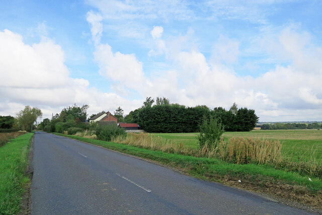
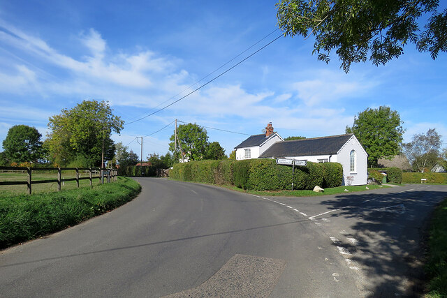
With a population of around 250 residents, Carlton Green is a close-knit community known for its peaceful and picturesque surroundings. The village is characterized by its charming countryside landscapes, dotted with quaint cottages and traditional English gardens.

Despite its small size, Carlton Green offers a range of amenities for its residents. These include a local pub, the Carlton Green Inn, which serves as a popular meeting point for locals and visitors alike. The village also boasts a village hall, which hosts various community events throughout the year, such as fairs and social gatherings.

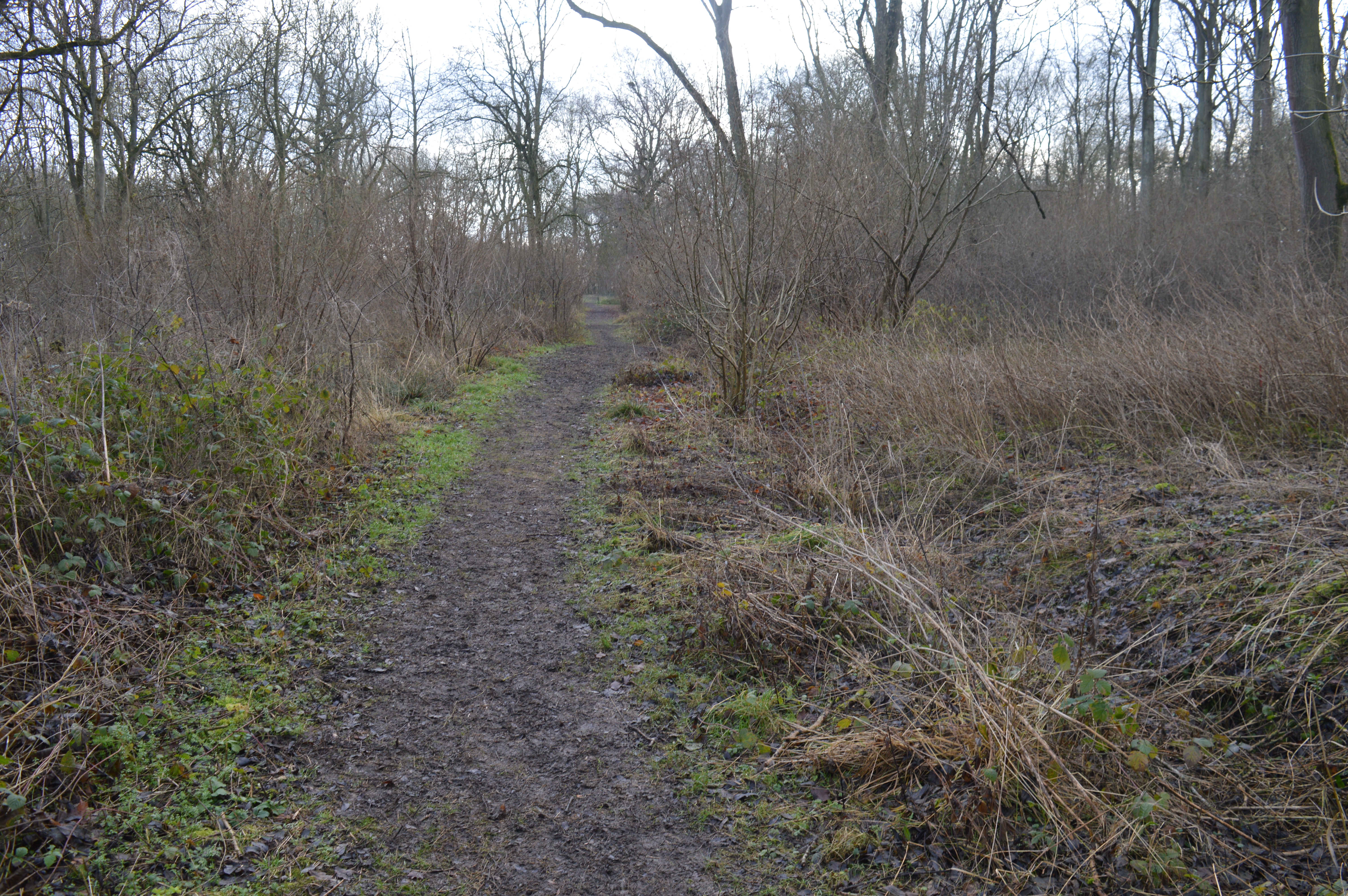
The village is surrounded by beautiful open countryside, making it an ideal location for outdoor enthusiasts. There are several footpaths and bridleways that crisscross the area, providing opportunities for scenic walks, cycling, and horse riding. Additionally, the nearby River Cam offers opportunities for boating and fishing.

Overall, Carlton Green is a quiet and idyllic village, offering a peaceful retreat from the hustle and bustle of nearby cities. Its natural beauty and community spirit make it a desirable place to live for those seeking a rural lifestyle in the heart of Cambridgeshire.

If you have any feedback on the listing, please let us know in the comments section below.

Carlton Green Images

Images are sourced within 2km of 52.138404/0.399413 or Grid Reference TL6451. Thanks to Geograph Open Source API. All images are credited.

On the road to West Wratting The red speck among the trees, to the left of centre, is a chimney stack of Parys Manor, a timber-framed house set behind trees and high hedges.
On the road to West Wratting
The red speck among the trees, to the left of centre, is a chimney stack of Parys Manor, a timber-framed house set behind trees and high hedges.
Cottages near Randswood Farm The road to West Wratting on a late-September morning.
Cottages near Randswood Farm
The road to West Wratting on a late-September morning.
A Cambridgeshire crossroads Straight on for West Wratting, left for West Wickham, Horseheath and Balsham, right for Carlton (and the RAF Wratting Green memorial).
A Cambridgeshire crossroads
Straight on for West Wratting, left for West Wickham, Horseheath and Balsham, right for Carlton (and the RAF Wratting Green memorial).
Furniture store in a former RAF hangar Home Brands is based in one of the hangars of RAF Wratting Common, a Bomber Command Station during the Second World War. For more about RAF Wratting, see <span class="nowrap"><a title="http://www.wcnhistory.org.uk/overview.html" rel="nofollow ugc noopener" href="http://www.wcnhistory.org.uk/overview.html">Link</a><img style="margin-left:2px;" alt="External link" title="External link - shift click to open in new window" src="https://s1.geograph.org.uk/img/external.png" width="10" height="10"/></span> .
Furniture store in a former RAF hangar
Home Brands is based in one of the hangars of RAF Wratting Common, a Bomber Command Station during the Second World War. For more about RAF Wratting, see LinkExternal link .
Jelly Warehouse Jelly Warehouse is based in one of the hangars of RAF Wratting Common, a Bomber Command Station during the Second World War. For more about RAF Wratting, see the very thorough <span class="nowrap"><a title="http://www.wcnhistory.org.uk/overview.html" rel="nofollow ugc noopener" href="http://www.wcnhistory.org.uk/overview.html">Link</a><img style="margin-left:2px;" alt="External link" title="External link - shift click to open in new window" src="https://s1.geograph.org.uk/img/external.png" width="10" height="10"/></span> .
Jelly Warehouse
Jelly Warehouse is based in one of the hangars of RAF Wratting Common, a Bomber Command Station during the Second World War. For more about RAF Wratting, see the very thorough LinkExternal link .
Carlton: a cottage on Brinkley Road In the valley of the River Stour, which rises on nearby Wratting Common. The original parts of the Grade II listed cottage were built in the 18th century.
Carlton: a cottage on Brinkley Road
In the valley of the River Stour, which rises on nearby Wratting Common. The original parts of the Grade II listed cottage were built in the 18th century.
Carlton Hill: across the Stour Valley John Constable's Stour is a Suffolk river, but it rises not far from here, at Wratting Common near Weston Colville in the hills of East Cambridgeshire and reaches the sea at Manningtree in Essex. <a href="https://www.geograph.org.uk/photo/7307887">TL6453 : Carlton: a cottage on Brinkley Road</a> is a closer look at the house in the centre middle distance.
Carlton Hill: across the Stour Valley
John Constable's Stour is a Suffolk river, but it rises not far from here, at Wratting Common near Weston Colville in the hills of East Cambridgeshire and reaches the sea at Manningtree in Essex. TL6453 : Carlton: a cottage on Brinkley Road is a closer look at the house in the centre middle distance.
Carlton: former school and school house This is where Church Road, Brinkley Road (left) and Acre Road (right) meet. The picture was taken on a sunny October morning when only some trees' leaves had changed colour.
Carlton: former school and school house
This is where Church Road, Brinkley Road (left) and Acre Road (right) meet. The picture was taken on a sunny October morning when only some trees' leaves had changed colour.
Carlton: houses and path on Church Road Looking towards Carlton Hill at the north end of this straggling Cambridgeshire village.
Carlton: houses and path on Church Road
Looking towards Carlton Hill at the north end of this straggling Cambridgeshire village.
Carlton: white walls on Church Street Looking towards the centre of the village on a bright October morning.
Carlton: white walls on Church Street
Looking towards the centre of the village on a bright October morning.
Carlton: churchyard light and shade Taken from shaded Carlton Green Road on a sunny October morning. St Peter's is a small and rewarding church: see, for instance, <a href="https://www.geograph.org.uk/photo/3143308">TL6452 : Carlton: St Peter - font</a>, <a href="https://www.geograph.org.uk/photo/3143323">TL6452 : Carlton: St Peter - south window</a> and <a href="https://www.geograph.org.uk/photo/3143339">TL6452 : Carlton: St Peter - interior</a>, taken ten years before.
Carlton: churchyard light and shade
Taken from shaded Carlton Green Road on a sunny October morning. St Peter's is a small and rewarding church: see, for instance, TL6452 : Carlton: St Peter - font, TL6452 : Carlton: St Peter - south window and TL6452 : Carlton: St Peter - interior, taken ten years before.
Autumn rolling A tractor pulling a huge disc roller, photographed from the road from Carlton Green to Carlton on a sunny October morning.
Autumn rolling
A tractor pulling a huge disc roller, photographed from the road from Carlton Green to Carlton on a sunny October morning.
On the road to Carlton Between Carlton Green and Carlton on a sunny October morning.
On the road to Carlton
Between Carlton Green and Carlton on a sunny October morning.
Carlton Green: once a pub The red-roofed cottage was once a public house.
Carlton Green: once a pub
The red-roofed cottage was once a public house.
Towards Carlton Green A straight stretch of the winding road from Little Thurlow.
Towards Carlton Green
A straight stretch of the winding road from Little Thurlow.
Nearing Temple End Plantation A short stretch of the Little Thurlow to Carlton Green road forms the county boundary: Suffolk and Temple End Plantation are to the left, Cambridgeshire to the right.
Nearing Temple End Plantation
A short stretch of the Little Thurlow to Carlton Green road forms the county boundary: Suffolk and Temple End Plantation are to the left, Cambridgeshire to the right.
A farm track on the county boundary Cambridgeshire to the left of the hedge, Suffolk to the right.
A farm track on the county boundary
Cambridgeshire to the left of the hedge, Suffolk to the right.
A single-track road on the edge of Suffolk The narrow lane from Little Thurlow in Suffolk to Carlton Green in Cambridgeshire, photographed on a lovely October morning.
A single-track road on the edge of Suffolk
The narrow lane from Little Thurlow in Suffolk to Carlton Green in Cambridgeshire, photographed on a lovely October morning.
Show me another place!

Carlton Green is located at Grid Ref: TL6451 (Lat: 52.138404, Lng: 0.399413)

Administrative County: Cambridgeshire

District: South Cambridgeshire

Police Authority: Cambridgeshire

What 3 Words

///emperor.milk.depth. Near Balsham, Cambridgeshire

Related Wikis

Carlton, Cambridgeshire

Carlton is a village and civil parish near the eastern boundary of the county of Cambridgeshire in the east of England. It is in the district of South...

RAF Wratting Common

Royal Air Force Wratting Common, or more simply RAF Wratting Common, is a former Royal Air Force substation located near Newmarket, Suffolk, UK. ��2�...
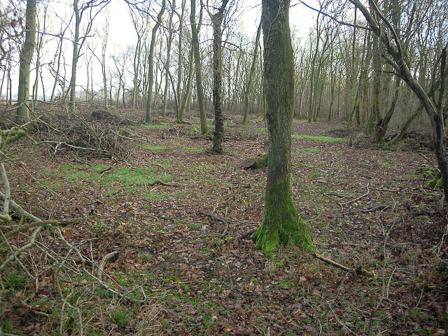
Carlton Wood

Carlton Wood is a 10.4-hectare (26-acre) biological Site of Special Scientific Interest on the eastern boundary of Cambridgeshire, and west of Great Bradley...

Lower Wood

Lower Wood is a 9 hectare nature reserve east of Weston Colville in Cambridgeshire. It is managed by the Wildlife Trust for Bedfordshire, Cambridgeshire...

Great Bradley

Great Bradley is a village and civil parish in the West Suffolk district of Suffolk in eastern England. According to Eilert Ekwall the meaning of the village...

Park Wood, Cambridgeshire

Park Wood is an 8.1-hectare (20-acre) biological Site of Special Scientific Interest east of Brinkley in Cambridgeshire.This is woodland of the wet ash/maple...

Weston Colville

Weston Colville is a village in South Cambridgeshire, 10 miles southeast of Cambridge and 6 miles south of Newmarket, close to the border with Suffolk...

Brinkley, Cambridgeshire

Brinkley is a small village in Cambridgeshire, England. It is situated about 15 miles east of Cambridge and 5 miles south of Newmarket, the horse racing...

Nearby Amenities

Located within 500m of 52.138404,0.399413
Bus Stop
Temple End
Naptan AtcoCode: 0500SCARL005
Naptan Bearing: NE
Naptan BusStopType: CUS
Naptan CommonName: Temple End
Naptan Indicator: opp
Naptan Landmark: Temple End
Naptan NaptanCode: cmbdtwmt
Naptan ShortCommonName: Temple End
Naptan Street: Carlton Green Road
Naptan Verified: no
Source: naptan_import
Lat/Long: 52.1383432/0.3980661
Bus Stop
Temple End
Naptan AtcoCode: 0500SWESC005
Naptan Bearing: SW
Naptan BusStopType: CUS
Naptan CommonName: Temple End
Naptan Indicator: near
Naptan Landmark: Common Road
Naptan NaptanCode: cmbgdamp
Naptan ShortCommonName: Temple End
Naptan Street: Carlton Green Road
Naptan Verified: no
Source: naptan_import
Lat/Long: 52.1382792/0.3981211
The data included in this document is from www.openstreetmap.org. The data is made available under ODbL.

Have you been to Carlton Green?

Leave your review of Carlton Green below (or comments, questions and feedback).