Crow Wood

Wood, Forest in Stirlingshire

Scotland

Crow Wood

Bield Farm Bield Farm at bend in road towards Gargunock from the road that runs from the A811
Bield Farm Credit: Eddie Mackinnon

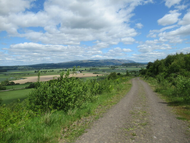
Crow Wood is a picturesque forest located in Stirlingshire, Scotland. Covering an area of approximately 150 acres, it is a natural haven renowned for its stunning beauty and rich biodiversity. The wood is situated near the village of Killearn, offering a tranquil escape from the bustling city life.

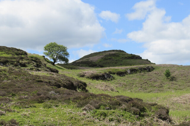
The forest boasts a diverse range of tree species, including oak, birch, beech, and pine, creating a varied and vibrant landscape. The dense canopy provides a habitat for a plethora of wildlife, making it a popular destination for nature enthusiasts and birdwatchers. Visitors may spot native bird species such as red kites, buzzards, and woodpeckers, as well as elusive creatures like red squirrels and roe deer.

Tranquil walking trails wind through Crow Wood, allowing visitors to explore its natural wonders and soak in the serene ambiance. The paths are well-maintained, making them accessible to people of all ages and abilities. Along the way, interpretive signs provide information about the various flora and fauna that call the wood home, enhancing the educational experience.

Aside from its natural splendor, Crow Wood also offers recreational activities. The forest features picnic areas where families and friends can enjoy a leisurely lunch amidst the peaceful surroundings. Additionally, there are designated spaces for outdoor games and sports, providing opportunities for active pursuits.

Crow Wood is an enchanting destination that offers a harmonious blend of nature, relaxation, and adventure. Whether one seeks solace in its tranquil beauty or wishes to engage in outdoor activities, this forest in Stirlingshire is a true gem worth exploring.

If you have any feedback on the listing, please let us know in the comments section below.

Crow Wood Images

Images are sourced within 2km of 56.124117/-4.0655591 or Grid Reference NS7194. Thanks to Geograph Open Source API. All images are credited.

Bield Farm Bield Farm at bend in road towards Gargunock from the road that runs from the A811
Bield Farm
Bield Farm at bend in road towards Gargunock from the road that runs from the A811
Approaching Gargunnock Approaching Gargunnock through the Leckie estate.
Approaching Gargunnock
Approaching Gargunnock through the Leckie estate.
Entrance to Leckie House
A811 by Dasherhead Farm
Garunnock from the A811 Garunnock is a small village at the foot of the Gargunnock Hills, part of the Campsie Fells
Garunnock from the A811
Garunnock is a small village at the foot of the Gargunnock Hills, part of the Campsie Fells
Track at Garshellach Forest A forestry track with a view across flat farmlands by the River Forth to the Wallace Monument and the Ochil Hills in the distance.
Track at Garshellach Forest
A forestry track with a view across flat farmlands by the River Forth to the Wallace Monument and the Ochil Hills in the distance.
Lone tree in the Touch Hills The Touch Hills (pronounced 'tooch', with the 'ch' as in loch), are an array of many knolls, hillocks and layered basalt lava flows. The name apparently derives from the Gaelic word 'tulach', meaning knoll or hillock, and it's not difficult to see why.
Lone tree in the Touch Hills
The Touch Hills (pronounced 'tooch', with the 'ch' as in loch), are an array of many knolls, hillocks and layered basalt lava flows. The name apparently derives from the Gaelic word 'tulach', meaning knoll or hillock, and it's not difficult to see why.
Cut line, Garshelloch Woods. The ride is the route of the Finnart - Grangemouth pipeline. Crude oil  is imported at a deep water terminal in Loch Long and transported to the refinery at Grangemouth by pipeline. The route is kept clear of trees.
Cut line, Garshelloch Woods.
The ride is the route of the Finnart - Grangemouth pipeline. Crude oil is imported at a deep water terminal in Loch Long and transported to the refinery at Grangemouth by pipeline. The route is kept clear of trees.
Touch Muir The hills above Gargunnock have a stepped appearance. This is due to the basalt flows that make up the hill, each layer laid down in a flood of molten basalt from   volcanic fissures. The process can be seen in action today in Iceland. 
The hillside is covered in bracken, an invasive weed, hard to remove and destroying a lot of the agricultural value of this fertile hillside.
Touch Muir
The hills above Gargunnock have a stepped appearance. This is due to the basalt flows that make up the hill, each layer laid down in a flood of molten basalt from volcanic fissures. The process can be seen in action today in Iceland. The hillside is covered in bracken, an invasive weed, hard to remove and destroying a lot of the agricultural value of this fertile hillside.
Doocot, Touch Muir The container was not surprising, a cheap and secure way of keeping agricultural equipment, the doos however were.
Doocot, Touch Muir
The container was not surprising, a cheap and secure way of keeping agricultural equipment, the doos however were.
Gargunnock House Gargonnock House owned & let by The Landmark Trust. 11 of us stayed here in Feb 2000
Gargunnock House
Gargonnock House owned & let by The Landmark Trust. 11 of us stayed here in Feb 2000
Gargunnock Burn Waterfall Taken whilst staying at Gargunnock House
Gargunnock Burn Waterfall
Taken whilst staying at Gargunnock House
Gargunnock Village Autumn colours
Gargunnock Village
Autumn colours
Scout Hill trig Looking N from position
Scout Hill trig
Looking N from position
Farmland near Gargunnock Looking east from the Kepdarroch driveway along the route of the old railway line. Dasherhead Farm is in the distance to the right of picture.
Farmland near Gargunnock
Looking east from the Kepdarroch driveway along the route of the old railway line. Dasherhead Farm is in the distance to the right of picture.
Gargunnock Bridge The B8075 crosses the River Forth.
Gargunnock Bridge
The B8075 crosses the River Forth.
Meiklewood House The house stands on a peninsula in the River Forth.
Meiklewood House
The house stands on a peninsula in the River Forth.
The River Forth View from where the river turns eastwards.
The River Forth
View from where the river turns eastwards.
Show me another place!

Crow Wood is located at Grid Ref: NS7194 (Lat: 56.124117, Lng: -4.0655591)

Unitary Authority: Stirling

Police Authority: Forth Valley

What 3 Words

///destiny.deodorant.owned. Near Kippen, Stirling

Related Wikis

Gargunnock railway station

Gargunnock railway station served the village of Gargunnock, Stirling, Scotland, from 1856 to 1959 on the Forth and Clyde Junction Railway. == History... ==

Stirling (UK Parliament constituency)

Stirling is a county constituency of the House of Commons of the Parliament of the United Kingdom. It elects one Member of Parliament (MP) by the first...

Gargunnock

Gargunnock is a small village in the Stirling council area with an active community trust, seven miles (eleven kilometres) west of Stirling, in Scotland...
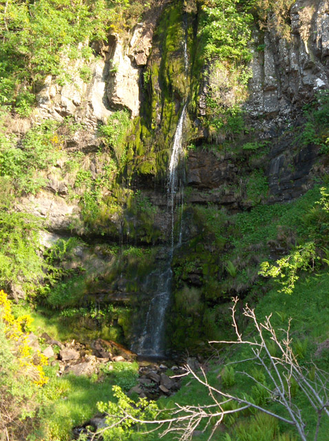
Downie's Loup

Downie's Loup is a waterfall of Scotland located near the village of Gargunnock. == See also == Waterfalls of Scotland == References ==
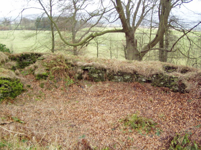
Leckie Broch

Leckie Broch is an iron-age broch located in Stirlingshire, Scotland. == Location == Just above the confluence of two streams with deep gulleys on the...

Touch House

Touch House is a country house located 4 kilometres (2.5 mi) west of Stirling in central Scotland. It stands at the foot of the Touch Hills, on the south...

Gargunnock Hills

The Gargunnock Hills are a range of hills west of the city of Stirling, Scotland. They culminate in the peak of Carleatheran, whose 485-metre (1,591 ft...

Coldoch Broch

Coldoch Broch is an Iron Age broch located in Stirlingshire in central Scotland (grid reference NS69649813). == Location == Coldoch Broch is located 4...

Nearby Amenities

Located within 500m of 56.124117,-4.0655591
Gargunnock House Gardens
Access: customers
Fee: yes
Leisure: garden
Phone: +44 1786 860392
Website: http://gargunnockgardens.co.uk/wp/
Lat/Long: 56.1256582/-4.0689753
Power: pole
Lat/Long: 56.1260526/-4.0585002
Power: pole
Lat/Long: 56.1265294/-4.0593181
Power: pole
Lat/Long: 56.1270086/-4.0601381
Power: pole
Lat/Long: 56.1271706/-4.0603974
Power: pole
Lat/Long: 56.1274703/-4.0609329
Power: pole
Lat/Long: 56.1279348/-4.0617361
Power: pole
Lat/Long: 56.1265318/-4.060092
Power: pole
Lat/Long: 56.1258847/-4.0597574
Power: pole
Lat/Long: 56.1252516/-4.0605313
Power: pole
Lat/Long: 56.1246687/-4.0612174
Power: pole
Lat/Long: 56.1280666/-4.068779
Power: pole
Lat/Long: 56.127423/-4.0686389
Power: pole
Lat/Long: 56.1267958/-4.0685301
Power: pole
Lat/Long: 56.1221913/-4.067764
Power: pole
Lat/Long: 56.1221878/-4.0692261
Power: pole
Lat/Long: 56.1221867/-4.0706862
Power: pole
Lat/Long: 56.1218532/-4.071914
The data included in this document is from www.openstreetmap.org. The data is made available under ODbL.

Have you been to Crow Wood?

Leave your review of Crow Wood below (or comments, questions and feedback).