Auchenflower Plantation

Wood, Forest in Kirkcudbrightshire

Scotland

Auchenflower Plantation

Farm entrance off A711 The entrance to the lane leading to Milton farm which stands at the edge of the military training area.
Farm entrance off A711 Credit: Gordon Hatton

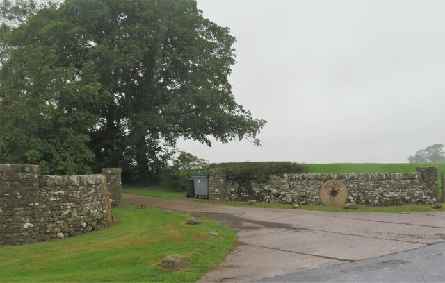
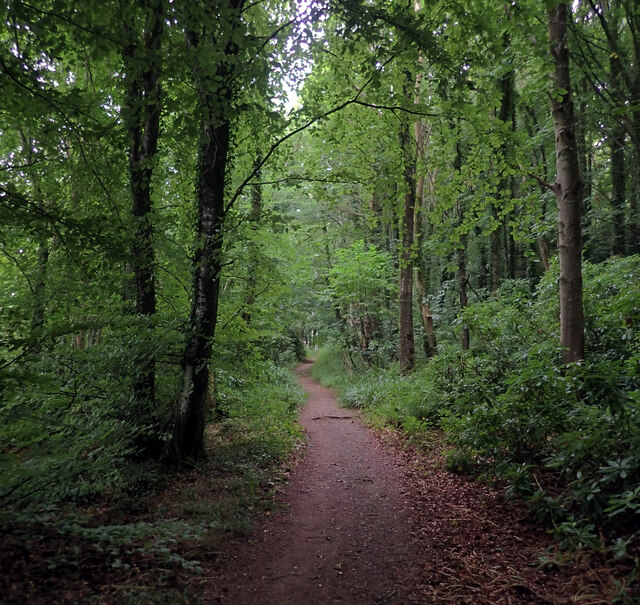
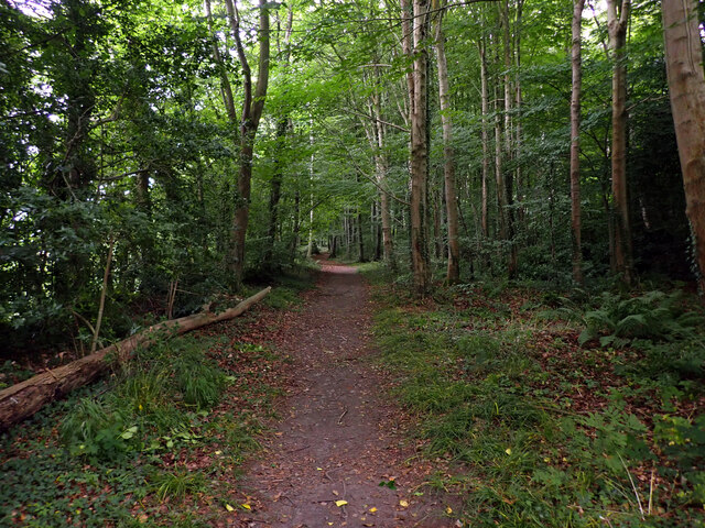
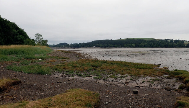
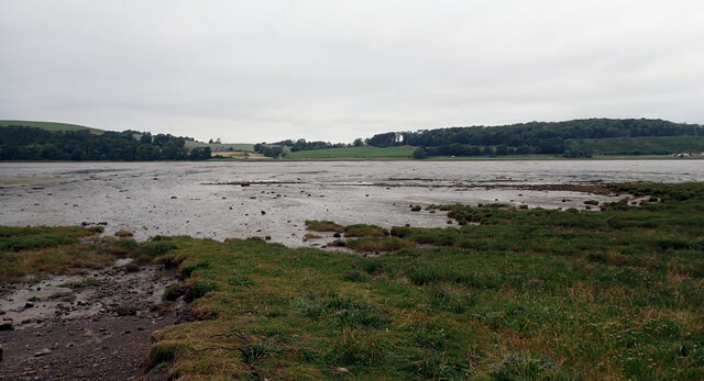
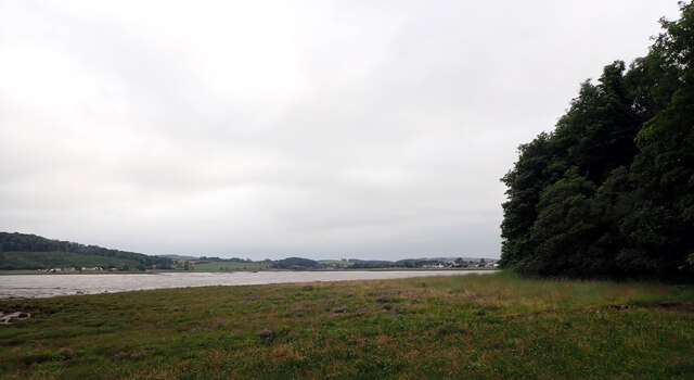
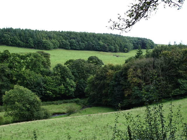
Auchenflower Plantation is a beautiful woodland located in Kirkcudbrightshire, Scotland. Situated in the southern part of the region, the plantation covers a vast area of lush greenery and ancient trees. The plantation is known for its diverse wildlife and rich ecosystem, making it a popular destination for nature enthusiasts and hikers.

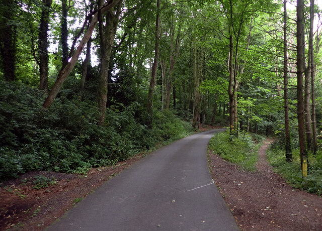
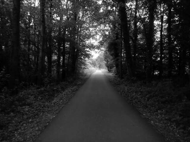
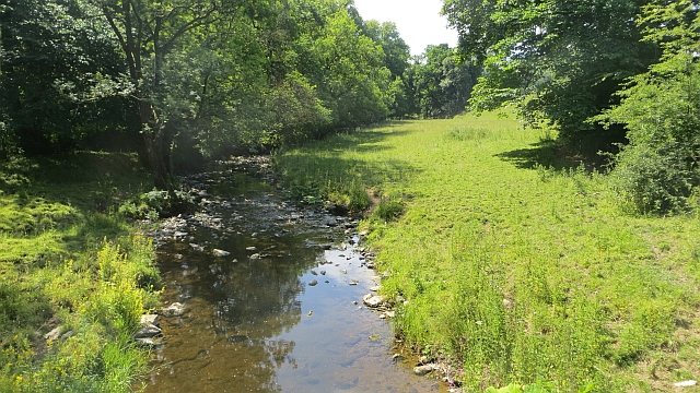
The woodlands of Auchenflower Plantation are home to a variety of tree species, including oak, ash, birch, and pine. These towering trees provide a serene and peaceful environment, perfect for long walks or picnics amidst nature. The forest floor is covered with a thick carpet of moss and ferns, creating a mystical atmosphere.

The plantation is also renowned for its diverse wildlife. Visitors have the opportunity to spot a wide range of animals, including red squirrels, roe deer, and a plethora of bird species. The plantation is a birdwatcher's paradise, with an abundance of songbirds and raptors inhabiting the area. It is not uncommon to see buzzards, owls, and woodpeckers flying through the treetops.

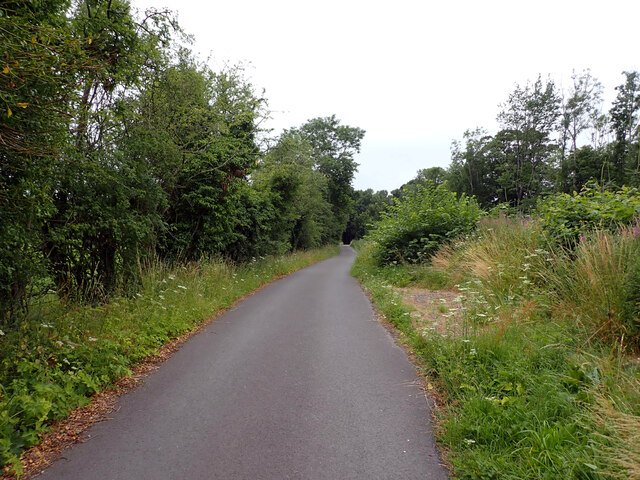
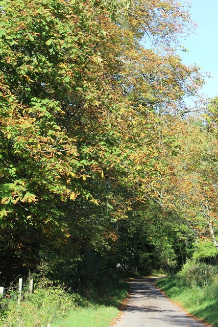
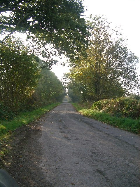
Auchenflower Plantation is easily accessible, with well-maintained paths and trails leading through the woodland. The plantation offers a range of recreational activities, such as hiking, cycling, and nature photography. There are also designated picnic areas and viewpoints, allowing visitors to fully immerse themselves in the stunning surroundings.

Overall, Auchenflower Plantation is a haven of tranquility and natural beauty. Its picturesque woodlands, diverse wildlife, and peaceful ambiance make it a must-visit destination for those seeking a serene escape into nature.

If you have any feedback on the listing, please let us know in the comments section below.

Auchenflower Plantation Images

Images are sourced within 2km of 54.819548/-4.041192 or Grid Reference NX6849. Thanks to Geograph Open Source API. All images are credited.

Farm entrance off A711 The entrance to the lane leading to Milton farm which stands at the edge of the military training area.
Farm entrance off A711
The entrance to the lane leading to Milton farm which stands at the edge of the military training area.
Woodland path, St. Mary's Isle, Kirkcudbright St Mary's Isle in a peninsula in the estuary of the River Dee to the south of Kirkcudbright. It lies between Manxman's Lake and Goat Well Bay. At low tide it is about 1.75km long and 550m wide at its widest. The tidal island of Inch lies to its south off Point of the Isle. There was an Augustinian Priory on the Isle between the 12th and 16th centuries; all traces of it were removed when the Earls of Selkirk landscaped the Isle in the 17th and 18th centuries.
Woodland path, St. Mary's Isle, Kirkcudbright
St Mary's Isle in a peninsula in the estuary of the River Dee to the south of Kirkcudbright. It lies between Manxman's Lake and Goat Well Bay. At low tide it is about 1.75km long and 550m wide at its widest. The tidal island of Inch lies to its south off Point of the Isle. There was an Augustinian Priory on the Isle between the 12th and 16th centuries; all traces of it were removed when the Earls of Selkirk landscaped the Isle in the 17th and 18th centuries.
Path, St. Mary's Isle, Kirkcudbright St Mary's Isle in a peninsula in the estuary of the River Dee to the south of Kirkcudbright. It lies between Manxman's Lake and Goat Well Bay. At low tide it is about 1.75km long and 550m wide at its widest. The tidal island of Inch lies to its south off Point of the Isle. There was an Augustinian Priory on the Isle between the 12th and 16th centuries; all traces of it were removed when the Earls of Selkirk landscaped the Isle in the 17th and 18th centuries.
Path, St. Mary's Isle, Kirkcudbright
St Mary's Isle in a peninsula in the estuary of the River Dee to the south of Kirkcudbright. It lies between Manxman's Lake and Goat Well Bay. At low tide it is about 1.75km long and 550m wide at its widest. The tidal island of Inch lies to its south off Point of the Isle. There was an Augustinian Priory on the Isle between the 12th and 16th centuries; all traces of it were removed when the Earls of Selkirk landscaped the Isle in the 17th and 18th centuries.
Woodland path, St. Mary's Isle, Kirkcudbright St Mary's Isle in a peninsula in the estuary of the River Dee to the south of Kirkcudbright. It lies between Manxman's Lake and Goat Well Bay. At low tide it is about 1.75km long and 550m wide at its widest. The tidal island of Inch lies to its south off Point of the Isle. There was an Augustinian Priory on the Isle between the 12th and 16th centuries; all traces of it were removed when the Earls of Selkirk landscaped the Isle in the 17th and 18th centuries.
Woodland path, St. Mary's Isle, Kirkcudbright
St Mary's Isle in a peninsula in the estuary of the River Dee to the south of Kirkcudbright. It lies between Manxman's Lake and Goat Well Bay. At low tide it is about 1.75km long and 550m wide at its widest. The tidal island of Inch lies to its south off Point of the Isle. There was an Augustinian Priory on the Isle between the 12th and 16th centuries; all traces of it were removed when the Earls of Selkirk landscaped the Isle in the 17th and 18th centuries.
The Dee estuary seen from St. Mary's Isle, Kirkcudbright The River Dee, in south-west Scotland, flows from Loch Dee in the Galloway Hills. It passes through Clatteringshaws Loch and Loch Ken towards to Kirkcudbright, where there is a harbour on its banks. It ends at Kirkcudbright Bay where it flows into the Solway Firth. It is approximately 61km long.
The Dee estuary seen from St. Mary's Isle, Kirkcudbright
The River Dee, in south-west Scotland, flows from Loch Dee in the Galloway Hills. It passes through Clatteringshaws Loch and Loch Ken towards to Kirkcudbright, where there is a harbour on its banks. It ends at Kirkcudbright Bay where it flows into the Solway Firth. It is approximately 61km long.
Track, St. Mary's Isle, Kirkcudbright St Mary's Isle in a peninsula in the estuary of the River Dee to the south of Kirkcudbright. It lies between Manxman's Lake and Goat Well Bay. At low tide it is about 1.75km long and 550m wide at its widest. The tidal island of Inch lies to its south off Point of the Isle. There was an Augustinian Priory on the Isle between the 12th and 16th centuries; all traces of it were removed when the Earls of Selkirk landscaped the Isle in the 17th and 18th centuries.
Track, St. Mary's Isle, Kirkcudbright
St Mary's Isle in a peninsula in the estuary of the River Dee to the south of Kirkcudbright. It lies between Manxman's Lake and Goat Well Bay. At low tide it is about 1.75km long and 550m wide at its widest. The tidal island of Inch lies to its south off Point of the Isle. There was an Augustinian Priory on the Isle between the 12th and 16th centuries; all traces of it were removed when the Earls of Selkirk landscaped the Isle in the 17th and 18th centuries.
Track, St. Mary's Isle, Kirkcudbright
Track, St. Mary's Isle, Kirkcudbright St Mary's Isle in a peninsula in the estuary of the River Dee to the south of Kirkcudbright. It lies between Manxman's Lake and Goat Well Bay. At low tide it is about 1.75km long and 550m wide at its widest. The tidal island of Inch lies to its south off Point of the Isle. There was an Augustinian Priory on the Isle between the 12th and 16th centuries; all traces of it were removed when the Earls of Selkirk landscaped the Isle in the 17th and 18th centuries.
Track, St. Mary's Isle, Kirkcudbright
St Mary's Isle in a peninsula in the estuary of the River Dee to the south of Kirkcudbright. It lies between Manxman's Lake and Goat Well Bay. At low tide it is about 1.75km long and 550m wide at its widest. The tidal island of Inch lies to its south off Point of the Isle. There was an Augustinian Priory on the Isle between the 12th and 16th centuries; all traces of it were removed when the Earls of Selkirk landscaped the Isle in the 17th and 18th centuries.
Buckland Burn Downstream from Buckland Bridge.
Buckland Burn
Downstream from Buckland Bridge.
Minor Road SW of Buckland Bridge
Buckland Bridge
Buckland Bridge
The Buckland Burn at Cannee This is a view of the burn just after the Buckland Bridge, taken from the road, just before it enters the former Orchard Banks Plantation
The Buckland Burn at Cannee
This is a view of the burn just after the Buckland Bridge, taken from the road, just before it enters the former Orchard Banks Plantation
Trees lining the road near Grange Farm, Muthill One of the few bits of this area of the countryside that wasn't flying a red flag that day - most of this peninsula (if you can call it that) is MOD training area and I didn't want to get shot as a spy/terrorist, so this is as exciting as the photos got!
Trees lining the road near Grange Farm, Muthill
One of the few bits of this area of the countryside that wasn't flying a red flag that day - most of this peninsula (if you can call it that) is MOD training area and I didn't want to get shot as a spy/terrorist, so this is as exciting as the photos got!
Mudflats towards Paul Jones Point, St Mary's Isle, Kirkcudbright taken from the shore in the Black Moray Plantation across Manxman's Lake to Paul Jones Point, St Mary's Isle, Kirkcudbright
Mudflats towards Paul Jones Point, St Mary's Isle, Kirkcudbright
taken from the shore in the Black Moray Plantation across Manxman's Lake to Paul Jones Point, St Mary's Isle, Kirkcudbright
Show me another place!

Auchenflower Plantation is located at Grid Ref: NX6849 (Lat: 54.819548, Lng: -4.041192)

Unitary Authority: Dumfries and Galloway

Police Authority: Dumfries and Galloway

What 3 Words

///daisy.widely.chat. Near Kirkcudbright, Dumfries & Galloway

Related Wikis

Kirkcudbright

Kirkcudbright ( kur-KOO-bree; Scots: Kirkcoubrie; Scottish Gaelic: Cille Chùithbeirt) is a town, parish and a Royal Burgh from 1455 in Kirkcudbrightshire...

Kirkcudbright Hospital

Kirkcudbright Hospital is a health facility in Barrhill Road, Kirkcudbright, Dumfries and Galloway, Scotland. It is managed by NHS Dumfries and Galloway...

Stewartry Museum

The Stewartry Museum is a local museum in Kirkcudbright, Scotland, which covers the history of this part of Galloway. == History == The museum was originally...

County Buildings, Kirkcudbright

County Buildings is a municipal building in Kirkcudbright, in the Dumfries and Galloway council area in Scotland. It was originally two houses on High...

Nearby Amenities

Located within 500m of 54.819548,-4.041192
Source: PGS
Lat/Long: 54.8210646/-4.0485203
Source: PGS
Lat/Long: 54.820391/-4.0486421
Source: PGS
Lat/Long: 54.8200908/-4.0485134
Source: PGS
Lat/Long: 54.8198421/-4.0486355
Power: pole
Lat/Long: 54.8228779/-4.0365352
Power: pole
Lat/Long: 54.8222525/-4.0362187
Power: pole
Lat/Long: 54.8216111/-4.0358703
Power: pole
Lat/Long: 54.8208829/-4.0354687
Power: pole
Lat/Long: 54.8200959/-4.0350502
Power: pole
Lat/Long: 54.8192182/-4.0347549
Power: pole
Lat/Long: 54.8184752/-4.034517
Power: pole
Lat/Long: 54.8181729/-4.0358299
Power: pole
Lat/Long: 54.8178375/-4.0372512
Power: pole
Lat/Long: 54.8175095/-4.0386788
Power: pole
Lat/Long: 54.8171839/-4.0401085
Power: pole
Lat/Long: 54.8166526/-4.0408776
Power: pole
Lat/Long: 54.8161177/-4.0416403
Power: pole
Lat/Long: 54.8155986/-4.0423945
The data included in this document is from www.openstreetmap.org. The data is made available under ODbL.

Have you been to Auchenflower Plantation?

Leave your review of Auchenflower Plantation below (or comments, questions and feedback).