Black Moray Plantation

Wood, Forest in Kirkcudbrightshire

Scotland

Black Moray Plantation

The A711 leaving Kirkcudbright
The A711 leaving Kirkcudbright Credit: habiloid

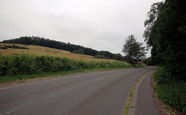
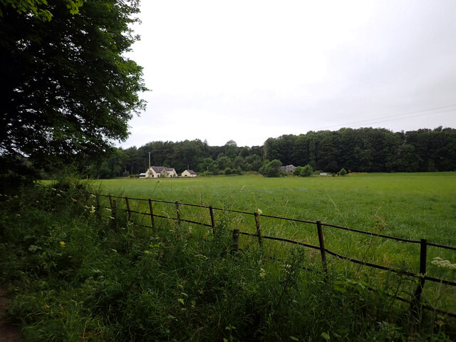
Black Moray Plantation is a sprawling woodland located in Kirkcudbrightshire, a historic county in Scotland. Covering a vast area of lush, verdant terrain, this plantation is renowned for its dense and diverse forest, making it a haven for nature enthusiasts and outdoor adventurers alike.

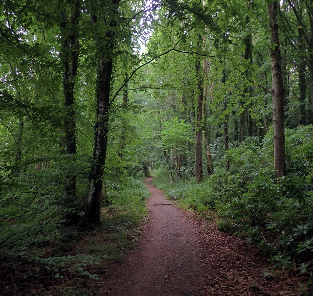
The plantation is primarily composed of black moray trees, from which it derives its name. These tall, majestic trees create a stunning canopy that provides shade and shelter for a wide array of flora and fauna. The black moray trees boast dark, glossy leaves and a straight, sturdy trunk, adding to the plantation's aesthetic appeal.

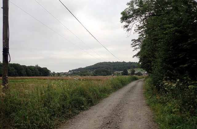
Walking through the plantation, visitors will be greeted by a rich tapestry of vegetation. The forest floor is carpeted with a variety of mosses, ferns, and wildflowers, creating a vibrant and picturesque landscape. The air is filled with the sweet scent of pine and the melodious songs of birds that call the plantation home.

Black Moray Plantation is also home to numerous animal species. Red squirrels can be spotted darting among the branches, while deer gracefully roam the woodland. Birdwatchers will be delighted by the presence of woodpeckers, owls, and various songbirds.

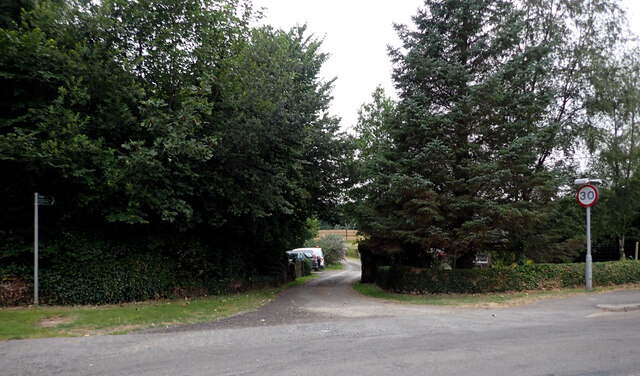
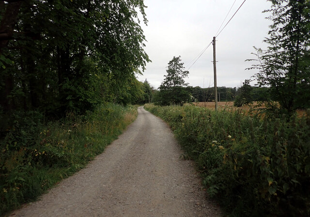
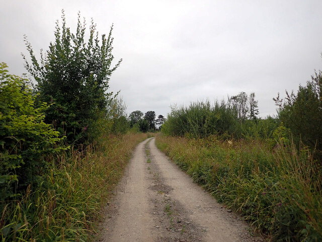
In addition to its natural beauty, the plantation offers a network of well-maintained walking trails, allowing visitors to explore its enchanting surroundings. These trails cater to different levels of difficulty, providing options for both leisurely strolls and more challenging hikes.

Overall, Black Moray Plantation is a captivating destination that showcases the breathtaking beauty of Kirkcudbrightshire's woodlands. Its diverse ecosystem, scenic trails, and abundant wildlife make it a must-visit location for nature lovers and those seeking tranquility in the heart of Scotland.

If you have any feedback on the listing, please let us know in the comments section below.

Black Moray Plantation Images

Images are sourced within 2km of 54.82366/-4.0462565 or Grid Reference NX6849. Thanks to Geograph Open Source API. All images are credited.

The A711 leaving Kirkcudbright
A track to St. Mary's Isle leaving the A711, Kirkcudbright
Track, St. Mary's Isle, Kirkcudbright St Mary's Isle in a peninsula in the estuary of the River Dee to the south of Kirkcudbright. It lies between Manxman's Lake and Goat Well Bay. At low tide it is about 1.75km long and 550m wide at its widest. The tidal island of Inch lies to its south off Point of the Isle. There was an Augustinian Priory on the Isle between the 12th and 16th centuries; all traces of it were removed when the Earls of Selkirk landscaped the Isle in the 17th and 18th centuries.
Track, St. Mary's Isle, Kirkcudbright
St Mary's Isle in a peninsula in the estuary of the River Dee to the south of Kirkcudbright. It lies between Manxman's Lake and Goat Well Bay. At low tide it is about 1.75km long and 550m wide at its widest. The tidal island of Inch lies to its south off Point of the Isle. There was an Augustinian Priory on the Isle between the 12th and 16th centuries; all traces of it were removed when the Earls of Selkirk landscaped the Isle in the 17th and 18th centuries.
Cow Green, St. Mary's Isle, Kirkcudbright St Mary's Isle in a peninsula in the estuary of the River Dee to the south of Kirkcudbright. It lies between Manxman's Lake and Goat Well Bay. At low tide it is about 1.75km long and 550m wide at its widest. The tidal island of Inch lies to its south off Point of the Isle. There was an Augustinian Priory on the Isle between the 12th and 16th centuries; all traces of it were removed when the Earls of Selkirk landscaped the Isle in the 17th and 18th centuries.
Cow Green, St. Mary's Isle, Kirkcudbright
St Mary's Isle in a peninsula in the estuary of the River Dee to the south of Kirkcudbright. It lies between Manxman's Lake and Goat Well Bay. At low tide it is about 1.75km long and 550m wide at its widest. The tidal island of Inch lies to its south off Point of the Isle. There was an Augustinian Priory on the Isle between the 12th and 16th centuries; all traces of it were removed when the Earls of Selkirk landscaped the Isle in the 17th and 18th centuries.
Track, St. Mary's Isle, Kirkcudbright St Mary's Isle in a peninsula in the estuary of the River Dee to the south of Kirkcudbright. It lies between Manxman's Lake and Goat Well Bay. At low tide it is about 1.75km long and 550m wide at its widest. The tidal island of Inch lies to its south off Point of the Isle. There was an Augustinian Priory on the Isle between the 12th and 16th centuries; all traces of it were removed when the Earls of Selkirk landscaped the Isle in the 17th and 18th centuries.
Track, St. Mary's Isle, Kirkcudbright
St Mary's Isle in a peninsula in the estuary of the River Dee to the south of Kirkcudbright. It lies between Manxman's Lake and Goat Well Bay. At low tide it is about 1.75km long and 550m wide at its widest. The tidal island of Inch lies to its south off Point of the Isle. There was an Augustinian Priory on the Isle between the 12th and 16th centuries; all traces of it were removed when the Earls of Selkirk landscaped the Isle in the 17th and 18th centuries.
Manxman's Lake seen from St. Mary's Isle, Kirkcudbright St Mary's Isle in a peninsula in the estuary of the River Dee to the south of Kirkcudbright. It lies between Manxman's Lake and Goat Well Bay. At low tide it is about 1.75km long and 550m wide at its widest. The tidal island of Inch lies to its south off Point of the Isle. There was an Augustinian Priory on the Isle between the 12th and 16th centuries; all traces of it were removed when the Earls of Selkirk landscaped the Isle in the 17th and 18th centuries.
Manxman's Lake seen from St. Mary's Isle, Kirkcudbright
St Mary's Isle in a peninsula in the estuary of the River Dee to the south of Kirkcudbright. It lies between Manxman's Lake and Goat Well Bay. At low tide it is about 1.75km long and 550m wide at its widest. The tidal island of Inch lies to its south off Point of the Isle. There was an Augustinian Priory on the Isle between the 12th and 16th centuries; all traces of it were removed when the Earls of Selkirk landscaped the Isle in the 17th and 18th centuries.
Woodland path, St. Mary's Isle, Kirkcudbright St Mary's Isle in a peninsula in the estuary of the River Dee to the south of Kirkcudbright. It lies between Manxman's Lake and Goat Well Bay. At low tide it is about 1.75km long and 550m wide at its widest. The tidal island of Inch lies to its south off Point of the Isle. There was an Augustinian Priory on the Isle between the 12th and 16th centuries; all traces of it were removed when the Earls of Selkirk landscaped the Isle in the 17th and 18th centuries.
Woodland path, St. Mary's Isle, Kirkcudbright
St Mary's Isle in a peninsula in the estuary of the River Dee to the south of Kirkcudbright. It lies between Manxman's Lake and Goat Well Bay. At low tide it is about 1.75km long and 550m wide at its widest. The tidal island of Inch lies to its south off Point of the Isle. There was an Augustinian Priory on the Isle between the 12th and 16th centuries; all traces of it were removed when the Earls of Selkirk landscaped the Isle in the 17th and 18th centuries.
Path, St. Mary's Isle, Kirkcudbright St Mary's Isle in a peninsula in the estuary of the River Dee to the south of Kirkcudbright. It lies between Manxman's Lake and Goat Well Bay. At low tide it is about 1.75km long and 550m wide at its widest. The tidal island of Inch lies to its south off Point of the Isle. There was an Augustinian Priory on the Isle between the 12th and 16th centuries; all traces of it were removed when the Earls of Selkirk landscaped the Isle in the 17th and 18th centuries.
Path, St. Mary's Isle, Kirkcudbright
St Mary's Isle in a peninsula in the estuary of the River Dee to the south of Kirkcudbright. It lies between Manxman's Lake and Goat Well Bay. At low tide it is about 1.75km long and 550m wide at its widest. The tidal island of Inch lies to its south off Point of the Isle. There was an Augustinian Priory on the Isle between the 12th and 16th centuries; all traces of it were removed when the Earls of Selkirk landscaped the Isle in the 17th and 18th centuries.
Woodland path, St. Mary's Isle, Kirkcudbright St Mary's Isle in a peninsula in the estuary of the River Dee to the south of Kirkcudbright. It lies between Manxman's Lake and Goat Well Bay. At low tide it is about 1.75km long and 550m wide at its widest. The tidal island of Inch lies to its south off Point of the Isle. There was an Augustinian Priory on the Isle between the 12th and 16th centuries; all traces of it were removed when the Earls of Selkirk landscaped the Isle in the 17th and 18th centuries.
Woodland path, St. Mary's Isle, Kirkcudbright
St Mary's Isle in a peninsula in the estuary of the River Dee to the south of Kirkcudbright. It lies between Manxman's Lake and Goat Well Bay. At low tide it is about 1.75km long and 550m wide at its widest. The tidal island of Inch lies to its south off Point of the Isle. There was an Augustinian Priory on the Isle between the 12th and 16th centuries; all traces of it were removed when the Earls of Selkirk landscaped the Isle in the 17th and 18th centuries.
Remains of a slipway into the River Dee, St. Mary's Isle, Kirkcudbright St Mary's Isle in a peninsula in the estuary of the River Dee to the south of Kirkcudbright. It lies between Manxman's Lake and Goat Well Bay. At low tide it is about 1.75km long and 550m wide at its widest. The tidal island of Inch lies to its south off Point of the Isle. There was an Augustinian Priory on the Isle between the 12th and 16th centuries; all traces of it were removed when the Earls of Selkirk landscaped the Isle in the 17th and 18th centuries.
Remains of a slipway into the River Dee, St. Mary's Isle, Kirkcudbright
St Mary's Isle in a peninsula in the estuary of the River Dee to the south of Kirkcudbright. It lies between Manxman's Lake and Goat Well Bay. At low tide it is about 1.75km long and 550m wide at its widest. The tidal island of Inch lies to its south off Point of the Isle. There was an Augustinian Priory on the Isle between the 12th and 16th centuries; all traces of it were removed when the Earls of Selkirk landscaped the Isle in the 17th and 18th centuries.
The Dee estuary seen from St. Mary's Isle, Kirkcudbright The River Dee, in south-west Scotland, flows from Loch Dee in the Galloway Hills. It passes through Clatteringshaws Loch and Loch Ken towards to Kirkcudbright, where there is a harbour on its banks. It ends at Kirkcudbright Bay where it flows into the Solway Firth. It is approximately 61km long.
The Dee estuary seen from St. Mary's Isle, Kirkcudbright
The River Dee, in south-west Scotland, flows from Loch Dee in the Galloway Hills. It passes through Clatteringshaws Loch and Loch Ken towards to Kirkcudbright, where there is a harbour on its banks. It ends at Kirkcudbright Bay where it flows into the Solway Firth. It is approximately 61km long.
Remains of a slipway into the River Dee, St. Mary's Isle, Kirkcudbright St Mary's Isle in a peninsula in the estuary of the River Dee to the south of Kirkcudbright. It lies between Manxman's Lake and Goat Well Bay. At low tide it is about 1.75km long and 550m wide at its widest. The tidal island of Inch lies to its south off Point of the Isle. There was an Augustinian Priory on the Isle between the 12th and 16th centuries; all traces of it were removed when the Earls of Selkirk landscaped the Isle in the 17th and 18th centuries.
Remains of a slipway into the River Dee, St. Mary's Isle, Kirkcudbright
St Mary's Isle in a peninsula in the estuary of the River Dee to the south of Kirkcudbright. It lies between Manxman's Lake and Goat Well Bay. At low tide it is about 1.75km long and 550m wide at its widest. The tidal island of Inch lies to its south off Point of the Isle. There was an Augustinian Priory on the Isle between the 12th and 16th centuries; all traces of it were removed when the Earls of Selkirk landscaped the Isle in the 17th and 18th centuries.
Steps from the remains of a slipway into the River Dee, St. Mary's Isle, Kirkcudbright St Mary's Isle in a peninsula in the estuary of the River Dee to the south of Kirkcudbright. It lies between Manxman's Lake and Goat Well Bay. At low tide it is about 1.75km long and 550m wide at its widest. The tidal island of Inch lies to its south off Point of the Isle. There was an Augustinian Priory on the Isle between the 12th and 16th centuries; all traces of it were removed when the Earls of Selkirk landscaped the Isle in the 17th and 18th centuries.
Steps from the remains of a slipway into the River Dee, St. Mary's Isle, Kirkcudbright
St Mary's Isle in a peninsula in the estuary of the River Dee to the south of Kirkcudbright. It lies between Manxman's Lake and Goat Well Bay. At low tide it is about 1.75km long and 550m wide at its widest. The tidal island of Inch lies to its south off Point of the Isle. There was an Augustinian Priory on the Isle between the 12th and 16th centuries; all traces of it were removed when the Earls of Selkirk landscaped the Isle in the 17th and 18th centuries.
Woodland path, St. Mary's Isle, Kirkcudbright St Mary's Isle in a peninsula in the estuary of the River Dee to the south of Kirkcudbright. It lies between Manxman's Lake and Goat Well Bay. At low tide it is about 1.75km long and 550m wide at its widest. The tidal island of Inch lies to its south off Point of the Isle. There was an Augustinian Priory on the Isle between the 12th and 16th centuries; all traces of it were removed when the Earls of Selkirk landscaped the Isle in the 17th and 18th centuries.
Woodland path, St. Mary's Isle, Kirkcudbright
St Mary's Isle in a peninsula in the estuary of the River Dee to the south of Kirkcudbright. It lies between Manxman's Lake and Goat Well Bay. At low tide it is about 1.75km long and 550m wide at its widest. The tidal island of Inch lies to its south off Point of the Isle. There was an Augustinian Priory on the Isle between the 12th and 16th centuries; all traces of it were removed when the Earls of Selkirk landscaped the Isle in the 17th and 18th centuries.
Show me another place!

Black Moray Plantation is located at Grid Ref: NX6849 (Lat: 54.82366, Lng: -4.0462565)

Unitary Authority: Dumfries and Galloway

Police Authority: Dumfries and Galloway

What 3 Words

///dorms.foster.became. Near Kirkcudbright, Dumfries & Galloway

Related Wikis

Kirkcudbright

Kirkcudbright ( kur-KOO-bree; Scots: Kirkcoubrie; Scottish Gaelic: Cille Chùithbeirt) is a town, parish and a Royal Burgh from 1455 in Kirkcudbrightshire...

Kirkcudbright Hospital

Kirkcudbright Hospital is a health facility in Barrhill Road, Kirkcudbright, Dumfries and Galloway, Scotland. It is managed by NHS Dumfries and Galloway...

Stewartry Museum

The Stewartry Museum is a local museum in Kirkcudbright, Scotland, which covers the history of this part of Galloway. == History == The museum was originally...

County Buildings, Kirkcudbright

County Buildings is a municipal building in Kirkcudbright, in the Dumfries and Galloway council area in Scotland. It was originally two houses on High...

St Cuthbert Wanderers F.C.

Saint Cuthbert Wanderers Football Club are a football club from the town of Kirkcudbright in the Stewartry in Galloway, Scotland. They play in the South...

Kirkcudbright Town Hall

Kirkcudbright Town Hall is a municipal building in St Mary's Street, Kirkcudbright, Scotland. The building, which was the headquarters of Kirkcudbright...

Kirkcudbright Tolbooth

Kirkcudbright Tolbooth is a historic municipal building in Kirkcudbright in Dumfries and Galloway, Scotland. Built between 1627 and 1629 to serve the town...

Kirkcudbright Academy

Kirkcudbright Academy is a state funded, six-year secondary school in Kirkcudbright, Scotland with about 400 pupils and 87 staff including teaching, support...

Nearby Amenities

Located within 500m of 54.82366,-4.0462565
Source: PGS
Lat/Long: 54.8246688/-4.0538131
Source: PGS
Lat/Long: 54.8245732/-4.0535871
Source: PGS
Lat/Long: 54.8244298/-4.0536047
Source: PGS
Lat/Long: 54.8241649/-4.0530969
Source: PGS
Lat/Long: 54.8241841/-4.0520459
Source: PGS
Lat/Long: 54.823886/-4.0517327
Source: PGS
Lat/Long: 54.8231397/-4.0515003
Source: PGS
Lat/Long: 54.8230557/-4.0512227
Source: PGS
Lat/Long: 54.8225979/-4.0510999
Source: PGS
Lat/Long: 54.8223753/-4.0510666
Source: PGS
Lat/Long: 54.822178/-4.0506111
Source: PGS
Lat/Long: 54.8220359/-4.0499878
Source: PGS
Lat/Long: 54.8216187/-4.0489616
Source: PGS
Lat/Long: 54.821213/-4.0488672
Source: PGS
Lat/Long: 54.8210646/-4.0485203
Source: PGS
Lat/Long: 54.820391/-4.0486421
Source: PGS
Lat/Long: 54.8200908/-4.0485134
Source: PGS
Lat/Long: 54.8198421/-4.0486355
Source: PGS
Lat/Long: 54.8195821/-4.0490651
The data included in this document is from www.openstreetmap.org. The data is made available under ODbL.

Have you been to Black Moray Plantation?

Leave your review of Black Moray Plantation below (or comments, questions and feedback).