Castlehill Plantation

Wood, Forest in Kirkcudbrightshire

Scotland

Castlehill Plantation

Wooden sign, Kirkcudbright Training Area
Wooden sign, Kirkcudbright Training Area Credit: Steven Brown

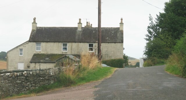
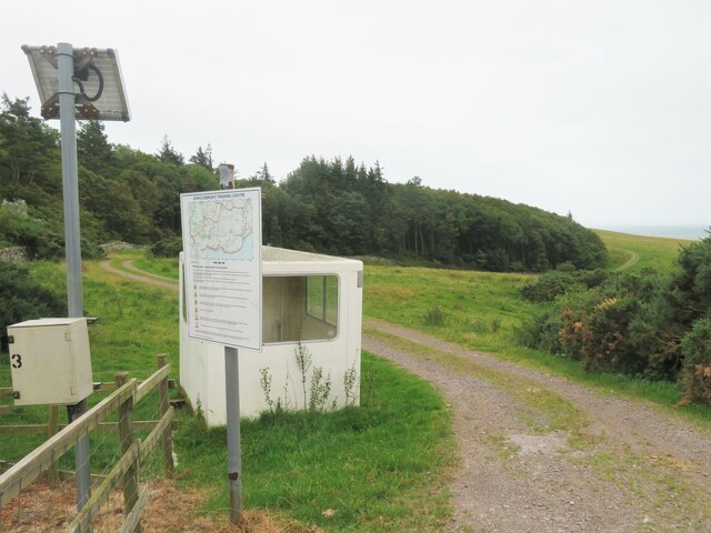
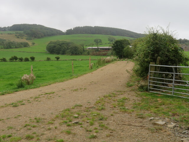
Castlehill Plantation is a sprawling woodland located in Kirkcudbrightshire, Scotland. Covering an area of approximately 1,500 acres, the plantation is a diverse mix of mature trees, including oak, beech, and pine, as well as younger saplings and shrubs. The woodland is well-maintained, with clear paths and trails for visitors to explore and enjoy the natural beauty of the area.

The plantation is home to a variety of wildlife, including deer, squirrels, and a wide range of bird species. Birdwatchers will delight in the opportunity to spot rare and native birds in their natural habitat. The tranquil setting of Castlehill Plantation makes it a popular destination for nature lovers, hikers, and photographers looking to capture the stunning scenery.

Visitors to Castlehill Plantation can also learn about the history of the area, as the woodland has a rich past dating back centuries. The plantation has been carefully managed over the years, with efforts to preserve and protect the natural environment for future generations to enjoy. Whether looking for a peaceful retreat or an outdoor adventure, Castlehill Plantation offers something for everyone to appreciate and explore.

If you have any feedback on the listing, please let us know in the comments section below.

Castlehill Plantation Images

Images are sourced within 2km of 54.788924/-4.0433658 or Grid Reference NX6845. Thanks to Geograph Open Source API. All images are credited.
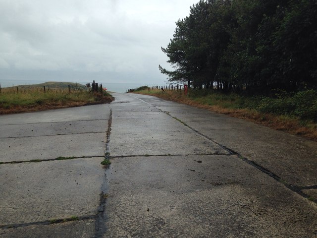
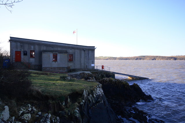
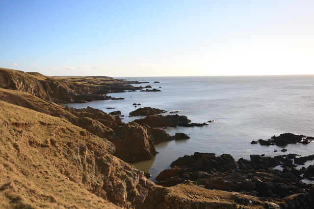
Wooden sign, Kirkcudbright Training Area
Lane towards Mutehill This country lane flirts with this grid square, being inside it for some 200m here and for a similar length at the NW corner of the grid square.
Lane towards Mutehill
This country lane flirts with this grid square, being inside it for some 200m here and for a similar length at the NW corner of the grid square.
House at Dromore farm According to the signs on the map, the buildings here are just within the danger zone of the military training area. Fortunately all was quiet and there was no danger from flying shrapnel.
House at Dromore farm
According to the signs on the map, the buildings here are just within the danger zone of the military training area. Fortunately all was quiet and there was no danger from flying shrapnel.
Military training area, access point No red flag and no sentry on duty at the little hut, so one could venture into the danger area.
Military training area, access point
No red flag and no sentry on duty at the little hut, so one could venture into the danger area.
Edge of the danger area A short stroll down the track from the road [no red flag flying] and one could photograph the track that leads towards the coast near Torrs Point.
Edge of the danger area
A short stroll down the track from the road [no red flag flying] and one could photograph the track that leads towards the coast near Torrs Point.
Farmland near Torrs Green pastures between the coast and Castle Hill.
Farmland near Torrs
Green pastures between the coast and Castle Hill.
Hard standing, Kirkcudbright Training Area
Concreted surface at Kirkcudbright Training Area
Townhead Telephone Exchange The lane from Townhead to Ringliggate junction (A711) passes the Townhead telephone exchange. The MOD Kirkcudbright Training Range boundary runs along the southern stone dyke – with the exchange apparently breaching that boundary.
Townhead Telephone Exchange
The lane from Townhead to Ringliggate junction (A711) passes the Townhead telephone exchange. The MOD Kirkcudbright Training Range boundary runs along the southern stone dyke – with the exchange apparently breaching that boundary.
Little Gregory lane This section of the lane between Townhead and Ringliggate Junction (A711) runs through the MOD Kirkcudbright Training Range and is subject to closure. A large area is permanently closed to the public, including this lane that led off the Townhead lane southward to the Little Gregory area.
Little Gregory lane
This section of the lane between Townhead and Ringliggate Junction (A711) runs through the MOD Kirkcudbright Training Range and is subject to closure. A large area is permanently closed to the public, including this lane that led off the Townhead lane southward to the Little Gregory area.
Townhead telephone exchange. Still in use using microwave technology.The entry beside it leads to the Dunrod Graveyard
Townhead telephone exchange.
Still in use using microwave technology.The entry beside it leads to the Dunrod Graveyard
Gregory Lane ,Townhead An interesting comparison with a previous geograph of the same view
Gregory Lane ,Townhead
An interesting comparison with a previous geograph of the same view
Grazing land near to Townhead Good grazing land close to Townhead Farm.
Grazing land near to Townhead
Good grazing land close to Townhead Farm.
Minor road near to Townhead The old telephone exchange can be seen in this photograph.
Minor road near to Townhead
The old telephone exchange can be seen in this photograph.
Trees lining the road near Grange Farm, Muthill One of the few bits of this area of the countryside that wasn't flying a red flag that day - most of this peninsula (if you can call it that) is MOD training area and I didn't want to get shot as a spy/terrorist, so this is as exciting as the photos got!
Trees lining the road near Grange Farm, Muthill
One of the few bits of this area of the countryside that wasn't flying a red flag that day - most of this peninsula (if you can call it that) is MOD training area and I didn't want to get shot as a spy/terrorist, so this is as exciting as the photos got!
Long Robin, Dee Estuary Rocky foreshore at Long Robin on the River Dee Estuary, looking NNW towards St Mary's Isle and Kirkcudbright.
Long Robin, Dee Estuary
Rocky foreshore at Long Robin on the River Dee Estuary, looking NNW towards St Mary's Isle and Kirkcudbright.
Kirkcudbright Lifeboat Station Looking SW across the Dee Estuary.
Kirkcudbright Lifeboat Station
Looking SW across the Dee Estuary.
Coastline at Balmae Ha'en The view over the Solway Firth, southwest of Torrs Point on the coastal path.
Coastline at Balmae Ha'en
The view over the Solway Firth, southwest of Torrs Point on the coastal path.
Show me another place!

Castlehill Plantation is located at Grid Ref: NX6845 (Lat: 54.788924, Lng: -4.0433658)

Unitary Authority: Dumfries and Galloway

Police Authority: Dumfries and Galloway

What 3 Words

///afraid.chapels.shears. Near Kirkcudbright, Dumfries & Galloway

Related Wikis

River Dee, Galloway

The River Dee (Scottish Gaelic: Dè / Uisge Dhè), in south-west Scotland, flows from its source in Loch Dee amongst the Galloway Hills, firstly to Clatteringshaws...

Kirkcudbright Bay

Kirkcudbright Bay is an inlet of the Irish Sea on the coast of Galloway in southwest Scotland. Its coastline falls entirely within the modern administrative...

Dundrennan Range

Dundrennan Range is a weapons testing range on the Solway Firth, near Kirkcudbright in Dumfries and Galloway, in south west Scotland, it is part of the...

Little Ross

Little Ross is a 29-acre (12-hectare) island with a lighthouse on the Solway Coast south of the town of Kirkcudbright in Galloway, Scotland. It is next...

Nearby Amenities

Located within 500m of 54.788924,-4.0433658
Aeroway: helipad
Lat/Long: 54.7873509/-4.0371731
Man Made: mast
Lat/Long: 54.7875113/-4.0365403
Power: pole
Lat/Long: 54.7913835/-4.0493987
Power: pole
Lat/Long: 54.7900748/-4.0484772
Power: pole
Lat/Long: 54.7902206/-4.0464918
Power: pole
Lat/Long: 54.7903423/-4.0451189
Power: pole
Lat/Long: 54.7901356/-4.0438166
Power: pole
Lat/Long: 54.789917/-4.0424685
Power: pole
Lat/Long: 54.7897105/-4.0411888
Power: pole
Lat/Long: 54.7895253/-4.0400723
Power: pole
Lat/Long: 54.7892429/-4.038166
Power: pole
Lat/Long: 54.789037/-4.0367215
Power: pole
Lat/Long: 54.7895323/-4.0359861
Power: pole
Lat/Long: 54.7899813/-4.0496309
The data included in this document is from www.openstreetmap.org. The data is made available under ODbL.

Have you been to Castlehill Plantation?

Leave your review of Castlehill Plantation below (or comments, questions and feedback).