Tilework Plantation

Wood, Forest in Ayrshire

Scotland

Tilework Plantation

A70 passing through Muirkirk The picture looks along Muirkirk Main Street which is also the A70. Temporary road signs warn that the road further east is currently closed: <span class="nowrap"><a title="https://www.southlanarkshire.gov.uk/view/news/article/1046/Plan_ahead_for_A70_roadworks_closure" rel="nofollow ugc noopener" href="https://www.southlanarkshire.gov.uk/view/news/article/1046/Plan_ahead_for_A70_roadworks_closure">Link</a><img style="margin-left:2px;" alt="External link" title="External link - shift click to open in new window" src="https://s1.geograph.org.uk/img/external.png" width="10" height="10"/></span> Fortunately my journey went west.
A70 passing through Muirkirk Credit: Alec MacKinnon

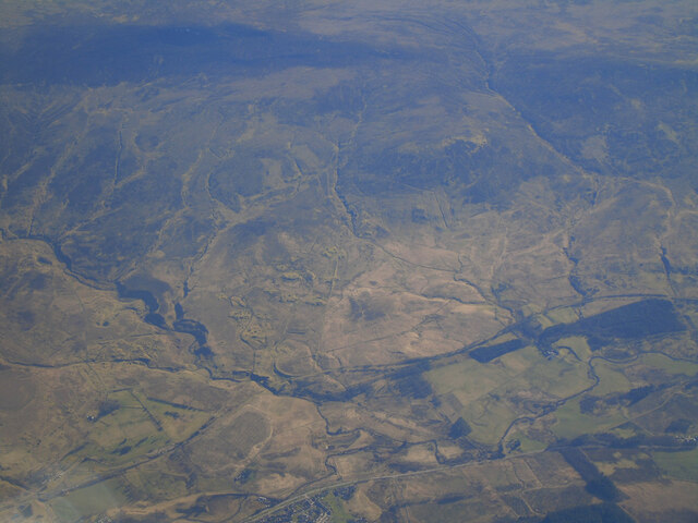
Tilework Plantation is a picturesque woodland located in Ayrshire, Scotland. Covering an area of approximately 50 acres, it is a well-known destination for nature lovers and outdoor enthusiasts. The plantation is characterized by its dense and diverse collection of trees, making it a vital habitat for a variety of wildlife species.

The dominant tree species found in Tilework Plantation include oak, birch, beech, and pine. These trees create a lush canopy, providing a sheltered and tranquil environment for both flora and fauna. The forest floor is adorned with a carpet of ferns, mosses, and wildflowers, adding to the plantation's natural beauty.

The plantation's name, Tilework, is believed to be derived from its historical association with the local tile-making industry. In the past, clay was extracted from nearby quarries to produce tiles, and the plantation provided a convenient source of fuel for the kilns. While the tile-making industry is no longer active, remnants of the past can still be seen in the form of old kilns and abandoned quarry sites.

The plantation offers a network of well-maintained trails, allowing visitors to explore its enchanting surroundings. These trails cater to different levels of difficulty, providing options for leisurely strolls or more challenging hikes. Along the way, visitors may encounter various wildlife species such as roe deer, foxes, and a wide range of birdlife, making it a popular spot for birdwatching enthusiasts.

Tilework Plantation is not only a haven for nature enthusiasts but also a valuable asset for the local community, providing opportunities for recreational activities and promoting the appreciation of Scotland's natural heritage.

If you have any feedback on the listing, please let us know in the comments section below.

Tilework Plantation Images

Images are sourced within 2km of 55.508861/-4.0883042 or Grid Reference NS6825. Thanks to Geograph Open Source API. All images are credited.

A70 passing through Muirkirk The picture looks along Muirkirk Main Street which is also the A70. Temporary road signs warn that the road further east is currently closed: <span class="nowrap"><a title="https://www.southlanarkshire.gov.uk/view/news/article/1046/Plan_ahead_for_A70_roadworks_closure" rel="nofollow ugc noopener" href="https://www.southlanarkshire.gov.uk/view/news/article/1046/Plan_ahead_for_A70_roadworks_closure">Link</a><img style="margin-left:2px;" alt="External link" title="External link - shift click to open in new window" src="https://s1.geograph.org.uk/img/external.png" width="10" height="10"/></span> Fortunately my journey went west.
A70 passing through Muirkirk
The picture looks along Muirkirk Main Street which is also the A70. Temporary road signs warn that the road further east is currently closed: LinkExternal link Fortunately my journey went west.
Main Street car park, Muirkirk The car park sits at the west end of the row of businesses on Main Street. Cairn Table is on the horizon behind.
Main Street car park, Muirkirk
The car park sits at the west end of the row of businesses on Main Street. Cairn Table is on the horizon behind.
The River Ayr at Muirkirk from the air Muirkirk just makes an appearance at the bottom of the photo. The route of the GSWR Muirkirk Branch railway line can be seen running diagonally up from the lower left corner.
The River Ayr at Muirkirk from the air
Muirkirk just makes an appearance at the bottom of the photo. The route of the GSWR Muirkirk Branch railway line can be seen running diagonally up from the lower left corner.
Whisky Knowe Whisky Knowe on the Old Sanquhar Road.
This photo was taken on the 10th August 2022.
Whisky Knowe
Whisky Knowe on the Old Sanquhar Road. This photo was taken on the 10th August 2022.
Kames Institute Benchmark on the Kames Institute building.
Kames Institute
Benchmark on the Kames Institute building.
Wellwood House Wellwood House once stood where the piles of debris lie, on the
far side of the ruined bridge over the Water Ayr.
Wellwood House
Wellwood House once stood where the piles of debris lie, on the far side of the ruined bridge over the Water Ayr.
Ruins at Knowehead The water in this old byne at Knowehead was frozen solid.
Knowehead was once a shepherd's place, then a sheepfold.
Ruins at Knowehead
The water in this old byne at Knowehead was frozen solid. Knowehead was once a shepherd's place, then a sheepfold.
Parking for Cairn Table Situated in the hamlet of Kames this is the main car park for Cairn Table as well as other walks in the area.
Parking for Cairn Table
Situated in the hamlet of Kames this is the main car park for Cairn Table as well as other walks in the area.
Kames Motorsport Complex, Muirkirk
The old  Muirkirk to Sanquhar drove road Muirkirk just showing in the distance on this frosty morning.
The old Muirkirk to Sanquhar drove road
Muirkirk just showing in the distance on this frosty morning.
The Garpel Water by the old  Sanquhar drove road
The Garpel Water by the old Sanquhar drove road
Kames Car Park Car park at the start of the walk to Cairn Table and other walks in the Muirkirk area.
Kames Car Park
Car park at the start of the walk to Cairn Table and other walks in the Muirkirk area.
Garpel Water Flowing through a well-defined moorland valley at this point.
Garpel Water
Flowing through a well-defined moorland valley at this point.
Macadam Cairn The plaque on the cairn reads: In memory of John Loudon Macadam the famous roadmaker 1756-1836. This cairn marks the site of HIS tar kilns 1786-1827 and is built with stones from them in 1931.
Macadam Cairn
The plaque on the cairn reads: In memory of John Loudon Macadam the famous roadmaker 1756-1836. This cairn marks the site of HIS tar kilns 1786-1827 and is built with stones from them in 1931.
The Site of Springhill House (Stopping Point 12 on the River Ayr Way) This was the first of several country houses built during the height of Muirkirk's industrial prosperity to accommodate the town's various ironmasters and pit managers.
The Site of Springhill House (Stopping Point 12 on the River Ayr Way)
This was the first of several country houses built during the height of Muirkirk's industrial prosperity to accommodate the town's various ironmasters and pit managers.
Memorial to miners at Muirkirk
Kames Institute near Muirkirk
On the River Ayr Way, southwest of Kames
Show me another place!

Tilework Plantation is located at Grid Ref: NS6825 (Lat: 55.508861, Lng: -4.0883042)

Unitary Authority: East Ayrshire

Police Authority: Ayrshire

What 3 Words

///maker.emotional.blessing. Near Muirkirk, East Ayrshire

Nearby Locations

Tilework Plantation

Related Wikis

Garpel Water

The Garpel Water is a river near Muirkirk, Scotland. It flows under the Sanquhar bridge and Tibbie's Brig. It flows into the River Ayr.

Muirkirk railway station

Muirkirk railway station was a railway station serving the village of Muirkirk, East Ayrshire, Scotland. == First station == The station opened on 9 August...
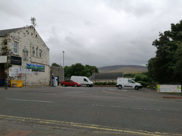
Muirkirk

Muirkirk (Scottish Gaelic: Eaglais an t-Slèibh) is a small village in East Ayrshire, southwest Scotland. It is located on the north bank of the River Ayr...

Greenock Water

Greenock Water is a river in East Ayrshire, Scotland. It flows out of the Dippal Burn, about 2 miles south of Dungavel Hill. A tributary of the River Ayr...

Nearby Amenities

Located within 500m of 55.508861,-4.0883042
Wellwood Pit
Historic: mine
Mineral: coal
Lat/Long: 55.5064366/-4.0818342
Power: pole
Lat/Long: 55.5099571/-4.0915434
Power: pole
Lat/Long: 55.5096676/-4.0927604
Power: pole
Lat/Long: 55.5092705/-4.0943732
Power: pole
Lat/Long: 55.508876/-4.0959702
Power: pole
Lat/Long: 55.5102443/-4.0903111
Power: pole
Lat/Long: 55.5106833/-4.0896841
Power: pole
Lat/Long: 55.51109/-4.0890518
Power: pole
Lat/Long: 55.5116978/-4.0881041
Power: pole
Lat/Long: 55.5123452/-4.0871269
Power: pole
Lat/Long: 55.5130644/-4.0860547
The data included in this document is from www.openstreetmap.org. The data is made available under ODbL.

Have you been to Tilework Plantation?

Leave your review of Tilework Plantation below (or comments, questions and feedback).