Bargatton Wood
Wood, Forest in Kirkcudbrightshire
Scotland
Bargatton Wood
![Bellymack Fields A large modern [post-2010] house on the B795 just east of Laurieston.](https://s3.geograph.org.uk/geophotos/07/03/04/7030495_5afb0445.jpg)
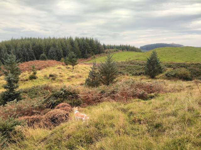
Bargatton Wood is a beautiful forest located in the historic county of Kirkcudbrightshire in southwestern Scotland. Covering an area of approximately 200 acres, the wood is situated on the outskirts of the town of Kirkcudbright, making it easily accessible to both locals and visitors.
The wood features a diverse range of tree species, including oak, beech, and ash, creating a lush and vibrant environment. The dense canopy provides a haven for numerous bird species, such as woodpeckers and owls, making it a popular spot for birdwatching enthusiasts.
Traversing through Bargatton Wood, visitors can enjoy a network of well-maintained footpaths that wind their way through the woodland. These paths offer a tranquil and peaceful setting for leisurely walks and hikes, allowing visitors to immerse themselves in the natural beauty of the area.
In addition to its natural splendor, Bargatton Wood also holds historical significance. The wood was once part of the Bargatton Estate, which dates back to the 17th century. Remnants of the estate's past, including old stone walls and ruins, can still be seen scattered throughout the woodland, adding an element of intrigue to the setting.
Overall, Bargatton Wood is a picturesque and enchanting forest that showcases the diverse flora and fauna of the Kirkcudbrightshire region. Its combination of natural beauty and historical charm make it a must-visit destination for nature lovers and history enthusiasts alike.
If you have any feedback on the listing, please let us know in the comments section below.
Bargatton Wood Images
Images are sourced within 2km of 54.947021/-4.060266 or Grid Reference NX6863. Thanks to Geograph Open Source API. All images are credited.


![Mum and Kid at red kite feeding station Red kites were once common scavengers around our cities, feeding on scraps and carrion. They were, however, persecuted in the 19C, wrongly thought to take lambs and game. By 1880 only a dozen or so remained in the UK, in valleys in mid-Wales. In 1989 a reintroduction programme was launched and 104 red kites were released in Galloway between 2001 and 2005. They are now well established and have bred since 2003 with increasing success, with 18 young fledging in 2003 to 104 in 2011, and from 4 to 58 nesting pairs over the same period. There are now about 320 in the area. They are encouraged by a feeding station near Laurieston at Bellymack Hill Farm, and large numbers can be seen and heard calling every day as they gather in the trees and wheel about making their whistling calls, waiting for the daily feed at 2pm [road kill and chicken]. For more information see the Galloway Kite Trail and RSPB links – <span class="nowrap"><a title="www.gallowaykitetrail.com" rel="nofollow ugc noopener" href="http://www.gallowaykitetrail.com">Link</a><img style="margin-left:2px;" alt="External link" title="External link - shift click to open in new window" src="https://s1.geograph.org.uk/img/external.png" width="10" height="10"/></span> and <span class="nowrap"><a title="www.rspb.org.uk/scotland" rel="nofollow ugc noopener" href="http://www.rspb.org.uk/scotland">Link</a><img style="margin-left:2px;" alt="External link" title="External link - shift click to open in new window" src="https://s1.geograph.org.uk/img/external.png" width="10" height="10"/></span>](https://s0.geograph.org.uk/geophotos/07/62/81/7628164_92a0e1e3.jpg)


Bargatton Wood is located at Grid Ref: NX6863 (Lat: 54.947021, Lng: -4.060266)
Unitary Authority: Dumfries and Galloway
Police Authority: Dumfries and Galloway
What 3 Words
///spoon.firmly.swordfish. Near Castle Douglas, Dumfries & Galloway
Nearby Locations
Related Wikis

Balmaghie
Balmaghie ( bal-mə-GEE), from the Scottish Gaelic Baile Mhic Aoidh, is an ecclesiastical and civil parish in the historical county of Kirkcudbrightshire...

Glenlochar
Glenlochar (Gd: Gleann Lochair) is a hamlet on the western bank of the River Dee in the parish of Balmaghie in the historical county of Kirkcudbrightshire...

Abbey Yard
Abbey Yard is a location in Dumfries and Galloway, Scotland. Abbey Yard is near Glenlochar in the historical county of Kirkcudbrightshire in the Dumfries...
Ringford
Ringford is a village in the historical county of Kirkcudbrightshire in Dumfries and Galloway located at grid reference NX689578 beside the Tarff Water...

Threave Castle
Threave Castle is situated on an island in the River Dee, 2.5 kilometres (1.6 mi) west of Castle Douglas in the historical county of Kirkcudbrightshire...

Bridge of Dee railway station
Bridge of Dee railway station served the settlement of Bridge of Dee, Dumfries and Galloway, Scotland from 1864 to 1949 on the Kirkcudbright Railway....

Crossmichael railway station
Crossmichael railway station served the village of Crossmichael, Kirkcudbrightshire, Scotland, from 1861 to 1965 on the Portpatrick and Wigtownshire Joint...

Crossmichael Parish Church
Crossmichael Parish Church is an ecclesiastical building in Crossmichael, Dumfries and Galloway, Scotland. It lies on a knoll, which was probably an ancient...
Nearby Amenities
Located within 500m of 54.947021,-4.060266Have you been to Bargatton Wood?
Leave your review of Bargatton Wood below (or comments, questions and feedback).