Ardtrostan Wood

Wood, Forest in Perthshire
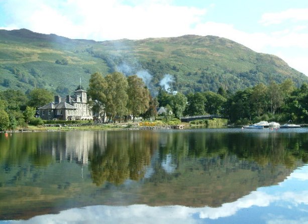
Scotland

Ardtrostan Wood

Glentarken Burn View from bridge on A85.
Glentarken Burn Credit: Sandy Gerrard

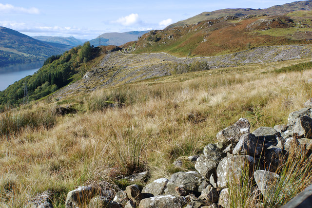
Ardtrostan Wood is a picturesque forest located in Perthshire, Scotland. Covering an area of approximately 100 hectares, this woodland is a haven for nature enthusiasts and outdoor adventurers alike. The wood is situated near the town of Crieff and offers a variety of attractions and activities for visitors to enjoy.

The woodland is predominantly composed of native tree species, such as oak, birch, and Scots pine, providing a diverse habitat for numerous plant and animal species. The dense canopy of trees creates a serene and peaceful atmosphere, making it an ideal place for leisurely walks and picnics.

A network of well-maintained trails winds through the wood, allowing visitors to explore the area at their own pace. These paths range in difficulty, catering to both casual strollers and more seasoned hikers. Along the way, visitors can enjoy breathtaking views of the surrounding countryside and may even spot red squirrels, roe deer, and a variety of bird species.

For those seeking more adventure, Ardtrostan Wood offers opportunities for mountain biking and horse riding. There are dedicated trails and tracks for these activities, ensuring a safe and enjoyable experience for all participants.

In addition to its natural beauty, the wood also has historical significance. Within its boundaries, there are remnants of ancient settlements and iron age forts, providing a glimpse into the area's past.

Overall, Ardtrostan Wood is a hidden gem in Perthshire, offering a rich blend of natural beauty, recreational activities, and historical interest. Whether exploring the trails, observing wildlife, or simply enjoying the tranquility, visitors are sure to find something to captivate them in this enchanting woodland.

If you have any feedback on the listing, please let us know in the comments section below.

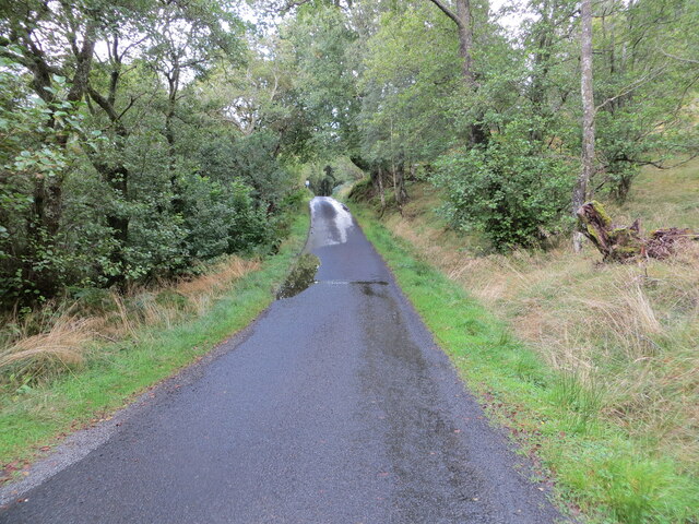
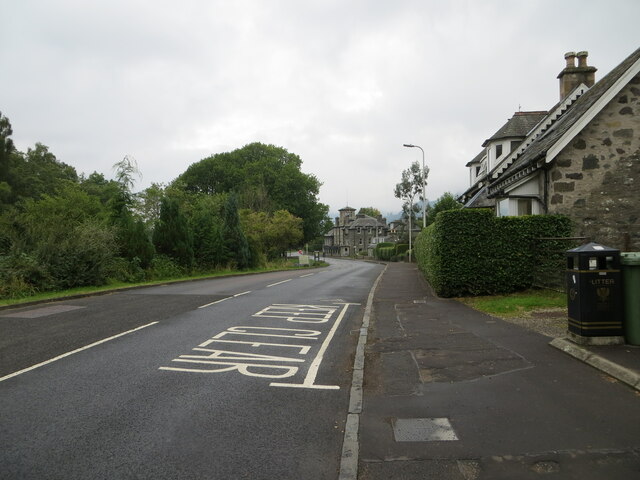
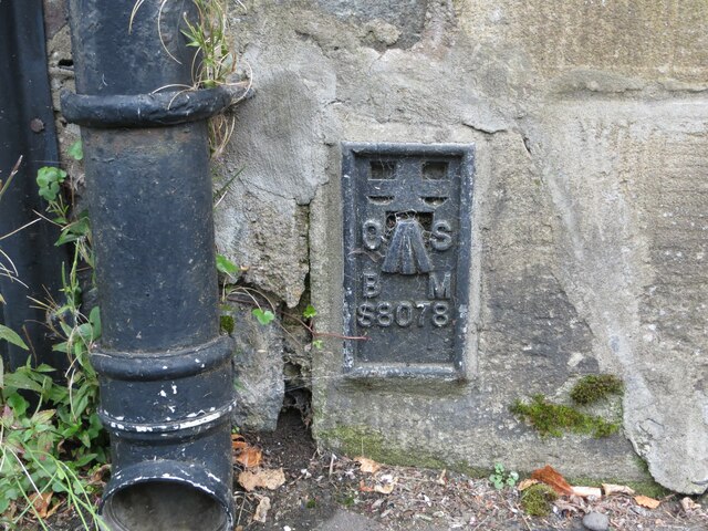
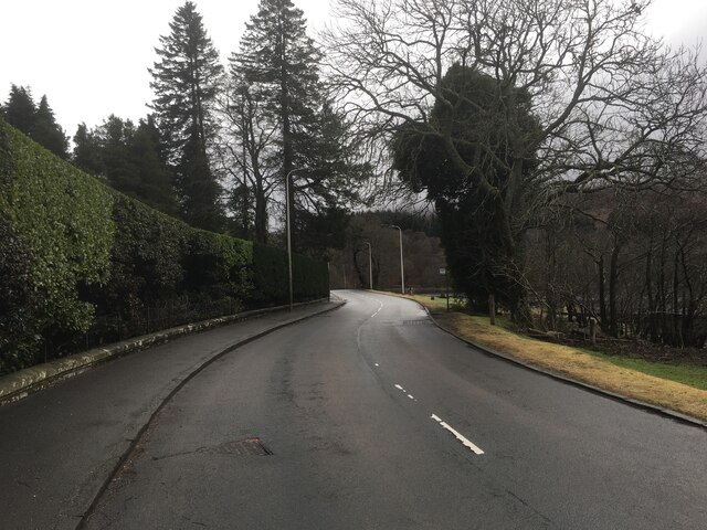
Ardtrostan Wood Images

Images are sourced within 2km of 56.385865/-4.1393896 or Grid Reference NN6823. Thanks to Geograph Open Source API. All images are credited.

Glentarken Burn View from bridge on A85.
Glentarken Burn
View from bridge on A85.
Minor road on the south shore of Loch Earn near Finglen Looking north-eastward.
Minor road on the south shore of Loch Earn near Finglen
Looking north-eastward.
Minor road on the south shore of Loch Earn near Ardtrostan Looking north-eastward.
Minor road on the south shore of Loch Earn near Ardtrostan
Looking north-eastward.
Road (A85), St Fillans Looking north-westward.
Road (A85), St Fillans
Looking north-westward.
A85 near St Fillans
A85 near St Fillans
Ordnance Survey Flush Bracket S8078 This bracket can be found on the roadside (A85) wall of a building in St Fillans.
The recorded details give a height of 102.299 metres above seal level.
For more detail see : <span class="nowrap"><a title="https://www.bench-marks.org.uk/bm21159" rel="nofollow ugc noopener" href="https://www.bench-marks.org.uk/bm21159">Link</a><img style="margin-left:2px;" alt="External link" title="External link - shift click to open in new window" src="https://s1.geograph.org.uk/img/external.png" width="10" height="10"/></span>
Ordnance Survey Flush Bracket S8078
This bracket can be found on the roadside (A85) wall of a building in St Fillans. The recorded details give a height of 102.299 metres above seal level. For more detail see : LinkExternal link
Route of Lochearnhead, St Fillans and Comrie Railway The route of the railway is heading near to south-west but its general direction is east to west above and parallel to the northern shore of Loch Earn. It's now in use as a 'core path'. The view is from a hill road rising from the A85 and crossing the old track bed.
Route of Lochearnhead, St Fillans and Comrie Railway
The route of the railway is heading near to south-west but its general direction is east to west above and parallel to the northern shore of Loch Earn. It's now in use as a 'core path'. The view is from a hill road rising from the A85 and crossing the old track bed.
Glentarken Burn passing farm buildings The burn coming out of Glen Tarken and about to pass under a bridge carrying the A85, before entering Loch Earn at Woodhouse.
Glentarken Burn passing farm buildings
The burn coming out of Glen Tarken and about to pass under a bridge carrying the A85, before entering Loch Earn at Woodhouse.
A85 in St Fillans
A85 in St Fillans
Gate with a view From above Glentarken Wood
Gate with a view
From above Glentarken Wood
Disappearing Woodland Here there used to be dense woodland - as the map still shows - but parts of Glentarken's forestry have now been harvested.
Disappearing Woodland
Here there used to be dense woodland - as the map still shows - but parts of Glentarken's forestry have now been harvested.
Welcome to St Fillans Signs at the entrance to the village, as the A85 wriggles itself east along the edge of Loch Earn
Welcome to St Fillans
Signs at the entrance to the village, as the A85 wriggles itself east along the edge of Loch Earn
Waterside Caravans Ardtrostan, Loch Earn
Waterside Caravans
Ardtrostan, Loch Earn
June Poppies Near St Fillans Power Station
June Poppies
Near St Fillans Power Station
Lupins Near Dundurn Parish Church, St Fillans
Lupins
Near Dundurn Parish Church, St Fillans
Hardy and beautiful Growing at 1500ft above Fin Glen, Loch Earn
Hardy and beautiful
Growing at 1500ft above Fin Glen, Loch Earn
Equal opportunity chicks Near St Fillans Village Shop
Equal opportunity chicks
Near St Fillans Village Shop
Equine Grace Highland ponies in Fin Glen, Loch Earn
Equine Grace
Highland ponies in Fin Glen, Loch Earn
Show me another place!

Ardtrostan Wood is located at Grid Ref: NN6823 (Lat: 56.385865, Lng: -4.1393896)

Unitary Authority: Perth and Kinross

Police Authority: Tayside

What 3 Words

///crown.venue.unspoiled. Near Comrie, Perth & Kinross

Related Wikis

Neish Island

Neish Island is an island in Loch Earn, Scotland. == History == It is recorded that in 1490 James IV of Scotland ordered Lord Drummond to cast down the...

St Fillans

St Fillans is a village in Perthshire in the central highlands of Scotland, in the council area of Perth and Kinross. The village lies at the eastern end...

St Fillans railway station

St Fillans railway station served the village of St Fillans, in the historical county of Perthshire, Scotland, from 1901 to 1951 on the Lochearnhead, St...

Dundurn, Scotland

Dundurn is the site of a Pictish hillfort in what is now Strathearn in Perth and Kinross, Scotland. The fort was situated on a hill with the River Earn...

Nearby Amenities

Located within 500m of 56.385865,-4.1393896
Restaurant
Stags Head Pub
Addr City: St Fillans
Addr Postcode: PH6 2NL
Fhrs Id: 440519
Lat/Long: 56.3878191/-4.1428985
Power: pole
Lat/Long: 56.3873844/-4.1465522
Power: pole
Lat/Long: 56.3874598/-4.1458285
Power: pole
Lat/Long: 56.3873679/-4.1446394
Power: pole
Lat/Long: 56.3872656/-4.1434629
Power: pole
Lat/Long: 56.3875223/-4.1419653
The data included in this document is from www.openstreetmap.org. The data is made available under ODbL.

Have you been to Ardtrostan Wood?

Leave your review of Ardtrostan Wood below (or comments, questions and feedback).