Black Plantation

Wood, Forest in Ayrshire

Scotland

Black Plantation

The Long Stone of Convention The Long Stone of Convention, with Middlefield Law in the distance.
The Long Stone of Convention Credit: Rab McMurdo

Black Plantation, located in Ayrshire, Scotland, is a captivating woodland area that spans across several hectares. Situated in close proximity to the town of Ayr, this enchanting forest is renowned for its rich biodiversity and natural beauty.

The plantation is predominantly composed of tall, majestic trees, including oak, beech, and pine, which create a dense canopy overhead. The lush undergrowth is adorned with a myriad of vibrant wildflowers, ferns, and mosses, adding to the area's visual appeal. Several small streams meander through the woodland, providing a serene atmosphere and creating a habitat for various aquatic species.

Black Plantation is a haven for wildlife, attracting a diverse range of animals, birds, and insects. Visitors may be lucky enough to spot red squirrels darting between the trees or catch a glimpse of roe deer gracefully grazing in the open clearings. The forest is also home to a plethora of bird species, including woodpeckers, owls, and various songbirds, filling the air with their melodious tunes.

For outdoor enthusiasts, the plantation offers numerous walking trails that wind through the forest, allowing visitors to immerse themselves in the tranquil surroundings. These paths are well-maintained and suitable for both leisurely strolls and more challenging hikes. The area is also equipped with picnic spots and benches, providing opportunities for visitors to relax and enjoy the peaceful ambiance.

Black Plantation, Ayrshire, is a captivating woodland retreat that offers a respite from the hustle and bustle of daily life. With its diverse flora and fauna, scenic trails, and serene atmosphere, it is a must-visit destination for nature lovers and those seeking solace in the embrace of nature.

If you have any feedback on the listing, please let us know in the comments section below.

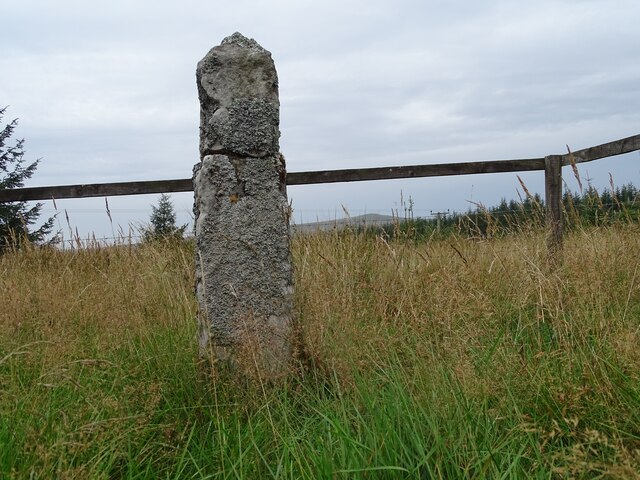
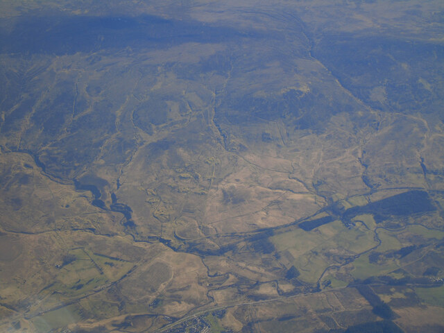
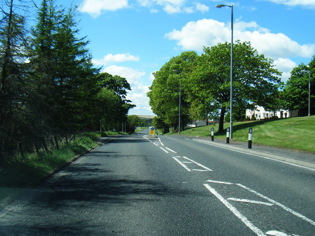
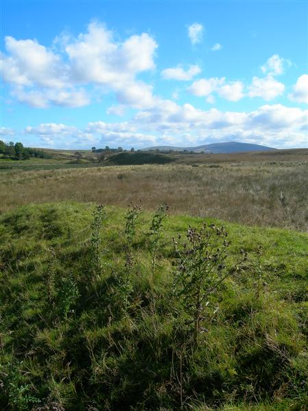
Black Plantation Images

Images are sourced within 2km of 55.516053/-4.1024025 or Grid Reference NS6726. Thanks to Geograph Open Source API. All images are credited.

The Long Stone of Convention The Long Stone of Convention, with Middlefield Law in the distance.
The Long Stone of Convention
The Long Stone of Convention, with Middlefield Law in the distance.
The River Ayr at Muirkirk from the air Muirkirk just makes an appearance at the bottom of the photo. The route of the GSWR Muirkirk Branch railway line can be seen running diagonally up from the lower left corner.
The River Ayr at Muirkirk from the air
Muirkirk just makes an appearance at the bottom of the photo. The route of the GSWR Muirkirk Branch railway line can be seen running diagonally up from the lower left corner.
Wellwood Rows The Wellwood Rows stood on the high ground, where the trees are now,
on the left bank of the Water Ayr.
Wellwood Rows
The Wellwood Rows stood on the high ground, where the trees are now, on the left bank of the Water Ayr.
Wellwood House Wellwood House once stood where the piles of debris lie, on the
far side of the ruined bridge over the Water Ayr.
Wellwood House
Wellwood House once stood where the piles of debris lie, on the far side of the ruined bridge over the Water Ayr.
Ruins at Knowehead The water in this old byne at Knowehead was frozen solid.
Knowehead was once a shepherd's place, then a sheepfold.
Ruins at Knowehead
The water in this old byne at Knowehead was frozen solid. Knowehead was once a shepherd's place, then a sheepfold.
Track leading down to Garpel Bridge, southwest of Muirkirk This is part of the River Ayr Way. By using buses from Catrine to Cumnock then another from Cumnock to Muirkirk, this section of the path can be walked in a day.
Track leading down to Garpel Bridge, southwest of Muirkirk
This is part of the River Ayr Way. By using buses from Catrine to Cumnock then another from Cumnock to Muirkirk, this section of the path can be walked in a day.
Covenanters' grave close to Upper Wellwood, west of Muirkirk This grave can be viewed from the River Ayr Way. There is an information board where the picture was taken from.
Covenanters' grave close to Upper Wellwood, west of Muirkirk
This grave can be viewed from the River Ayr Way. There is an information board where the picture was taken from.
River Ayr Way below Beacon Hill close to Wellwood Bridge The River Ayr Way has a good surface such as this over much of its length and provides many miles of good firm walking.
River Ayr Way below Beacon Hill close to Wellwood Bridge
The River Ayr Way has a good surface such as this over much of its length and provides many miles of good firm walking.
A70 westbound at Smallburn
A70 north of Beacon Hill
A70 westbound at Wellwood
Powharnal Revisited We wondered what would happen to the open cast sites when Scottish Coal collapsed. This part of the Powharnal site near Muirkirk has become a huge and extremely deep loch, visible from the road. <a href="https://www.geograph.org.uk/photo/2142598">NS6525 : Powharnal Open Cast Mine</a> shows the site in full-scale operation.
Powharnal Revisited
We wondered what would happen to the open cast sites when Scottish Coal collapsed. This part of the Powharnal site near Muirkirk has become a huge and extremely deep loch, visible from the road. NS6525 : Powharnal Open Cast Mine shows the site in full-scale operation.
Danger: Deep Water at Powharnal We wondered what would happen to the open cast sites when Scottish Coal collapsed. This part of the Powharnal site near Muirkirk has become a huge and extremely deep loch, visible from the road. <a href="https://www.geograph.org.uk/photo/2142598">NS6525 : Powharnal Open Cast Mine</a> shows the site in full-scale operation in 2010. The prominent warning signs on this gate are specially important, as the River Ayr Way passes here.
Danger: Deep Water at Powharnal
We wondered what would happen to the open cast sites when Scottish Coal collapsed. This part of the Powharnal site near Muirkirk has become a huge and extremely deep loch, visible from the road. NS6525 : Powharnal Open Cast Mine shows the site in full-scale operation in 2010. The prominent warning signs on this gate are specially important, as the River Ayr Way passes here.
Approaching B743 junction at Beacon Hill
A70 at Haystackhill Plantation
A70 entering Smallburn
Garage and Village shop in Smallburn
Smallburn fire station
Show me another place!

Black Plantation is located at Grid Ref: NS6726 (Lat: 55.516053, Lng: -4.1024025)

Unitary Authority: East Ayrshire

Police Authority: Ayrshire

What 3 Words

///compounds.refilled.scribble. Near Muirkirk, East Ayrshire

Related Wikis

Garpel Water

The Garpel Water is a river near Muirkirk, Scotland. It flows under the Sanquhar bridge and Tibbie's Brig. It flows into the River Ayr.

Muirkirk

Muirkirk (Scottish Gaelic: Eaglais an t-Slèibh) is a small village in East Ayrshire, southwest Scotland. It is located on the north bank of the River Ayr...

Muirkirk railway station

Muirkirk railway station was a railway station serving the village of Muirkirk, East Ayrshire, Scotland. == First station == The station opened on 9 August...

Greenock Water

Greenock Water is a river in East Ayrshire, Scotland. It flows out of the Dippal Burn, about 2 miles south of Dungavel Hill. A tributary of the River Ayr...

Garpel Linn

Garpel Linn is a waterfall of Scotland. == See also == Waterfalls of Scotland == References ==

Cronberry railway station

Cronberry railway station was a railway station serving the hamlet of Cronberry, East Ayrshire, Scotland. The station was originally part of the Glasgow...

Glenbuck railway station

Glenbuck railway station served the village of Glenbuck in Ayrshire, Scotland. == Opening == The Caledonian Railway extended a line from Douglas to Muirkirk...

Airds Moss

Airds Moss is a large area of moor in East Ayrshire, the site is a protected area because of the extensive blanket bogs. In 1680 it was the location of...

Nearby Amenities

Located within 500m of 55.516053,-4.1024025
Power: pole
Lat/Long: 55.5116191/-4.1018694
Power: pole
Lat/Long: 55.51181/-4.1005412
Power: pole
Lat/Long: 55.5120015/-4.0992083
Power: pole
Lat/Long: 55.5125694/-4.0983555
Power: pole
Lat/Long: 55.5132405/-4.0974168
The data included in this document is from www.openstreetmap.org. The data is made available under ODbL.

Have you been to Black Plantation?

Leave your review of Black Plantation below (or comments, questions and feedback).