Bore Wood

Downs, Moorland in Ayrshire

Scotland

Bore Wood

A70 passing through Muirkirk The picture looks along Muirkirk Main Street which is also the A70. Temporary road signs warn that the road further east is currently closed: <span class="nowrap"><a title="https://www.southlanarkshire.gov.uk/view/news/article/1046/Plan_ahead_for_A70_roadworks_closure" rel="nofollow ugc noopener" href="https://www.southlanarkshire.gov.uk/view/news/article/1046/Plan_ahead_for_A70_roadworks_closure">Link</a><img style="margin-left:2px;" alt="External link" title="External link - shift click to open in new window" src="https://s1.geograph.org.uk/img/external.png" width="10" height="10"/></span> Fortunately my journey went west.
A70 passing through Muirkirk Credit: Alec MacKinnon

Bore Wood is a picturesque nature reserve located in Ayrshire, Scotland. Situated amidst the beautiful countryside, the woodland covers a vast area of rolling hills, downs, and moorland, providing a diverse and enchanting environment for visitors to explore.

The wood boasts a rich assortment of flora and fauna, with ancient trees such as oak, birch, and hawthorn dominating the landscape. The dense canopy provides a sheltered habitat for a wide variety of wildlife, including birds, insects, and small mammals.

Traversing through Bore Wood, one can discover a network of well-maintained walking trails that offer breathtaking views of the surrounding countryside. The paths meander through the wood, leading visitors to hidden gems such as tranquil ponds and babbling brooks. The serene atmosphere and peaceful surroundings make Bore Wood a perfect spot for nature enthusiasts and those seeking a peaceful retreat.

In addition to its natural beauty, Bore Wood is also known for its historical significance. The wood has been a part of the local community for centuries, with evidence of human habitation dating back to ancient times. It served as a source of timber and fuel for the nearby villages, contributing to the region's economic prosperity.

Today, Bore Wood continues to be cherished by locals and visitors alike. Its tranquil ambiance, diverse wildlife, and stunning scenery make it a popular destination for walking, picnicking, and wildlife spotting. Whether you are an avid hiker, a nature lover, or simply looking for a peaceful escape, Bore Wood offers a unique and unforgettable experience.

If you have any feedback on the listing, please let us know in the comments section below.

Bore Wood Images

Images are sourced within 2km of 55.515646/-4.0946669 or Grid Reference NS6726. Thanks to Geograph Open Source API. All images are credited.

A70 passing through Muirkirk The picture looks along Muirkirk Main Street which is also the A70. Temporary road signs warn that the road further east is currently closed: <span class="nowrap"><a title="https://www.southlanarkshire.gov.uk/view/news/article/1046/Plan_ahead_for_A70_roadworks_closure" rel="nofollow ugc noopener" href="https://www.southlanarkshire.gov.uk/view/news/article/1046/Plan_ahead_for_A70_roadworks_closure">Link</a><img style="margin-left:2px;" alt="External link" title="External link - shift click to open in new window" src="https://s1.geograph.org.uk/img/external.png" width="10" height="10"/></span> Fortunately my journey went west.
A70 passing through Muirkirk
The picture looks along Muirkirk Main Street which is also the A70. Temporary road signs warn that the road further east is currently closed: LinkExternal link Fortunately my journey went west.
Main Street car park, Muirkirk The car park sits at the west end of the row of businesses on Main Street. Cairn Table is on the horizon behind.
Main Street car park, Muirkirk
The car park sits at the west end of the row of businesses on Main Street. Cairn Table is on the horizon behind.
R.O.C. Bunker An old R.O.C. bunker.
R.O.C. Bunker
An old R.O.C. bunker.
The Long Stone of Convention The Long Stone of Convention, with Middlefield Law in the distance.
The Long Stone of Convention
The Long Stone of Convention, with Middlefield Law in the distance.
The River Ayr at Muirkirk from the air Muirkirk just makes an appearance at the bottom of the photo. The route of the GSWR Muirkirk Branch railway line can be seen running diagonally up from the lower left corner.
The River Ayr at Muirkirk from the air
Muirkirk just makes an appearance at the bottom of the photo. The route of the GSWR Muirkirk Branch railway line can be seen running diagonally up from the lower left corner.
Kames Institute Benchmark on the Kames Institute building.
Kames Institute
Benchmark on the Kames Institute building.
Wellwood House Wellwood House once stood where the piles of debris lie, on the
far side of the ruined bridge over the Water Ayr.
Wellwood House
Wellwood House once stood where the piles of debris lie, on the far side of the ruined bridge over the Water Ayr.
Ruins at Knowehead The water in this old byne at Knowehead was frozen solid.
Knowehead was once a shepherd's place, then a sheepfold.
Ruins at Knowehead
The water in this old byne at Knowehead was frozen solid. Knowehead was once a shepherd's place, then a sheepfold.
Parking for Cairn Table Situated in the hamlet of Kames this is the main car park for Cairn Table as well as other walks in the area.
Parking for Cairn Table
Situated in the hamlet of Kames this is the main car park for Cairn Table as well as other walks in the area.
Kames Motorsport Complex, Muirkirk
Kames Car Park Car park at the start of the walk to Cairn Table and other walks in the Muirkirk area.
Kames Car Park
Car park at the start of the walk to Cairn Table and other walks in the Muirkirk area.
Macadam Cairn The plaque on the cairn reads: In memory of John Loudon Macadam the famous roadmaker 1756-1836. This cairn marks the site of HIS tar kilns 1786-1827 and is built with stones from them in 1931.
Macadam Cairn
The plaque on the cairn reads: In memory of John Loudon Macadam the famous roadmaker 1756-1836. This cairn marks the site of HIS tar kilns 1786-1827 and is built with stones from them in 1931.
The Site of Springhill House (Stopping Point 12 on the River Ayr Way) This was the first of several country houses built during the height of Muirkirk's industrial prosperity to accommodate the town's various ironmasters and pit managers.
The Site of Springhill House (Stopping Point 12 on the River Ayr Way)
This was the first of several country houses built during the height of Muirkirk's industrial prosperity to accommodate the town's various ironmasters and pit managers.
Memorial to miners at Muirkirk
Kames Institute near Muirkirk
On the River Ayr Way, southwest of Kames
Track passing Springhill House (ruin) southwest of Kames
Cairn marking location of John Loudon Macadam Tar Works near Muirkirk
Show me another place!

Bore Wood is located at Grid Ref: NS6726 (Lat: 55.515646, Lng: -4.0946669)

Unitary Authority: East Ayrshire

Police Authority: Ayrshire

What 3 Words

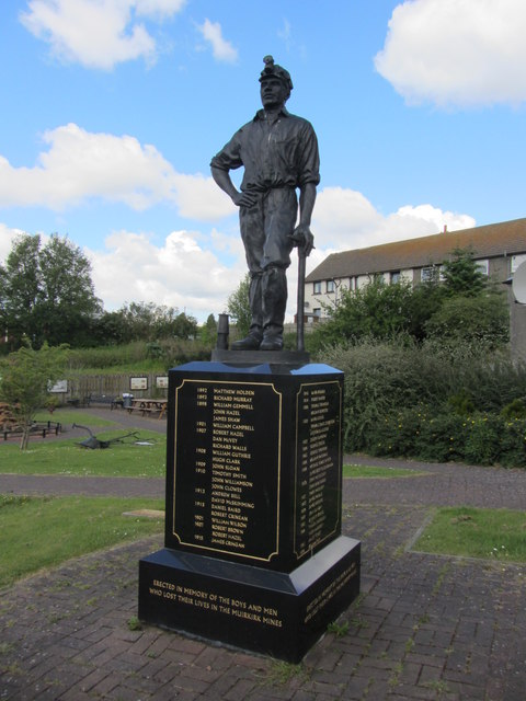
///hats.sentences.butchers. Near Muirkirk, East Ayrshire

Related Wikis

Garpel Water

The Garpel Water is a river near Muirkirk, Scotland. It flows under the Sanquhar bridge and Tibbie's Brig. It flows into the River Ayr.

Muirkirk railway station

Muirkirk railway station was a railway station serving the village of Muirkirk, East Ayrshire, Scotland. == First station == The station opened on 9 August...

Muirkirk

Muirkirk (Scottish Gaelic: Eaglais an t-Slèibh) is a small village in East Ayrshire, southwest Scotland. It is located on the north bank of the River Ayr...

Greenock Water

Greenock Water is a river in East Ayrshire, Scotland. It flows out of the Dippal Burn, about 2 miles south of Dungavel Hill. A tributary of the River Ayr...

Nearby Amenities

Located within 500m of 55.515646,-4.0946669
Power: pole
Lat/Long: 55.5120015/-4.0992083
Power: pole
Lat/Long: 55.5122163/-4.0977138
Power: pole
Lat/Long: 55.5124062/-4.0963922
Power: pole
Lat/Long: 55.5126078/-4.0949899
Power: pole
Lat/Long: 55.5128295/-4.0934471
Power: pole
Lat/Long: 55.5129897/-4.092332
Power: pole
Lat/Long: 55.5131423/-4.0912705
Power: pole
Lat/Long: 55.513346/-4.0898527
Power: pole
Lat/Long: 55.5135505/-4.0884301
Power: pole
Lat/Long: 55.5125694/-4.0983555
Power: pole
Lat/Long: 55.5132405/-4.0974168
Power: pole
Lat/Long: 55.5138963/-4.091445
The data included in this document is from www.openstreetmap.org. The data is made available under ODbL.

Have you been to Bore Wood?

Leave your review of Bore Wood below (or comments, questions and feedback).