Carleton

Settlement in Lancashire Wyre

England

Carleton

St Chad's church by Market Square
St Chad's church by Market Square Credit: Steve Daniels

Carleton is a small village located in the county of Lancashire, England. Nestled in the picturesque countryside, it lies about 5 miles east of the market town of Skipton, and is surrounded by rolling hills and scenic landscapes.

The village itself is home to a close-knit community, with a population of around 700 residents. The architecture of Carleton reflects its rich history, with several traditional stone-built houses and buildings dotting the village. The local church, St. Mary's Church, is a notable landmark, dating back to the 12th century, and serves as a focal point for religious activities and community gatherings.

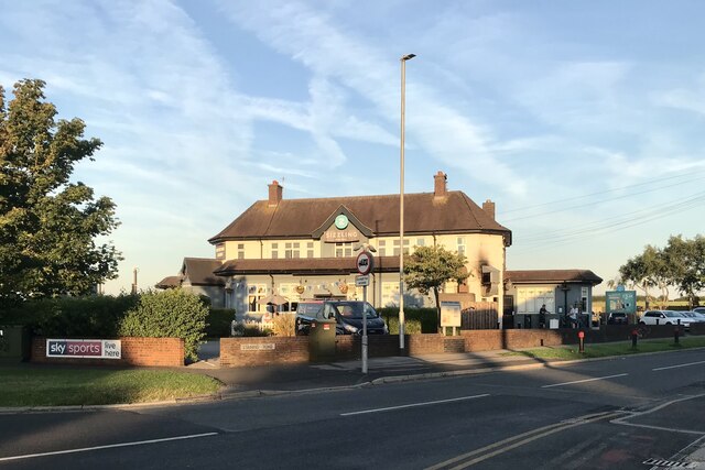
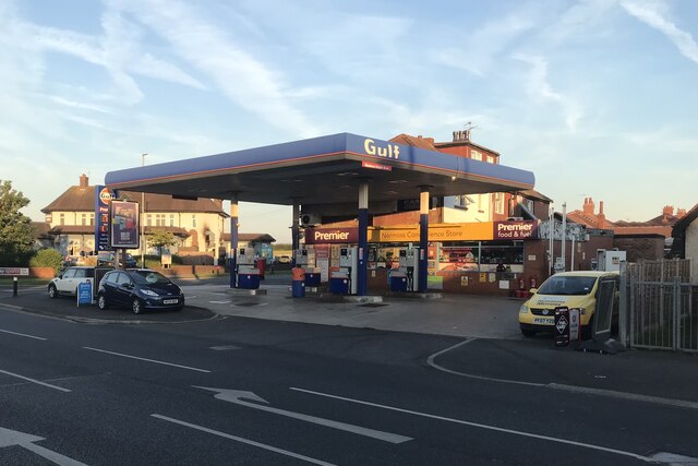
Carleton offers a range of amenities and facilities to its residents. There is a primary school, providing education for children in the area, as well as a village hall that acts as a hub for various social and recreational activities. The village also boasts a local pub, The Swan Inn, which serves as a popular meeting place for locals.

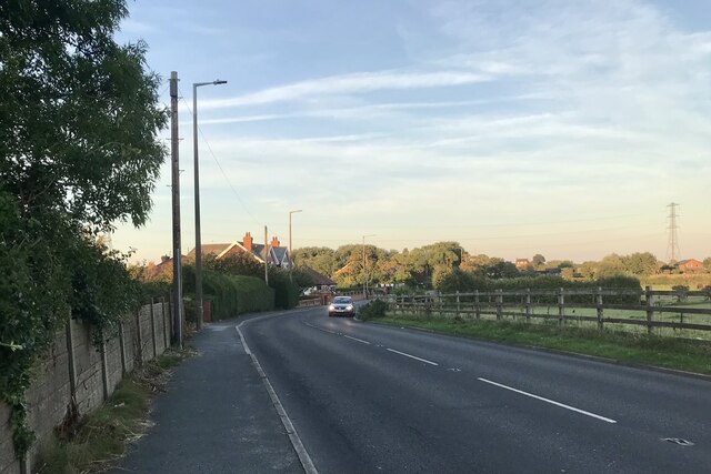
The surrounding countryside provides ample opportunities for outdoor activities, such as hiking, cycling, and horseback riding, with many scenic trails and pathways to explore. Carleton is also conveniently located near the Yorkshire Dales National Park, offering residents and visitors access to stunning natural beauty and outdoor adventures.

Overall, Carleton is a charming village that offers a peaceful and idyllic lifestyle, surrounded by beautiful landscapes and a strong sense of community.

If you have any feedback on the listing, please let us know in the comments section below.

Carleton Images

Images are sourced within 2km of 53.843855/-3.013735 or Grid Reference SD3339. Thanks to Geograph Open Source API. All images are credited.

St Chad's church by Market Square
The war memorial in Market Square
The Newton Arms, Normoss
Normoss Petrol Station and Convenience Store
Normoss Road
Normoss Road
The Grounds of Carleton Crematorium
Railway Tracks at Blackpool Road Level Crossing
Ladybower Lane - Poulton-le-Fylde
Booths Supermarket - Poulton-le-Fylde
Pressed 2 Impress and Station Road - Poulton-le-Fylde
Poulton-le-Fylde Station
Flowers at Poulton-le-Fylde Flower tubs and hanging baskets on the station platform.
Flowers at Poulton-le-Fylde
Flower tubs and hanging baskets on the station platform.
Warbreck water tower Viewed from the railway. See <a href="https://www.geograph.org.uk/photo/5802205">SD3138 : Warbreck water tower</a> for a closer view of this local landmark. It was built in 1932 alongside an existing reservoir, for the Fylde Water Board by engineer George Atkinson. It holds about 750,000 gallons (3400 cubic metres) of water and is locally listed <span class="nowrap"><a title="https://local-heritage-list.org.uk/lancashire/asset/128" rel="nofollow ugc noopener" href="https://local-heritage-list.org.uk/lancashire/asset/128">Link</a><img style="margin-left:2px;" alt="External link" title="External link - shift click to open in new window" src="https://s1.geograph.org.uk/img/external.png" width="10" height="10"/></span>.
Warbreck water tower
Viewed from the railway. See SD3138 : Warbreck water tower for a closer view of this local landmark. It was built in 1932 alongside an existing reservoir, for the Fylde Water Board by engineer George Atkinson. It holds about 750,000 gallons (3400 cubic metres) of water and is locally listed LinkExternal link.
Ashfield Road in Whiteholme
Poulton Road in Carleton
Castle Gardens on Poulton Road
Show me another place!

Carleton is located at Grid Ref: SD3339 (Lat: 53.843855, Lng: -3.013735)

Administrative County: Lancashire

District: Wyre

Police Authority: Lancashire

What 3 Words

///leap.editor.wiped. Near Poulton-le-Fylde, Lancashire

Nearby Locations

Carleton

Related Wikis

Blackpool Sixth Form College

The Blackpool Sixth Form College is a co-educational state funded sixth form college serving the Fylde and surrounding areas in Lancashire, England. The...

Carleton Crematorium and Cemetery

Carleton Crematorium, together with the adjacent necropolis, Carleton Cemetery, is a graveyard located within the Greenlands ward of Blackpool with its...

Blackpool Aspire Academy

Blackpool Aspire Academy is a secondary school located in the Layton area of Blackpool, Lancashire, England.The school was formed in 2014 by merging Collegiate...

Fylde Memorial Arboretum and Community Woodland

Fylde Memorial Arboretum and Community Woodland is a site of remembrance at Bispham, Blackpool, Lancashire, England. It is the only one of its kind outside...

Nearby Amenities

Located within 500m of 53.843855,-3.013735
Railway: level_crossing
Lat/Long: 53.8431398/-3.0145301
Barrier: cycle_barrier
Lat/Long: 53.8412479/-3.0192483
Turning Circle
Lat/Long: 53.8448383/-3.007413
Turning Circle
Lat/Long: 53.8438662/-3.0112204
Mini Roundabout
Direction: clockwise
Lat/Long: 53.8424751/-3.0092782
Post Box
Brand: Royal Mail
Brand Wikidata: Q638098
Collection Times: Mo-Fr 09:00; Sa 07:00; Su off
Drive Through: no
Operator: Royal Mail
Operator Wikidata: Q638098
Post Box Design: type_b
Post Box Type: pillar
Ref: FY6 163D
Royal Cypher: EIIR
Royal Cypher Wikidata: Q33102113
Source: survey;aerial imagery;streetlevel imagery
Lat/Long: 53.8431058/-3.0142668
Power: tower
Lat/Long: 53.8411336/-3.0126894
Power: tower
Lat/Long: 53.8415556/-3.01835
Crossing Barrier: full
Crossing Bell: yes
Crossing Supervision: yes
Railway: level_crossing
Lat/Long: 53.8431066/-3.0144992
Turning Circle
Lat/Long: 53.8433132/-3.0113186
Turning Circle
Lat/Long: 53.8434224/-3.0114552
Turning Circle
Lat/Long: 53.8413369/-3.0141783
Turning Circle
Lat/Long: 53.841462/-3.0140506
Turning Circle
Lat/Long: 53.842069/-3.0099183
Turning Circle
Lat/Long: 53.8422026/-3.0097545
Turning Circle
Lat/Long: 53.8432395/-3.0078021
Turning Circle
Lat/Long: 53.8437365/-3.0076536
Turning Circle
Lat/Long: 53.8438643/-3.0076476
Turning Circle
Lat/Long: 53.8438762/-3.0096134
Turning Circle
Lat/Long: 53.8439969/-3.009499
Turning Circle
Lat/Long: 53.8446312/-3.0066707
Turning Circle
Lat/Long: 53.8447685/-3.0066788
Turning Circle
Lat/Long: 53.844189/-3.0099185
Turning Circle
Lat/Long: 53.8443156/-3.0101979
Turning Circle
Lat/Long: 53.8446912/-3.0082604
Turning Circle
Lat/Long: 53.8448211/-3.0083159
Turning Circle
Lat/Long: 53.8415656/-3.009173
Turning Circle
Lat/Long: 53.8417144/-3.0090496
Turning Circle
Lat/Long: 53.8419359/-3.0081108
Turning Circle
Lat/Long: 53.8419518/-3.0078372
Cafe
Nibbles
Addr City: Poulton-le-Fylde
Addr Postcode: FY6 7QS
Addr Street: Stocks Lane
Fhrs Id: 1075526
Lat/Long: 53.8467942/-3.019202
Blackpool Sixth Form College
Bus: yes
Naptan AtcoCode: 250010642
Naptan Bearing: S
Naptan BusStopType: MKD
Naptan CommonName: Blackpool Sixth Form College
Naptan Indicator: by
Naptan Landmark: 6th Form College
Naptan LocalityCode: E0016541
Naptan NaptanCode: lanadmgt
Naptan Street: Blackpool Old Road
Naptan Verified: no
Public Transport: stop_position
Ref: lanadmgt
Lat/Long: 53.840029/-3.0175254
Fairway
Bus: yes
Naptan AtcoCode: 250020144
Naptan Bearing: SW
Naptan BusStopType: MKD
Naptan CommonName: Fairway
Naptan Indicator: by
Naptan Landmark: Crossing Shelter
Naptan LocalityCode: E0016541
Naptan NaptanCode: lanatwag
Naptan Street: Blackpool Old Road
Naptan Verified: no
Public Transport: stop_position
Ref: lanatwag
Lat/Long: 53.8424456/-3.0144435
Kingfisher Drive
Bus: yes
Naptan AtcoCode: 250014235
Naptan Bearing: NW
Naptan BusStopType: MKD
Naptan CommonName: Kingfisher Drive
Naptan Indicator: by
Naptan Landmark: Kingfisher Drive
Naptan LocalityCode: E0016583
Naptan NaptanCode: lanamjwt
Naptan Street: Blackpool Old Road
Naptan Verified: no
Public Transport: stop_position
Ref: lanamjwt
Lat/Long: 53.8429488/-3.0111136
Kingfisher Drive
Bus: yes
Naptan AtcoCode: 2500IMG474
Naptan Bearing: SE
Naptan BusStopType: MKD
Naptan CommonName: Kingfisher Drive
Naptan Indicator: opp
Naptan Landmark: Blackpool Old Road
Naptan LocalityCode: E0016583
Naptan NaptanCode: langjpgw
Naptan Street: Blackpool Old Road
Naptan Verified: no
Public Transport: stop_position
Ref: langjpgw
Lat/Long: 53.8428459/-3.0108071
Fairway
Bus: yes
Naptan AtcoCode: 2500595
Naptan Bearing: NE
Naptan BusStopType: MKD
Naptan CommonName: Fairway
Naptan Indicator: opp
Naptan Landmark: Crossing
Naptan LocalityCode: E0016541
Naptan NaptanCode: lanawpgw
Naptan Street: Blackpool Old Road
Naptan Verified: no
Public Transport: stop_position
Ref: lanawpgw
Lat/Long: 53.8423419/-3.0147131
Blackpool Sixth Form College
Bus: yes
Naptan AtcoCode: 2500IMG484
Naptan Bearing: N
Naptan BusStopType: MKD
Naptan CommonName: Blackpool Sixth Form College
Naptan Indicator: opp
Naptan Landmark: 6 Form College
Naptan LocalityCode: E0016541
Naptan NaptanCode: langjpjd
Naptan Street: Blackpool Old Road
Naptan Verified: no
Public Transport: stop_position
Ref: langjpjd
Lat/Long: 53.8402728/-3.0174854
Kim Harrison
Addr City: Poulton-le-Fylde
Addr Housenumber: 310
Addr Postcode: FY6 7QU
Addr Street: Blackpool Road
Shop: hairdresser
Lat/Long: 53.8430287/-3.0140895
Poulton Village Stores
Addr City: Poulton-le-Fylde
Addr Housenumber: 308
Addr Postcode: FY6 7QU
Addr Street: Blackpool Road
Check Date: 2023-11-06
Fhrs Id: 1100822
Shop: convenience
Lat/Long: 53.8430809/-3.0141404
The Beach Barber
Addr City: Poulton-le-Fylde
Addr Housenumber: 309
Addr Postcode: FY6 7QT
Addr Street: Blackpool Road
Shop: hairdresser
Lat/Long: 53.8428863/-3.0145776
Generator Output Electricity: yes
Generator Source: solar
Generator Type: solar_photovoltaic_panel
Location: roof
Power: generator
Lat/Long: 53.843816/-3.0117828
Generator Output Electricity: yes
Generator Source: solar
Generator Type: solar_photovoltaic_panel
Location: roof
Power: generator
Lat/Long: 53.844468/-3.0099857
Generator Output Electricity: yes
Generator Source: solar
Generator Type: solar_photovoltaic_panel
Location: roof
Power: generator
Lat/Long: 53.8445313/-3.0070701
Generator Output Electricity: yes
Generator Source: solar
Generator Type: solar_photovoltaic_panel
Location: roof
Power: generator
Lat/Long: 53.8441024/-3.0070165
Generator Output Electricity: yes
Generator Source: solar
Generator Type: solar_photovoltaic_panel
Location: roof
Power: generator
Lat/Long: 53.844191/-3.0065632
Generator Output Electricity: yes
Generator Source: solar
Generator Type: solar_photovoltaic_panel
Location: roof
Power: generator
Lat/Long: 53.8416084/-3.0079767
Generator Output Electricity: yes
Generator Source: solar
Generator Type: solar_photovoltaic_panel
Location: roof
Power: generator
Lat/Long: 53.8415973/-3.0079043
Generator Output Electricity: yes
Generator Source: solar
Generator Type: solar_photovoltaic_panel
Location: roof
Power: generator
Lat/Long: 53.8414232/-3.0089691
Generator Output Electricity: yes
Generator Source: solar
Generator Type: solar_photovoltaic_panel
Location: roof
Power: generator
Lat/Long: 53.8414549/-3.009232
Generator Output Electricity: yes
Generator Source: solar
Generator Type: solar_photovoltaic_panel
Location: roof
Power: generator
Lat/Long: 53.8414565/-3.0094653
Generator Output Electricity: yes
Generator Source: solar
Generator Type: solar_photovoltaic_panel
Location: roof
Power: generator
Lat/Long: 53.8417255/-3.0104041
Generator Output Electricity: yes
Generator Source: solar
Generator Type: solar_photovoltaic_panel
Location: roof
Power: generator
Lat/Long: 53.8415783/-3.0145857
Generator Output Electricity: yes
Generator Source: solar
Generator Type: solar_photovoltaic_panel
Location: roof
Power: generator
Lat/Long: 53.841629/-3.0140197
Generator Output Electricity: yes
Generator Source: solar
Generator Type: solar_photovoltaic_panel
Location: roof
Power: generator
Lat/Long: 53.8418679/-3.0115977
Generator Output Electricity: yes
Generator Source: solar
Generator Type: solar_photovoltaic_panel
Location: roof
Power: generator
Lat/Long: 53.8427541/-3.0111739
Generator Output Electricity: yes
Generator Source: solar
Generator Type: solar_photovoltaic_panel
Location: roof
Power: generator
Lat/Long: 53.842129/-3.0160421
Generator Output Electricity: yes
Generator Source: solar
Generator Type: solar_photovoltaic_panel
Location: roof
Power: generator
Lat/Long: 53.8474017/-3.0161923
Little Carleton
Place: suburb
Lat/Long: 53.8434137/-3.0144632
Feltons
Addr City: Blackpool
Addr Postcode: FY3 7NA
Addr Street: Higher Moor Road
Craft: metal_construction
Lat/Long: 53.8408935/-3.0187307
Abelglass
Addr City: Blackpool
Addr Housenumber: 361
Addr Postcode: FY3 7LX
Addr Street: Blackpool Old Road
Craft: glaziery
Lat/Long: 53.8403338/-3.0179979
Barry Wilkinson
Addr City: Blackpool
Addr Postcode: FY3 7LX
Addr Street: Blackpool Old Road
Shop: tyres
Lat/Long: 53.8407659/-3.0180097
Information: guidepost
Tourism: information
Lat/Long: 53.8427015/-3.0140125
Give Way
Direction: backward
Lat/Long: 53.8426321/-3.0140831
Bus Stop
Bus: yes
Public Transport: platform
Lat/Long: 53.8443975/-3.0160547
Bus Stop
Bus: yes
Public Transport: platform
Lat/Long: 53.8444684/-3.0159145
Bus Stop
Bus: yes
Public Transport: platform
Lat/Long: 53.8423928/-3.0144399
Bus Stop
Bus: yes
Public Transport: platform
Lat/Long: 53.8424789/-3.0145325
Bus Stop
Blackpool Sixth Form College
Bus: yes
Public Transport: platform
Shelter: yes
Lat/Long: 53.8403662/-3.0175537
The data included in this document is from www.openstreetmap.org. The data is made available under ODbL.

Have you been to Carleton?

Leave your review of Carleton below (or comments, questions and feedback).