Bank Plantation

Wood, Forest in Kirkcudbrightshire

Scotland

Bank Plantation

Glengap Burn in Glengap Forest
Glengap Burn in Glengap Forest Credit: John Ferguson

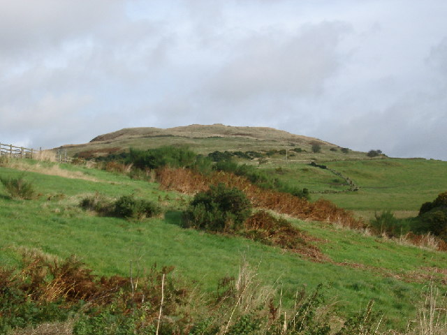
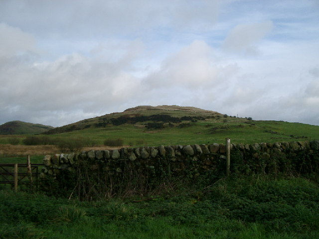
Bank Plantation is a large wooded area located in Kirkcudbrightshire, Scotland. Covering approximately 100 hectares, the plantation is predominantly made up of a variety of tree species, including oak, beech, and pine. The trees in the plantation are well-established and provide a dense canopy, creating a peaceful and secluded atmosphere for visitors to enjoy.

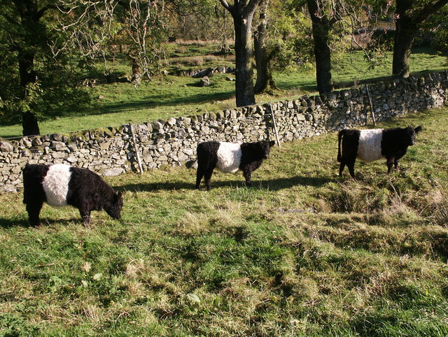
The plantation is a popular destination for outdoor enthusiasts, offering opportunities for walking, hiking, and birdwatching. There are several well-maintained trails that wind through the woodland, allowing visitors to explore the diverse flora and fauna that call Bank Plantation home. Wildlife such as red squirrels, deer, and a variety of bird species can often be spotted throughout the area.

Bank Plantation is managed by the local forestry commission, who work to maintain the health and sustainability of the woodland. They regularly carry out tree thinning and replanting projects to ensure the continued growth and development of the plantation. Overall, Bank Plantation is a tranquil and picturesque woodland that provides a natural escape for visitors to immerse themselves in the beauty of the Scottish countryside.

If you have any feedback on the listing, please let us know in the comments section below.

Bank Plantation Images

Images are sourced within 2km of 54.910204/-4.0944847 or Grid Reference NX6559. Thanks to Geograph Open Source API. All images are credited.

Glengap Burn in Glengap Forest
Rough farm track at a small plantation at Glengap Farm
Cattle grazing below Dow Craig Hill
Farm track below Dow Craig Hill
Sheepfold and woods towards Flee Cairn taken pretty much up the boundary between NX6460 and NX6560.
Sheepfold and woods towards Flee Cairn
taken pretty much up the boundary between NX6460 and NX6560.
Linn Hill Viewed from north-west, over Loch Mannoch.
Linn Hill
Viewed from north-west, over Loch Mannoch.
Northern slopes of Dow Craig This Craig can be called Dow, Dhu, Dew, or Daw. The mixed language of Galloway place-names.
Northern slopes of Dow Craig
This Craig can be called Dow, Dhu, Dew, or Daw. The mixed language of Galloway place-names.
Dow Craig Hill Taken from the track at the other side of the stream
Dow Craig Hill
Taken from the track at the other side of the stream
Fuffock Burn, Glencap Forest Taken from the southernmost forest track in the Glencap Forest
Fuffock Burn, Glencap Forest
Taken from the southernmost forest track in the Glencap Forest
Looking towards Meikle Culcaigrie Hill Meikle Culcaigrie Hill from under the sheepfold near Trostrie. Sheepfold is on the left. Put this photo against the hill in the foreground.
Looking towards Meikle Culcaigrie Hill
Meikle Culcaigrie Hill from under the sheepfold near Trostrie. Sheepfold is on the left. Put this photo against the hill in the foreground.
Meikle Culcaigrie from Glencap Bridge Think that must be Pharoah's Throne at the left hand side.
Meikle Culcaigrie from Glencap Bridge
Think that must be Pharoah's Throne at the left hand side.
Beeches at 'Oaks of Kirkconnell'
Glengap Forest – Red Nick View south where Red Nick Burn flows under the track into the Glengap Burn; the forestry track leads down to the hamlet of Glengap.
Glengap Forest – Red Nick
View south where Red Nick Burn flows under the track into the Glengap Burn; the forestry track leads down to the hamlet of Glengap.
Fore Hill of Glengap The forest road can just be seen climbing and cutting up the north side of Fore Hill of Glengap to an approximate height of 250m in the Glengap Forest.
Fore Hill of Glengap
The forest road can just be seen climbing and cutting up the north side of Fore Hill of Glengap to an approximate height of 250m in the Glengap Forest.
Loch Mannoch looking northwards There are several well-defined tracks in the vicinity but none circumscribes the loch itself and the north-western shoreline can be very boggy and subject to flooding. Glengap Forest lies to the south-west. The area is accessible via a narrow road running northwards from the A75 at Twynholm.
Loch Mannoch looking northwards
There are several well-defined tracks in the vicinity but none circumscribes the loch itself and the north-western shoreline can be very boggy and subject to flooding. Glengap Forest lies to the south-west. The area is accessible via a narrow road running northwards from the A75 at Twynholm.
Belted Galloway cattle - Lairdmannoch Estate These are characteristic cattle of the Galloway region. Several life-size sculptures of them can be seen in the gardens at Threave, Castle Douglas.
Belted Galloway cattle - Lairdmannoch Estate
These are characteristic cattle of the Galloway region. Several life-size sculptures of them can be seen in the gardens at Threave, Castle Douglas.
Glengap Bridge, Twynholm.
Fuffock Burn at Glengap Bridge.
Show me another place!

Bank Plantation is located at Grid Ref: NX6559 (Lat: 54.910204, Lng: -4.0944847)

Unitary Authority: Dumfries and Galloway

Police Authority: Dumfries and Galloway

What 3 Words

///paintings.slicing.hiker. Near Kirkcudbright, Dumfries & Galloway

Related Wikis

Ringford

Ringford is a village in the historical county of Kirkcudbrightshire in Dumfries and Galloway located at grid reference NX689578 beside the Tarff Water...

Tarff railway station

Tarff railway station served the village of Ringford, Dumfries and Galloway, Scotland from 1864 to 1965 on the Kirkcudbright Railway. == History == The...

Twynholm

Twynholm () is a village in Scotland. It is located 2+1⁄4 miles (3.6 km) north-northwest of Kirkcudbright and 4+1⁄2 miles (7.2 km) east of Gatehouse of...

Gatehouse of Fleet

Gatehouse of Fleet (Scots: Gatehoose o Fleet Scottish Gaelic: Taigh an Rathaid) is a town half in the civil parish of Girthon and half in the parish of...

Nearby Amenities

Located within 500m of 54.910204,-4.0944847
Lairdmannoch Lodge
Place: isolated_dwelling
Lat/Long: 54.9118904/-4.0966463
The data included in this document is from www.openstreetmap.org. The data is made available under ODbL.

Have you been to Bank Plantation?

Leave your review of Bank Plantation below (or comments, questions and feedback).