Kenick Wood

Wood, Forest in Kirkcudbrightshire

Scotland

Kenick Wood

Forestry near Lochenbreck Sitka Spruce in Laurieston Forest.
Forestry near Lochenbreck Credit: M J Richardson

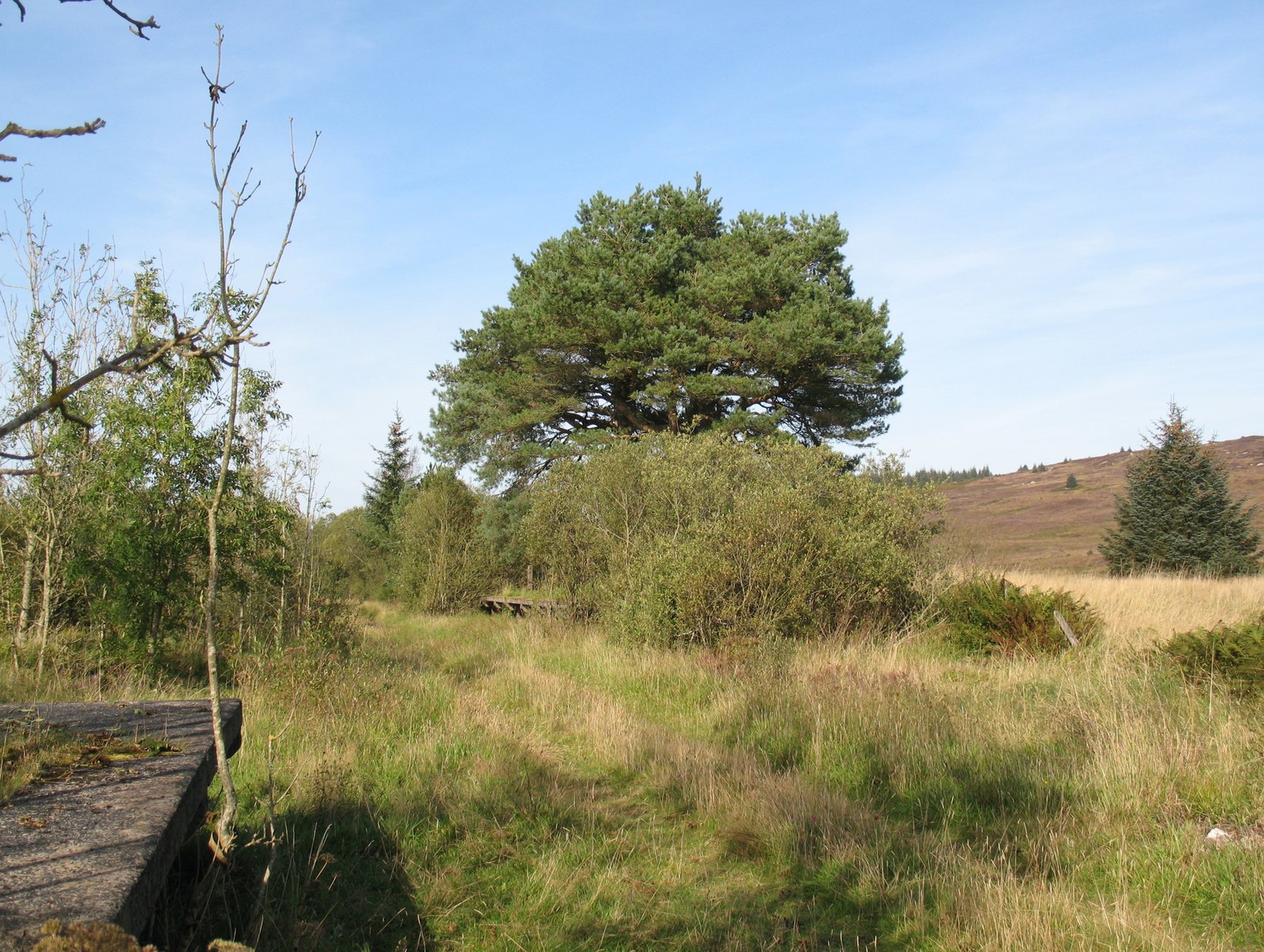
Kenick Wood, located in Kirkcudbrightshire, is a picturesque woodland that covers an area of approximately 100 acres. Situated near the town of Castle Douglas, this enchanting forest is a popular destination for nature lovers and outdoor enthusiasts.

The wood is known for its diverse range of tree species, including oak, beech, birch, and Scots pine. These towering trees create a dense canopy, providing a tranquil and shaded atmosphere within the wood. The forest floor is carpeted with a rich undergrowth of ferns, moss, and wildflowers, adding to the natural beauty of the surroundings.

Kenick Wood is crisscrossed with a network of well-maintained paths and trails, making it easily accessible for visitors. These paths offer a variety of walking and hiking opportunities, catering to all levels of fitness and experience. As visitors explore the wood, they may come across a range of wildlife, including deer, squirrels, and a variety of bird species.

The wood also features a small stream that meanders through its heart, adding to the serene ambiance. This stream is home to numerous aquatic creatures, and its gentle babbling provides a soothing soundtrack to the woodland experience.

Kenick Wood is managed by local authorities, who ensure the preservation and conservation of this natural gem. It is a designated Site of Special Scientific Interest (SSSI), highlighting its ecological importance. Visitors are encouraged to respect the environment and follow the guidelines provided to maintain the wood's natural balance.

Overall, Kenick Wood offers a peaceful retreat from the bustle of everyday life, providing a haven for nature enthusiasts and a valuable habitat for a diverse range of plants and animals.

If you have any feedback on the listing, please let us know in the comments section below.

Kenick Wood Images

Images are sourced within 2km of 54.963432/-4.1013003 or Grid Reference NX6565. Thanks to Geograph Open Source API. All images are credited.

Forestry near Lochenbreck Sitka Spruce in Laurieston Forest.
Forestry near Lochenbreck
Sitka Spruce in Laurieston Forest.
Laurieston Forest Sitka Spruce and roadside bracken.
Laurieston Forest
Sitka Spruce and roadside bracken.
Communication mast in Laurieston Forest Just off the minor road from Gatehouse of Fleet to Laurieston.
Communication mast in Laurieston Forest
Just off the minor road from Gatehouse of Fleet to Laurieston.
Lochenbreck Cottage And the road to Laurieston.
Lochenbreck Cottage
And the road to Laurieston.
Ramerish Holiday Cottage Adjacent to Lochenbreck Cottage, near Laurieston.
Ramerish Holiday Cottage
Adjacent to Lochenbreck Cottage, near Laurieston.
Laurieston Forest The road to Laurieston, in the valley of Kenick Burn.
Laurieston Forest
The road to Laurieston, in the valley of Kenick Burn.
Kenick Woods Dense mixed woodland in Galloway Forest Park.
Kenick Woods
Dense mixed woodland in Galloway Forest Park.
Kennick Burn car park A small car park and picnic site in Laurieston Forest.
Kennick Burn car park
A small car park and picnic site in Laurieston Forest.
Kennick Burn car park A small car park and picnic site in Laurieston Forest.
Kennick Burn car park
A small car park and picnic site in Laurieston Forest.
Kennick Burn car park sign A small car park and picnic site in Laurieston Forest, although local features - burn, wood and hill - are all spelt 'Kenick' on the OS maps.
Kennick Burn car park sign
A small car park and picnic site in Laurieston Forest, although local features - burn, wood and hill - are all spelt 'Kenick' on the OS maps.
Kenick Burn Looking upstream from the footbridge at the car park.
Kenick Burn
Looking upstream from the footbridge at the car park.
Footbridge across Kenick Burn Leading into Kenick Wood, part of Galloway Forest Park.
Footbridge across Kenick Burn
Leading into Kenick Wood, part of Galloway Forest Park.
Beech lined road, Laurieston Forest A contrast to the conifers on either side further in. The 1980 JK (year's biggest orienteering event) was held here and I remember it being particularly tough as well as the brief relief passing through this strip of beeches. Sitka plantations rarely give an enjoyable run.
Beech lined road, Laurieston Forest
A contrast to the conifers on either side further in. The 1980 JK (year's biggest orienteering event) was held here and I remember it being particularly tough as well as the brief relief passing through this strip of beeches. Sitka plantations rarely give an enjoyable run.
Road to Laurieston
Road to Laurieston
A short road, Laurieston Forest
Edge of Laurieston Forest A field under Craigcroft Wood.
Edge of Laurieston Forest
A field under Craigcroft Wood.
Craigcroft Wood This part of Laurieston Forest has had its conifers harvested but not replanted and has been left to the birches.
Craigcroft Wood
This part of Laurieston Forest has had its conifers harvested but not replanted and has been left to the birches.
Laurieston Forest
Laurieston Forest
Show me another place!

Kenick Wood is located at Grid Ref: NX6565 (Lat: 54.963432, Lng: -4.1013003)

Unitary Authority: Dumfries and Galloway

Police Authority: Dumfries and Galloway

What 3 Words

///softest.bluffing.shocks. Near Castle Douglas, Dumfries & Galloway

Nearby Locations

Kenick Hill Kenick Wood

Related Wikis

New Galloway railway station

New Galloway railway station served the town of New Galloway in Dumfries and Galloway, Scotland, from 1861 to 1965 on the Portpatrick and Wigtownshire...

Skerrow

Skerrow was a burgh in Dumfries and Galloway, Scotland. Loch Skerrow Halt railway station, on the Portpatrick and Wigtownshire Joint Railway, served Skerrow...

Loch Skerrow Halt railway station

Loch Skerrow Halt railway station served the burgh of Skerrow, Dumfries and Galloway, Scotland on the Portpatrick and Wigtownshire Joint Railway. ��2...

Airds of Kells

Airds of Kells is a farm and small estate in the historical county of Kirkcudbrightshire in the parish of Kells, Dumfries and Galloway, Scotland. The...

Nearby Amenities

Located within 500m of 54.963432,-4.1013003
Power: pole
Lat/Long: 54.9608184/-4.0953307
Power: pole
Lat/Long: 54.9608318/-4.0965968
Power: pole
Lat/Long: 54.9608428/-4.0977228
Power: pole
Lat/Long: 54.9608538/-4.0987723
Power: pole
Lat/Long: 54.960866/-4.0999152
Power: pole
Lat/Long: 54.9608782/-4.1011559
Power: pole
Lat/Long: 54.9608843/-4.1028343
Power: pole
Lat/Long: 54.9609318/-4.1046825
Power: pole
Lat/Long: 54.9609416/-4.1058489
Power: pole
Lat/Long: 54.9609501/-4.1072722
The data included in this document is from www.openstreetmap.org. The data is made available under ODbL.

Have you been to Kenick Wood?

Leave your review of Kenick Wood below (or comments, questions and feedback).