Rowantree Plantation

Wood, Forest in Kirkcudbrightshire

Scotland

Rowantree Plantation

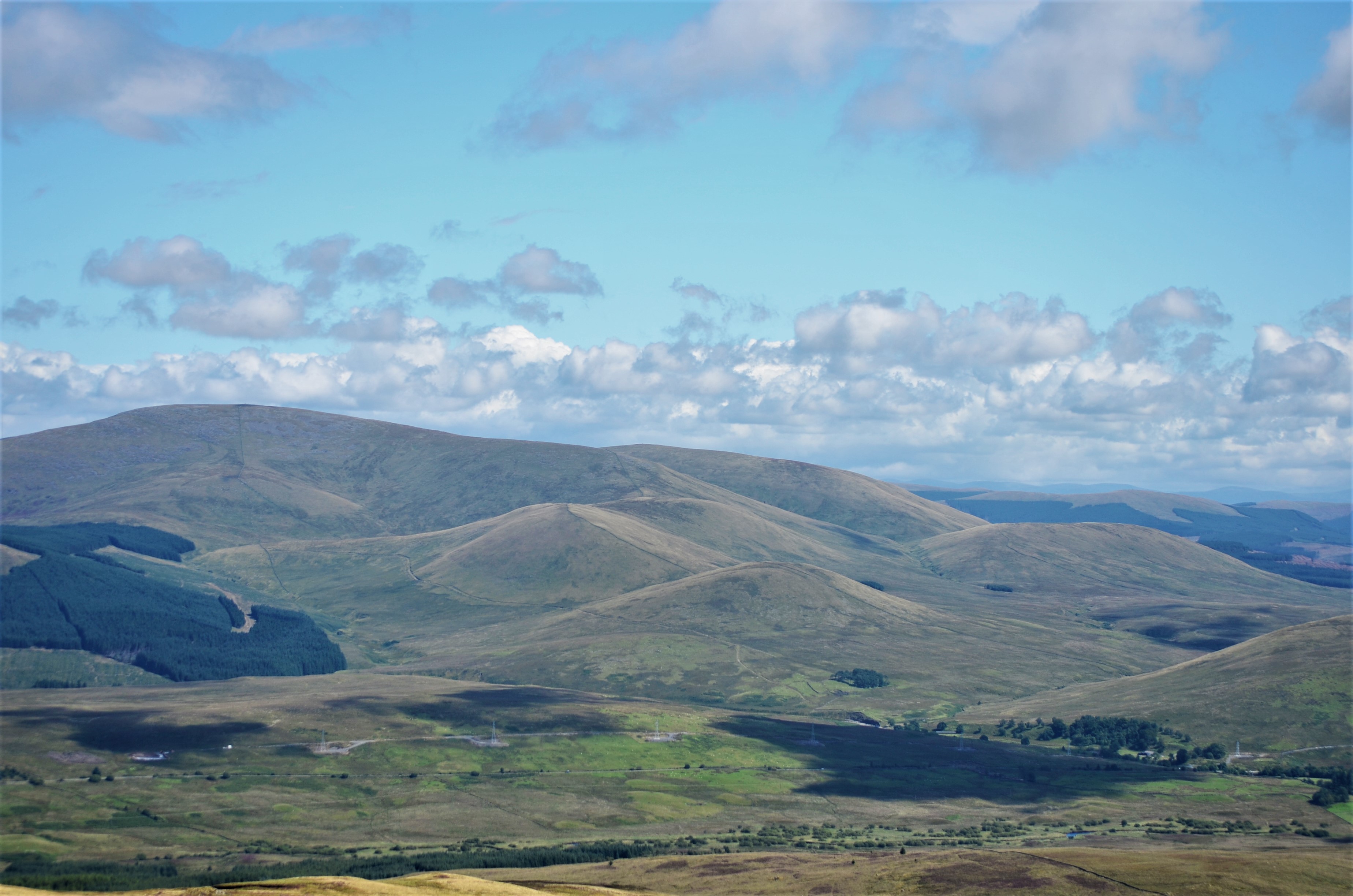
Forestry and moorland below Moorbrock Hill Near the start of the Polifferie Burn.
Forestry and moorland below Moorbrock Hill Credit: wrobison

Rowantree Plantation is a picturesque wood located in the region of Kirkcudbrightshire, Scotland. Spread across a sprawling area, this plantation is known for its stunning beauty, rich biodiversity, and historical significance.

The wood is predominantly filled with rowan trees, which lend their name to the plantation. These trees, with their vibrant red berries, create a mesmerizing sight during autumn. The plantation is also home to a variety of other tree species, including oak, beech, and birch, which contribute to the diverse ecosystem present within the wood.

Wandering through Rowantree Plantation, visitors can enjoy the tranquility and peacefulness of nature. The wood features well-maintained walking trails, allowing visitors to explore the different corners of the plantation at their own pace. The trails wind through the dense foliage, offering glimpses of native wildlife such as red squirrels, deer, and a wide array of bird species.

With its rich history, Rowantree Plantation holds cultural significance as well. The wood was once a part of the historic Carlingwark Estate, which dates back to the 18th century. Remnants of the estate, including old stone walls and ruins, can still be found within the wood, providing a glimpse into its past.

Rowantree Plantation is a popular destination for nature enthusiasts, hikers, and photographers, who are drawn to its natural beauty and serenity. Its accessibility and well-maintained trails make it an ideal spot for a leisurely walk or a picnic amidst the peaceful surroundings.

If you have any feedback on the listing, please let us know in the comments section below.

Rowantree Plantation Images

Images are sourced within 2km of 55.267036/-4.1191783 or Grid Reference NX6599. Thanks to Geograph Open Source API. All images are credited.

Forestry and moorland below Moorbrock Hill Near the start of the Polifferie Burn.
Forestry and moorland below Moorbrock Hill
Near the start of the Polifferie Burn.
Wind Farm track on Dodd Hill The access road to Windy Rig Wind Farm.
Wind Farm track on Dodd Hill
The access road to Windy Rig Wind Farm.
Wind Farm track junction on Dodd Hill The access road to Windy Rig Wind Farm.
Wind Farm track junction on Dodd Hill
The access road to Windy Rig Wind Farm.
Old sheepfold below Ewe Hill The steep hillside is split here by the Small Cleugh which tumbles down through several waterfalls.  The small outcrop on its left is named as Glede Craig (kite or buzzard's crag, in Scots) on the 1: 25000 map.
Old sheepfold below Ewe Hill
The steep hillside is split here by the Small Cleugh which tumbles down through several waterfalls. The small outcrop on its left is named as Glede Craig (kite or buzzard's crag, in Scots) on the 1: 25000 map.
Small Cleugh The Small Cleugh Burn tumbles down the steep hillside of Ewe Hill.
Small Cleugh
The Small Cleugh Burn tumbles down the steep hillside of Ewe Hill.
Upper reaches of Small Cleugh This burn drains off Ewe Hill through the deeply eroded cleugh.
Upper reaches of Small Cleugh
This burn drains off Ewe Hill through the deeply eroded cleugh.
Lorg Bridge and the Water of Ken A 22 wind turbine development is proposed for this peaceful spot, including turbines on Altry Hill on the opposite side of the Water of Ken.
Lorg Bridge and the Water of Ken
A 22 wind turbine development is proposed for this peaceful spot, including turbines on Altry Hill on the opposite side of the Water of Ken.
Fence on Ewe Hill A slight rise up to the 575m point on Ewe Hill.
Fence on Ewe Hill
A slight rise up to the 575m point on Ewe Hill.
Mid Rig A spur leading south-east from Alhang.
Mid Rig
A spur leading south-east from Alhang.
Ewe Hill forestry plantations Sitka spruce plantations above the valley of the Spout Burn.
Ewe Hill forestry plantations
Sitka spruce plantations above the valley of the Spout Burn.
New fence on Mid Rig An electric fence to keep sheep away from the steep drops on the right.
New fence on Mid Rig
An electric fence to keep sheep away from the steep drops on the right.
Water of Ken valley from Mid Rig Looking down the steep spur leading down from Alhang to the farm land at Holm of Dalquhairn.
Water of Ken valley from Mid Rig
Looking down the steep spur leading down from Alhang to the farm land at Holm of Dalquhairn.
Below Mid Hill of Glenhead
Slopes of Dodd Hill to Glenhead Rig
Pond on top of Dodd Hill
Holm Burn from Mid Hill of Glenhead
Corlae on the Water of Ken road
Water of Ken road looking towards Ewe Hill
Show me another place!

Rowantree Plantation is located at Grid Ref: NX6599 (Lat: 55.267036, Lng: -4.1191783)

Unitary Authority: Dumfries and Galloway

Police Authority: Dumfries and Galloway

What 3 Words

///bolsters.messaging.each. Near New Cumnock, East Ayrshire

Nearby Locations

Rowantree Plantation

Related Wikis

Windy Standard

Windy Standard is a hill in the Carsphairn and Scaur Hills range, part of the Southern Uplands of Scotland. It lies in Dumfries and Galloway, south of...

Cairnsmore of Carsphairn

Cairnsmore of Carsphairn is a hill in the Carsphairn and Scaur Hills range, part of the Southern Uplands of Scotland. An alternative name, rarely used...

Blackcraig Hill

Blackcraig Hill is a hill in the Carsphairn and Scaur Hills range, part of the Southern Uplands of Scotland. It lies southeast of the town of New Cumnock...

Carsphairn and Scaur Hills

The Carsphairn and Scaur Hills are the western and eastern hills respectively of a hill range in the Southern Uplands of Scotland. Ordnance Survey maps...

Nearby Amenities

Located within 500m of 55.267036,-4.1191783
Turning Circle
Lat/Long: 55.2634857/-4.1201683
Ford: yes
Lat/Long: 55.2690853/-4.1229736
Ford: yes
Lat/Long: 55.2688571/-4.1240458
The data included in this document is from www.openstreetmap.org. The data is made available under ODbL.

Have you been to Rowantree Plantation?

Leave your review of Rowantree Plantation below (or comments, questions and feedback).