Barbey Wood

Wood, Forest in Kirkcudbrightshire

Scotland

Barbey Wood

The Doon and old fort West of Twynholm Why is it that a fair number of old hill forts etc are tree-enshrouded?
The Doon and old fort West of Twynholm Credit: Kirsty Smith

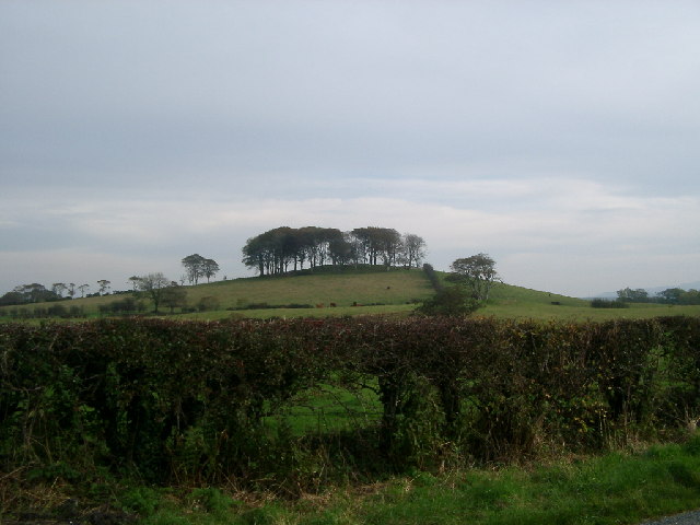
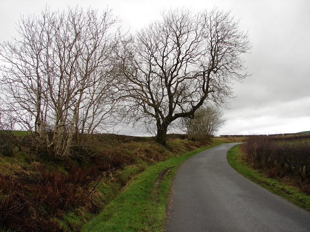
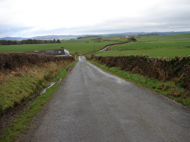
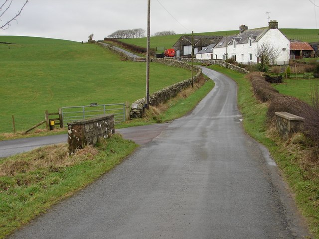
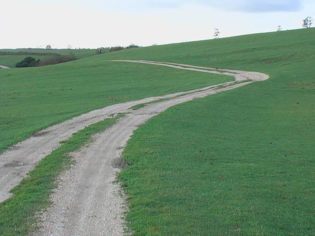
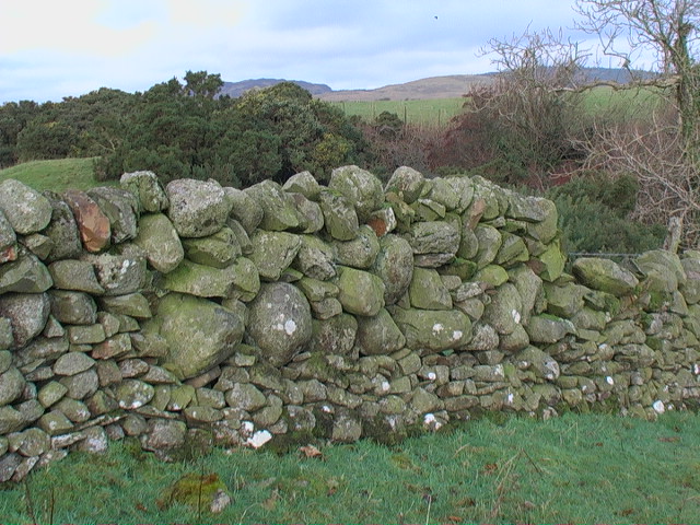
Barbey Wood is a stunning forest located in the region of Kirkcudbrightshire, Scotland. Stretching across a vast area, this wood is known for its natural beauty and diverse flora and fauna. The wood is situated on undulating terrain, providing visitors with breathtaking views of the surrounding landscape.

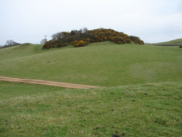
Barbey Wood is primarily composed of native species such as oak, beech, and birch trees, creating a rich and vibrant canopy. These trees provide a habitat for a wide range of wildlife, including deer, birds, and various small mammals. The wood is also home to a number of rare and protected species, making it an important conservation area.

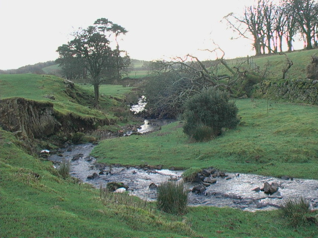
Walking trails wind their way through the wood, allowing visitors to explore its enchanting beauty. The paths are well-maintained and suitable for all levels of fitness, providing a peaceful and serene environment for leisurely strolls or more adventurous hikes. Along the trails, visitors can discover hidden ponds, babbling brooks, and picturesque clearings, providing ample opportunities for nature photography.

Barbey Wood is a popular destination for nature enthusiasts, hikers, and birdwatchers. The wood offers a peaceful retreat from the hustle and bustle of everyday life, providing a chance to connect with nature and enjoy the tranquility it offers. Whether it's a leisurely walk, a picnic among the trees, or birdwatching from one of the strategically placed observation points, Barbey Wood has something to offer for everyone seeking a slice of natural beauty in Kirkcudbrightshire.

If you have any feedback on the listing, please let us know in the comments section below.
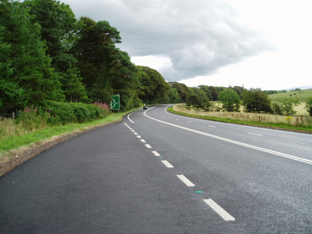
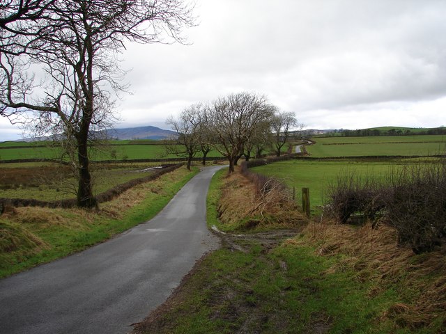
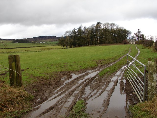
Barbey Wood Images

Images are sourced within 2km of 54.860341/-4.1160189 or Grid Reference NX6453. Thanks to Geograph Open Source API. All images are credited.

The Doon and old fort West of Twynholm Why is it that a fair number of old hill forts etc are tree-enshrouded?
The Doon and old fort West of Twynholm
Why is it that a fair number of old hill forts etc are tree-enshrouded?
Cattle Grazing
Cattle Grazing
Minto Cottage at the Junction with the A755
Llamas Grazing
Llamas Grazing
The A755 At Standingstone
A75 Gretna-Stranraer Road near Twynholm. Picture taken from the east end of the lay-by west of the junction of the A75 and the Old Military Road.
A75 Gretna-Stranraer Road near Twynholm.
Picture taken from the east end of the lay-by west of the junction of the A75 and the Old Military Road.
A75 Gretna-Stranraer Road near Barluka, Twynholm. Picture taken from the lay-by just west of the drive leading to Barwhinnock.
A75 Gretna-Stranraer Road near Barluka, Twynholm.
Picture taken from the lay-by just west of the drive leading to Barwhinnock.
Lodge cottage at Auchenhay
Tannymass - Old Military Road View westward along the unclassified Old Military Road between Twynholm and Gatehouse-of-Fleet. In the distance is Cairnharrow (456m).
Tannymass - Old Military Road
View westward along the unclassified Old Military Road between Twynholm and Gatehouse-of-Fleet. In the distance is Cairnharrow (456m).
Tanymaas Farm Winter muddy track leads up from the Old Military Road to thelonely Tanymaas Farm. NNW are the cottages and farm of Greenslack.
Tanymaas Farm
Winter muddy track leads up from the Old Military Road to thelonely Tanymaas Farm. NNW are the cottages and farm of Greenslack.
Gategill Hill Rather featureless stretch on the unclassified Old Military Road (Twynholm - Gatehouse-of-Fleet) with ascending fields on either side. Gategill Hill rises on the S (left of photo).
Gategill Hill
Rather featureless stretch on the unclassified Old Military Road (Twynholm - Gatehouse-of-Fleet) with ascending fields on either side. Gategill Hill rises on the S (left of photo).
Muiryard The Old Military Road (Gatehouse-of-Fleet - Twynholm) descends to Muiryard before continuing on for a further mile to join the A75 trunk road.
Muiryard
The Old Military Road (Gatehouse-of-Fleet - Twynholm) descends to Muiryard before continuing on for a further mile to join the A75 trunk road.
Muiryard Bridge and Farm Bridge over the Muiryard Burn, situated on the unclassified Old Military Road between Twynholm and Gatehouse-of-Fleet.
Muiryard Bridge and Farm
Bridge over the Muiryard Burn, situated on the unclassified Old Military Road between Twynholm and Gatehouse-of-Fleet.
Gaitgil Lane, Back Lodge View south along the Gaitgil lane near Back Lodge. In the distance is Wigtown Bay.
Gaitgil Lane, Back Lodge
View south along the Gaitgil lane near Back Lodge. In the distance is Wigtown Bay.
Campbelltown Mote Campbelltown Mote is a small double-trenched fort on top of the hillock, best preserved at the north end. The track/footpath below runs from west Twynholm to Campbelton (modern spelling?).
Campbelltown Mote
Campbelltown Mote is a small double-trenched fort on top of the hillock, best preserved at the north end. The track/footpath below runs from west Twynholm to Campbelton (modern spelling?).
Farm track to Auchengassel The surfacing material was broken shell giving a rustic look to the track.
Farm track to Auchengassel
The surfacing material was broken shell giving a rustic look to the track.
The no-messing approach to dyking. This is probably solid enough but it has a 'come close and be crushed' aura.
The no-messing approach to dyking.
This is probably solid enough but it has a 'come close and be crushed' aura.
Course of the Auchengassel Burn looking south
Show me another place!

Barbey Wood is located at Grid Ref: NX6453 (Lat: 54.860341, Lng: -4.1160189)

Unitary Authority: Dumfries and Galloway

Police Authority: Dumfries and Galloway

What 3 Words

///jeering.anguished.minerals. Near Kirkcudbright, Dumfries & Galloway

Nearby Locations

Barbey Wood Moor Hill

Related Wikis

Twynholm

Twynholm () is a village in Scotland. It is located 2+1⁄4 miles (3.6 km) north-northwest of Kirkcudbright and 4+1⁄2 miles (7.2 km) east of Gatehouse of...

Girthon Old Parish Church

Girthon Old Parish Church is a ruined ecclesiastical building in Girthon, near Gatehouse of Fleet in Dumfries and Galloway. Built around 1620 on the foundations...

Cally Palace

Cally Palace, formerly known as Cally House, is an 18th-century country house in the historical county of Kirkcudbrightshire in Dumfries and Galloway...

Kirkcudbright Castle

Kirkcudbright Castle, was a castle that was located on the banks of the River Dee, in Kirkcudbright, Scotland.A motte and bailey castle was built in the...

Kirkcudbright Academy

Kirkcudbright Academy is a state funded, six-year secondary school in Kirkcudbright, Scotland with about 400 pupils and 87 staff including teaching, support...

St Cuthbert Wanderers F.C.

Saint Cuthbert Wanderers Football Club are a football club from the town of Kirkcudbright in the Stewartry in Galloway, Scotland. They play in the South...

Broughton House

Broughton House is an 18th-century town house standing on the High Street of Kirkcudbright, Scotland. It was the home of Scots impressionist artist E....

Kirkcudbright Tolbooth

Kirkcudbright Tolbooth is a historic municipal building in Kirkcudbright in Dumfries and Galloway, Scotland. Built between 1627 and 1629 to serve the town...

Nearby Amenities

Located within 500m of 54.860341,-4.1160189
Parking
Source: survey
Lat/Long: 54.8600051/-4.1135378
Parking
Source: survey
Lat/Long: 54.8586429/-4.1188936
Power: pole
Lat/Long: 54.857715/-4.1210362
Power: pole
Lat/Long: 54.8583944/-4.1206209
Power: pole
Lat/Long: 54.8602438/-4.1195112
Power: pole
Lat/Long: 54.8615395/-4.1187244
Power: pole
Lat/Long: 54.8624715/-4.1181658
Power: pole
Lat/Long: 54.8632469/-4.117732
Power: pole
Lat/Long: 54.8640551/-4.117243
Power: pole
Lat/Long: 54.8647472/-4.1155769
Power: pole
Lat/Long: 54.8644262/-4.1143699
Power: pole
Lat/Long: 54.8640958/-4.1129859
Power: pole
Lat/Long: 54.8636914/-4.1114999
Power: pole
Lat/Long: 54.8595861/-4.1199059
Power: pole
Lat/Long: 54.8589424/-4.1202921
Power: pole
Lat/Long: 54.861529/-4.1177516
Power: pole
Lat/Long: 54.8615249/-4.1167881
Power: pole
Lat/Long: 54.8615316/-4.1157663
Power: pole
Lat/Long: 54.861529/-4.1146046
Power: pole
Lat/Long: 54.8615182/-4.1134429
Power: pole
Lat/Long: 54.861529/-4.1122345
Power: pole
Lat/Long: 54.861529/-4.1110027
Power: pole
Lat/Long: 54.861529/-4.1097337
Power: pole
Lat/Long: 54.861529/-4.1085603
Power: pole
Lat/Long: 54.8617962/-4.1200307
Power: pole
Lat/Long: 54.8621023/-4.1215704
The data included in this document is from www.openstreetmap.org. The data is made available under ODbL.

Have you been to Barbey Wood?

Leave your review of Barbey Wood below (or comments, questions and feedback).