Carharrack

Settlement in Cornwall

England

Carharrack

Mine remains in Poldice Valley
Mine remains in Poldice Valley Credit: Chris Andrews

Carharrack is a small village located in the county of Cornwall, in the southwestern part of England. Nestled in the heart of the countryside, Carharrack is situated about 7 miles southeast of the town of Redruth and approximately 5 miles northwest of the city of Truro.

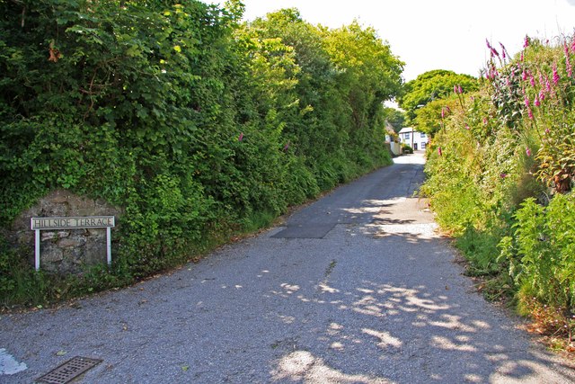
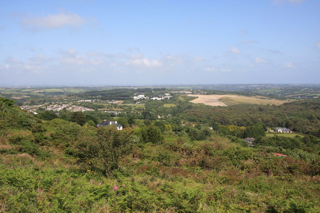
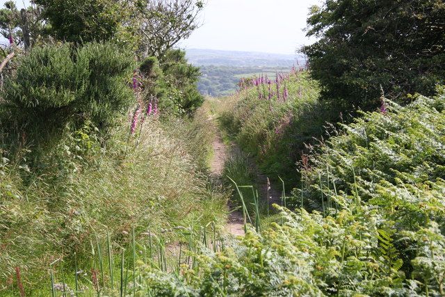
With a population of around 1,500 people, Carharrack exudes a charming and picturesque atmosphere. The village is characterized by its traditional stone-built houses, giving it a quintessentially Cornish feel. The surrounding landscape is dominated by rolling hills, offering breathtaking views of the countryside.

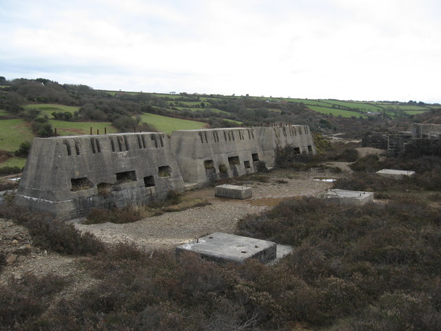
Carharrack is known for its rich mining heritage, which dates back to the 19th century. The village was once a thriving center for tin and copper mining, and remnants of this industrial past can still be seen in the form of old mine buildings and engine houses scattered throughout the area.

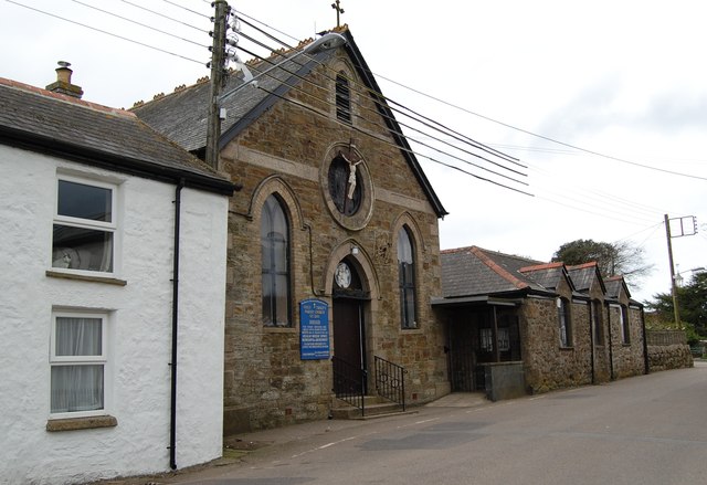
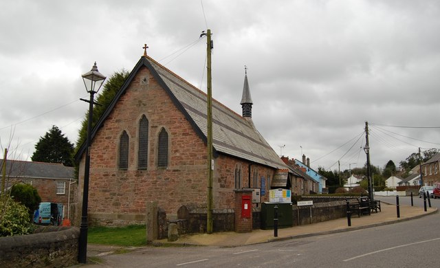
Today, Carharrack is a quiet and close-knit community, with a range of amenities to cater to its residents. These include a primary school, a community center, a local pub, and a village shop. The village also boasts several walking and cycling routes, allowing residents and visitors to explore the beautiful surrounding countryside.

Overall, Carharrack offers a peaceful and idyllic setting, making it an attractive destination for those seeking a rural retreat in the heart of Cornwall.

If you have any feedback on the listing, please let us know in the comments section below.
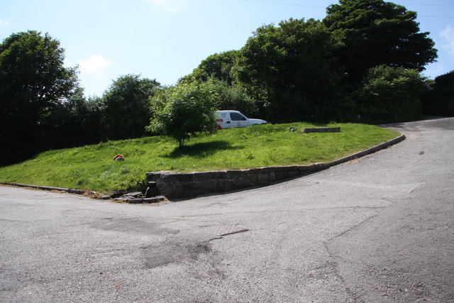
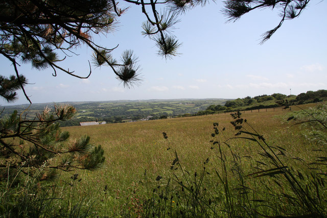
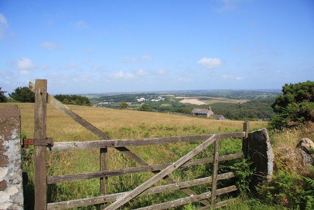
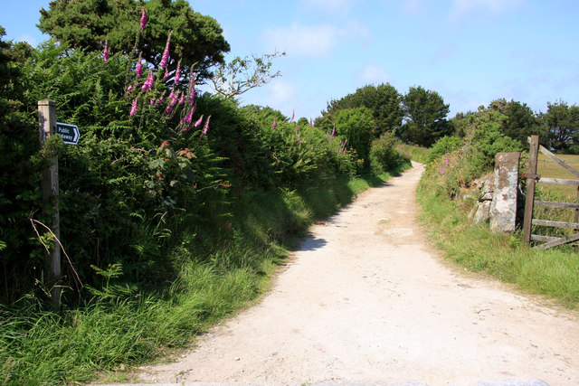
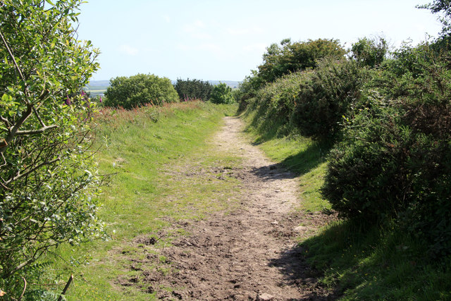
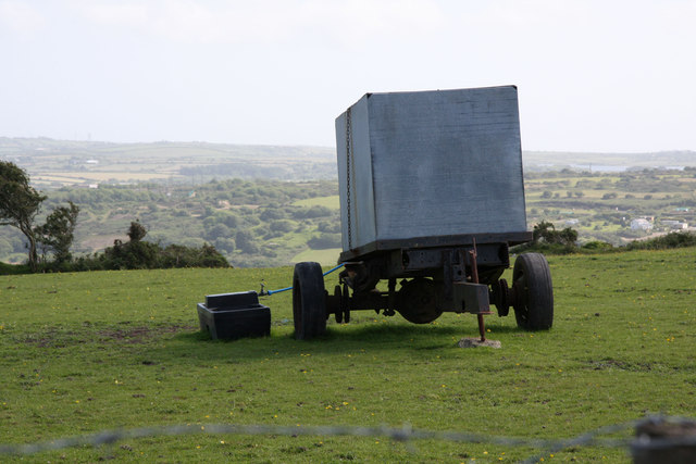
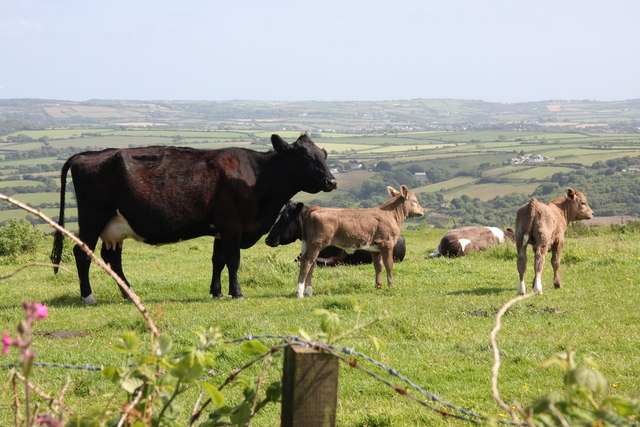
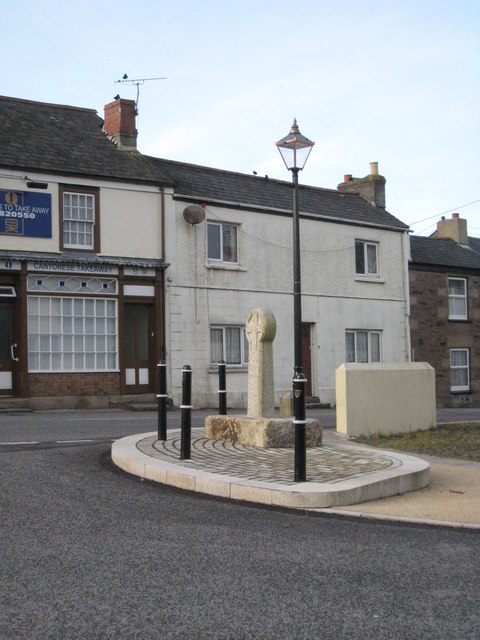
Carharrack Images

Images are sourced within 2km of 50.228867/-5.182529 or Grid Reference SW7341. Thanks to Geograph Open Source API. All images are credited.

Mine remains in Poldice Valley
St Day's new church was the old Sunday School
St Piran's Church, Carharrack
St Weneppa's church, Gwennap The detached tower of St Weneppa's church.
St Weneppa's church, Gwennap
The detached tower of St Weneppa's church.
Hillside Terrace, from the junction with Pennance Road
St. Day: the post office The post office, in Fore Street, retains a traditional looking frontage and unlike many these days is not part of a general village store. There has been a post office in St. Day since 1830.
St. Day: the post office
The post office, in Fore Street, retains a traditional looking frontage and unlike many these days is not part of a general village store. There has been a post office in St. Day since 1830.
St. Day: postbox № TR16 62, Fore Street The off-centre positioning of the collection plate is a giveaway that this postbox was designed for a post office frontage - and that is indeed the case, within the window of <a href="https://www.geograph.org.uk/photo/3705996">SW7242 : St. Day: the post office</a>.
St. Day: postbox № TR16 62, Fore Street
The off-centre positioning of the collection plate is a giveaway that this postbox was designed for a post office frontage - and that is indeed the case, within the window of SW7242 : St. Day: the post office.
Gwennap Pit John Wesley preached here.
Gwennap Pit
John Wesley preached here.
Old Railway Track Sections of the track of the Redruth and Chacewater Railway.  The track was not laid on wooden sleepers, but rather on granite "chairs" set in the ground.  In this shot there are actually two generations of track.  Nearer the camera the track is the original style, from when the wagons were horse-drawn.  Further from the camera the track is of a heavier cross section, installed when steam locomotives replaced horses.
Old Railway Track
Sections of the track of the Redruth and Chacewater Railway. The track was not laid on wooden sleepers, but rather on granite "chairs" set in the ground. In this shot there are actually two generations of track. Nearer the camera the track is the original style, from when the wagons were horse-drawn. Further from the camera the track is of a heavier cross section, installed when steam locomotives replaced horses.
The Shute The Shute, on the eponymous Shute Hill, flows non-stop regardless of the level of rainfall.  Reputedly it has never been known to dry up.  The water is believed to originate from ground water under the mass of Carn Marth, to the west, and is potable.  People still come to fill containers from it.  In days gone by villagers from Carharrack would come here not just to collect water but also to do the weekly wash.  Old photographs show the shute looking just the same as it does now.
The Shute
The Shute, on the eponymous Shute Hill, flows non-stop regardless of the level of rainfall. Reputedly it has never been known to dry up. The water is believed to originate from ground water under the mass of Carn Marth, to the west, and is potable. People still come to fill containers from it. In days gone by villagers from Carharrack would come here not just to collect water but also to do the weekly wash. Old photographs show the shute looking just the same as it does now.
Farmland on the lower slopes of Carn Marth Looking broadly towards Lanner, though Lanner itself is hidden in the valley.
Farmland on the lower slopes of Carn Marth
Looking broadly towards Lanner, though Lanner itself is hidden in the valley.
Farmland on the lower slopes of Carn Marth Looking broadly north east, towards United Downs and the site of the former refuse tip.  The white sheds in the distance, near the skyline, are on the United Downs industrial estate.  The light coloured field is the site of the former tip, now being grassed over.  The house slightly right of middle was once a barn.
Farmland on the lower slopes of Carn Marth
Looking broadly north east, towards United Downs and the site of the former refuse tip. The white sheds in the distance, near the skyline, are on the United Downs industrial estate. The light coloured field is the site of the former tip, now being grassed over. The house slightly right of middle was once a barn.
Bridleway near Carharrack
Bridleway on Carn Marth
Scrub on the slopes of Carn Marth Looking towards United Downs Industrial Estate (white sheds)  and the former refuse tip (light coloured field).  Carharrack village nestles in the middle left.
Scrub on the slopes of Carn Marth
Looking towards United Downs Industrial Estate (white sheds) and the former refuse tip (light coloured field). Carharrack village nestles in the middle left.
Water Bowser on Carn Marth A number of horses, and a small number of cattle, are kept on grazing on the slopes of Carn Marth.  There is no piped water supply up here, however, as there are now no dwellings this high up, so livestock owners tend to bring water up in multiple containers in the back of 4x4s and fill up the bowsers which then feed troughs.
Water Bowser on Carn Marth
A number of horses, and a small number of cattle, are kept on grazing on the slopes of Carn Marth. There is no piped water supply up here, however, as there are now no dwellings this high up, so livestock owners tend to bring water up in multiple containers in the back of 4x4s and fill up the bowsers which then feed troughs.
Footpath on Carn Marth On the ground there are many more footpaths criss-crossing Carn Marth than appear on the 1:25,000 OS.  This makes the area quite popular with mountain bikers, as well as locals wanting exercise for themselves and their dogs.
Footpath on Carn Marth
On the ground there are many more footpaths criss-crossing Carn Marth than appear on the 1:25,000 OS. This makes the area quite popular with mountain bikers, as well as locals wanting exercise for themselves and their dogs.
Cow with calves on Carn Marth
Show me another place!

Carharrack is located at Grid Ref: SW7341 (Lat: 50.228867, Lng: -5.182529)

Unitary Authority: Cornwall

Police Authority: Devon and Cornwall

What 3 Words

///drops.declines.parked. Near St Day, Cornwall

Nearby Locations

Carharrack Sparry Bottom

Related Wikis

Carharrack

Carharrack (Cornish: Karardhek) is a civil parish and village in west Cornwall, England, United Kingdom. It is situated two miles (3 km) east of Redruth...

Trevarth

Trevarth (Cornish: Trevargh) is a hamlet in the parish of Lanner, Cornwall, England, United Kingdom. The name Trevarth comes from the Cornish language...
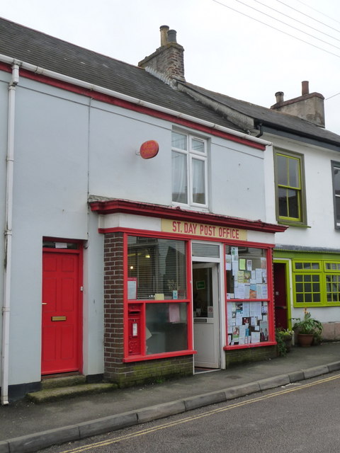
St Day

St Day (Cornish: Sen Day) is a civil parish and village in Cornwall, England, United Kingdom. It is positioned between the village of Chacewater and the...

Crofthandy

Crofthandy is a hamlet in the parish of Gwennap, Cornwall, England. == References ==

Nearby Amenities

Located within 500m of 50.228867,-5.182529
Carharrack
Is In: Cornwall, England, UK
Is In Country: England
Is In Country Code: GB
Is In County: Cornwall
Name Kw: Karardhek
Place: village
Source: local knowledge
Lat/Long: 50.2305988/-5.1789175
Post Box
Collection Times: Mo-Fr 16:45; Sa 11:15
Operator: Royal Mail
Operator Wikidata: Q638098
Post Box Type: wall
Ref: TR16 36
Royal Cypher: EIIR
Royal Cypher Wikidata: Q33102113
Source: survey
Lat/Long: 50.2294/-5.1819147
Bus Stop
Bus Shelter
Bus: yes
Naptan AtcoCode: 0800COC30524
Naptan Bearing: SW
Naptan CommonName: Bus Shelter
Naptan NaptanCode: corapdwd
Naptan PlusbusZoneRef: CBORNE
Naptan Street: Higher Albion Row
Naptan Verified: no
Public Transport: platform
Source: naptan_import
Lat/Long: 50.229647/-5.1811627
Bus Stop
Opp Bus Shelter
Bus: yes
Naptan AtcoCode: 0800COC30525
Naptan Bearing: NE
Naptan CommonName: Opp Bus Shelter
Naptan Indicator: Opp
Naptan NaptanCode: corapdwa
Naptan PlusbusZoneRef: CBORNE
Naptan Street: Higher Albion Row
Naptan Verified: no
Public Transport: platform
Source: naptan_import
Lat/Long: 50.2295667/-5.1814659
Bus Stop
Gwennap Pit Turn
Bus: yes
Naptan AtcoCode: 0800COC30526
Naptan Bearing: SW
Naptan CommonName: Gwennap Pit Turn
Naptan Crossing: Pennance Road
Naptan Indicator: Opp
Naptan NaptanCode: corapdtd
Naptan PlusbusZoneRef: CBORNE
Naptan Street: Church Street
Naptan Verified: no
Public Transport: platform
Source: naptan_import
Lat/Long: 50.2284738/-5.1829357
Bus Stop
Carharrack
Bus: yes
Naptan AtcoCode: 0800COD41067
Naptan Bearing: NE
Naptan CommonName: Carharrack
Naptan NaptanCode: corapdtm
Naptan PlusbusZoneRef: CBORNE
Naptan Street: Church Street
Naptan Verified: no
Public Transport: platform
Source: naptan_import
Lat/Long: 50.2286464/-5.1828771
Bus Stop
The Bus Shelter
Bus: yes
Naptan AtcoCode: 0800COD41069
Naptan Bearing: NE
Naptan CommonName: The Bus Shelter
Naptan NaptanCode: corapgdt
Naptan PlusbusZoneRef: CBORNE
Naptan Street: Fore Street
Naptan Verified: no
Public Transport: platform
Source: naptan_import
Lat/Long: 50.2315154/-5.1786364
Bus Stop
Fore Street
Bus: yes
Naptan AtcoCode: 0800COD41070
Naptan Bearing: SW
Naptan BusStopType: CUS
Naptan CommonName: Fore Street
Naptan NaptanCode: corapgdp
Naptan PlusbusZoneRef: CBORNE
Naptan Street: Fore Street
Naptan Verified: no
Public Transport: platform
Source: naptan_import
Lat/Long: 50.231168/-5.1788377
Barrier: kissing_gate
Lat/Long: 50.2304754/-5.1796879
Historic: memorial
Note: Memorial for William John Mills
Lat/Long: 50.2307366/-5.179311
Source: survey;estimated
Sport: basketball
Lat/Long: 50.2303225/-5.1796918
Access: yes
Leisure: playground
Source: survey;estimated
Lat/Long: 50.2305777/-5.1790553
Note: Wooden pavillion
Source: survey;estimated
Lat/Long: 50.2303509/-5.1793873
Parking
Source: local knowledge
Lat/Long: 50.2313469/-5.1789618
Barrier: cycle_barrier
Source: survey
Lat/Long: 50.231995/-5.177656
Barrier: cycle_barrier
Source: survey
Lat/Long: 50.2332287/-5.1811524
Bench
Backrest: yes
Lat/Long: 50.22824/-5.1833086
Car6 FORD
Fixme: Confim name
Ford: yes
Lat/Long: 50.2329715/-5.184526
Parking
P4 1Box
Lat/Long: 50.2260505/-5.1863514
Barrier: cycle_barrier
Bicycle: yes
Foot: yes
Source: survey
Lat/Long: 50.2327773/-5.180559
Waste Basket
Source: survey
Waste: dog_excrement
Lat/Long: 50.2328109/-5.1805653
Material: wood
Power: pole
Source: survey; bing
Lat/Long: 50.2330823/-5.1820495
Material: wood
Power: pole
Source: survey; bing
Lat/Long: 50.2321204/-5.1809158
Material: wood
Power: pole
Source: survey; bing
Lat/Long: 50.2324705/-5.1819771
Generator Method: photovoltaic
Generator Output Electricity: small_installation
Generator Source: solar
Generator Type: solar_photovoltaic_panel
Location: roof
Power: generator
Source: bing
Lat/Long: 50.2289705/-5.1864964
Generator Method: photovoltaic
Generator Output Electricity: small_installation
Generator Source: solar
Generator Type: solar_photovoltaic_panel
Location: roof
Power: generator
Source: bing
Lat/Long: 50.2280353/-5.1859304
Generator Method: photovoltaic
Generator Output Electricity: small_installation
Generator Source: solar
Generator Type: solar_photovoltaic_panel
Location: roof
Power: generator
Source: bing
Lat/Long: 50.229535/-5.1841307
Generator Method: photovoltaic
Generator Output Electricity: small_installation
Generator Source: solar
Generator Type: solar_photovoltaic_panel
Location: roof
Power: generator
Source: bing
Lat/Long: 50.2314378/-5.1819903
Generator Method: photovoltaic
Generator Output Electricity: small_installation
Generator Source: solar
Generator Type: solar_photovoltaic_panel
Location: roof
Power: generator
Source: bing
Lat/Long: 50.2319405/-5.1795159
Generator Method: photovoltaic
Generator Output Electricity: small_installation
Generator Source: solar
Generator Type: solar_photovoltaic_panel
Location: roof
Power: generator
Source: bing
Lat/Long: 50.231117/-5.1800752
Generator Method: photovoltaic
Generator Output Electricity: small_installation
Generator Source: solar
Generator Type: solar_photovoltaic_panel
Location: roof
Power: generator
Source: bing
Lat/Long: 50.2310483/-5.180279
Generator Method: photovoltaic
Generator Output Electricity: small_installation
Generator Source: solar
Generator Type: solar_photovoltaic_panel
Location: roof
Power: generator
Source: bing
Lat/Long: 50.2308321/-5.1824114
Generator Method: photovoltaic
Generator Output Electricity: small_installation
Generator Source: solar
Generator Type: solar_photovoltaic_panel
Location: roof
Power: generator
Source: bing
Lat/Long: 50.2306211/-5.1827145
Generator Method: photovoltaic
Generator Output Electricity: small_installation
Generator Source: solar
Generator Type: solar_photovoltaic_panel
Location: roof
Power: generator
Source: bing
Lat/Long: 50.2304701/-5.18217
Generator Method: photovoltaic
Generator Output Electricity: small_installation
Generator Source: solar
Generator Type: solar_photovoltaic_panel
Location: roof
Power: generator
Source: bing
Lat/Long: 50.2302093/-5.1823309
Generator Method: photovoltaic
Generator Output Electricity: small_installation
Generator Source: solar
Generator Type: solar_photovoltaic_panel
Location: roof
Power: generator
Source: bing
Lat/Long: 50.2309059/-5.1774868
Generator Method: photovoltaic
Generator Output Electricity: small_installation
Generator Source: solar
Generator Type: solar_photovoltaic_panel
Location: roof
Power: generator
Source: bing
Lat/Long: 50.2304444/-5.1761189
Generator Method: photovoltaic
Generator Output Electricity: small_installation
Generator Source: solar
Generator Type: solar_photovoltaic_panel
Location: roof
Power: generator
Source: bing
Lat/Long: 50.230235/-5.1781386
Generator Method: photovoltaic
Generator Output Electricity: small_installation
Generator Source: solar
Generator Type: solar_photovoltaic_panel
Location: roof
Power: generator
Source: bing
Lat/Long: 50.2300223/-5.1761243
Generator Method: photovoltaic
Generator Output Electricity: small_installation
Generator Source: solar
Generator Type: solar_photovoltaic_panel
Location: roof
Power: generator
Source: bing
Lat/Long: 50.2299622/-5.1762316
Generator Method: photovoltaic
Generator Output Electricity: small_installation
Generator Source: solar
Generator Type: solar_photovoltaic_panel
Location: roof
Power: generator
Source: bing
Lat/Long: 50.229897/-5.1769209
Generator Method: photovoltaic
Generator Output Electricity: small_installation
Generator Source: solar
Generator Type: solar_photovoltaic_panel
Location: roof
Power: generator
Source: bing
Lat/Long: 50.2298284/-5.1770899
Generator Method: photovoltaic
Generator Output Electricity: small_installation
Generator Source: solar
Generator Type: solar_photovoltaic_panel
Location: roof
Power: generator
Source: bing
Lat/Long: 50.22971/-5.1772293
Generator Method: photovoltaic
Generator Output Electricity: small_installation
Generator Source: solar
Generator Type: solar_photovoltaic_panel
Location: roof
Power: generator
Source: bing
Lat/Long: 50.2294955/-5.1770201
Generator Method: photovoltaic
Generator Output Electricity: small_installation
Generator Source: solar
Generator Type: solar_photovoltaic_panel
Location: roof
Power: generator
Source: bing
Lat/Long: 50.2276441/-5.1786134
Generator Method: photovoltaic
Generator Output Electricity: small_installation
Generator Source: solar
Generator Type: solar_photovoltaic_panel
Location: roof
Power: generator
Source: bing
Lat/Long: 50.2277076/-5.1762128
Direction: SE
Generator Method: photovoltaic
Generator Output Electricity: small_installation
Generator Source: solar
Generator Type: solar_photovoltaic_panel
Location: roof
Power: generator
Source: bing;survey
Survey Date: 2020-07-25
Lat/Long: 50.2301711/-5.1776585
Direction: SW
Generator Method: photovoltaic
Generator Output Electricity: small_installation
Generator Source: solar
Generator Type: solar_photovoltaic_panel
Location: roof
Power: generator
Source: bing;survey
Survey Date: 2020-07-25
Lat/Long: 50.2297048/-5.1831517
The data included in this document is from www.openstreetmap.org. The data is made available under ODbL.

Have you been to Carharrack?

Leave your review of Carharrack below (or comments, questions and feedback).