Benjarg Wood

Wood, Forest in Kirkcudbrightshire

Scotland

Benjarg Wood

Spring flowers Lesser celandines [Ranunculus ficaria], and a daisy, flowering by the roadside, Gatehouse of Fleet
Spring flowers Credit: M J Richardson

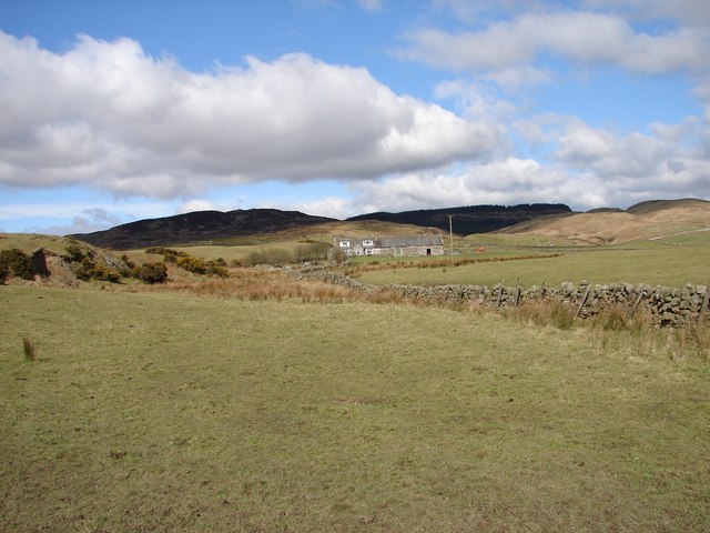
Benjarg Wood is a picturesque forest located in Kirkcudbrightshire, Scotland. Covering an area of approximately 100 hectares, this woodland is a stunning example of the natural beauty that the region has to offer.

The wood is predominantly made up of native broadleaf trees such as oak, birch, and beech, creating a diverse and vibrant ecosystem. These trees provide a habitat for a wide range of wildlife, including birds, mammals, and insects. Visitors to the wood may be lucky enough to spot species such as red squirrels, woodpeckers, and roe deer as they explore the forest trails.

The wood is crisscrossed by a network of paths, making it accessible to walkers of all abilities. These paths wind through the dense woodland, offering visitors the opportunity to immerse themselves in the peaceful surroundings and enjoy the tranquility of nature. There are also designated picnic areas where visitors can take a break and enjoy a packed lunch amidst the stunning scenery.

Benjarg Wood is not only a haven for wildlife but also a valuable resource for the local community. It is managed by the local forestry commission, who work to ensure the sustainable management of the forest, balancing the needs of both nature and people. The wood also serves as an educational resource, with school groups and nature enthusiasts visiting to learn about the importance of conservation and woodland management.

Overall, Benjarg Wood is a hidden gem in Kirkcudbrightshire, offering visitors a chance to connect with nature and explore the beauty of the Scottish countryside.

If you have any feedback on the listing, please let us know in the comments section below.

Benjarg Wood Images

Images are sourced within 2km of 54.891332/-4.1513733 or Grid Reference NX6257. Thanks to Geograph Open Source API. All images are credited.

Spring flowers Lesser celandines [Ranunculus ficaria], and a daisy, flowering by the roadside, Gatehouse of Fleet
Spring flowers
Lesser celandines [Ranunculus ficaria], and a daisy, flowering by the roadside, Gatehouse of Fleet
The Hill Road. Descent into Gatehouse of Fleet. The warning sign is for 14% descent.
The Hill Road. Descent into Gatehouse of Fleet.
The warning sign is for 14% descent.
Car park, Cally Park Forestry car park in the grounds of the Cally Estate.
Car park, Cally Park
Forestry car park in the grounds of the Cally Estate.
Townhead Farm View over the fields to Townhead Farm, taken from the S side of the unclassified Old Military Road between Gatehouse-of-Fleet and Twynholm.
Townhead Farm
View over the fields to Townhead Farm, taken from the S side of the unclassified Old Military Road between Gatehouse-of-Fleet and Twynholm.
Disdow Lane, Gatehouse Lane to Disdow cattle farm and house, east of Gatehouse of Fleet.
Disdow Lane, Gatehouse
Lane to Disdow cattle farm and house, east of Gatehouse of Fleet.
Upper Drumwall Upper Drumwall on the Gatehouse to Cairn lane near Townhead Hill.
Upper Drumwall
Upper Drumwall on the Gatehouse to Cairn lane near Townhead Hill.
Townhead Hill View west to Upper Drumwall. Beyond, over the Fleet Valley, are the south-western Galloway Hills.
Townhead Hill
View west to Upper Drumwall. Beyond, over the Fleet Valley, are the south-western Galloway Hills.
Cairn Farm, Gatehouse Remote farm situated at the end of the lane from Gatehouse of Fleet; situated on the Littleton Burn between Rig of Cairn and Irelandton Moor.
Cairn Farm, Gatehouse
Remote farm situated at the end of the lane from Gatehouse of Fleet; situated on the Littleton Burn between Rig of Cairn and Irelandton Moor.
Gatehouse Loch A small lochan on the outskirts of Gatehouse.
Gatehouse Loch
A small lochan on the outskirts of Gatehouse.
Gatehouse of Fleet Near Gatehouse of Fleet village centre.
Gatehouse of Fleet
Near Gatehouse of Fleet village centre.
Cally Park Lodges An asymmetrical pair of granite mid-Victorian crowstep-gabled lodges at the north entrance to Cally Forest park and the Cally Palace Hotel. The east (left) with a conical-roofed tower, the west with a triangular bay window.
Cally Park Lodges
An asymmetrical pair of granite mid-Victorian crowstep-gabled lodges at the north entrance to Cally Forest park and the Cally Palace Hotel. The east (left) with a conical-roofed tower, the west with a triangular bay window.
One of the Calley House gate houses
The High Street The street decorations were from the recent Gatehouse of Fleet Gala Week (an annual event). For how the scene looks without bunting, see <a href="https://www.geograph.org.uk/photo/6155243">NX6056 : High Street, Gatehouse of Fleet</a>.
The High Street
The street decorations were from the recent Gatehouse of Fleet Gala Week (an annual event). For how the scene looks without bunting, see NX6056 : High Street, Gatehouse of Fleet.
Scott's Mill Scott’s Mill in Ann St was built c.1790 as a cotton mill, later it became a sawmill then converted to flats 1994.
Scott's Mill
Scott’s Mill in Ann St was built c.1790 as a cotton mill, later it became a sawmill then converted to flats 1994.
Toll House, Gatehouse of Fleet Built 1823 at the east end of High Street, the Toll House was later extended to form a school. Now a private residence. On the right is the Celtic cross war memorial <a href="https://www.geograph.org.uk/photo/973073">NX6056 : War Memorial, Gatehouse of Fleet</a>
Toll House, Gatehouse of Fleet
Built 1823 at the east end of High Street, the Toll House was later extended to form a school. Now a private residence. On the right is the Celtic cross war memorial NX6056 : War Memorial, Gatehouse of Fleet
War Memorial, Gatehouse of Fleet Granite Celtic cross (1921), the faces carved with Pictish motifs.
War Memorial, Gatehouse of Fleet
Granite Celtic cross (1921), the faces carved with Pictish motifs.
ROC Underground Monitoring Post, Gatehouse Extant surface features of a Royal Observer Corps underground monitoring post (1959-68) on Galla Hill.
ROC Underground Monitoring Post, Gatehouse
Extant surface features of a Royal Observer Corps underground monitoring post (1959-68) on Galla Hill.
Laurieston Road Laurieston Road, near Gatehouse of Fleet.
Laurieston Road
Laurieston Road, near Gatehouse of Fleet.
Show me another place!

Benjarg Wood is located at Grid Ref: NX6257 (Lat: 54.891332, Lng: -4.1513733)

Unitary Authority: Dumfries and Galloway

Police Authority: Dumfries and Galloway

What 3 Words

///majors.defaults.improvise. Near Kirkcudbright, Dumfries & Galloway

Related Wikis

Gatehouse of Fleet

Gatehouse of Fleet (Scots: Gatehoose o Fleet Scottish Gaelic: Taigh an Rathaid) is a town half in the civil parish of Girthon and half in the parish of...

Gatehouse of Fleet Town Hall

Gatehouse of Fleet Town Hall is a former municipal building in the High Street in Gatehouse of Fleet, Dumfries and Galloway, Scotland. The structure, which...

Cally Palace

Cally Palace, formerly known as Cally House, is an 18th-century country house in the historical county of Kirkcudbrightshire in Dumfries and Galloway...

Trusty's Hill

Trusty's Hill is a small vitrified hillfort about a mile to the west of the present-day town of Gatehouse of Fleet, in the parish of Anwoth in the Stewartry...

Have you been to Benjarg Wood?

Leave your review of Benjarg Wood below (or comments, questions and feedback).