Carew Cheriton
Settlement in Pembrokeshire
Wales
Carew Cheriton
Carew Cheriton is a small village located in the county of Pembrokeshire, Wales. Situated on the southern edge of the national park, it lies just a few miles north of the bustling town of Tenby. The village is known for its picturesque setting, surrounded by lush countryside and rolling hills.
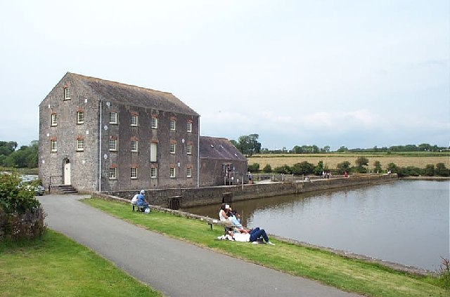
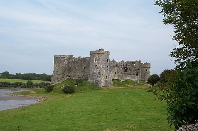
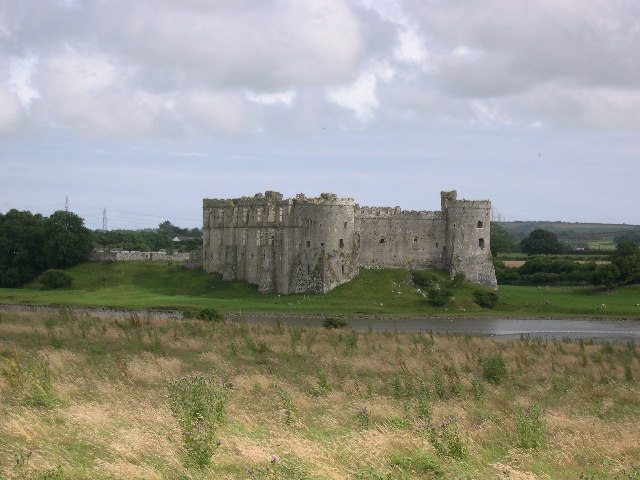
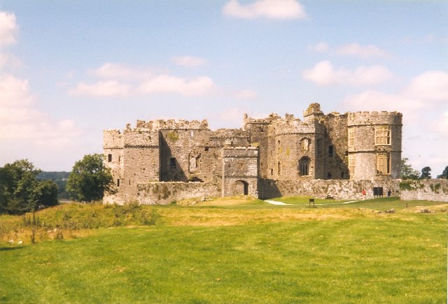
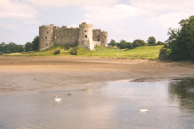
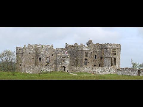
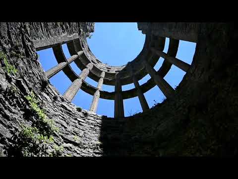
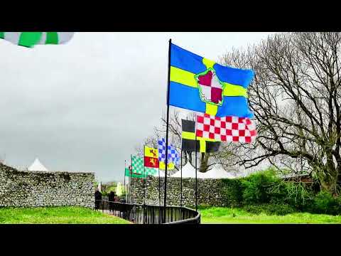
One of the main attractions in Carew Cheriton is Carew Castle, a medieval fortress that dates back to the 12th century. The castle stands on the banks of the Carew River and offers visitors a glimpse into its rich history through its well-preserved ruins and informative exhibitions. Additionally, the adjacent Carew Tidal Mill, one of the only restored tidal mills in Wales, provides a fascinating insight into the area's industrial past.
Nature enthusiasts can explore the nearby Carew Cheriton Control Tower, which has been converted into a visitor center and bird hide. From here, one can observe a variety of bird species that inhabit the nearby estuary, including wading birds and waterfowl.
The village itself is quaint and peaceful, with charming cottages and a traditional village pub. The surrounding countryside offers ample opportunities for outdoor activities such as walking, cycling, and fishing. The Pembrokeshire Coast Path, a renowned long-distance trail, passes through the village, attracting hikers and nature lovers from near and far.
In summary, Carew Cheriton is a picturesque village that boasts a rich history, stunning natural landscapes, and a range of attractions for visitors to enjoy.
If you have any feedback on the listing, please let us know in the comments section below.
Carew Cheriton Images
Images are sourced within 2km of 51.689319/-4.826836 or Grid Reference SN0402. Thanks to Geograph Open Source API. All images are credited.


Carew Cheriton is located at Grid Ref: SN0402 (Lat: 51.689319, Lng: -4.826836)
Unitary Authority: Pembrokeshire
Police Authority: Dyfed Powys
What 3 Words
///groomed.rejoiced.refusals. Near Manorbier, Pembrokeshire
Nearby Locations
Related Wikis

Old Mortuary Chapel, Carew
Old Mortuary Chapel is a medieval Grade I listed building in St Mary's churchyard, Carew, Pembrokeshire, Wales. == Structure == The building has two storeys...
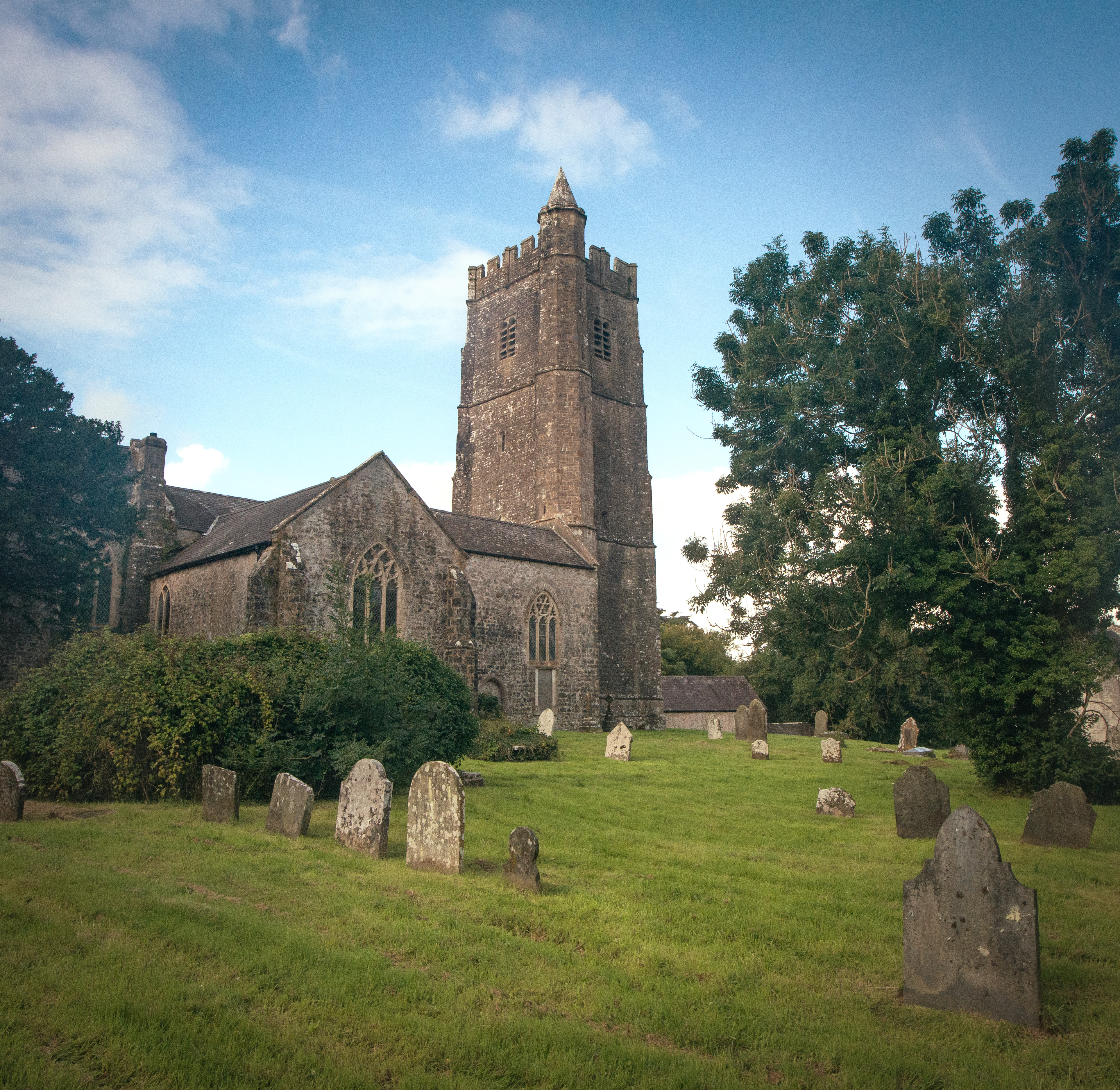
St Mary's Church, Carew
St Mary's Church, Carew, is the parish church of Carew, Pembrokeshire, Wales and a Grade I listed building. Lewis's Topographical Dictionary of Wales states...

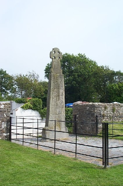
Carew Cross
Carew Cross (Welsh: Croes Caeriw) is an 11th-century Grade I listed monument in the village of Carew, Pembrokeshire, Wales. == Description == The cross...

Carew, Pembrokeshire
Carew (Welsh: Caeriw) is a village, parish and community on an inlet of Milford Haven in the former Hundred of Narberth, Pembrokeshire, West Wales, 4 miles...
Related Videos
Carew Castle Visit - Pembrokeshire
This lovely castle located in Pembrokeshire is a great place to visit and in a beautiful location along with the old Tidal Mill just ...
Carew Castle & Tidal Mill
Carew Castle & Tidal Mill #uk #travelvlog #travel #ukvlog #wales #walking #walestravel #waleswalking #castle #carew ...

Carew Castel & Tidal Mill + A Car Show!
We knew we'd be exploring a castle, but we had no idea there would also be a car show! Talk about a fun surprise! It was such a ...
Carew Castle, Pembrokeshire
A visit to Carew Castle with the family.
Nearby Amenities
Located within 500m of 51.689319,-4.826836Have you been to Carew Cheriton?
Leave your review of Carew Cheriton below (or comments, questions and feedback).