March Wood

Wood, Forest in Perthshire

Scotland

March Wood

Ben Gullipen welcoming committee Part of a small herd of cattle grazing - and lazing - by the Ben Gullipen access track.  A 4x4 heading up to access the masts on Ben Gullipen, as seen in the background here, got past the gang after a few horn blasts.

This photograph was taken during the Coronavirus (COVID-19) pandemic of 2020/21/22.
Ben Gullipen welcoming committee Credit: James T M Towill

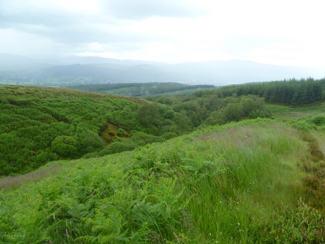
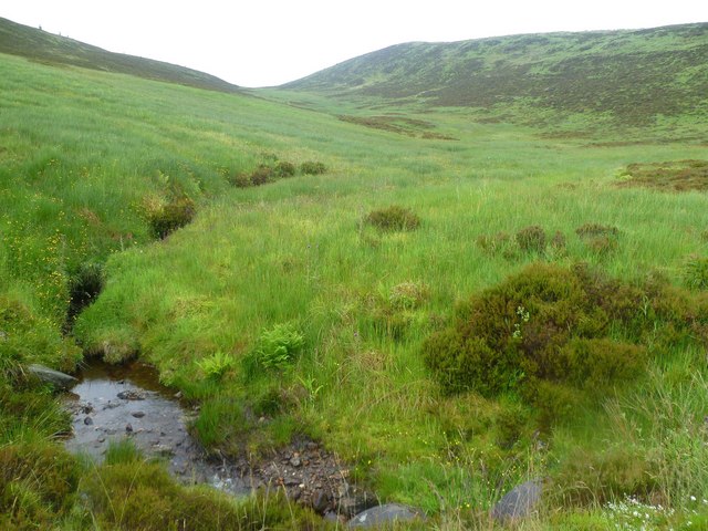
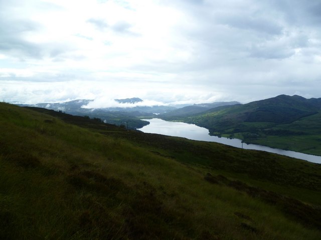
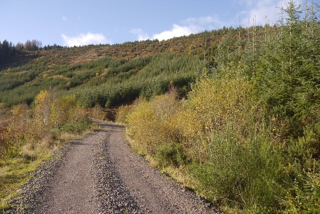
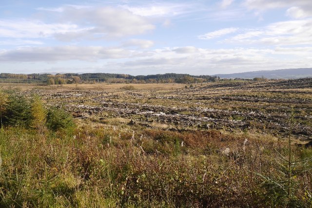
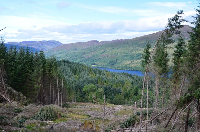
March Wood is a picturesque forest located in Perthshire, Scotland. Covering an area of approximately 500 acres, it is a popular destination for nature enthusiasts and outdoor activities. The wood is situated near the village of Bridge of Earn, just a short drive from the city of Perth.

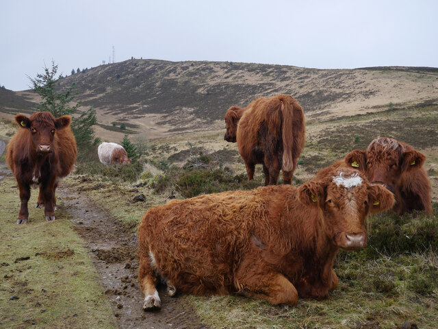
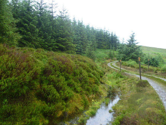
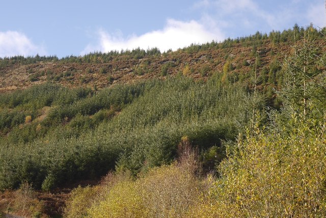
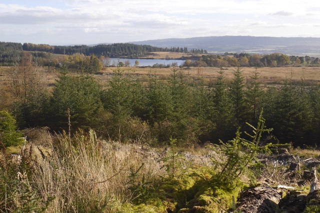
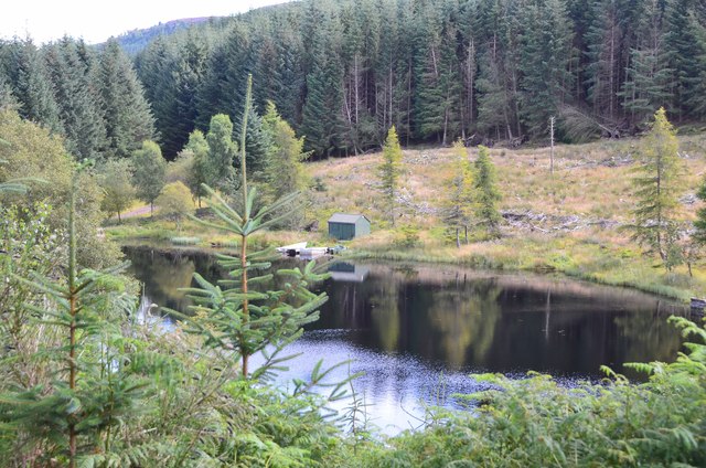
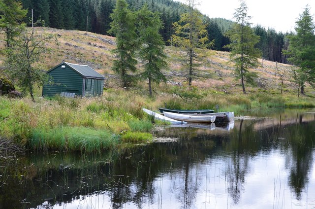
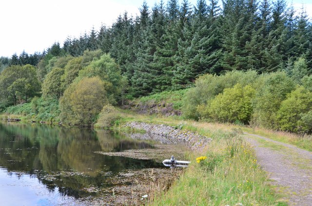
March Wood is characterized by its diverse range of tree species, including oak, birch, and Scots pine. The woodland environment provides a habitat for various wildlife, such as red squirrels, roe deer, and a wide variety of bird species. The forest's natural beauty is further enhanced by the presence of a small stream that meanders through the wood, adding to the tranquility of the surroundings.

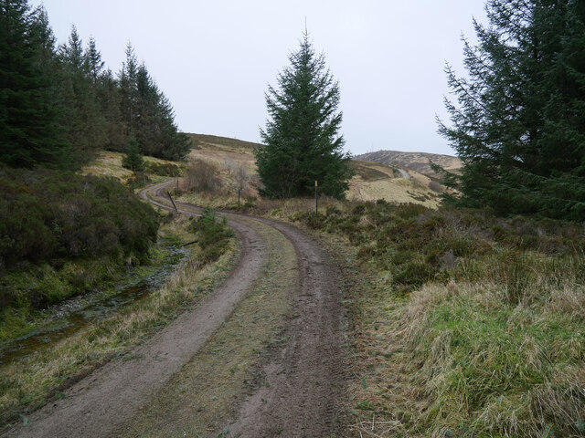
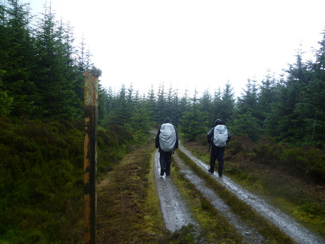
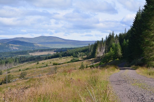
Visitors to March Wood can enjoy a network of well-maintained footpaths and trails, allowing them to explore the forest at their own pace. These paths offer stunning views of the surrounding countryside, making it an ideal location for hiking, jogging, or leisurely strolls. Additionally, the forest provides opportunities for birdwatching, as many species can be spotted throughout the year.

March Wood is managed by the local forestry commission, ensuring its preservation and promoting sustainable practices. The forest is accessible year-round, with the changing seasons adding to its allure. In the spring, the wood is adorned with vibrant wildflowers, while autumn brings a stunning display of colors as the leaves turn golden and red.

Overall, March Wood in Perthshire is a haven for nature lovers, offering a peaceful retreat and a chance to connect with the natural beauty of Scotland's woodlands.

If you have any feedback on the listing, please let us know in the comments section below.

March Wood Images

Images are sourced within 2km of 56.215236/-4.2728276 or Grid Reference NN5904. Thanks to Geograph Open Source API. All images are credited.

Ben Gullipen welcoming committee Part of a small herd of cattle grazing - and lazing - by the Ben Gullipen access track.  A 4x4 heading up to access the masts on Ben Gullipen, as seen in the background here, got past the gang after a few horn blasts.

This photograph was taken during the Coronavirus (COVID-19) pandemic of 2020/21/22.
Ben Gullipen welcoming committee
Part of a small herd of cattle grazing - and lazing - by the Ben Gullipen access track. A 4x4 heading up to access the masts on Ben Gullipen, as seen in the background here, got past the gang after a few horn blasts. This photograph was taken during the Coronavirus (COVID-19) pandemic of 2020/21/22.
Heading out of the forest bound for Ben Gullipen An overcast day on the Ben Gullipen access track.

This photograph was taken during the Coronavirus (COVID-19) pandemic of 2020/21/22.
Heading out of the forest bound for Ben Gullipen
An overcast day on the Ben Gullipen access track. This photograph was taken during the Coronavirus (COVID-19) pandemic of 2020/21/22.
Forest Track, Cock Hill Heading for Ben Gullipen
Forest Track, Cock Hill
Heading for Ben Gullipen
Forest Track Heading for Ben Gullipen
Forest Track
Heading for Ben Gullipen
Wooded Gulley Under Ben Gullipen. The watercourse it conceals flows into Eas Gobhain at Easter Dullater and thence into The River Teith.
Wooded Gulley
Under Ben Gullipen. The watercourse it conceals flows into Eas Gobhain at Easter Dullater and thence into The River Teith.
Under Ben Gullipen Very wet grass and moorland under The Ben
Under Ben Gullipen
Very wet grass and moorland under The Ben
On Ben Gullipen Looking towards Loch Venachar
On Ben Gullipen
Looking towards Loch Venachar
Easter Dullater A large house in farmland on the road to Invertrossachs Estate.
Easter Dullater
A large house in farmland on the road to Invertrossachs Estate.
Letter Hill Steep wooded slopes on the Highland Boundary Fault. There are conglomerate crags up there.
Letter Hill
Steep wooded slopes on the Highland Boundary Fault. There are conglomerate crags up there.
Letter Hill Conglomerate crags and young trees on the Highland Boundary Fault.
Letter Hill
Conglomerate crags and young trees on the Highland Boundary Fault.
Clearfell, Letter
Clearfell, Letter
View towards Loch Rusky A clear felled area allows a view of the loch from near Letter. Rotting logs in the foreground date from when the last crop was felled.
View towards Loch Rusky
A clear felled area allows a view of the loch from near Letter. Rotting logs in the foreground date from when the last crop was felled.
Lochan Allt a' Chip Dhuibh The lochan and boathouse from the NW bank.
Lochan Allt a' Chip Dhuibh
The lochan and boathouse from the NW bank.
Fishing boats, Lochan Allt a' Chip Dhuibh Shed and boats at this private fishing lochan.
Fishing boats, Lochan Allt a' Chip Dhuibh
Shed and boats at this private fishing lochan.
Track by the lochan Track by Lochan Allt a' Chip Dhuibh, on the Rob Roy Way between Aberfoyle and Callander.
Track by the lochan
Track by Lochan Allt a' Chip Dhuibh, on the Rob Roy Way between Aberfoyle and Callander.
Loch Venachar in view A break in the forest reveals the loch and the summit of Stuc Odhar (634m).
Loch Venachar in view
A break in the forest reveals the loch and the summit of Stuc Odhar (634m).
Milton of Callander and Ben Ledi Looking across Loch Venachar from the forest track to East Lodge.
Milton of Callander and Ben Ledi
Looking across Loch Venachar from the forest track to East Lodge.
Forest track to East Lodge The track down to the shore of Loch Venachar, on the route from Aberfoyle.
Forest track to East Lodge
The track down to the shore of Loch Venachar, on the route from Aberfoyle.
Show me another place!

March Wood is located at Grid Ref: NN5904 (Lat: 56.215236, Lng: -4.2728276)

Unitary Authority: Stirling

Police Authority: Forth Valley

What 3 Words

///third.union.salaried. Near Callander, Stirling

Related Wikis

Eas Gobhain

Eas Gobhain is a river in the Trossachs of Scotland just west of Callander . It is the outflow of Loch Venachar and joins with Garbh Uisge west of Callander...

Loch Venachar

Loch Venachar (Scottish Gaelic: Loch Bheannchair) is a freshwater loch in Stirling district, Scotland. == Geography == The loch is situated between Callander...

Rusky Castle

Rusky Castle, also known as Ruskie Castle, is a ruined castle on an islet on Loch Rusky, Stirling, Scotland. The islet is now submerged. The castle was...

Loch Rusky

Loch Rusky is a small freshwater loch near Callander in the Stirling council area in Scottish Highlands. == Geography == The lake lies in the Registration...

Nearby Amenities

Located within 500m of 56.215236,-4.2728276
Turning Circle
Lat/Long: 56.2122541/-4.276725
Power: pole
Lat/Long: 56.2185862/-4.2688953
Power: pole
Lat/Long: 56.2184525/-4.2701336
Power: pole
Lat/Long: 56.2183699/-4.2709892
Power: pole
Lat/Long: 56.2182722/-4.2720748
Power: pole
Lat/Long: 56.2181629/-4.2731834
Power: pole
Lat/Long: 56.2180547/-4.2743004
Power: pole
Lat/Long: 56.2176348/-4.2755638
Power: pole
Lat/Long: 56.2172184/-4.2767958
Power: pole
Lat/Long: 56.2168556/-4.2778856
Power: pole
Lat/Long: 56.2165031/-4.2789692
Power: pole
Lat/Long: 56.2161612/-4.2799795
The data included in this document is from www.openstreetmap.org. The data is made available under ODbL.

Have you been to March Wood?

Leave your review of March Wood below (or comments, questions and feedback).