Letter Hill

Hill, Mountain in Perthshire

Scotland

Letter Hill

Ben Gullipen welcoming committee Part of a small herd of cattle grazing - and lazing - by the Ben Gullipen access track.  A 4x4 heading up to access the masts on Ben Gullipen, as seen in the background here, got past the gang after a few horn blasts.

This photograph was taken during the Coronavirus (COVID-19) pandemic of 2020/21/22.
Ben Gullipen welcoming committee Credit: James T M Towill

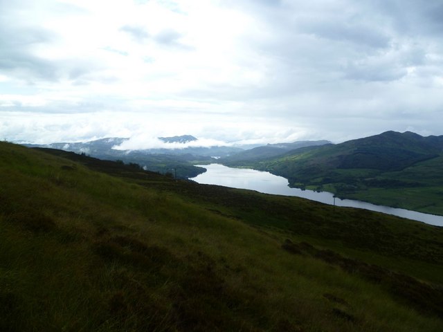
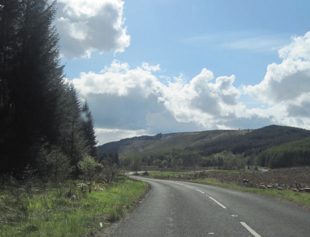
Letter Hill is a prominent hill located in the picturesque region of Perthshire, Scotland. Standing at an impressive height of 409 meters (1,342 feet), it offers breathtaking panoramic views of the surrounding countryside. The hill is situated near the towns of Aberfeldy and Strathtay, making it easily accessible for both locals and visitors.

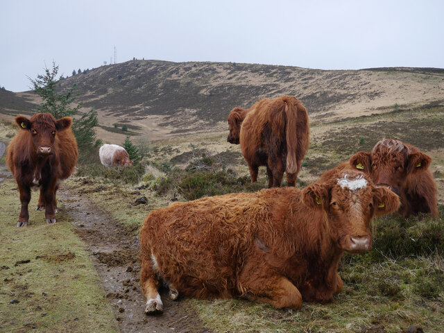
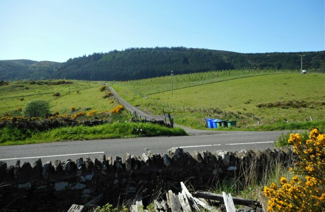
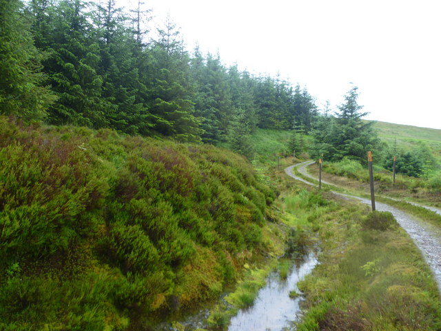
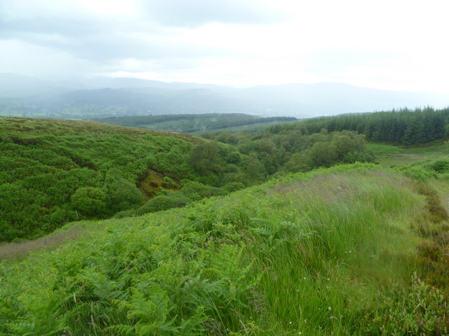
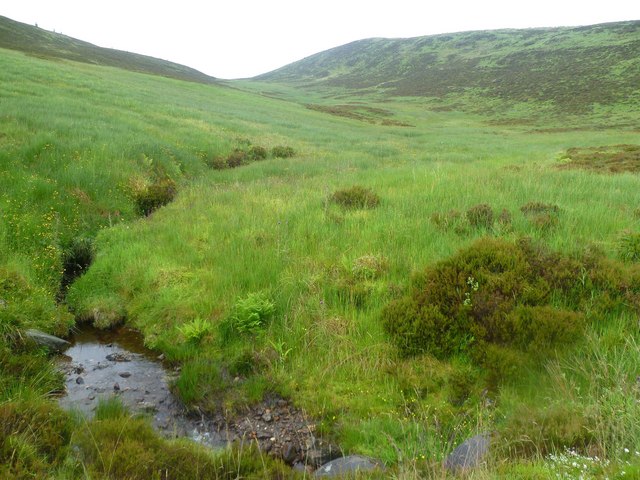
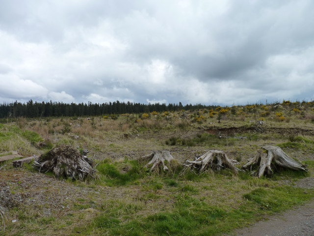
The terrain of Letter Hill is characterized by rolling green slopes and scattered rocky outcrops, creating a diverse and visually appealing landscape. The hill is covered in heather and grasses, which add to its natural beauty, particularly when they bloom in vibrant colors during the summer months.

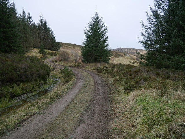
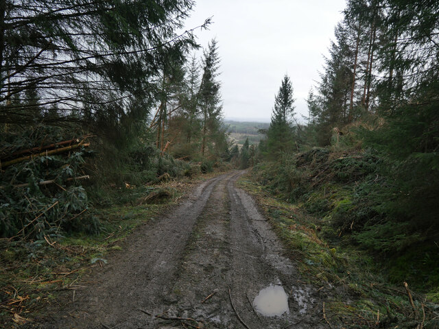
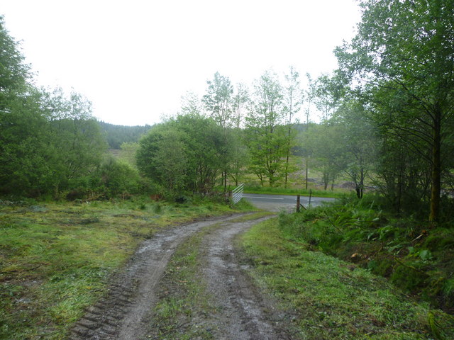
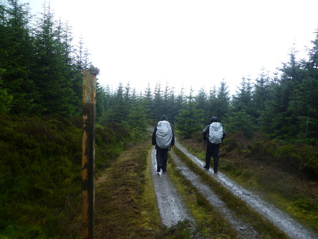
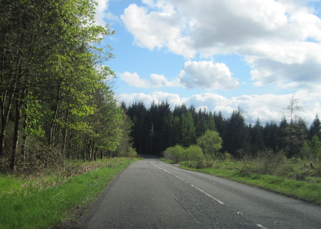
Hiking enthusiasts are drawn to Letter Hill for its well-marked trails and paths that cater to different levels of difficulty. The ascent to the summit provides a challenging but rewarding experience, with stunning views of the Tay Valley and the surrounding mountains as the ultimate reward. The hill is also home to a variety of wildlife, including red deer, hares, and various bird species, making it an ideal spot for nature lovers and photographers.

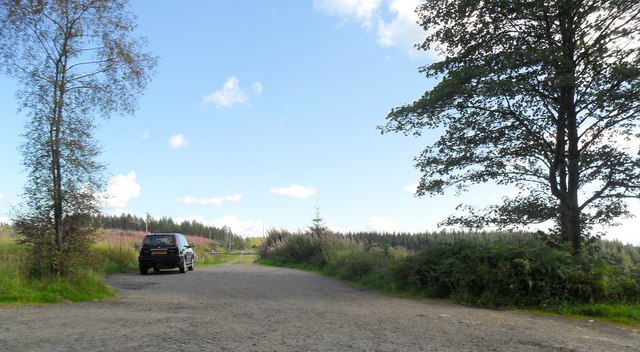
Due to its location, Letter Hill serves as a popular destination for outdoor activities such as walking, hiking, and picnicking. Its proximity to other attractions, including nearby castles and historic sites, enhances its appeal for tourists seeking a well-rounded experience in the region.

In conclusion, Letter Hill in Perthshire, Scotland, is a captivating natural landmark, offering visitors a chance to immerse themselves in the stunning beauty of the Scottish countryside while enjoying a range of outdoor activities.

If you have any feedback on the listing, please let us know in the comments section below.

Letter Hill Images

Images are sourced within 2km of 56.210474/-4.2590482 or Grid Reference NN5904. Thanks to Geograph Open Source API. All images are credited.

Ben Gullipen welcoming committee Part of a small herd of cattle grazing - and lazing - by the Ben Gullipen access track.  A 4x4 heading up to access the masts on Ben Gullipen, as seen in the background here, got past the gang after a few horn blasts.

This photograph was taken during the Coronavirus (COVID-19) pandemic of 2020/21/22.
Ben Gullipen welcoming committee
Part of a small herd of cattle grazing - and lazing - by the Ben Gullipen access track. A 4x4 heading up to access the masts on Ben Gullipen, as seen in the background here, got past the gang after a few horn blasts. This photograph was taken during the Coronavirus (COVID-19) pandemic of 2020/21/22.
Heading out of the forest bound for Ben Gullipen An overcast day on the Ben Gullipen access track.

This photograph was taken during the Coronavirus (COVID-19) pandemic of 2020/21/22.
Heading out of the forest bound for Ben Gullipen
An overcast day on the Ben Gullipen access track. This photograph was taken during the Coronavirus (COVID-19) pandemic of 2020/21/22.
Storm Arwen damage in the Letter Forest This access track to Ben Gullipen and surrounding forest has been cleared in the aftermath of Storm Arwen (26/27 November 2021).

This photograph was taken during the Coronavirus (COVID-19) pandemic of 2020/21/22.
Storm Arwen damage in the Letter Forest
This access track to Ben Gullipen and surrounding forest has been cleared in the aftermath of Storm Arwen (26/27 November 2021). This photograph was taken during the Coronavirus (COVID-19) pandemic of 2020/21/22.
A81 towards Callander
A glimpse of Loch Rusky From beside the A81.
A glimpse of Loch Rusky
From beside the A81.
Road to Letter and Auchrig Off the A81. Letter Hill is in the distance, covered by forestry.
Road to Letter and Auchrig
Off the A81. Letter Hill is in the distance, covered by forestry.
Entering the Forest Leaving the A81 for Ben Gullipen
Entering the Forest
Leaving the A81 for Ben Gullipen
Forest Track, Cock Hill Heading for Ben Gullipen
Forest Track, Cock Hill
Heading for Ben Gullipen
Forest Track Heading for Ben Gullipen
Forest Track
Heading for Ben Gullipen
Wooded Gulley Under Ben Gullipen. The watercourse it conceals flows into Eas Gobhain at Easter Dullater and thence into The River Teith.
Wooded Gulley
Under Ben Gullipen. The watercourse it conceals flows into Eas Gobhain at Easter Dullater and thence into The River Teith.
Under Ben Gullipen Very wet grass and moorland under The Ben
Under Ben Gullipen
Very wet grass and moorland under The Ben
On Ben Gullipen Looking towards Loch Venachar
On Ben Gullipen
Looking towards Loch Venachar
Forest road at Lettermuir off A81
Remains of a forest Tree stumps beside a clearfelled area of Torrie Forest.
Remains of a forest
Tree stumps beside a clearfelled area of Torrie Forest.
Bare trees Behind Glenhead House.
Bare trees
Behind Glenhead House.
Bends in A81 north of Lettermuir This area has been deforested
Bends in A81 north of Lettermuir
This area has been deforested
Approaching forest track east of Lettermuir A81 west. Track on right
Approaching forest track east of Lettermuir
A81 west. Track on right
A81 south of Glenhead House Lake of Menteith can be seen on the horizon.
A81 south of Glenhead House
Lake of Menteith can be seen on the horizon.
Show me another place!

Letter Hill is located at Grid Ref: NN5904 (Lat: 56.210474, Lng: -4.2590482)

Unitary Authority: Stirling

Police Authority: Forth Valley

What 3 Words

///bigger.doctor.amplified. Near Callander, Stirling

Related Wikis

Rusky Castle

Rusky Castle, also known as Ruskie Castle, is a ruined castle on an islet on Loch Rusky, Stirling, Scotland. The islet is now submerged. The castle was...

Loch Rusky

Loch Rusky is a small freshwater loch near Callander in the Stirling council area in Scottish Highlands. == Geography == The lake lies in the Registration...

Eas Gobhain

Eas Gobhain is a river in the Trossachs of Scotland just west of Callander . It is the outflow of Loch Venachar and joins with Garbh Uisge west of Callander...

Loch Venachar

Loch Venachar (Scottish Gaelic: Loch Bheannchair) is a freshwater loch in Stirling district, Scotland. == Geography == The loch is situated between Callander...

Nearby Amenities

Located within 500m of 56.210474,-4.2590482
Ben Gullipen
Natural: peak
Lat/Long: 56.2120983/-4.2644617
Communication Radio: yes
Man Made: mast
Tower Type: communication
Lat/Long: 56.2121334/-4.2639612
Communication Radio: yes
Man Made: mast
Tower Type: communication
Lat/Long: 56.2122841/-4.2637674
Communication Radio: yes
Man Made: mast
Tower Type: communication
Lat/Long: 56.2123926/-4.2635481
Barrier: stile
Lat/Long: 56.2121121/-4.2640768
Power: pole
Lat/Long: 56.2135149/-4.2638689
Power: pole
Lat/Long: 56.212888/-4.2635007
The data included in this document is from www.openstreetmap.org. The data is made available under ODbL.

Have you been to Letter Hill?

Leave your review of Letter Hill below (or comments, questions and feedback).