Achmore Wood

Wood, Forest in Perthshire

Scotland

Achmore Wood

Road south of Loch Tay Route 7 runs 540 miles from Sunderland to Inverness.
<span class="nowrap"><a title="https://en.wikipedia.org/wiki/National_Cycle_Route_7" rel="nofollow ugc noopener" href="https://en.wikipedia.org/wiki/National_Cycle_Route_7">Link</a><img style="margin-left:2px;" alt="External link" title="External link - shift click to open in new window" src="https://s1.geograph.org.uk/img/external.png" width="10" height="10"/></span>
Road south of Loch Tay Credit: N Chadwick

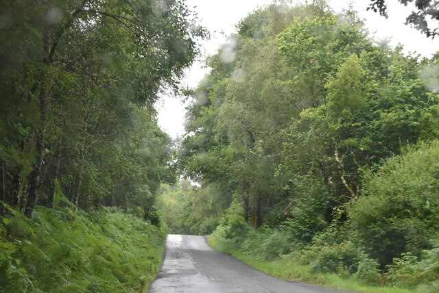
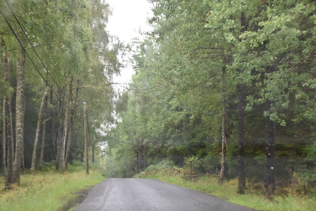
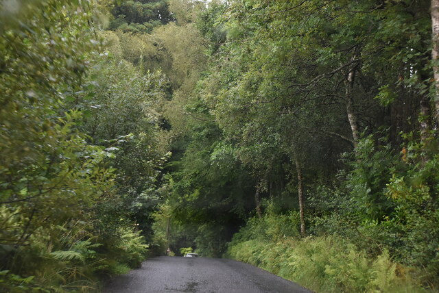
Achmore Wood, located in Perthshire, Scotland, is a picturesque woodland known for its natural beauty and diverse wildlife. Spanning an area of approximately 100 hectares, this forest is a popular destination for nature lovers and outdoor enthusiasts.

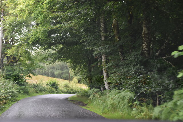
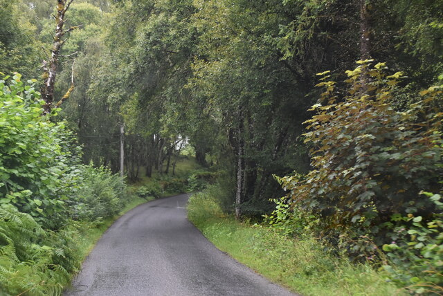
The woodland is characterized by a mix of native trees, including Scots pine, oak, birch, and rowan. These trees create a dense canopy, providing a habitat for a wide range of flora and fauna. Walking through the wood, visitors can expect to see a variety of wildflowers, ferns, and mosses, adding to the enchanting atmosphere.

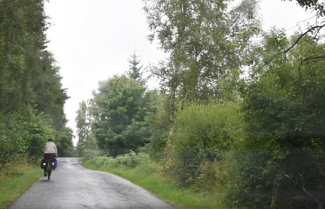
Achmore Wood is home to an abundance of wildlife, making it a prime spot for birdwatching and animal spotting. Bird species such as crossbills, woodpeckers, and various songbirds can be observed throughout the year. Other animals that can be encountered include red squirrels, deer, badgers, and foxes. The wood's diverse ecosystem ensures that there is always something new to discover.

The wood offers a network of well-maintained paths and trails, allowing visitors to explore the area at their own pace. These paths cater to different levels of difficulty, making the wood accessible to both casual walkers and more experienced hikers. Additionally, there are picnic areas and viewpoints scattered throughout the wood, providing opportunities for relaxation and enjoying the stunning surroundings.

Overall, Achmore Wood in Perthshire offers a tranquil escape from the hustle and bustle of everyday life. Its natural beauty, diverse wildlife, and well-maintained trails make it a must-visit destination for nature enthusiasts and those seeking a peaceful retreat.

If you have any feedback on the listing, please let us know in the comments section below.
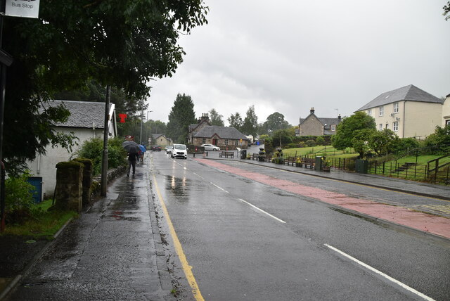
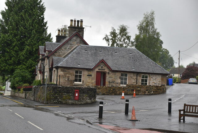
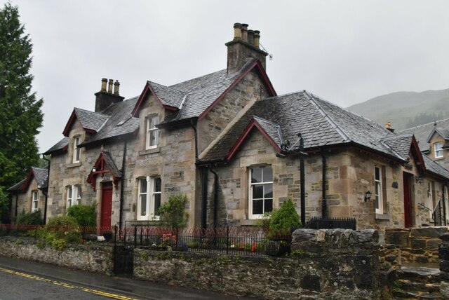
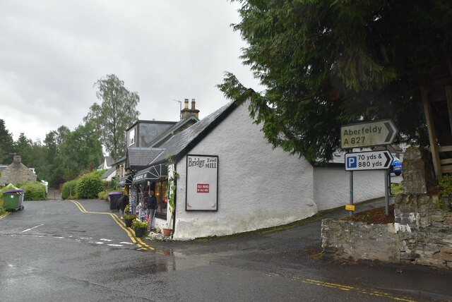
Achmore Wood Images

Images are sourced within 2km of 56.462735/-4.3035706 or Grid Reference NN5832. Thanks to Geograph Open Source API. All images are credited.

Road south of Loch Tay Route 7 runs 540 miles from Sunderland to Inverness.
<span class="nowrap"><a title="https://en.wikipedia.org/wiki/National_Cycle_Route_7" rel="nofollow ugc noopener" href="https://en.wikipedia.org/wiki/National_Cycle_Route_7">Link</a><img style="margin-left:2px;" alt="External link" title="External link - shift click to open in new window" src="https://s1.geograph.org.uk/img/external.png" width="10" height="10"/></span>
Road south of Loch Tay
Route 7 runs 540 miles from Sunderland to Inverness. LinkExternal link
Cyclist on route 7 Route 7 runs 540 miles from Sunderland to Inverness.
<span class="nowrap"><a title="https://en.wikipedia.org/wiki/National_Cycle_Route_7" rel="nofollow ugc noopener" href="https://en.wikipedia.org/wiki/National_Cycle_Route_7">Link</a><img style="margin-left:2px;" alt="External link" title="External link - shift click to open in new window" src="https://s1.geograph.org.uk/img/external.png" width="10" height="10"/></span>
Cyclist on route 7
Route 7 runs 540 miles from Sunderland to Inverness. LinkExternal link
National Cycleroute 7, south of Loch Tay Route 7 runs 540 miles from Sunderland to Inverness.
<span class="nowrap"><a title="https://en.wikipedia.org/wiki/National_Cycle_Route_7" rel="nofollow ugc noopener" href="https://en.wikipedia.org/wiki/National_Cycle_Route_7">Link</a><img style="margin-left:2px;" alt="External link" title="External link - shift click to open in new window" src="https://s1.geograph.org.uk/img/external.png" width="10" height="10"/></span>
National Cycleroute 7, south of Loch Tay
Route 7 runs 540 miles from Sunderland to Inverness. LinkExternal link
Rob Roy Way and National Cycleroute 7 Route 7 runs 540 miles from Sunderland to Inverness.
<span class="nowrap"><a title="https://en.wikipedia.org/wiki/National_Cycle_Route_7" rel="nofollow ugc noopener" href="https://en.wikipedia.org/wiki/National_Cycle_Route_7">Link</a><img style="margin-left:2px;" alt="External link" title="External link - shift click to open in new window" src="https://s1.geograph.org.uk/img/external.png" width="10" height="10"/></span>
Rob Roy Way and National Cycleroute 7
Route 7 runs 540 miles from Sunderland to Inverness. LinkExternal link
Rob Roy Way and National Cycleroute 7, Auchmore Wood The Rob Roy Way is a long distance footpath in Scotland. It runs 79 miles from Dryman in Stirling to Pitlochry in Perth & Kinross.
Wikipedia: <span class="nowrap"><a title="https://en.wikipedia.org/wiki/Rob_Roy_Way" rel="nofollow ugc noopener" href="https://en.wikipedia.org/wiki/Rob_Roy_Way">Link</a><img style="margin-left:2px;" alt="External link" title="External link - shift click to open in new window" src="https://s1.geograph.org.uk/img/external.png" width="10" height="10"/></span>
Rob Roy Way and National Cycleroute 7, Auchmore Wood
The Rob Roy Way is a long distance footpath in Scotland. It runs 79 miles from Dryman in Stirling to Pitlochry in Perth & Kinross. Wikipedia: LinkExternal link
Road through Auchmore Woods Route 7 runs 540 miles from Sunderland to Inverness.
<span class="nowrap"><a title="https://en.wikipedia.org/wiki/National_Cycle_Route_7" rel="nofollow ugc noopener" href="https://en.wikipedia.org/wiki/National_Cycle_Route_7">Link</a><img style="margin-left:2px;" alt="External link" title="External link - shift click to open in new window" src="https://s1.geograph.org.uk/img/external.png" width="10" height="10"/></span>
Road through Auchmore Woods
Route 7 runs 540 miles from Sunderland to Inverness. LinkExternal link
Falls of Dochart The Falls of Dochart are a cascade of waterfalls situated on the River Dochart at Killin in Stirling, near the western end of Loch Tay. The Bridge of Dochart, first constructed in 1760, crosses the river at Killin offering a view of the falls as they cascade over the rocks and around the island of Inchbuie, which is the ancient burial place of the MacNab clan.
Falls of Dochart
The Falls of Dochart are a cascade of waterfalls situated on the River Dochart at Killin in Stirling, near the western end of Loch Tay. The Bridge of Dochart, first constructed in 1760, crosses the river at Killin offering a view of the falls as they cascade over the rocks and around the island of Inchbuie, which is the ancient burial place of the MacNab clan.
Main St, Killin Killin (Scottish Gaelic: Cill Fhinn) is a village situated at the western end of Loch Tay in the central highlands of Scotland. The Falls of Dochart are located here.
Wikipedia: <span class="nowrap"><a title="https://en.wikipedia.org/wiki/Killin" rel="nofollow ugc noopener" href="https://en.wikipedia.org/wiki/Killin">Link</a><img style="margin-left:2px;" alt="External link" title="External link - shift click to open in new window" src="https://s1.geograph.org.uk/img/external.png" width="10" height="10"/></span>
Main St, Killin
Killin (Scottish Gaelic: Cill Fhinn) is a village situated at the western end of Loch Tay in the central highlands of Scotland. The Falls of Dochart are located here. Wikipedia: LinkExternal link
The Old Smiddy Killin (Scottish Gaelic: Cill Fhinn) is a village situated at the western end of Loch Tay in the central highlands of Scotland. The Falls of Dochart are located here.
Wikipedia: <span class="nowrap"><a title="https://en.wikipedia.org/wiki/Killin" rel="nofollow ugc noopener" href="https://en.wikipedia.org/wiki/Killin">Link</a><img style="margin-left:2px;" alt="External link" title="External link - shift click to open in new window" src="https://s1.geograph.org.uk/img/external.png" width="10" height="10"/></span>
The Old Smiddy
Killin (Scottish Gaelic: Cill Fhinn) is a village situated at the western end of Loch Tay in the central highlands of Scotland. The Falls of Dochart are located here. Wikipedia: LinkExternal link
Riverview Killin (Scottish Gaelic: Cill Fhinn) is a village situated at the western end of Loch Tay in the central highlands of Scotland. The Falls of Dochart are located here.
Wikipedia: <span class="nowrap"><a title="https://en.wikipedia.org/wiki/Killin" rel="nofollow ugc noopener" href="https://en.wikipedia.org/wiki/Killin">Link</a><img style="margin-left:2px;" alt="External link" title="External link - shift click to open in new window" src="https://s1.geograph.org.uk/img/external.png" width="10" height="10"/></span>
Riverview
Killin (Scottish Gaelic: Cill Fhinn) is a village situated at the western end of Loch Tay in the central highlands of Scotland. The Falls of Dochart are located here. Wikipedia: LinkExternal link
Shop, Killin Killin (Scottish Gaelic: Cill Fhinn) is a village situated at the western end of Loch Tay in the central highlands of Scotland. The Falls of Dochart are located here.
Wikipedia: <span class="nowrap"><a title="https://en.wikipedia.org/wiki/Killin" rel="nofollow ugc noopener" href="https://en.wikipedia.org/wiki/Killin">Link</a><img style="margin-left:2px;" alt="External link" title="External link - shift click to open in new window" src="https://s1.geograph.org.uk/img/external.png" width="10" height="10"/></span>
Shop, Killin
Killin (Scottish Gaelic: Cill Fhinn) is a village situated at the western end of Loch Tay in the central highlands of Scotland. The Falls of Dochart are located here. Wikipedia: LinkExternal link
Bridge of Dochart Grade A listed.
Bridge of Dochart
Grade A listed.
River Dochart The River Dochart rises on Ben Lui,(as the River Coronish), it flows east out of Loch Dochart and through the glen of the same name. At Killin just before it enters Loch Tay are the Falls of Dochart. The river is considered to be a part of the upper reaches of the River Tay.
River Dochart
The River Dochart rises on Ben Lui,(as the River Coronish), it flows east out of Loch Dochart and through the glen of the same name. At Killin just before it enters Loch Tay are the Falls of Dochart. The river is considered to be a part of the upper reaches of the River Tay.
Falls of Dochart The Falls of Dochart are a cascade of waterfalls situated on the River Dochart at Killin in Stirling, near the western end of Loch Tay. The Bridge of Dochart, first constructed in 1760, crosses the river at Killin offering a view of the falls as they cascade over the rocks and around the island of Inchbuie, which is the ancient burial place of the MacNab clan.
Falls of Dochart
The Falls of Dochart are a cascade of waterfalls situated on the River Dochart at Killin in Stirling, near the western end of Loch Tay. The Bridge of Dochart, first constructed in 1760, crosses the river at Killin offering a view of the falls as they cascade over the rocks and around the island of Inchbuie, which is the ancient burial place of the MacNab clan.
Entrance to Burial Grounds, Innis Bhuidhe Killin (Scottish Gaelic: Cill Fhinn) is a village situated at the western end of Loch Tay in the central highlands of Scotland. The Falls of Dochart are located here.
Wikipedia: <span class="nowrap"><a title="https://en.wikipedia.org/wiki/Killin" rel="nofollow ugc noopener" href="https://en.wikipedia.org/wiki/Killin">Link</a><img style="margin-left:2px;" alt="External link" title="External link - shift click to open in new window" src="https://s1.geograph.org.uk/img/external.png" width="10" height="10"/></span>
Entrance to Burial Grounds, Innis Bhuidhe
Killin (Scottish Gaelic: Cill Fhinn) is a village situated at the western end of Loch Tay in the central highlands of Scotland. The Falls of Dochart are located here. Wikipedia: LinkExternal link
Falls of Dochart Inn Killin (Scottish Gaelic: Cill Fhinn) is a village situated at the western end of Loch Tay in the central highlands of Scotland. The Falls of Dochart are located here.
Wikipedia: <span class="nowrap"><a title="https://en.wikipedia.org/wiki/Killin" rel="nofollow ugc noopener" href="https://en.wikipedia.org/wiki/Killin">Link</a><img style="margin-left:2px;" alt="External link" title="External link - shift click to open in new window" src="https://s1.geograph.org.uk/img/external.png" width="10" height="10"/></span>
Falls of Dochart Inn
Killin (Scottish Gaelic: Cill Fhinn) is a village situated at the western end of Loch Tay in the central highlands of Scotland. The Falls of Dochart are located here. Wikipedia: LinkExternal link
Show me another place!

Achmore Wood is located at Grid Ref: NN5832 (Lat: 56.462735, Lng: -4.3035706)

Unitary Authority: Stirling

Police Authority: Forth Valley

What 3 Words

///shredding.passport.unique. Near Pubil, Perth & Kinross

Nearby Locations

Achmore Wood

Related Wikis

Rob Roy Way

The Rob Roy Way is a Scottish long distance footpath that runs from Drymen in Stirling to Pitlochry in Perth and Kinross. The path was created in 2002...
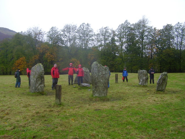
Killin Stone Circle

Killin Stone Circle (or Kinnell Stone Circle) is a prehistoric stone circle situated at the west end of Loch Tay near the village of Killin, Stirling,...
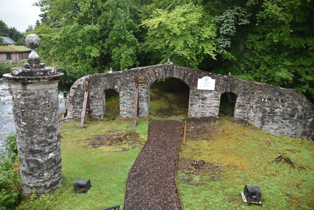
Inchbuie

Inchbuie (Scottish Gaelic: Innis Bhuidhe, 'yellow island') is an island of the River Dochart, near Killin. A bridge links it with both riverbanks, just...
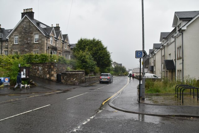
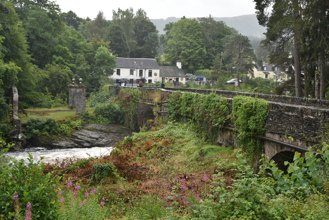
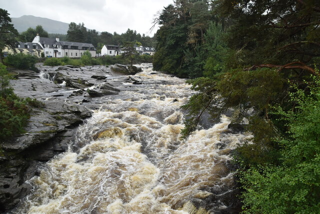
Killin

Killin (; Scottish Gaelic: Cill Fhinn) is a village in Perthshire in the central Highlands of Scotland. Situated at the western head of Loch Tay, it is...
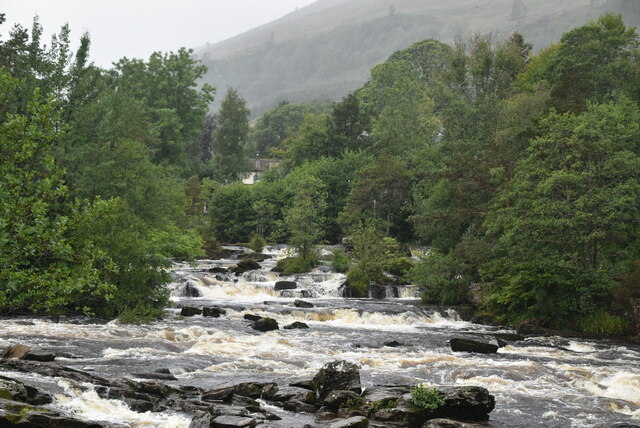
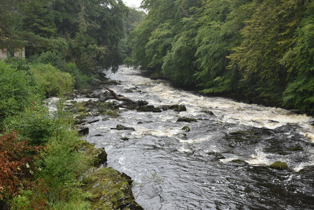
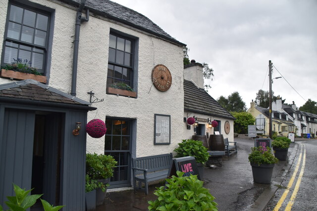
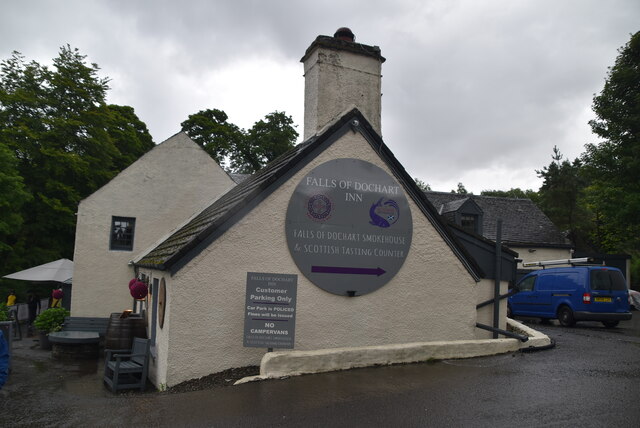
Falls of Dochart

The Falls of Dochart (Scottish Gaelic:Eas Dochart) are a cascade of waterfalls situated on the River Dochart at Killin in Perthshire, Scotland, near the...

Killin railway station

Killin railway station was a railway station located at Killin, Stirling. == History == Opened on 1 April 1886, the station comprised a single platform...
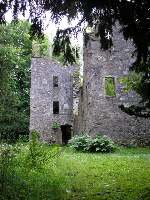
Finlarig Castle

Finlarig Castle is an early 17th-century castle standing on a mound on a peninsula between the River Lochay and Loch Tay, just over 1⁄2 mile (0.80 km)...

Loch Tay railway station

Loch Tay was a railway station located at the head of Loch Tay, Stirling. == History == Opened as Loch Tay Killin Pier on 1 April 1886, the station comprised...

Related Videos

Creag Gharbh . Walking from killin part of the rob roy way

Murrayofscotland #killin #hike #hiking #summit #creaggharbh #robroyway.

A ramble around ACHARN FOREST CIRCULAR WALK, KILLIN - Scotland tour September 2022

Welcome to my Channel - In this video Karen & I go for a walk from Maragowan C&MC site to take a ramble around Acharn Forest ...

walking through killin @Falls of Dochart

Edited by VideoGuru:https://videoguru.page.link/Best.

Nearby Amenities

Located within 500m of 56.462735,-4.3035706
Power: pole
Lat/Long: 56.4594298/-4.3083861
Power: pole
Lat/Long: 56.4599197/-4.3071422
Power: pole
Lat/Long: 56.4603888/-4.3059297
Power: pole
Lat/Long: 56.4607922/-4.3048707
Power: pole
Lat/Long: 56.4612111/-4.3037898
Power: pole
Lat/Long: 56.4617166/-4.303395
Power: pole
Lat/Long: 56.4626825/-4.302654
Power: pole
Lat/Long: 56.4630893/-4.3020008
Power: pole
Lat/Long: 56.4635506/-4.3012582
Power: pole
Lat/Long: 56.4640352/-4.3004671
Power: pole
Lat/Long: 56.464397/-4.2998436
Power: pole
Lat/Long: 56.4661011/-4.2984791
Power: pole
Lat/Long: 56.4662309/-4.2997606
Power: pole
Lat/Long: 56.4663659/-4.3010217
Power: pole
Lat/Long: 56.4664836/-4.3022389
Power: pole
Lat/Long: 56.4669215/-4.303207
Power: pole
Lat/Long: 56.4656424/-4.2989538
Parking
Capacity: 5
Lat/Long: 56.4607913/-4.3007627
The data included in this document is from www.openstreetmap.org. The data is made available under ODbL.

Have you been to Achmore Wood?

Leave your review of Achmore Wood below (or comments, questions and feedback).