Bankhouse Plantation

Wood, Forest in Ayrshire

Scotland

Bankhouse Plantation

Foulpapple Road at Knevocklaw Foulpapple Road heads uphill at left. Across the road is the farm road to Knevocklaw.
Foulpapple Road at Knevocklaw Credit: Alec MacKinnon

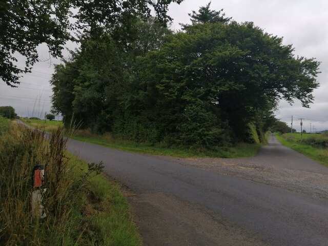
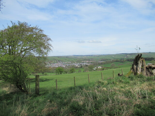
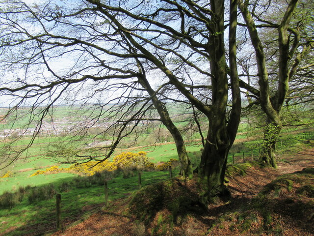
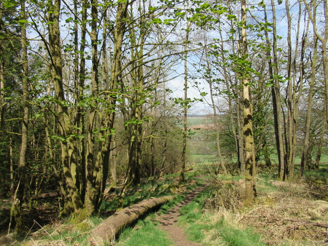
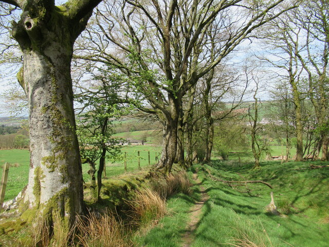
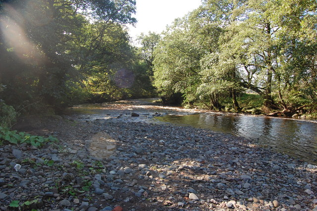
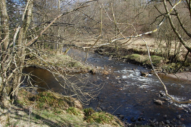
Bankhouse Plantation is a lush woodland area located in Ayrshire, Scotland. Spread over a sprawling area, it is known for its diverse collection of trees and plants, making it a popular destination for nature enthusiasts and hikers alike.

The plantation boasts a variety of tree species, including oak, beech, birch, and pine, among others. These trees form an impressive canopy, creating a serene and peaceful environment for visitors. The undergrowth is rich with an assortment of wildflowers, ferns, and mosses, adding to the beauty and biodiversity of the area.

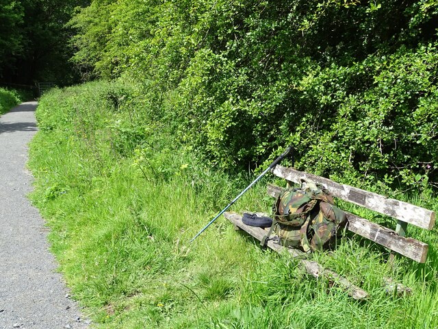
Tranquil walking trails meander through the plantation, allowing visitors to explore the natural wonders at their own pace. The paths are well-maintained and clearly marked, ensuring a safe and enjoyable experience for all. Along the way, there are benches strategically placed for those who wish to rest and admire the surroundings.

Bankhouse Plantation is also home to a variety of wildlife, with many bird species making it their habitat. Birdwatchers can spot robins, blackbirds, chaffinches, and woodpeckers, among others. Squirrels and rabbits can also be seen darting through the underbrush, adding a touch of liveliness to the woodland.

The plantation is open to the public throughout the year, and entry is free of charge. It is an ideal destination for a peaceful stroll, a family picnic, or simply to reconnect with nature. The combination of its diverse flora and fauna, well-maintained trails, and picturesque setting make Bankhouse Plantation a true haven for nature lovers in Ayrshire.

If you have any feedback on the listing, please let us know in the comments section below.

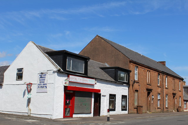
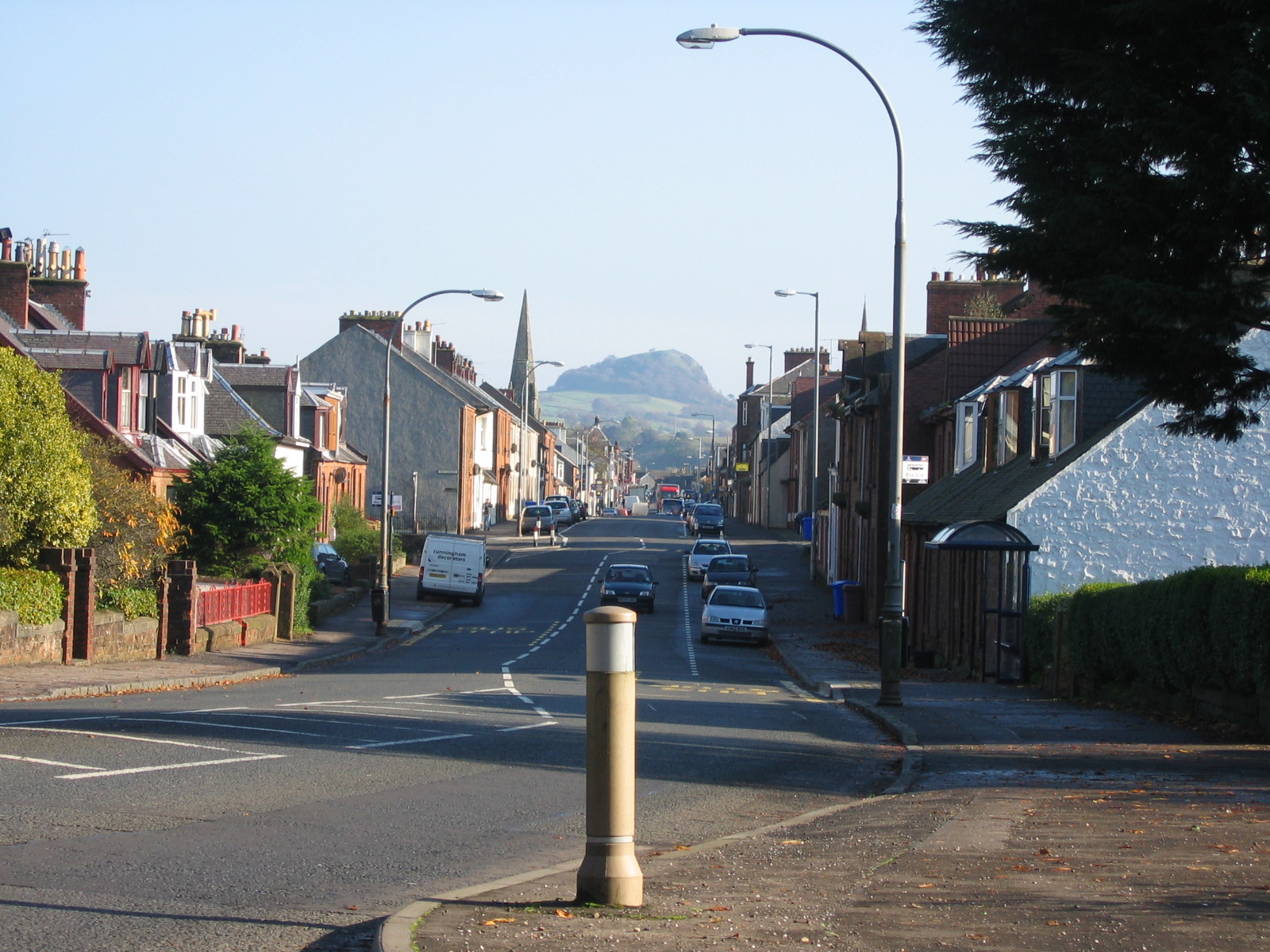
Bankhouse Plantation Images

Images are sourced within 2km of 55.607553/-4.274166 or Grid Reference NS5637. Thanks to Geograph Open Source API. All images are credited.

Foulpapple Road at Knevocklaw Foulpapple Road heads uphill at left. Across the road is the farm road to Knevocklaw.
Foulpapple Road at Knevocklaw
Foulpapple Road heads uphill at left. Across the road is the farm road to Knevocklaw.
The Hendryton Burn The Hendryton Burn runs through a culvert under the old 
Darvel & Strathaven Branch of the old G.&.S.W.R.
This photo was taken on the 19th June 2022.
The Hendryton Burn
The Hendryton Burn runs through a culvert under the old Darvel & Strathaven Branch of the old G.&.S.W.R. This photo was taken on the 19th June 2022.
Old Bench A summer seat beside the pathway on the old railway.
This photo was taken on the 19th June 2022.
Old Bench
A summer seat beside the pathway on the old railway. This photo was taken on the 19th June 2022.
View towards Darvel From the "Dyke Path" above the farm of the same name, where there is bench on this spot.
View towards Darvel
From the "Dyke Path" above the farm of the same name, where there is bench on this spot.
Trees by the Dyke Path near Darvel A waymarked path following the edge of the Dykehill Plantation. It can be used as part of various circuits from Darvel, including parts of the Lanfine Estate.
Trees by the Dyke Path near Darvel
A waymarked path following the edge of the Dykehill Plantation. It can be used as part of various circuits from Darvel, including parts of the Lanfine Estate.
Path in Dykehill Plantation Fresh new leaves are appearing on the trees.
Path in Dykehill Plantation
Fresh new leaves are appearing on the trees.
Trees by the Dyke Path near Darvel A waymarked path that can be used as part of various circuits from Darvel, including parts of the Lanfine Estate.
Trees by the Dyke Path near Darvel
A waymarked path that can be used as part of various circuits from Darvel, including parts of the Lanfine Estate.
Road bridge Bridge over the River Irvine
Road bridge
Bridge over the River Irvine
River Irvine
River Irvine
Cold bath
Cold bath
Road Bridge Bridge on farm access road.
Road Bridge
Bridge on farm access road.
River meetings The Glen Water meets the River Irvine
River meetings
The Glen Water meets the River Irvine
Steel Bridge Private access bridge across River Irvine.
Steel Bridge
Private access bridge across River Irvine.
Burgh of Darvel - birth place of Sir Alexander Fleming Sign by the A71
Burgh of Darvel - birth place of Sir Alexander Fleming
Sign by the A71
West Main Street, Darvel
The Turf Hotel, West Main Street, Darvel Category B-listed. Built c1840
The Turf Hotel, West Main Street, Darvel
Category B-listed. Built c1840
The Black Bull, West Main Street, Darvel Dated 1840
The Black Bull, West Main Street, Darvel
Dated 1840
Show me another place!

Bankhouse Plantation is located at Grid Ref: NS5637 (Lat: 55.607553, Lng: -4.274166)

Unitary Authority: East Ayrshire

Police Authority: Ayrshire

What 3 Words

///bookings.speeding.sifts. Near Darvel, East Ayrshire

Related Wikis

Darvel F.C.

Darvel Football Club are a Scottish football club based in the town of Darvel, Ayrshire. Nicknamed "The Vale" and formed in 1889, the club play at Recreation...

Darvel

Darvel (Scots: Dairvel, Scottish Gaelic: Darbhail) is a small town in East Ayrshire, Scotland. It is at the eastern end of the Irvine Valley and is sometimes...

Darvel Town Hall

Darvel Town Hall is a municipal building in West Main Street, Darvel, East Ayrshire, Scotland. The structure, which is used as a library and a community...

Darvel Music Festival

Darvel Music Festival is a music festival that has been held in the town of Darvel, East Ayrshire, Ayrshire, Scotland, since 2002. The Darvel Music Festival...

Priestland

Priestland is a village in East Ayrshire, Scotland. It has a population of 121 (Census 2001) and lies on the A71, around two miles west of Loudoun Hill...

Kilmarnock and Loudoun (UK Parliament constituency)

Kilmarnock and Loudoun is a county constituency of the House of Commons of the Parliament of the United Kingdom. It elects one Member of Parliament (MP...

Newmilns Tower

Newmilns Tower is a 16th-century tower house, on Main Street, Newmilns, north of the River Irvine, East Ayrshire, Scotland. It may also be called Newmilns...

Castle and Lands of Auchruglen

The Castle and Lands of Auchruglen (NS5365436797) was a peel tower in the old district of Kyle held at different times by the Nesbitt and Campbell Clans...

Nearby Amenities

Located within 500m of 55.607553,-4.274166
Recycling
Lat/Long: 55.6085202/-4.2813156
Waterway: weir
Lat/Long: 55.6065199/-4.2806987
Post Box
Ref: KA17 61
Lat/Long: 55.6107574/-4.2744429
Power: pole
Lat/Long: 55.6037407/-4.2704771
Power: pole
Lat/Long: 55.6044293/-4.2703062
Power: pole
Lat/Long: 55.6051908/-4.2702583
Power: pole
Lat/Long: 55.6059524/-4.2702103
Power: pole
Lat/Long: 55.6067516/-4.2701583
Power: pole
Lat/Long: 55.607519/-4.2700999
Power: pole
Lat/Long: 55.6082981/-4.2700353
Power: pole
Lat/Long: 55.6090478/-4.2701603
Power: pole
Lat/Long: 55.609807/-4.2702729
Power: pole
Lat/Long: 55.6105543/-4.2703979
Power: pole
Lat/Long: 55.6037642/-4.2705625
Power: pole
Lat/Long: 55.604481/-4.270948
Power: pole
Lat/Long: 55.6051943/-4.2713147
Power: pole
Lat/Long: 55.6059947/-4.2717252
Power: pole
Lat/Long: 55.6068281/-4.2721607
Power: pole
Lat/Long: 55.6073189/-4.271844
Power: pole
Lat/Long: 55.607852/-4.2715064
Power: pole
Lat/Long: 55.6082969/-4.2712147
Power: pole
Lat/Long: 55.6086547/-4.2715397
Power: pole
Lat/Long: 55.6090984/-4.2719356
Power: pole
Lat/Long: 55.6093315/-4.2728149
Power: pole
Lat/Long: 55.6096057/-4.273861
Power: pole
Lat/Long: 55.6079986/-4.2663128
Bench
Backrest: no
Lat/Long: 55.6071942/-4.2772224
Bench
Backrest: no
Lat/Long: 55.6072079/-4.277158
Fast Food
Universal Chinese Carry Out
Cuisine: chinese
Name Zh: 環球
Takeaway: yes
Lat/Long: 55.6099121/-4.2808391
The data included in this document is from www.openstreetmap.org. The data is made available under ODbL.

Have you been to Bankhouse Plantation?

Leave your review of Bankhouse Plantation below (or comments, questions and feedback).