Whitelee Forest

Wood, Forest in Ayrshire

Scotland

Whitelee Forest

Track to High Overmuir One of the many turbines of the Whitelee Wind Farm is visible on the left-hand side.
Track to High Overmuir Credit: Alan O'Dowd

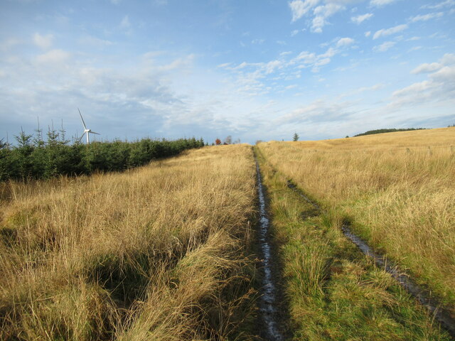
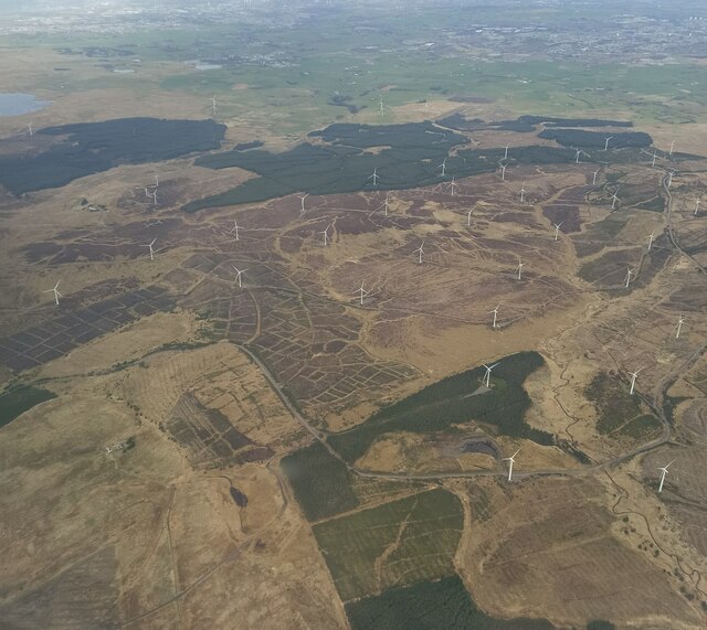
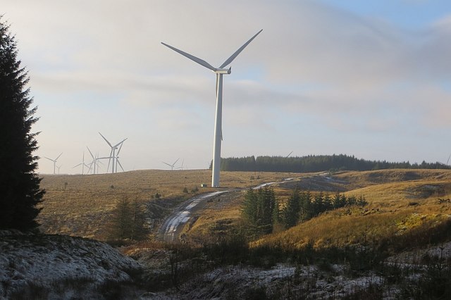
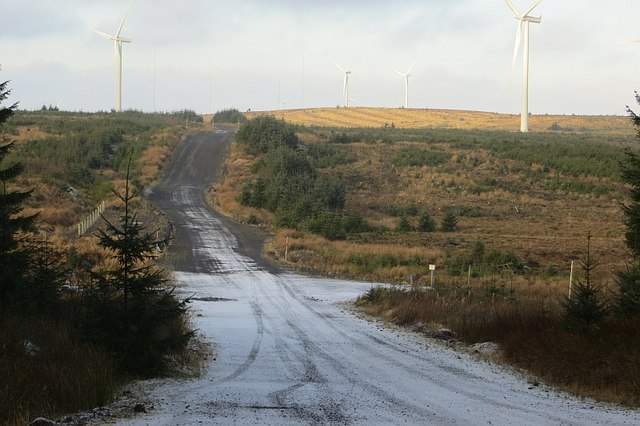
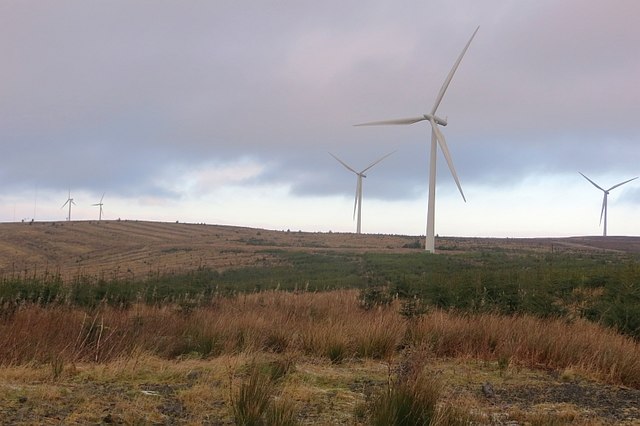
Whitelee Forest is a vast woodland located in East Ayrshire, Scotland. Spanning an impressive 2,000 hectares, it is considered to be one of the largest wind farms in Europe. The forest is situated on a plateau, offering breathtaking views of the surrounding landscape.

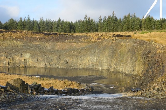
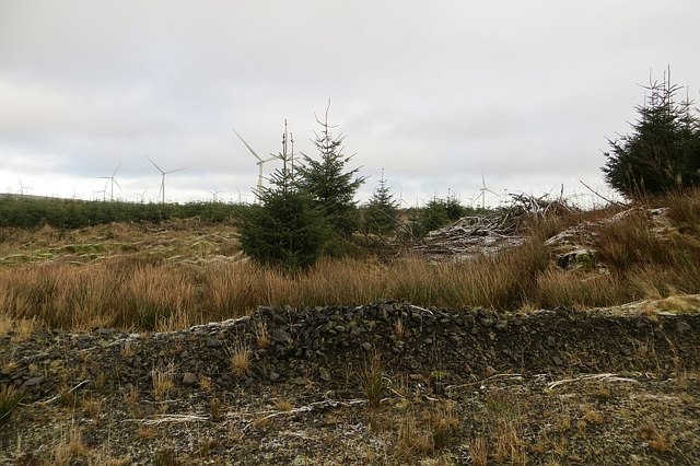
The woodland is predominantly made up of commercial coniferous plantations, with a mixture of spruce, pine, and fir trees dominating the area. However, there are also pockets of native broadleaf trees, such as oak and birch, which add diversity to the forest. The forest floor is covered in a variety of mosses, ferns, and wildflowers, creating a vibrant and colorful undergrowth.

Whitelee Forest is not just a haven for nature enthusiasts; it also serves as an important educational and recreational resource for visitors. The forest offers a network of well-maintained trails, providing opportunities for walking, cycling, and horse riding. Additionally, there are several viewpoints and picnic areas throughout the forest, allowing visitors to relax and take in the stunning scenery.

One of the main attractions of Whitelee Forest is the Whitelee Wind Farm Visitor Centre. This award-winning facility provides interactive displays, exhibitions, and guided tours, giving visitors a fascinating insight into renewable energy and the role the wind farm plays in reducing carbon emissions.

Overall, Whitelee Forest is a remarkable natural landscape that combines the beauty of a woodland with the innovation of renewable energy. It is a popular destination for both locals and tourists, offering a unique and educational experience for all who visit.

If you have any feedback on the listing, please let us know in the comments section below.

Whitelee Forest Images

Images are sourced within 2km of 55.670557/-4.2794908 or Grid Reference NS5644. Thanks to Geograph Open Source API. All images are credited.

Track to High Overmuir One of the many turbines of the Whitelee Wind Farm is visible on the left-hand side.
Track to High Overmuir
One of the many turbines of the Whitelee Wind Farm is visible on the left-hand side.
Whitelee wind farm from the air Crinshill Moss is in the foreground. Lochgoin Reservoir and Dunwan Dam are the prominent bodies of water.
Whitelee wind farm from the air
Crinshill Moss is in the foreground. Lochgoin Reservoir and Dunwan Dam are the prominent bodies of water.
Whitelee wind farm from the air Crinshill Moss is in the foreground. Lochgoin Reservoir and Dunwan Dam are the prominent bodies of water.
Whitelee wind farm from the air
Crinshill Moss is in the foreground. Lochgoin Reservoir and Dunwan Dam are the prominent bodies of water.
Whitelee wind farm from the air Whitelee Windfarm is the UK's largest onshore windfarm. It is located on Eaglesham Moor just 20 minutes south of central Glasgow. The windfarm has 215 turbines which can generate 539MW of electricity, enough to power over 300,000 homes.

You can access the windfarm for free and experience the wind turbines up close with over 130kms of trails to explore.  The Visitor Centre <span class="nowrap"><a title="https://www.scottishpower.co.uk/whitelee/visitor-centre" rel="nofollow ugc noopener" href="https://www.scottishpower.co.uk/whitelee/visitor-centre">Link</a><img style="margin-left:2px;" alt="External link" title="External link - shift click to open in new window" src="https://s1.geograph.org.uk/img/external.png" width="10" height="10"/></span> is also free and has an interactive exhibition and a Cafe to relax after the long walk on the windfarm.
Whitelee wind farm from the air
Whitelee Windfarm is the UK's largest onshore windfarm. It is located on Eaglesham Moor just 20 minutes south of central Glasgow. The windfarm has 215 turbines which can generate 539MW of electricity, enough to power over 300,000 homes. You can access the windfarm for free and experience the wind turbines up close with over 130kms of trails to explore. The Visitor Centre LinkExternal link is also free and has an interactive exhibition and a Cafe to relax after the long walk on the windfarm.
Whitelee Windfarm Turbine 18
Whitelee Windfarm
Turbine 18
Wham Brae, White Lee Turbines and clear fell, Whitelee Forest.
Wham Brae, White Lee
Turbines and clear fell, Whitelee Forest.
Quarry, Whitelee Forest Dug for building material for the wind farm. Lots of new roads have been built.
Quarry, Whitelee Forest
Dug for building material for the wind farm. Lots of new roads have been built.
Wind farm roads, Whitelee Whitelee Forest and its enormous wind farm.
Wind farm roads, Whitelee
Whitelee Forest and its enormous wind farm.
Whitelee Forest The wind farm means that there are many more roads here than when this square and its neighbours was recorded for the first time.  I had it easy.
Whitelee Forest
The wind farm means that there are many more roads here than when this square and its neighbours was recorded for the first time. I had it easy.
Whitelee Forest Looking towards Dumduff Hill.
Whitelee Forest
Looking towards Dumduff Hill.
Spine road, Whitelee Wind farm service road.
Spine road, Whitelee
Wind farm service road.
Whitelee Spine Road Service road for the wind farm.
Whitelee Spine Road
Service road for the wind farm.
Whitelee Forest By the Gowkshill Burn. The wind farm had recently been extended south and westwards.
Whitelee Forest
By the Gowkshill Burn. The wind farm had recently been extended south and westwards.
Whitelee Forest An extension to the Whitelee Wind Farm.
Whitelee Forest
An extension to the Whitelee Wind Farm.
Moorland, Whitelee Rough moorland amongst the turbines.
Moorland, Whitelee
Rough moorland amongst the turbines.
Crook Hill Whitelee Wind Farm.
Crook Hill
Whitelee Wind Farm.
Road on Crook Hill Once rather hard to get around here due to the rough ground, now there are many roads serving the Whitelees Wind Farm.
Road on Crook Hill
Once rather hard to get around here due to the rough ground, now there are many roads serving the Whitelees Wind Farm.
Show me another place!

Whitelee Forest is located at Grid Ref: NS5644 (Lat: 55.670557, Lng: -4.2794908)

Unitary Authority: East Ayrshire

Police Authority: Ayrshire

What 3 Words

///visit.takeover.procured. Near Darvel, East Ayrshire

Nearby Locations

Whitelee Forest

Related Wikis

Whitelee Wind Farm

Whitelee Wind Farm is a windfarm on the Eaglesham moor in Scotland. The main visitor centre is located in East Renfrewshire, but the majority of turbines...

Corse Hill

Corse Hill is a hill located between East Renfrewshire and South Lanarkshire of Scotland. With a height of 376 m (1,234 ft), it is the highest point in...
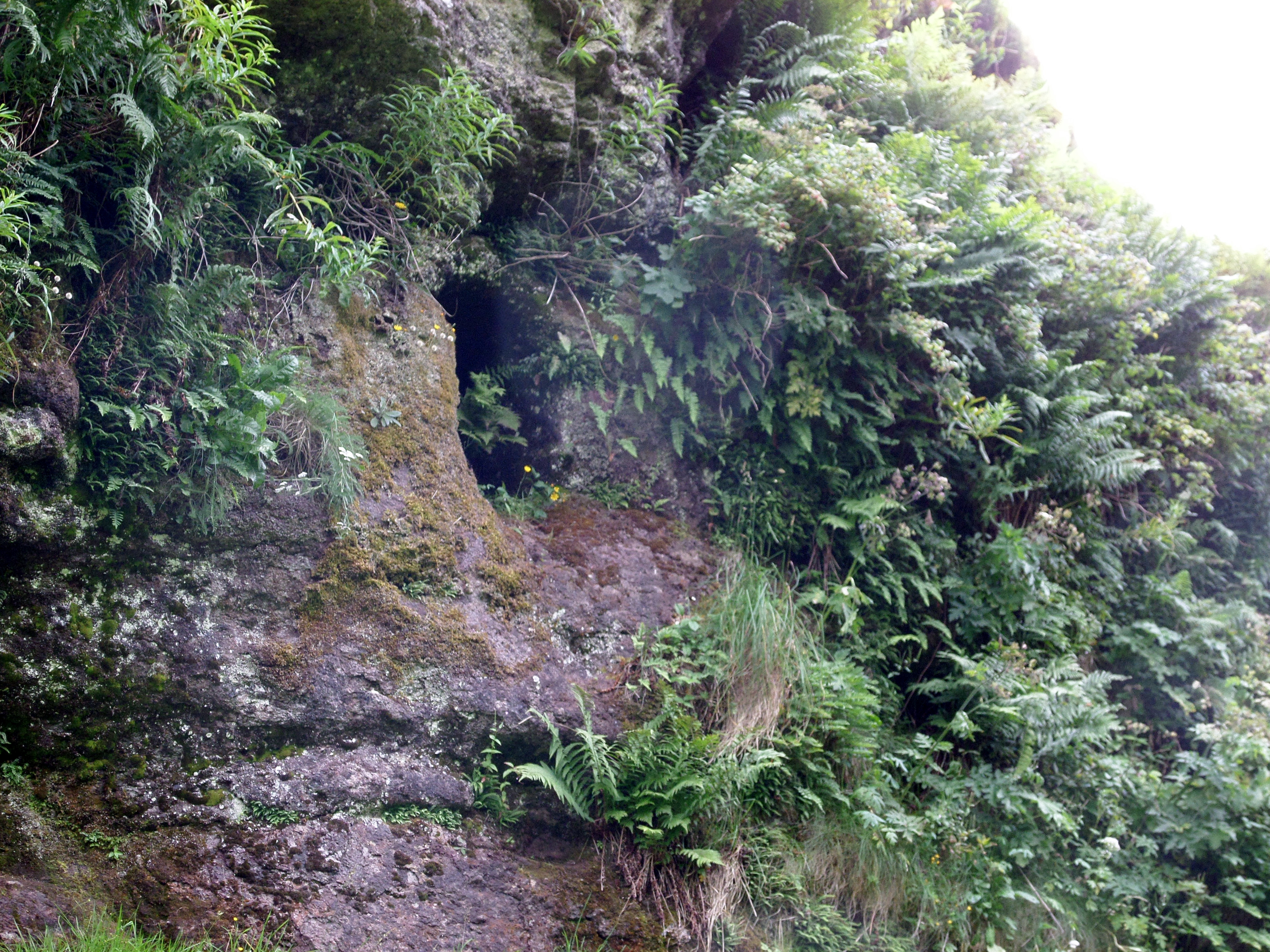
Dunton Cove

Dunton Cove or the Covenanters' Cave is an artificial cave in a craggy outcrop of rocks overlooking the Craufurdland Water just below the confluence of...
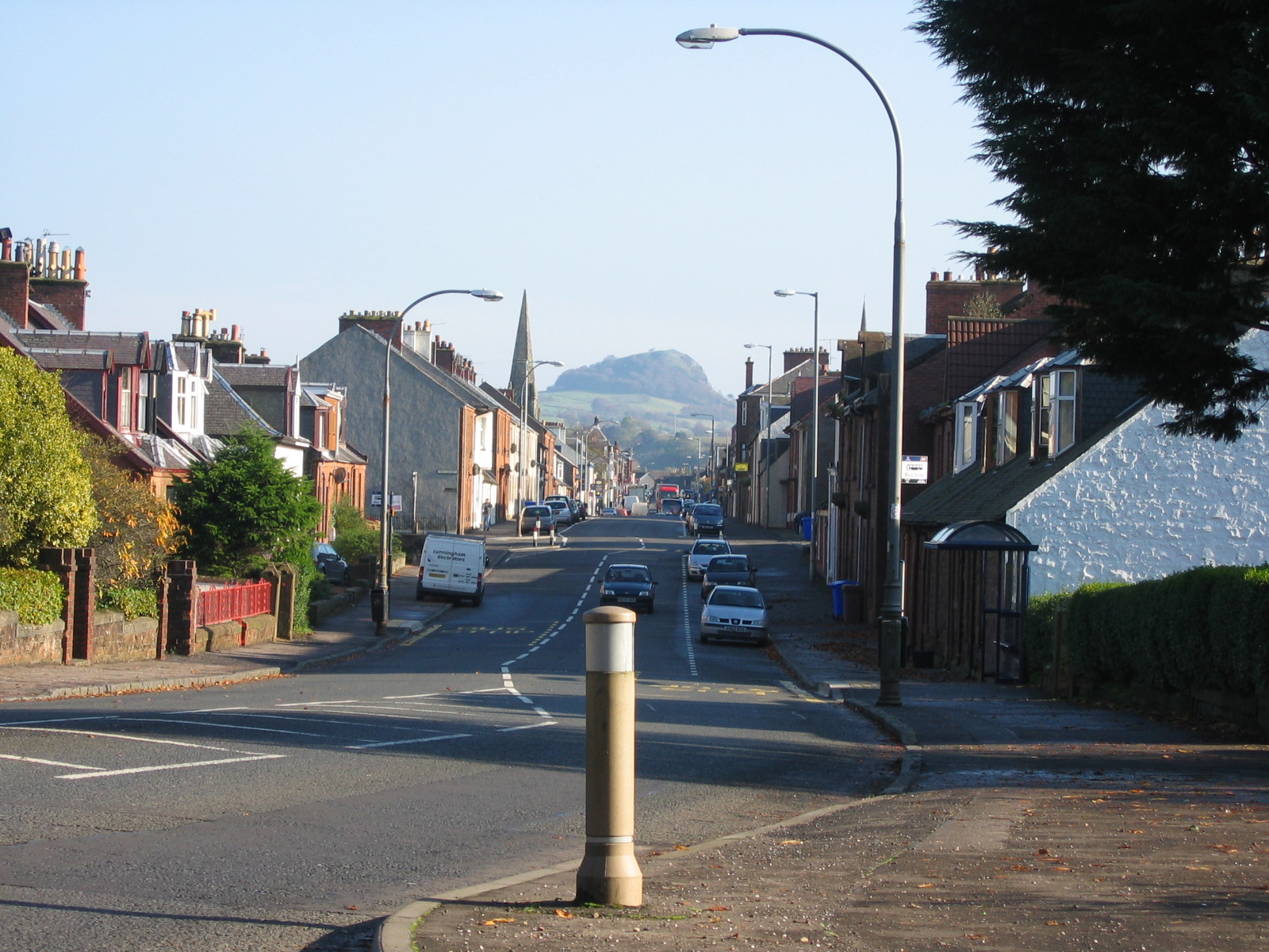
Darvel

Darvel (Scots: Dairvel, Scottish Gaelic: Darbhail) is a small town in East Ayrshire, Scotland. It is at the eastern end of the Irvine Valley and is sometimes...

Darvel Music Festival

Darvel Music Festival is a music festival that has been held in the town of Darvel, East Ayrshire, Ayrshire, Scotland, since 2002. The Darvel Music Festival...

Darvel Town Hall

Darvel Town Hall is a municipal building in West Main Street, Darvel, East Ayrshire, Scotland. The structure, which is used as a library and a community...

Darvel F.C.

Darvel Football Club are a Scottish football club based in the town of Darvel, Ayrshire. Nicknamed "The Vale" and formed in 1889, the club play at Recreation...

Priestland

Priestland is a village in East Ayrshire, Scotland. It has a population of 121 (Census 2001) and lies on the A71, around two miles west of Loudoun Hill...

Nearby Amenities

Located within 500m of 55.670557,-4.2794908
A145
Generator Method: wind_turbine
Generator Output Electricity: 2.3 MW
Generator Source: wind
Generator Type: horizontal_axis
Power: generator
Source: bing
Lat/Long: 55.6689906/-4.283252
A148
Generator Method: wind_turbine
Generator Output Electricity: 2.3 MW
Generator Source: wind
Generator Type: horizontal_axis
Power: generator
Source: bing
Lat/Long: 55.6727641/-4.2855695
The data included in this document is from www.openstreetmap.org. The data is made available under ODbL.

Have you been to Whitelee Forest?

Leave your review of Whitelee Forest below (or comments, questions and feedback).