Dalgainbank Plantation

Wood, Forest in Ayrshire

Scotland

Dalgainbank Plantation

Tincorn Hill Quarry from the air An aggregates quarry near Sorn, operated by Breedon <span class="nowrap"><a title="https://www.breedongroup.com/location-finder/sorn?utm_source=googlemybusiness&utm_medium=organic&utm_term=sorn" rel="nofollow ugc noopener" href="https://www.breedongroup.com/location-finder/sorn?utm_source=googlemybusiness&utm_medium=organic&utm_term=sorn">Link</a><img style="margin-left:2px;" alt="External link" title="External link - shift click to open in new window" src="https://s1.geograph.org.uk/img/external.png" width="10" height="10"/></span> .
Tincorn Hill Quarry from the air Credit: Thomas Nugent

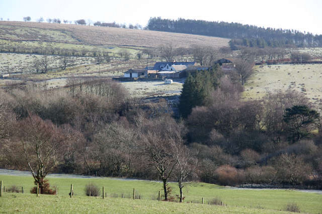
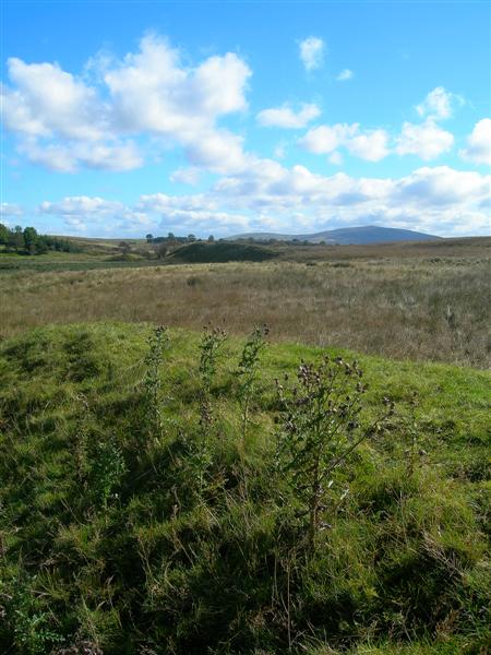
Dalgainbank Plantation is a sprawling woodland located in Ayrshire, Scotland. Covering an area of approximately 200 hectares, this ancient forest is known for its diverse range of flora and fauna. The plantation is situated on the eastern slopes of Dalgain Hill, providing a picturesque backdrop for nature enthusiasts and visitors alike.

The woodland is predominantly composed of native tree species such as oak, beech, and birch, which create a rich and vibrant ecosystem. These trees provide vital habitats for a variety of wildlife, including red squirrels, roe deer, and a wide array of bird species. Moreover, the forest floor is adorned with a carpet of wildflowers during the spring and summer months, adding to the enchanting beauty of the plantation.

Dalgainbank Plantation offers numerous walking trails and paths that allow visitors to explore its natural wonders. These trails cater to different levels of difficulty, ensuring accessibility for people of all ages and abilities. The plantation is also a popular destination for birdwatching, with several designated spots providing excellent vantage points for bird enthusiasts.

In addition to its natural beauty, Dalgainbank Plantation holds historical significance. The woodland has been managed sustainably for centuries, with evidence of past human activity, including ancient boundary walls and ruins of old buildings. This fusion of nature and history makes the plantation a fascinating place to visit for those interested in both the natural environment and cultural heritage.

Overall, Dalgainbank Plantation in Ayrshire is a captivating and diverse woodland that offers a tranquil escape for visitors, allowing them to immerse themselves in the beauty of nature and explore the rich history of the area.

If you have any feedback on the listing, please let us know in the comments section below.

Dalgainbank Plantation Images

Images are sourced within 2km of 55.51001/-4.2745226 or Grid Reference NS5626. Thanks to Geograph Open Source API. All images are credited.

Tincorn Hill Quarry from the air An aggregates quarry near Sorn, operated by Breedon <span class="nowrap"><a title="https://www.breedongroup.com/location-finder/sorn?utm_source=googlemybusiness&utm_medium=organic&utm_term=sorn" rel="nofollow ugc noopener" href="https://www.breedongroup.com/location-finder/sorn?utm_source=googlemybusiness&utm_medium=organic&utm_term=sorn">Link</a><img style="margin-left:2px;" alt="External link" title="External link - shift click to open in new window" src="https://s1.geograph.org.uk/img/external.png" width="10" height="10"/></span> .
Tincorn Hill Quarry from the air
An aggregates quarry near Sorn, operated by Breedon LinkExternal link .
Sorn bridge over the river Ayr
The Sorn Inn
The Sorn Inn
Old bridge over the river Ayr at Sorn
Sorn Castle
Sorn Castle
Sorn Church Church on road between village and Sorn Castle.
Sorn Church
Church on road between village and Sorn Castle.
Laigh Brocklar The outbuildings suggest a livestock farm. Additional information clarified that this was a beef fattening farm. It is located at the junction of two minor roads providing access to the B743 from Sorn to Muirkirk.There are well tended beech hedges and very old deciduous trees along the roadside. The Cleuch Burn drains the low land below the farm and along its banks deciduous trees and bushes, such as hawthorn, have become established.
Laigh Brocklar
The outbuildings suggest a livestock farm. Additional information clarified that this was a beef fattening farm. It is located at the junction of two minor roads providing access to the B743 from Sorn to Muirkirk.There are well tended beech hedges and very old deciduous trees along the roadside. The Cleuch Burn drains the low land below the farm and along its banks deciduous trees and bushes, such as hawthorn, have become established.
Valley of Cleuch Burn The Cleuch Burn drains from the western slope of the Blacksidend ridge to Sorn where it joins the R. Ayr. The farms along the minor road mark the dividing line between the improved grassland and the rough grazing of the higher hill land. The need to use trees and bushes to provide some shelter in a very exposed area is evident in the case of Laigh Brocklar Farm.
Valley of Cleuch Burn
The Cleuch Burn drains from the western slope of the Blacksidend ridge to Sorn where it joins the R. Ayr. The farms along the minor road mark the dividing line between the improved grassland and the rough grazing of the higher hill land. The need to use trees and bushes to provide some shelter in a very exposed area is evident in the case of Laigh Brocklar Farm.
High Brocklar Renovated farm house and steading with a garage/workshop located on the farm track leading to Blacksidend Farm and Blackside. There is a mixed plantation of conifers and deciduous trees behind the property and old gnarled deciduous trees provide a boundary between the well tended grass in front of the house and the rough grazing running down to the Cleuch Burn grazed by sheep. A line of relatively new trees to the right of the house has been planted to provide additional shelter from the SW winds.
High Brocklar
Renovated farm house and steading with a garage/workshop located on the farm track leading to Blacksidend Farm and Blackside. There is a mixed plantation of conifers and deciduous trees behind the property and old gnarled deciduous trees provide a boundary between the well tended grass in front of the house and the rough grazing running down to the Cleuch Burn grazed by sheep. A line of relatively new trees to the right of the house has been planted to provide additional shelter from the SW winds.
Cleuch Burn  Road Bridge, Sorn A red sandstone bridge carrying the B743 from Mauchline to Sorn providing a crossing point where the Cleuch Burn joins the R. Ayr. The manmade arrangement of the stones in the bed of the burn below this bridge suggests the existence of a former fording point. The steep sides of the narrow valley cut by the burn just above this point are covered in a mixture of rhododendrons, brambles and deciduous trees.
Cleuch Burn Road Bridge, Sorn
A red sandstone bridge carrying the B743 from Mauchline to Sorn providing a crossing point where the Cleuch Burn joins the R. Ayr. The manmade arrangement of the stones in the bed of the burn below this bridge suggests the existence of a former fording point. The steep sides of the narrow valley cut by the burn just above this point are covered in a mixture of rhododendrons, brambles and deciduous trees.
Dalgain Dalgain shows the typical layout of the farmstead of a tenant dairy farmer in this part of Ayrshire. The gable end of the main dwelling faces the prevailing wind with usually a byre, barn and a granary making a L-shape building around the 'farm close'. An additional building for storing machinery, providing a workshop facility or additional byre space, was often added when needed. This property lies above the floodplain of the R. Ayr near the private road leading to Glen Logan House.
Dalgain
Dalgain shows the typical layout of the farmstead of a tenant dairy farmer in this part of Ayrshire. The gable end of the main dwelling faces the prevailing wind with usually a byre, barn and a granary making a L-shape building around the 'farm close'. An additional building for storing machinery, providing a workshop facility or additional byre space, was often added when needed. This property lies above the floodplain of the R. Ayr near the private road leading to Glen Logan House.
Henryston Woodland A new woodland plantation extending along the top of the steep slope of the left bank of the R.Ayr and to the east of Sorn village. This makes use of an area of poorly drained land beside an already existing and much older mixed woodland area which extends downslope to the R. Ayr.
Henryston Woodland
A new woodland plantation extending along the top of the steep slope of the left bank of the R.Ayr and to the east of Sorn village. This makes use of an area of poorly drained land beside an already existing and much older mixed woodland area which extends downslope to the R. Ayr.
New Private Houses A new residential area being developed along the right bank of the R. Ayr on the very edge of the floodplain and so providing an unobstructed view of the river. The developers have made some attempt to push up soil behind the houses to create artificial levees along the top of the river bank. The geese and the rushes in the foreground show the wet nature of the land here.
New Private Houses
A new residential area being developed along the right bank of the R. Ayr on the very edge of the floodplain and so providing an unobstructed view of the river. The developers have made some attempt to push up soil behind the houses to create artificial levees along the top of the river bank. The geese and the rushes in the foreground show the wet nature of the land here.
Council Housing A crescent of council built houses from the mid 1950 period located back from the main street in Sorn. The building with the cream coloured tower is the primary school, built in 1850 and still in use to-day. Opposite the school and fitting in with the concept of a conservation village, are local authority housing reminiscent of the traditional thatched cottages which once occupied this part of Sorn, or Dalgain, which was the original name for the village.
Council Housing
A crescent of council built houses from the mid 1950 period located back from the main street in Sorn. The building with the cream coloured tower is the primary school, built in 1850 and still in use to-day. Opposite the school and fitting in with the concept of a conservation village, are local authority housing reminiscent of the traditional thatched cottages which once occupied this part of Sorn, or Dalgain, which was the original name for the village.
Private Housing, Sorn Small residential development of private houses of differing styles dating from the latter part of the 20th century. The thickly wooded slopes of the Ayr valley around Sorn are due to the planning and land management skills of a Dowager Duchess who on her marriage came to live in Sorn Castle. On arriving in the area from her father's estate in southern England, she found the valley barren,treeless and uninspiring and set out to plant trees and hedges and so provide shelter and improve the scenery of the area.
Private Housing, Sorn
Small residential development of private houses of differing styles dating from the latter part of the 20th century. The thickly wooded slopes of the Ayr valley around Sorn are due to the planning and land management skills of a Dowager Duchess who on her marriage came to live in Sorn Castle. On arriving in the area from her father's estate in southern England, she found the valley barren,treeless and uninspiring and set out to plant trees and hedges and so provide shelter and improve the scenery of the area.
Local Authority Housing An area of council housing adjacent to the junction of the B743 to Muirkirk with the B713 to Catrine over the Glenlogan road bridge. The photograph was taken from a new path network, which here skirts along the edge of the steep slope behind Sorn village  and which links up with other paths giving public access to walks through some of the surrounding estate lands.
Local Authority Housing
An area of council housing adjacent to the junction of the B743 to Muirkirk with the B713 to Catrine over the Glenlogan road bridge. The photograph was taken from a new path network, which here skirts along the edge of the steep slope behind Sorn village and which links up with other paths giving public access to walks through some of the surrounding estate lands.
Blindburn Farm This is an established, but at the same time a very modern equipped dairy farm on the minor road linking the eastern part of Sorn village to the farm of Laigh Brocklar.
Blindburn Farm
This is an established, but at the same time a very modern equipped dairy farm on the minor road linking the eastern part of Sorn village to the farm of Laigh Brocklar.
Blindburn Farm Traditional and modern farm buildings.
Blindburn Farm
Traditional and modern farm buildings.
Show me another place!

Dalgainbank Plantation is located at Grid Ref: NS5626 (Lat: 55.51001, Lng: -4.2745226)

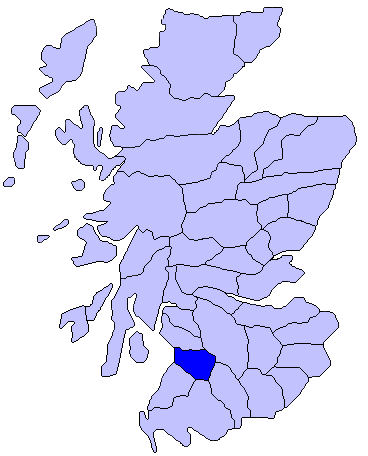
Unitary Authority: East Ayrshire

Police Authority: Ayrshire

What 3 Words

///sneezed.modifies.toffee. Near Catrine, East Ayrshire

Related Wikis

Sorn, East Ayrshire

Sorn (Scottish Gaelic: Sorn, meaning a kiln) is a small village in East Ayrshire, Scotland. It is situated on the River Ayr. It has a population of roughly...

Sorn Castle

Sorn Castle is located by the River Ayr just outside the village of Sorn in East Ayrshire, Scotland. The castle comprises a medieval tower house, which...

East Ayrshire

East Ayrshire (Scots: Aest Ayrshire; Scottish Gaelic: Siorrachd Àir an Ear) is one of 32 unitary council areas of Scotland. It shares borders with Dumfries...

Kyle, Ayrshire

Kyle (or Coila poetically; Scottish Gaelic: Cuil) is a former comital district of Scotland which stretched across parts of modern-day East Ayrshire and...

Catrine railway station

Catrine railway station served the village of Catrine in East Ayrshire, Scotland. Open 1903–1943, except for a temporary closure, the station was the only...

Catrine

Catrine is a village in East Ayrshire, Scotland which was formerly a centre of cotton manufacture. It has a population of around 2,020 (mid-2020 est...

Airds Moss

Airds Moss is a large area of moor in East Ayrshire, the site is a protected area because of the extensive blanket bogs. In 1680 it was the location of...
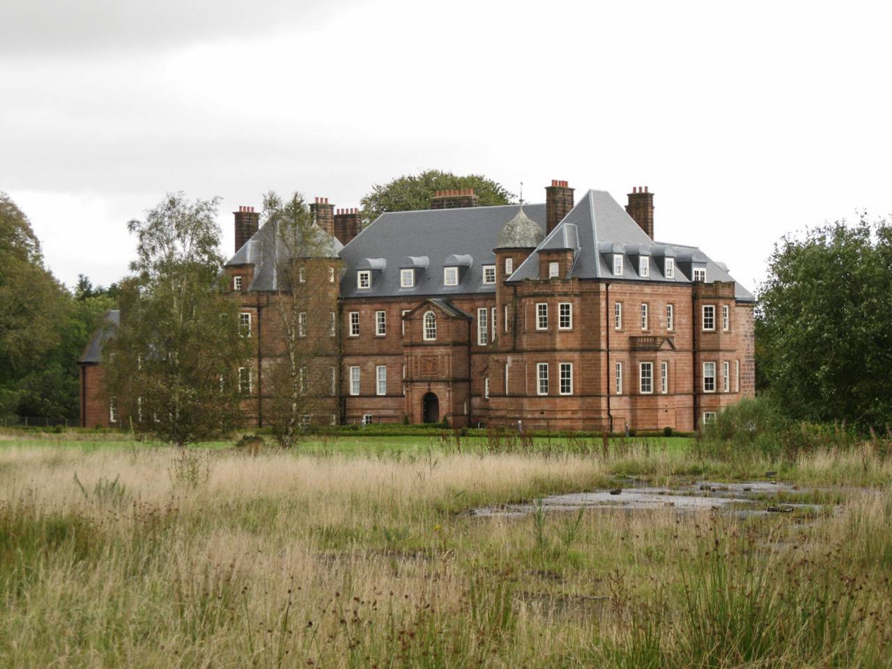
Ballochmyle House

Ballochmyle House is an 18th-century country house near Catrine in East Ayrshire, Scotland that was the seat of the Alexander of Ballochmyle family. From...

Nearby Amenities

Located within 500m of 55.51001,-4.2745226
Haggis Bank
Place: locality
Lat/Long: 55.5109172/-4.271163
Power: pole
Lat/Long: 55.5133225/-4.271873
Power: pole
Lat/Long: 55.5140852/-4.2723481
The data included in this document is from www.openstreetmap.org. The data is made available under ODbL.

Have you been to Dalgainbank Plantation?

Leave your review of Dalgainbank Plantation below (or comments, questions and feedback).